Prospero
-
Posts
1,168 -
Joined
-
Last visited
Content Type
Profiles
Blogs
Forums
American Weather
Media Demo
Store
Gallery
Everything posted by Prospero
-
That is crazy for this time of year! In the Spring with a warm wet storm and a major snow melt, creeks and rivers often flood in them mountains. Then it's time to white water raft if not too dangerous (New River in WV comes to mind). LOL
-
@Windspeed Tri-Cities, TN/VA Any Zeta effects up there? Was in Blacksburg just a week ago and had dinner with my Uncle and Aunt who live in Kingsport.
-
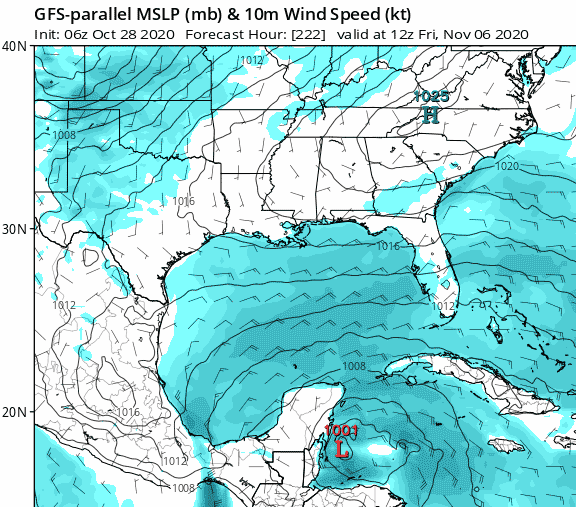
Every six hours various models dance different scenarios around with future development in the Caribbean and GOM. This being 2020, and enduring yet another hot muggy day on October 29 here in Florida, I tend to think we may not be done for the year. We still have healthy green leaves and fresh blooms on our Frangipani in our backyard that never has leaves past mid-September! Strange year.
-
I totally appreciated the alternative as something to watch last night...
-
The intensity was low, but they nailed US landfall very well.
-
Still tight circulation:
-
Some decent wind and surge footage:
-
Winds are increasing there. Zeta is packing a punch.
-
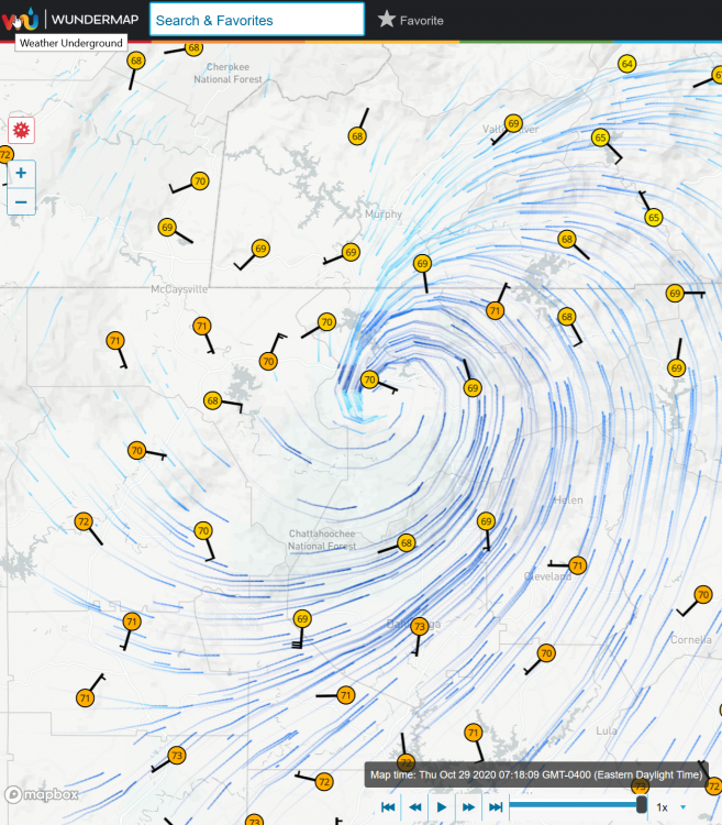
Tornado?
-
We might get a week or two before the next LA hurricane...
-
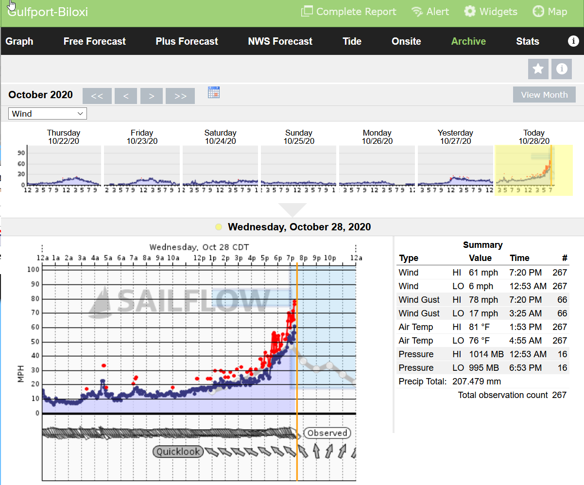
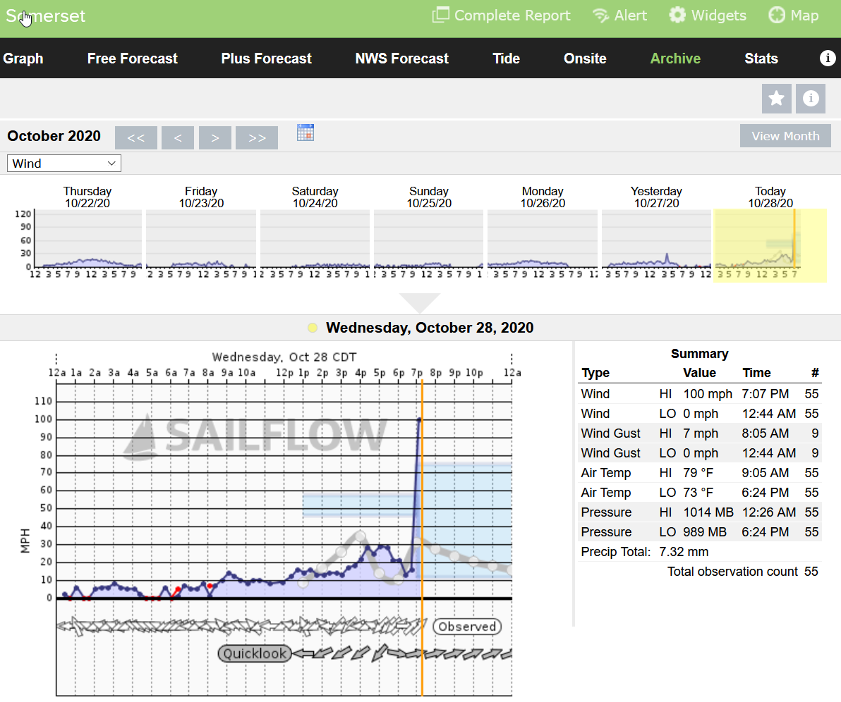
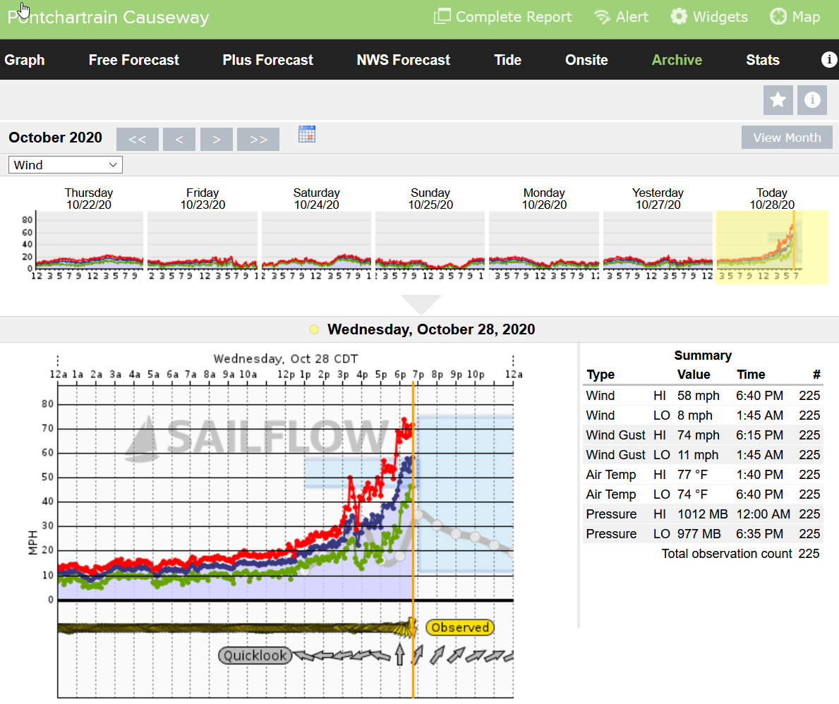
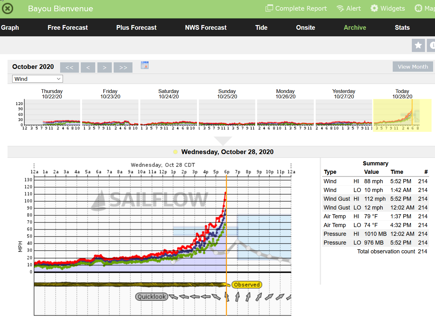
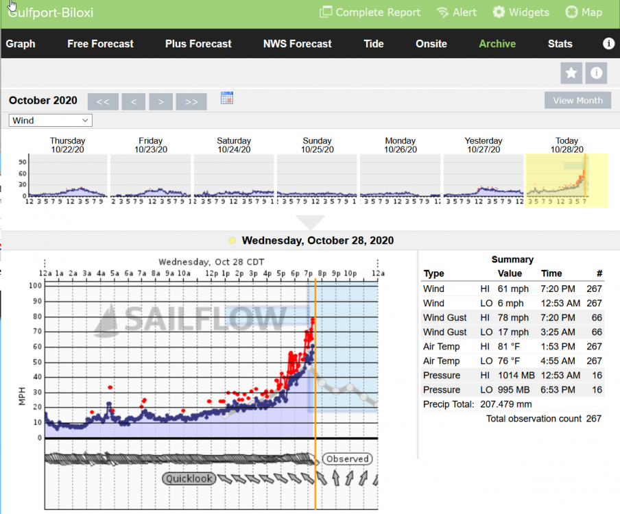
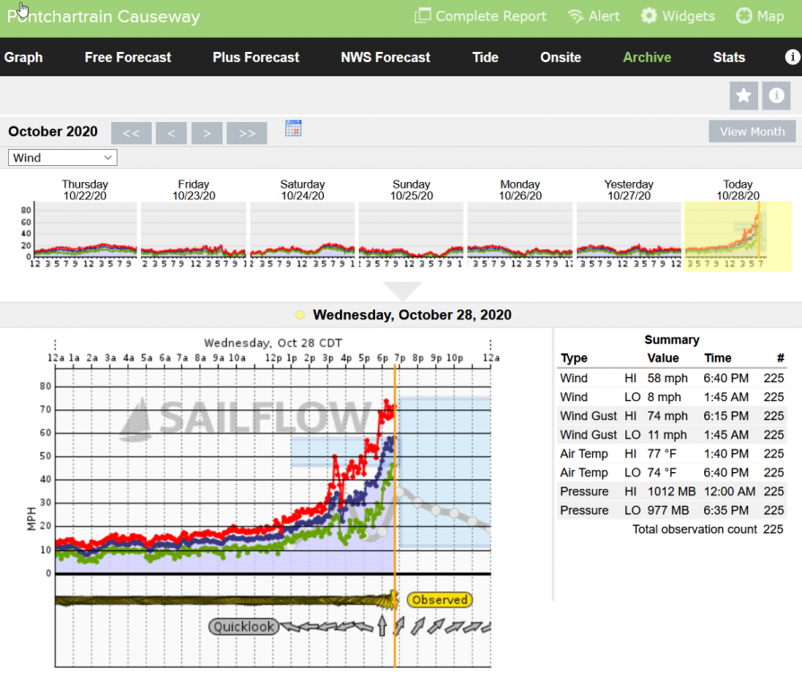
How a drive across the Pontchartrain Causeway?
-
Few minutes ago:

-
And I'll get to sleep at a reasonable hour tonight...
-
Seems like a treat for it to be still daylight during landfall. One of the better storms to watch this season.
-
At least the rain is not much of a factor.
-
10:37 pm https://tidesandcurrents.noaa.gov/noaatidepredictions.html?id=8761724&legacy=1 The wind has shifted in the past 30 minutes or so. It was coming almost in straight in but now from the right. I do not know the direction of the cam. The water has gone down quite a bit. https://irgir.click2stream.com/
-
Lot of erosion already. The landscape is changing quickly in front of this cam... EDIT: It is low tide right now, and whew, it is rising fast.
-
Grand Ilse cam is impressive with waves now over the dunes. A big difference from an hour ago. https://irgir.click2stream.com/
-
Could be the location of the radar not giving a full picture.
-
Watching the webcam posted earlier on Grand Ilse. The waves are starting to crash over the dunes and water is rising quickly. https://irgir.click2stream.com/
-
Not sure why "Capital One Building" keeps popping into my mind...
-
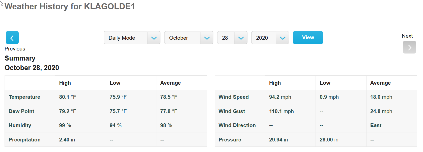
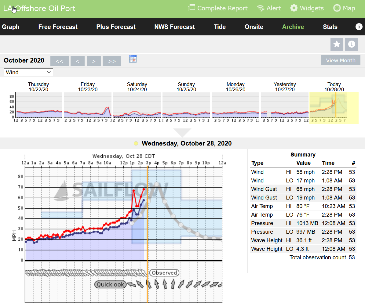
Looks like LA Offshore Oil Port just went offline. I think most in the area have dropped in last 30 minutes or so. 36.1 ft wave height. Whew, wonder how that will translate with any storm surge.

-
I think Irma was the first Tropical Storm Warning. Edit: "Breaking News: Hundreds of Storm Chasers descend on Atlanta to film Tropical Storm Zeta approach Atlanta!" Party!!!
-
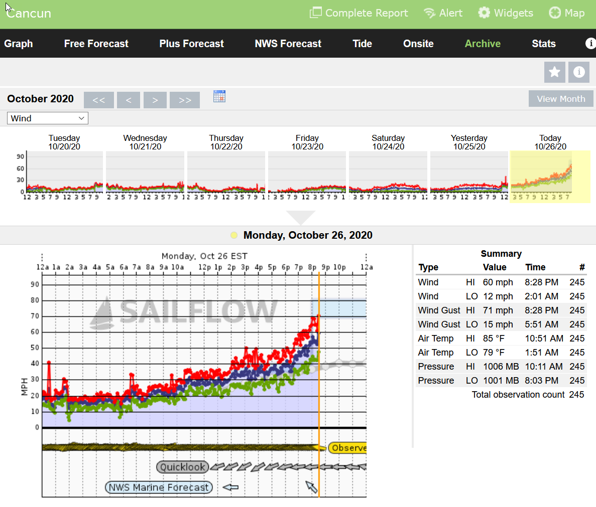
Cancun with 60 mph winds and a 71 mph gust (84/106 with Delta). That is enough to cause problems in Florida for sure.

-
Sitting here in Gulfport, Florida right now we are enjoying a very warm (frog strangler) strong thunderstorm that came in from the south in very late October. Usually this time of year it is dry as a bone and the only rain we might be lucky to get is from cold fronts that come through from the north. It has been muggy as heck this week, even taking showers outside to cool off as it has been so hot. Not a typical year at all, but it IS 2020... What will the next few weeks bring??