dallen7908
-
Posts
961 -
Joined
-
Last visited
Content Type
Profiles
Blogs
Forums
American Weather
Media Demo
Store
Gallery
Everything posted by dallen7908
-
Feb Long Range Discussion (Day 3 and beyond) - MERGED
dallen7908 replied to WinterWxLuvr's topic in Mid Atlantic
I don't mean to be a pain here but could you use "discrete". Discreet brings back bad memories. My sister lost a spelling bee because she spelled indiscreet as follows: I N D I S C R E T E. -
Feb Long Range Discussion (Day 3 and beyond) - MERGED
dallen7908 replied to WinterWxLuvr's topic in Mid Atlantic
00 UT EPS suggests that our best chance of snow is in a 2-day window beginning a week from Monday and ending a week from Wednesday. The EPS mean is 0.7" or greater for 4 consecutive 12-hour periods; a first for this season. Hopefully, my post tomorrow will be identical with the exception of the 0.7 being changed to 1" -
Wait ... we only need a 100% absolutely dead perfect textbook pattern. I thought we needed a storm during that ephemeral window too. Seriously, many of the the myriad things we need to get a substantial snow are highly correlated with each other so at some point things will improve rapidly. Hard not to think that luck has been lacking lately when we hear about snows in Texas, Oklahoma, Madrid etc. Its kind of amusing to be rooting for flow from Canada and when it comes several alert posters point out both graphically and with numbers that it is of Pacific origin - Those posts and the wonderful analysis by you and others makes this an enjoyable forum. Also, I encourage members to spend a few days each winter in northern New England and to track the weather at your destination several weeks in advance. Very rewarding. Unfortunately, this winter, a few trips to White Grass may have to suffice for me. On to the 12UT suite, hopefully, we can all meet in the 3-7 day forum soon ...
-
As snowdreamer noted, the best chance of snow in MBY according to the EPS is on the 20th - could be fun to watch the ... REMINDER: NO ... While there is nothing through the medium-range, the 15 day mean of 2 - 2 1/2 inches is higher than its been in quite a while. The 20th is roughly when the PNA is forecast to go negative for a while.
-
Even if that is the case there will be a window perhaps D10-D15 for an HA event or more likely just a wintry storm as the AO/NAO rise from very low levels and the PNA falls.
-
Certainly exciting to see that we have multiple chances of snow next week. However, the EPS mean for most of us continues to be stuck at ~2". The 10th and 90th percentile EPS "goal posts" for College Park, Frederick, and Camp David are 0-5", 0-3", and 0-4" of snow/sleet. While the NAO looks to remain negative for the foreseeable future it is "relaxing" towards neutral beginning mid-month. The AO continues negative with only a hint at moving towards neutral. The PNA pattern is solid positive (favorable for snow) through mid-month and then plummets. Hopefully, the time period when it begins to decline will excite snow- and acronym (HA) lovers.
-
12/16 0.6 " (College Park)
-
The NWS forecast discussions out of Sterling are about to get more interesting - for snow lovers https://www.weather.gov/lwx/GarrettCecilTransfer
-
https://frontierweather.dtn.com/WinterClimateDrivers.pdf Just in case you need background as to what a rising QBO value MAY mean for our winter weather.
-
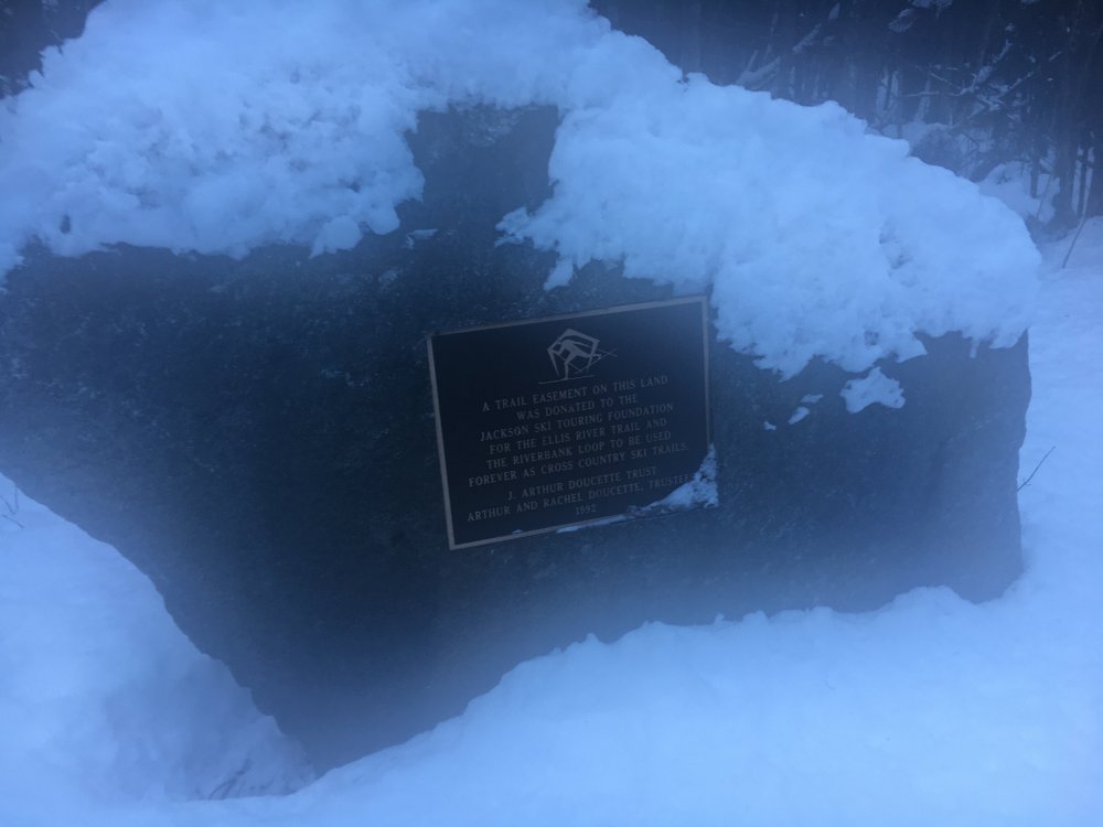
The climate change tangent got me thinking of nordic skiing and a sign I saw this past January. Hopefully "forever" won't end sooner than the Doucettes' hope
-
Which is more likely, another December like this one or another February like last one? My hunch is that February 2015's weather was less abnormal but haven't run the statistics. Thoughts?
-
Remember Ian's article about how uncommon 1" and above snows are becoming at DCA. Well in today's Washington Post there is a non-technical article by Reid Wilson on California's drought that speculates that melting of Arctic ice may be 'contributing to a slowing of the jet stream contributing to colder wetter weather in the eastern U.S. and more persistently dry conditions in the west". I guess for every winner there is a loser. Kind of reminds me of spring 2010, when several hopeful posters here speculated that 2009/2010 could become the new norm or last winter when several scientific articles predicted that melting of Arctic ice could be responsible for warmer eastern U.S. winters and colder European winters.