

Kmlwx
-
Posts
13,553 -
Joined
-
Last visited
Content Type
Profiles
Blogs
Forums
American Weather
Media Demo
Store
Gallery
Everything posted by Kmlwx
-

Jan 31st - 33rd Storm Obs and Disco like it's 1979
Kmlwx replied to Bob Chill's topic in Mid Atlantic
700mb mesoanalysis.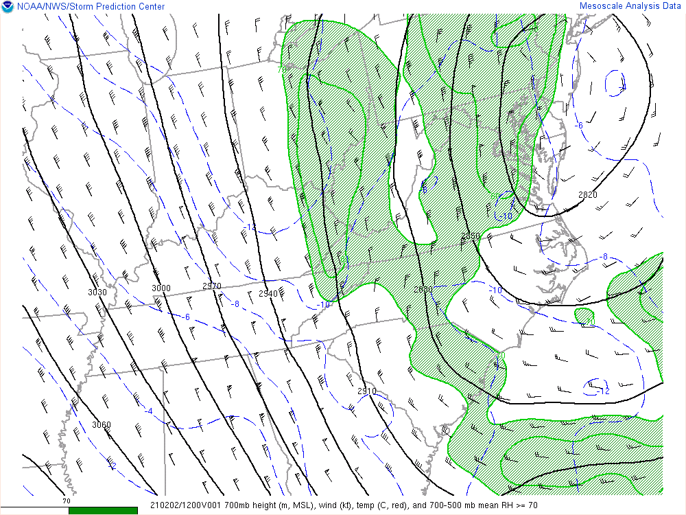
-
Jan 31st - 33rd Storm Obs and Disco like it's 1979
Kmlwx replied to Bob Chill's topic in Mid Atlantic
It's been such an interesting storm - so much of the accumulation has been drawn out over a ridiculously long period. Talk about nickel and diming. -
Jan 31st - 33rd Storm Obs and Disco like it's 1979
Kmlwx replied to Bob Chill's topic in Mid Atlantic
Picked up another inch or so (perhaps a little more) overnight with this banding! Wow. -
Jan 31st - 33rd Storm Obs and Disco like it's 1979
Kmlwx replied to Bob Chill's topic in Mid Atlantic
I don't think I've ever gotten such a small accumulation that has necessitated a plow coming through my parent's street 3 times. They've done two passes since the snow started on Sunday - and with that band that went through...seems they will need to plow/salt again. Already had a neighbor skid down the street in a truck already. -
Feb Long Range Discussion (Day 3 and beyond) - MERGED
Kmlwx replied to WinterWxLuvr's topic in Mid Atlantic
That is a salivation inducing post around these parts... -
Jan 31st - 33rd Storm Obs and Disco like it's 1979
Kmlwx replied to Bob Chill's topic in Mid Atlantic
Actually coming down nicely here now in Colesville! Walkway is slushily caving again - maybe even a hint of a dusting on the street too (dead end road/low traffic). -
Jan 31st - 33rd Storm Obs and Disco like it's 1979
Kmlwx replied to Bob Chill's topic in Mid Atlantic
If I could just get a taste of that deathband down here in Colesville for even just 15 minutes I'd call it a storm and move on to tracking the mid/long range again. -
Jan 31st - 33rd Storm Obs and Disco like it's 1979
Kmlwx replied to Bob Chill's topic in Mid Atlantic
That band looks neat on radar. Kind of reminds me of a backdoor cold front! -
Jan 31st - 33rd Storm Obs and Disco like it's 1979
Kmlwx replied to Bob Chill's topic in Mid Atlantic
Light snow with varied flake size here in Colesville, MD. -
Jan 31st - 33rd Storm Obs and Disco like it's 1979
Kmlwx replied to Bob Chill's topic in Mid Atlantic
Depending on which part of Rockville you're in, there's some subsidence between bands of whatever is falling. -
Jan 31st - 33rd Storm Obs and Disco like it's 1979
Kmlwx replied to Bob Chill's topic in Mid Atlantic
Tell us how you really feel In all seriousness - YES to Radarscope - probably the most widely used mobile radar app. It's great. -
Jan 31st - 33rd Storm Obs and Disco like it's 1979
Kmlwx replied to Bob Chill's topic in Mid Atlantic
Definitely seems like north of the Potomac and then north of US50 might be your best shot at seeing more wintry weather today. And ideally the further NE the better (of course). -
Jan 31st - 33rd Storm Obs and Disco like it's 1979
Kmlwx replied to Bob Chill's topic in Mid Atlantic
Surprisingly lost only a few of my parent's bamboo stalks (big swath of it between the neighbors and their house). Still no sign on the snow here - light freezing rain persisting. No pingers that I can hear either. -
Feb Long Range Discussion (Day 3 and beyond) - MERGED
Kmlwx replied to WinterWxLuvr's topic in Mid Atlantic
A 7-day forecast is always going to change except under extreme rare circumstances. Even a 5-day is likely to shift - though hopefully not as much. -
Jan 31st - 33rd Storm Obs and Disco like it's 1979
Kmlwx replied to Bob Chill's topic in Mid Atlantic
Was just out trying to get the walkway clear of the icy coating - seems like it's still rain here (so freezing rain). Hoping the change is not far. -
Jan 31st - 33rd Storm Obs and Disco like it's 1979
Kmlwx replied to Bob Chill's topic in Mid Atlantic
Makes sense - I am getting a couple drops of rain still - so either freezing drizzle or light freezing rain. Hope to switch soon since Gaithersburg has flipped. -
Jan 31st - 33rd Storm Obs and Disco like it's 1979
Kmlwx replied to Bob Chill's topic in Mid Atlantic
Definitely not to the extent as north of DC, but it does seem some light returns have been growing in size near Upper Marlboro and Andrews. -
Jan 31st - 33rd Storm Obs and Disco like it's 1979
Kmlwx replied to Bob Chill's topic in Mid Atlantic
Radar showing some very light (but noticeable) enhancement over the bay as well as in the area down near ADW. Seems a decent chunk of the area may be moistening back up. -
Jan 31st - 33rd Storm Obs and Disco like it's 1979
Kmlwx replied to Bob Chill's topic in Mid Atlantic
There' s a ship off of Virginia Beach by a bit that reported 20kt winds out of the southeast around 01z. -
Jan 31st - 33rd Storm Obs and Disco like it's 1979
Kmlwx replied to Bob Chill's topic in Mid Atlantic
Always attributed them to stronger storms. Cool to see on radar! -
Jan 31st - 33rd Storm Obs and Disco like it's 1979
Kmlwx replied to Bob Chill's topic in Mid Atlantic
Are those gravity waves on the radar radiating up the bay? -
Jan 31st - 33rd Storm Obs and Disco like it's 1979
Kmlwx replied to Bob Chill's topic in Mid Atlantic
But it WILL include anything after 18z. So that was way earlier this afternoon. -
Jan 31st - 33rd Storm Obs and Disco like it's 1979
Kmlwx replied to Bob Chill's topic in Mid Atlantic
CC shows mix line pretty much right along I-95 up to near Laurel/Bowie and other than that mainly south of BWI to Rock Hall. Pretty standard line for climo purposes. -
Jan 31st - 33rd Storm Obs and Disco like it's 1979
Kmlwx replied to Bob Chill's topic in Mid Atlantic
CC looks like it has some mixing in parts of DC and PG county and coming up the Potomac down near Charles Co. -
Jan 31st - 33rd Storm Obs and Disco like it's 1979
Kmlwx replied to Bob Chill's topic in Mid Atlantic
Was just outside doing another shoveling of the walk and driveway. Sounded like sleet and it was definitely snowing a little harder. Perhaps it was graupel. Not quite as pingy as I'd expect sleet to be.
