ORH_wxman
-
Posts
93,095 -
Joined
-
Last visited
Content Type
Profiles
Blogs
Forums
American Weather
Media Demo
Store
Gallery
Everything posted by ORH_wxman
-
March 21-22, 2013. Local jackpot over a foot near Acushnet/Fairhaven/Mattapoisett but I think your old place in Wareham had at least 8-10”? If not more. That was a real good one. Very intense where it happened. I remember tracking that one late evening on the 21st. I’m sure we could find the thread.
-
One of them was Dec 13, 1988….i remember I thought how lucky we were to get 1-2” but it turned out just west of ORH about 3 towns over had 6”. That would’ve extended down to your area.
-
How would to EPS and Euro show New Years Day temps? they don't go out far enough
-
That mid month torch is looking more and more flaccid each run of the EPS/Euro. GEFS are still trying for it for several days but I’ll say that the EPS has been taking the GEFS to the woodshed in the medium/long range over the past few weeks.
-
Euro has a little clipper overnight 12/9-10. Bigger looking clipper for 12/11…that one almost morphs into a SWFE. There’s stuff to watch at least.
-
Yeah, add 10 days of climo to yesterday's event and it looks a lot different from a sensible wx standpoint...that 1C mattered a lot for a good chunk of the storm. The pattern looks a bit colder anyway even if you adjust for climo. Not a good pattern to try and get a phased nuke....but these northern stream impulses can sometimes produce pretty nicely for us if we can get one of them to line up.
-
Yeah some of these events we had didn't show up well on guidance all that well until D7 or so. It's the type of flow that probably isn't easy on guidance with so much energy and then dealing with a stout -NAO block. Hopefully one of these can produce.
-
I noted that right before the storm started....the Euro was really going to get the W on the track, but it was just awful with the thermals. The whole system was pretty weird though. If you had told me before the storm started that the only information you would give me is that I would spend almost the entire storm below freezing, I would have at minimum expected snow to be overproducing in a very large swath of SNE.....but instead it was actually fairly underwhelming. Having low pretty decently SE with good ageo northeryl drain but yet we were ripping 925mb from the south relentlessly to the point of overperofming on warmth at that level....didn't have that on my bingo card. Typically I'd expect that type of track to have the warm nose way up at 750mb or something.
-
06z Euro was trying to get some snow into SNE early Saturday....not much, maybe a C-1"...not really buying it. Maybe a few flurries.
-
EPS trying to really mute the mid-month torch. No real coherent threats, but a lot of buckshot on the ensembles....I suppose 12/9-10 still has a bit of the clipper/redeveloper sig, but not super strong. It has a system right on its heels...another stronger clipper...could morph into a SWFE....or just be a glorified FROPA. Way too early to really care.
-
Really effing weird. Sfc low almost got elongated too to the northeast. Yet we had 925 taking forever to close off and ripping from 180-170.
-
This was a really weird sleet event. Not common you get sleet with a warm layer around 900mb, lol. But I agree it was probably not-fully melted flakes refreezing quickly into pellets.
-
Hrrr doesn’t flip us back until after 11pm now. We’re prob not gonna get much late snows.
-
There’s a ton of energy in the flow starting this weekend into next week…just a lot of vorticity firehosing off the pacific and if one of those amplifies, then we could see a larger system. I don’t think we’re going to be lacking for threats. They may not all materialize but I think guidance will show storms at different times next week.
-
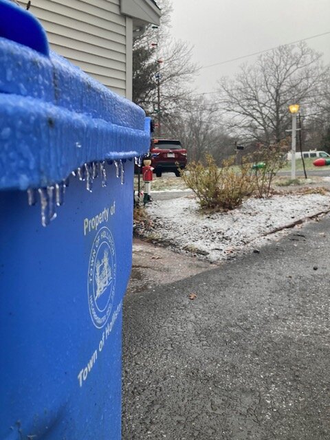
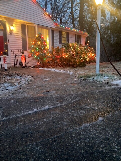
Finally crept above 32F. Rain and 32.5F. Lot of crap and ice still out there.
-
You guys up there may grab 2 or 3 inches this evening....the CCB actually looks kind of real up there. Down here I'm hoping for a couple inches but might be too far SW.
-
RAP has some stuff back your way...maybe a coating to an inch if lucky. HRRR not as enthused...more like flurries. Reggie was more like the RAP...maybe C-1" there? Would be mostly between prob 9pm-2am.
-
Yeah the ice is kind of nasty when you walk outside, but I won't lie and say having just that glaze shining and the very small layer of snow sugar coating the ground does keep it more festive. Keeping fingers crossed for a couple inches late this evening with the departing CCB.
-
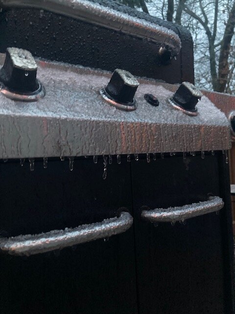
Icy…serves me right for forgetting to put the grill cover back on last night…that driveway/walkway glare is nasty right now

-
Icy…serves me right for forgetting to put the grill cover back on last night…that driveway/walkway glare is nasty right now


-
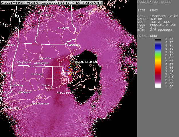
Very icy outside....31F right now. Epic fail on the sfc temps. Not totally uncommon to happen but a bit more surprising since we had no high to the north. But that sfc low kind of elongating to the northeast probably really turned ageo flow more northerly.
-
Freezing line runs from about Waltham down to Wellesley to Needham to Sherborn to Medway to Bellingham....so basically just west of 128 and then gets to 495 down near Bellingham. Still below freezing here at 30.5F.
-
Temp now creeping above 30F You can tell the warmth aloft is getting closer to ground as there’s way less sleet now and the accretion is mostly stopped. The previous glaze is still on bushes and other surfaces but the rain is mostly just running off it now. Short term guidance has been getting better and better for later this evening. Hoping to finish with a few hours of steady snow.
-
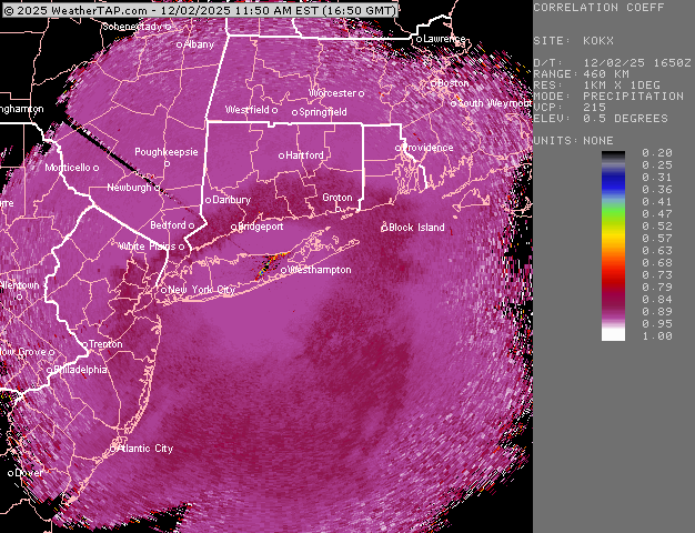
Yeah there’s def longitude component, but also the radar can’t see it beyond a certain distance.Too far away to show up in CT. But it’s there on the OKX radar. But even that radar is prob too far away to show it in northern CT…when it’s lower level warmth punching in and not up at 750-800mb, it’s harder for the radar to see it from far away
-
You can see the CC line getting some resistance just north of me literally almost on top of my head. Getting some very ugly mangled occasional flakes mixed in now with the IP/ZR. Temp 29.5F