

ORH_wxman
-
Posts
93,092 -
Joined
-
Last visited
Content Type
Profiles
Blogs
Forums
American Weather
Media Demo
Store
Gallery
Everything posted by ORH_wxman
-
New Years Day 2026 - 1st snows of the new year possible
ORH_wxman replied to Baroclinic Zone's topic in New England
Awesome band for SE areas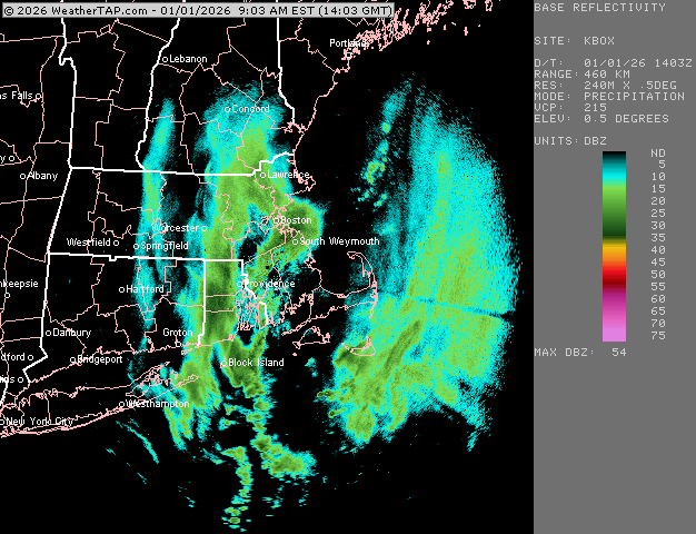
-
New Years Day 2026 - 1st snows of the new year possible
ORH_wxman replied to Baroclinic Zone's topic in New England
2.3” in Holliston
-
New Years Day 2026 - 1st snows of the new year possible
ORH_wxman replied to Baroclinic Zone's topic in New England
Incoming for PVD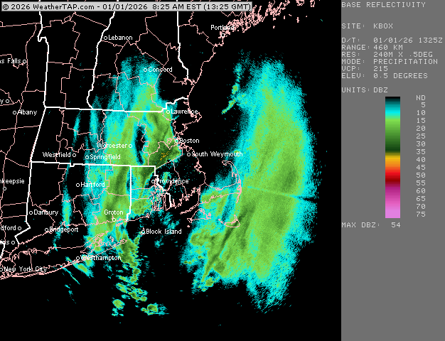
-
New Years Day 2026 - 1st snows of the new year possible
ORH_wxman replied to Baroclinic Zone's topic in New England
Gonna be a good round 2 for you -
New Years Day 2026 - 1st snows of the new year possible
ORH_wxman replied to Baroclinic Zone's topic in New England
Congrats Scooter…RI/MA border though is gonna get hit twice by the max intensity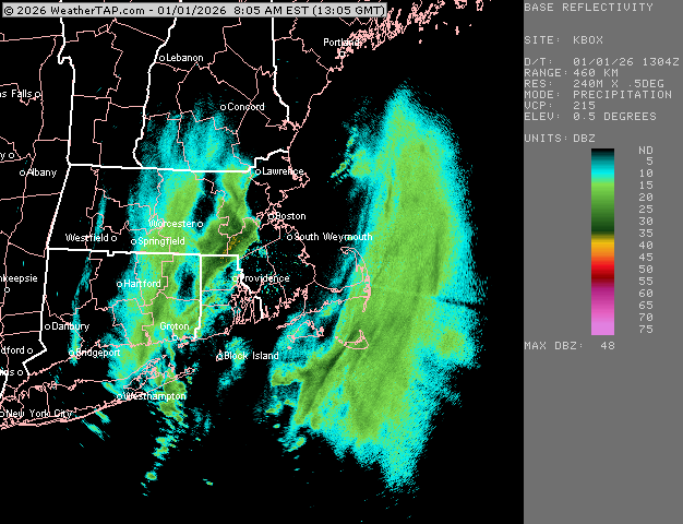
-
New Years Day 2026 - 1st snows of the new year possible
ORH_wxman replied to Baroclinic Zone's topic in New England
Woonsocket might get like 2-3” from the squalls alone….man. -
January 2026 regional war/obs/disco thread
ORH_wxman replied to Baroclinic Zone's topic in New England
I’d expect anything post-1/8 to be pretty poorly modeled right now with the big PAC changes going on. Our biggest chance at a monster torch day or two would be just beyond that…maybe 1/10ish if we warm sector cleanly with no precip like a few OP runs showed. But we’ve also seen some CAD looks around then too. So we wait. Heights will be way above normal but we don’t know on sfc temps yet. -
New Years Day 2026 - 1st snows of the new year possible
ORH_wxman replied to Baroclinic Zone's topic in New England
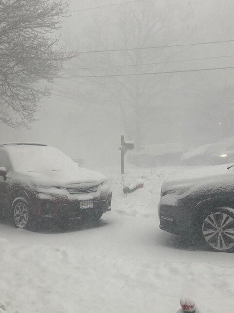
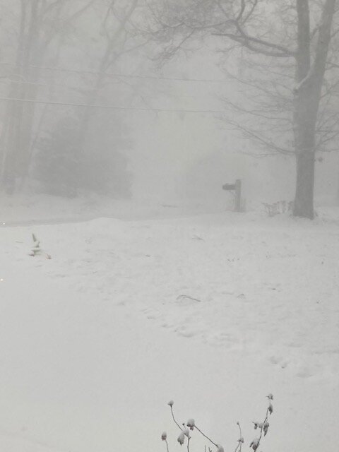
Vis got down to about 100 yards here at one point. Maybe even slightly lower. Must’ve been beyond insane just to the south in the better echoes -
New Years Day 2026 - 1st snows of the new year possible
ORH_wxman replied to Baroclinic Zone's topic in New England
Ghost of Scooter from St John incoming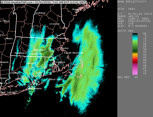
-
New Years Day 2026 - 1st snows of the new year possible
ORH_wxman replied to Baroclinic Zone's topic in New England
-
New Years Day 2026 - 1st snows of the new year possible
ORH_wxman replied to Baroclinic Zone's topic in New England
Ok maybe it was delayed a bit but this is insane now. Whiteout. -
January 2026 regional war/obs/disco thread
ORH_wxman replied to Baroclinic Zone's topic in New England
Could see a couple inches in the 1/6 disturbance if it doesn’t weaken too much. -
New Years Day 2026 - 1st snows of the new year possible
ORH_wxman replied to Baroclinic Zone's topic in New England
Scooter gonna miss the best squalls for him since Dec 2003…at least he’s in tropical paradise -
New Years Day 2026 - 1st snows of the new year possible
ORH_wxman replied to Baroclinic Zone's topic in New England

-
New Years Day 2026 - 1st snows of the new year possible
ORH_wxman replied to Baroclinic Zone's topic in New England
Dumpage here right now. The very best is to my south though going through Franklin/Bellingham -
January 2026 regional war/obs/disco thread
ORH_wxman replied to Baroclinic Zone's topic in New England
Woulda been a real Bomb if we had a bit more PNA ridging. -
New Years Day 2026 - 1st snows of the new year possible
ORH_wxman replied to Baroclinic Zone's topic in New England
It’s a very deep SGZ so that helps even in light snow. Still think 3-4” is a heavy lift but if you have very good snow growth, then you can fluff your way to 3” on like 0.13” of liquid. I just hate using ratios to try and get there…because I’ve seen good soundings before but if the lift ends up too weak or not organized, you don’t realize the potential. -
January 2026 regional war/obs/disco thread
ORH_wxman replied to Baroclinic Zone's topic in New England
Hopefully we actually get the EPO poleward like that. If so, it’s a decently cold look but also not suppressed…to support your analysis of it being a more storm-friendly pattern here. It is a bit riskier with the SE ridge lurking, but we have been through enough of these patterns to know that sometimes you need to play with fire to get the goods. -
January 2026 regional war/obs/disco thread
ORH_wxman replied to Baroclinic Zone's topic in New England
OP Euro today is kind of weak sauce on warmup as well. Not as much as Skynet....it does get pretty mild for a couple days, but no torching cutters....the 1/10 system bombs into the lakes but is more like a SWFE with snow/ice in CNE/NNE....SNE might be mixed to 35F rain in that scenario. But it just shows there's a lot of uncertainty even in a mild-ish longwave pattern. Early January is a good time to try and get away with a warmer longwave pattern. -
January 2026 regional war/obs/disco thread
ORH_wxman replied to Baroclinic Zone's topic in New England
Skynet is pretty weak sauce on the warmup out beyond the 7th. I don't think CNE-northward ever sees any liquid precip. -
New Years Day 2026 - 1st snows of the new year possible
ORH_wxman replied to Baroclinic Zone's topic in New England
Gonna need big ratios I think though to be seeing 3-4" numbers...it's a pretty dry system. Even the upslope spots on the mesos are having trouble squeezing out 2 tenths of liquid. -
New Years Day 2026 - 1st snows of the new year possible
ORH_wxman replied to Baroclinic Zone's topic in New England
That seems like a pretty bullish advisory given guidance... -
January 2026 regional war/obs/disco thread
ORH_wxman replied to Baroclinic Zone's topic in New England
Why are you engaging with QG? He hasn't been an honest actor since his handle was noreaster27 in the early days 12+ years ago. -
January 2026 regional war/obs/disco thread
ORH_wxman replied to Baroclinic Zone's topic in New England
I suspect that poster is referring to the 2-4 day mild spell when the EPO spike initially occurs. But yeah, it doesn't seem like a permanent shift to mild....the cold is right behind it. -
January 2026 regional war/obs/disco thread
ORH_wxman replied to Baroclinic Zone's topic in New England
It’s really too bad we couldn’t amplify the western ridge for Monday to send that northern stream vort further west and south because it would partially phase with that southern stream entity near Carolinas and probably produce a huge coastal. Im sure we will amplify the western ridge though just enough to cut a storm to our west when we don’t want it later this winter.


