

ORH_wxman
-
Posts
93,092 -
Joined
-
Last visited
Content Type
Profiles
Blogs
Forums
American Weather
Media Demo
Store
Gallery
Everything posted by ORH_wxman
-
Carbon copy of January 2013 and 2015. The bitching is always worse when the pattern isn't garbage but we're still not getting the snowstorms.
-
Good candidate for a 5-post
-
You don’t enjoy the semantical debate on whether we should call it “unpredictable shortwave chaos” or “luck”?
-
Who guaranteed snowstorms? It should be common knowledge for someone like you that has been on the boards for 15+ years that good patterns don’t guarantee snowstorms. But we’re not going to pretend the chances are the same in a good pattern vs a garbage one either. It’s ok to talk about potential.
-
You aren’t being a realist. You are doing exactly what you did in 2013. You even kept pretending that the Feb ‘13 blizzard threat was going to miss until it became really obvious like 60-72 hours out. It’s possible we keep whiffing in the upcoming pattern, but it has nothing to do with what happened earlier in the month.
-
Just close the shades man. We’ll see you in March.
-
We will be longing for the days of early January 2021 once the hadley cell destroys our geopotential medium later this month.
-
No worries, northern hemisphere is usually good.
-
Hopefully they can zoom it out even more on future updates. Maybe we can simulate the view from the moon.
-
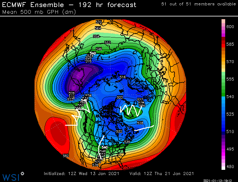
squiggly lines are ridges and straighter lines are the troughs....that's all.
-
They are directly related....NAO block holds the 50/50 low in place. I can see his point on the upstream ridging potential....it's definitely not a classic KU setup. We don't have a rockies/western ridge. This is more of a SWFE type threat running into a brick wall. Those can be very good of course....but they have a different mechanics behind them than the classic maturing coastal cyclone. Yep...as mentioned above, this is kind of a SWFE on steroids look....prob would be a cutter without that block.
-
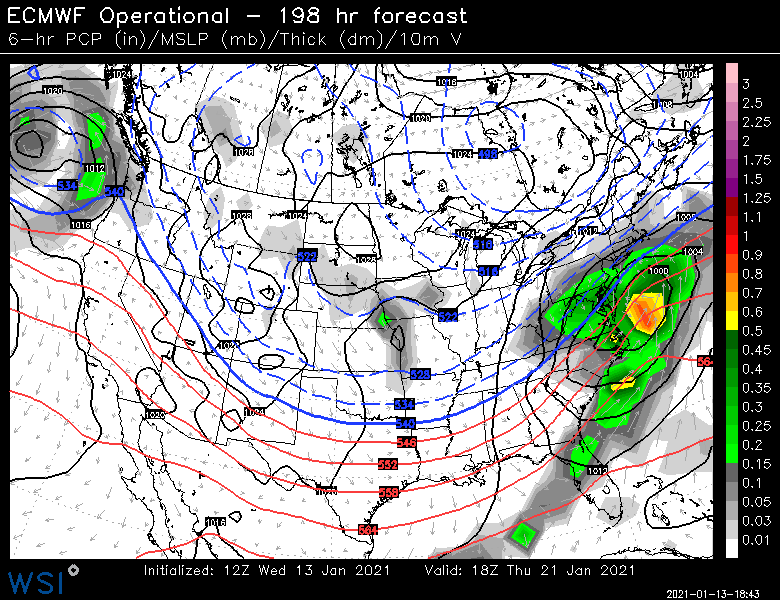
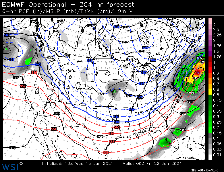
EPS is a pretty strong look for 1/21-1/22...prob our best synoptic look since the Dec 17 threat. We'll see if it sticks.
-
It's plenty cold...in fact, prob too much cold this run.
-
Could easily get nothing through Vday.
-
When was the last time we got screwed in an overrunning pattern?
-
We've like 5 of them too in the past 2 weeks...I've been outside several times on those days and said to myself "if I didn't know any better, I'd think snow might be coming".
-
Same for ORH....1988-1989 through 1991-1992 was the only time.
-
Eh, you get a lot of snow in April there which is part of the seasonal climo. You could easily put up a couple 40-spots in Feb/Mar and then add another 15-20 on the margins (end of Jan plus whatever falls April and beyond)
-
is a b*tch
-
Yeah and for those who don't like the term "luck"....it was unfortunate "unpredictable shortwave chaos" in an otherwise half-decent longwave pattern.
-
Yeah the PAC improvement was always mid-month, but usually when we have a good -NAO and kind of a cruddy PAC, the active firehose will spray a system or two into that block and give us an event. But in the 2021 version, we almost ended up with too many shortwaves and couldn't get anything to become dominant and solidify....and the single shortwave that did got crushed just enough to screw us (1/3-1/4).....kind of a bad break, but it happens. As we've preached, how many good breaks have we gotten in the past 15 years? LOL. But maybe we make up for it in the next 2-3 weeks with a big one.
-
No it hasn't....the somewhat more favorable pattern developed shortly after New Years....we narrowly missed a good storm on 1/3-1/4 and there were a couple other shots around 1/12 and 1/14 but we couldn't get the shortwaves to line up. It's true that the pattern was always going to improve as the month wore on, but we definitely could have scored something in New England before then in the 1/3-1/14 period. Them's the breaks.
-
I wouldn’t say never. Often times it’s “delayed but not denied” as referenced in here by some of us when we make fun of the melts in January 2015 and 2013. But you are right that often the best storms or even the start of a good snow run sneaks up on people. I’ve seen people obsess over day 8 or 9 threats and then something sneaks up inside of 4 days and gives us warning criteria snowfall.
-
Those won’t get implemented until next season I don’t think. They calculate them this year but all the data has to go through QC I’d assume before they finalize it.
-
There’s a lot of that type of mentality though when we’ve gone a while without snow. Everyone starts looking for the perfect pattern. Then everyone assumes once the ideal pattern breaks down, it means it is hostile and cannot produce snowstorms. That’s a false assumption but easy to fall into when there’s been a snow drought.


