ORH_wxman
-
Posts
93,110 -
Joined
-
Last visited
Content Type
Profiles
Blogs
Forums
American Weather
Media Demo
Store
Gallery
Everything posted by ORH_wxman
-
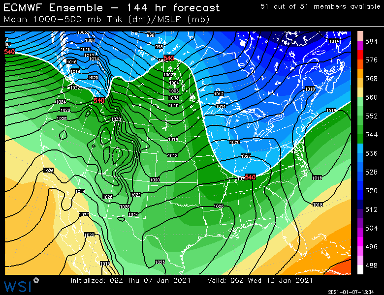
Definite shift on guidance for next week. The follow up wave is coming in quite potent so there may be a threat on 1/14 if thats real. GFS and GGEM both showed this shift. Ukie was a little more muted. Anyways, something maybe to watch. We’ll see what Euro does.
-
I actually still have snow cover in shaded spots from Sunday night. But it’s been like the same thing every day. Highs in upper 30s and lows in the mid 20s.
-
Lack of baroclinicity can definitely be a detriment to storm development. Storms love to form on boundaries and we've had a very weak temp gradient between NNE and the lower mid-atlantic during much of the past 2 weeks.
-
GGEM is trying for 1/12-13 again...scraper.
-

-
We got a 26" Ariens in fall of 2018 after hand-shoveling March 2018 was my breaking point....thing is a beast. I think they discontinued the 26" model after that year....now they have either 24 or 28. The key is how well it handles the snow banks at the end of the driveway. We have a wrap-around driveway living on the curve of a road on a hill. Worst possible spot for monster snow banks, they all get thrown to the outer part of the curve there so we'll get like 3 foot snow banks on a 10" storm. And because it's a wrap-around, we have two entrances to clear of snow banks. If you need to deal with high water content snow banks that pile up, then you definitely want a monster that can handle it. Otherwise, I feel like you can easily get away with something smaller and less powerful.
-
Also the caveat that the SSW might actually help us in February and the weeklies wouldn't be able to see it yet. I'm generally an SSW skeptic (in that the hype is way overplayed), but the timing of this one might actually be ideal.
-
Next week is a decent pattern, we're just not going to cash in. The pattern continuously improves through the month, but we're already in a decent pattern by next week. Shortwave nuances screw up the 1/13 threat though.
-
Yeah I agree. The hemispheric pattern becomes a lot more favorable for an arctic intrusion later in the month assuming guidance has a clue. Wouldn’t surprise me to see a legit polar express shot show up at some point post-ides
-
No real changes? All systems go for 2nd half of the month. Let’s hope it delivers.
-
Yeah it did. That was kind of weird but probably not totally surprising given the trouble that model guidance has had handling all these shortwaves. I’d still lean against a storm right now but we certainly cannot rule it out yet.
-
I think the most "useful" aspect of an SSW going on right now for snow lovers is that it would act as a major vehicle to disrupt the baseline La Nina Feburary climo (even if we take your stance that it is a muted ENSO climo signal with hadley cells....if anything that probably makes the Feb la nina climo even worse). Feb Nina is usually not all that favorable for our region unless we have some -AO assist or other disruption and the SSW could be that disruption we want.
-
The Dawn Awakening?
-
Completely destroyed his finished basement when the 1/24/15 storm was getting more defined on the models.
-
Pattern is definitely there for some big opportunities beyond the ides of the month. I know it's a pain in the ass to wait for a lot of people....sometimes the "meat" of a pattern change gets pushed back a few days even if the general favorable setup starts earlier (we're already in a generally favorable setup next week). I brought up Jan 2013 and 2015 on purpose to illustrate that point. 2015 actually got decently favorable earlier than when the storms started....we got an unlucky brutal cutter mid-month that sent a lot of people over the edge. Ditto Jan 2013....nice longwave pattern and then a brutal cutter to interrupt it before we cashed in. Obviously it would be silly to predict a HECS like either year right now, but the longwave set up is going to be there. It could merely end up with a string of moderate to borderline heavy events like Jan 2009 too (there are similarities with that month's pattern). Or we could get largely skunked like January 2003 after the 1/3-1/4 storm.
-
Northern steam + big meridional flow tends to wreak havoc on lead time (same thing happened in Boxing day too...even if we all didn't like that storm)
-
I'm just starting to get some late Jan 2013 vibes in here....or mid Jan 2015 vibes
-
Fixed your real complaint
-
Euro is a whiff too now next week. All the guidance looks pretty similar in the wave interference.
-
The pattern does support a good arctic intrusion later this month. Whether we get a truly frigid period or not is still up for debate, but when you see the Pacific load up a poleward ridge like that, then it is a definite possibility.
-
Ukie is a no-go as well. With so many shortwaves it's going to be difficult to get an ideal setup. The longwave trough is favorable at least, but you still have the problem of wave spacing inside the longwave flow with the multiple shortwaves.
-
Yeah they could really use some base....they did get that moderate SWFE back on New Years, but may places are still significantly behind.
-
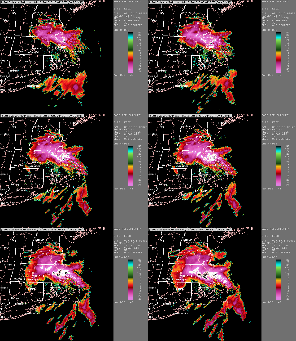
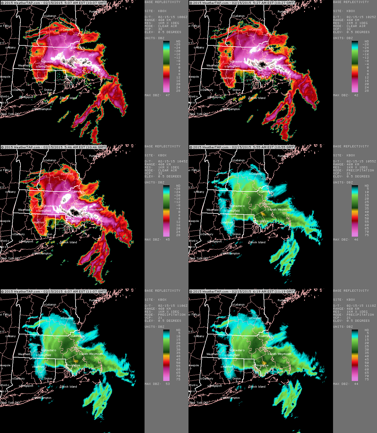
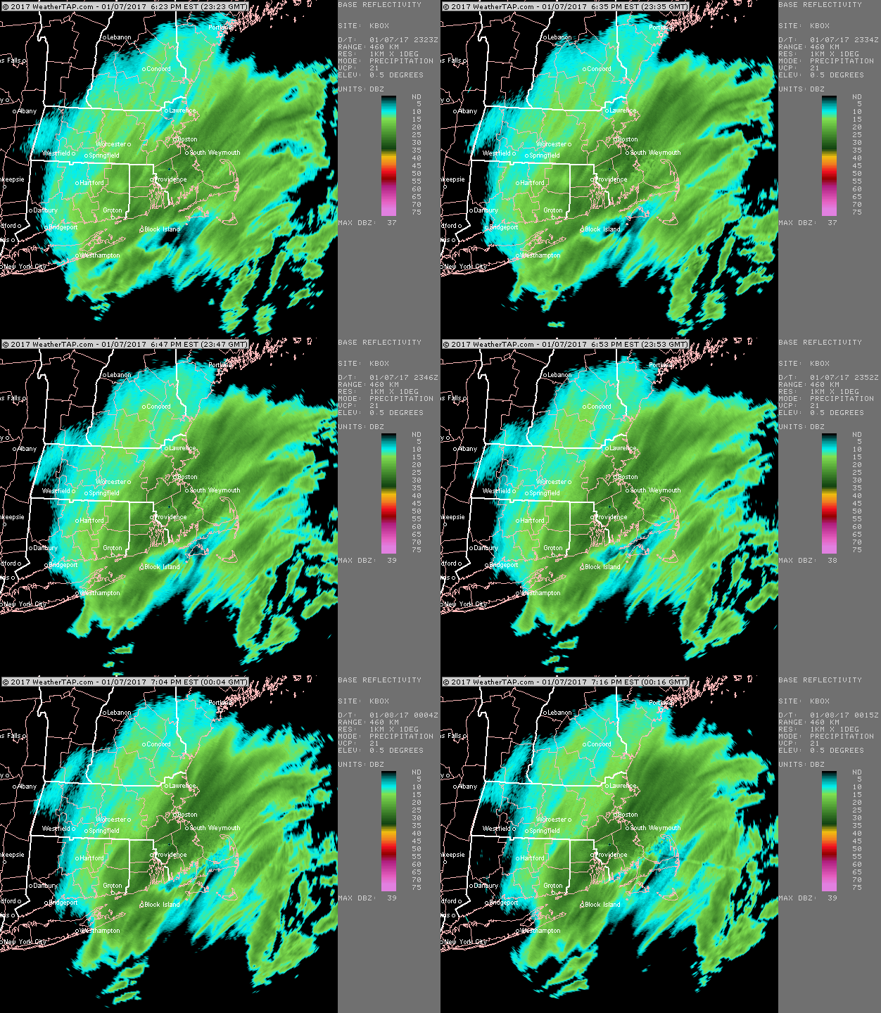
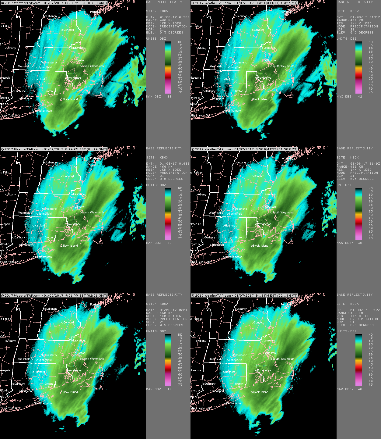
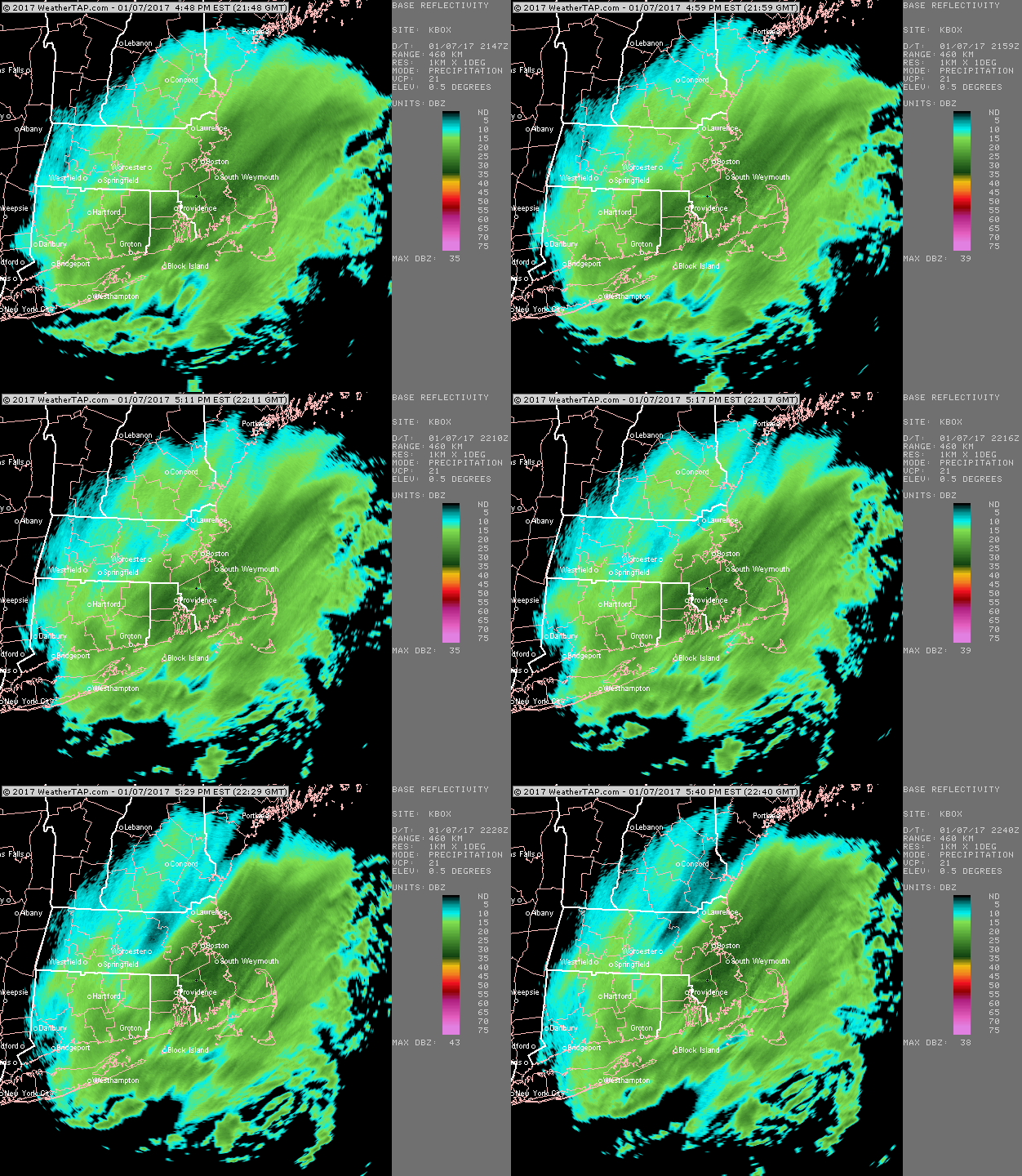
Yeah rough storm for SE MA...these loops are all 2 hours apart
-
EPS says we watch with one eye....but that's all for now