ORH_wxman
-
Posts
93,095 -
Joined
-
Last visited
Content Type
Profiles
Blogs
Forums
American Weather
Media Demo
Store
Gallery
Everything posted by ORH_wxman
-
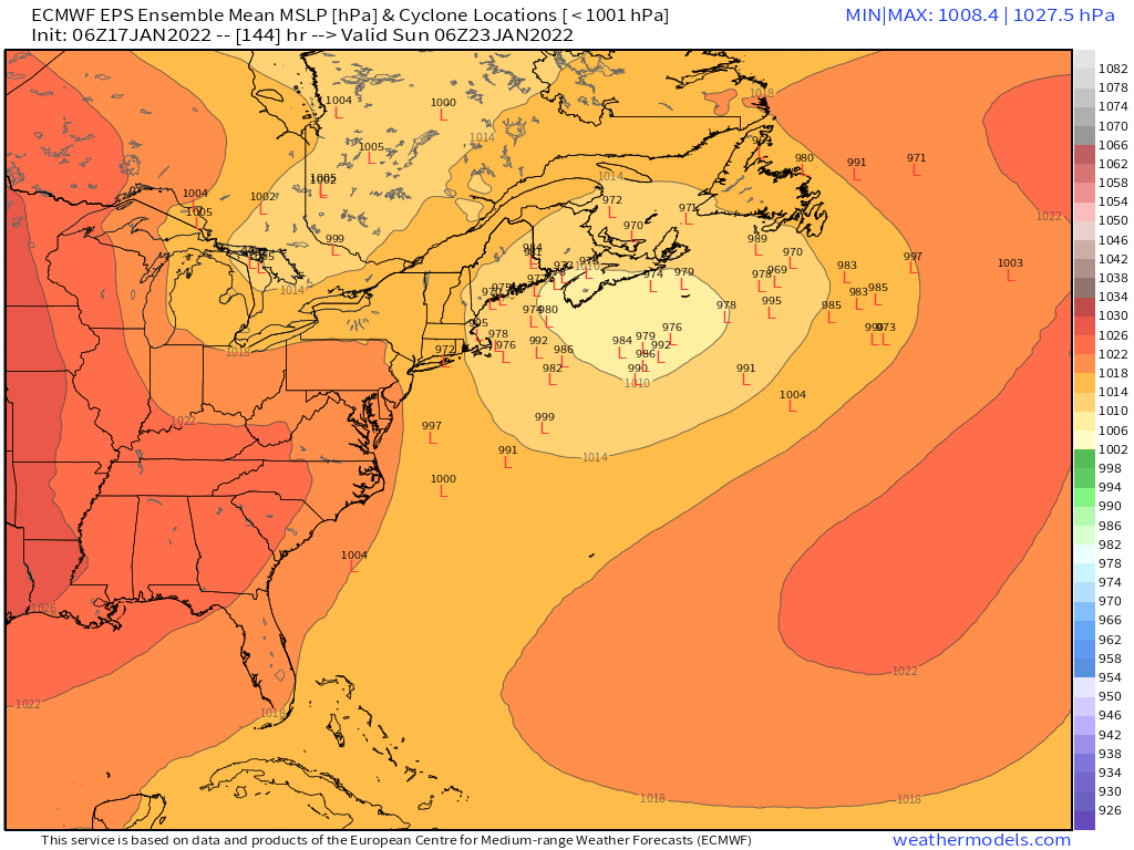
Yeah well I’m not counting on a repeat of a miraculous phase again to turn this due north. Euro looks pretty decent at 114h for the 1/22 threat. I’d like to see more guidance jump on it though.
-
Wave spacing looks like dogshit in both events. Gonna need help…24th is more viable.
-
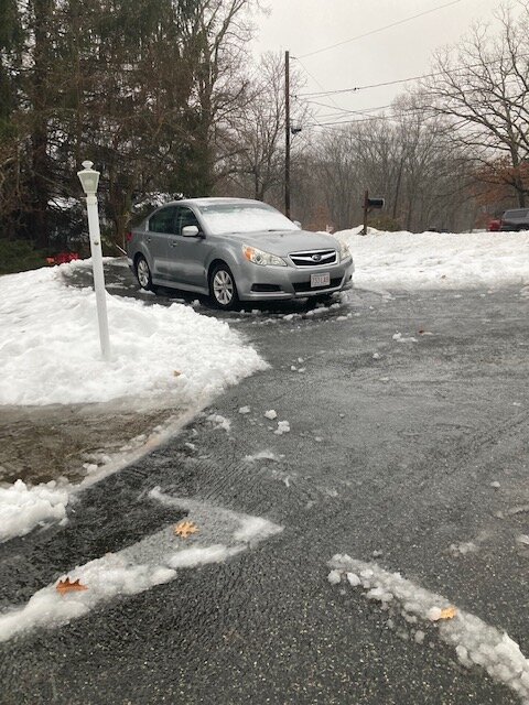
This stuff is gonna be the worst when it refreezes.
-
NAM loves the frontal wave but no other guidance biting that much. GFS does get some snow into SE areas. Maybe an inch or so.
-
Yeah I didn’t trust it all to melt in the next several hours and it would have been an epic disaster if it refroze.
-
Just got rid of the slush on the driveway. Absolutely hideous.
-
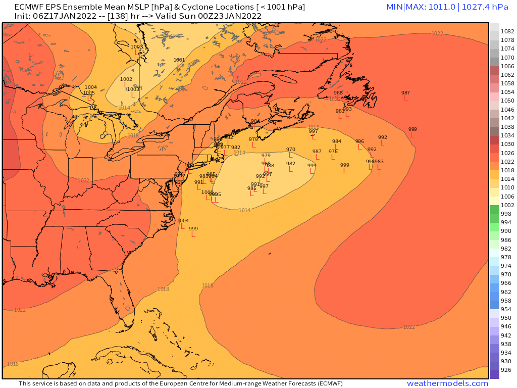
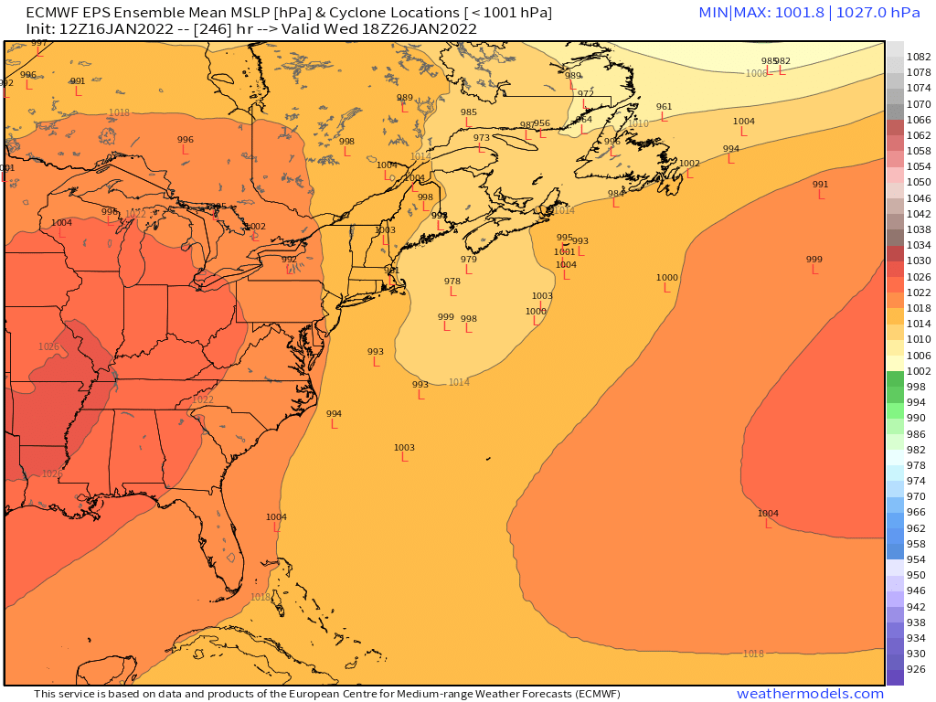
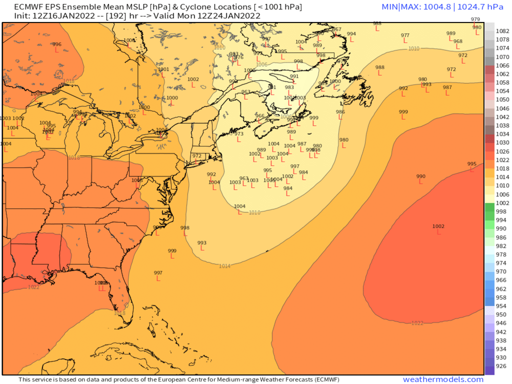
06z EPS trying for 1/22-23 but a little wide right on the mean. You can see plenty of westward members though.

-
-
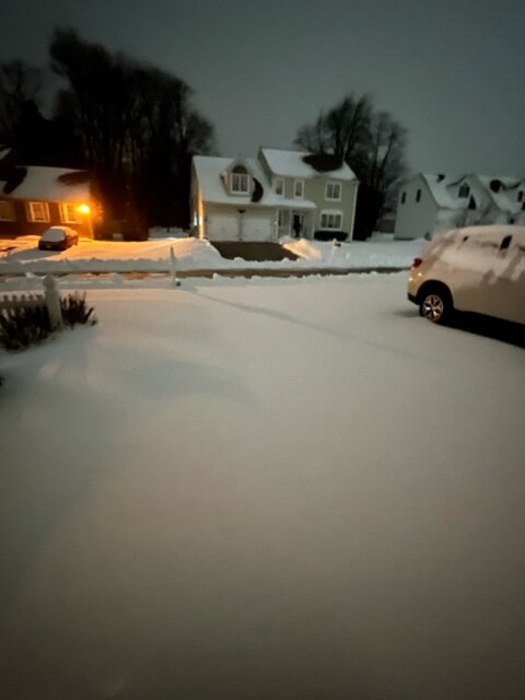
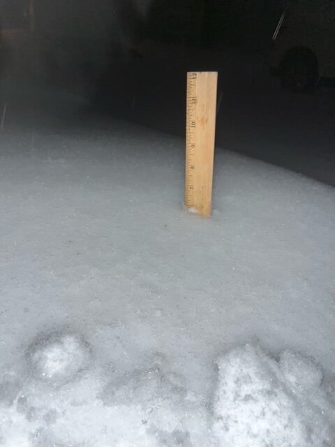
5.5” on winter hill before the changeover.
-
Still getting hammered with huge aggregates. But I think the end is near. Temp up to 32.5F
-
Monster aggregates here. Looks like about 1.5 so far
-
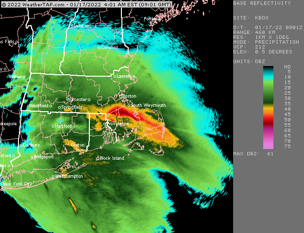
Monitoring a potential important TV to East Coastal storm: Jan 17
ORH_wxman replied to Typhoon Tip's topic in New England
Hopefully Beast grabs 8-10” before the flip. Good base builder for them -
Monitoring a potential important TV to East Coastal storm: Jan 17
ORH_wxman replied to Typhoon Tip's topic in New England
3k looks warmer too. -
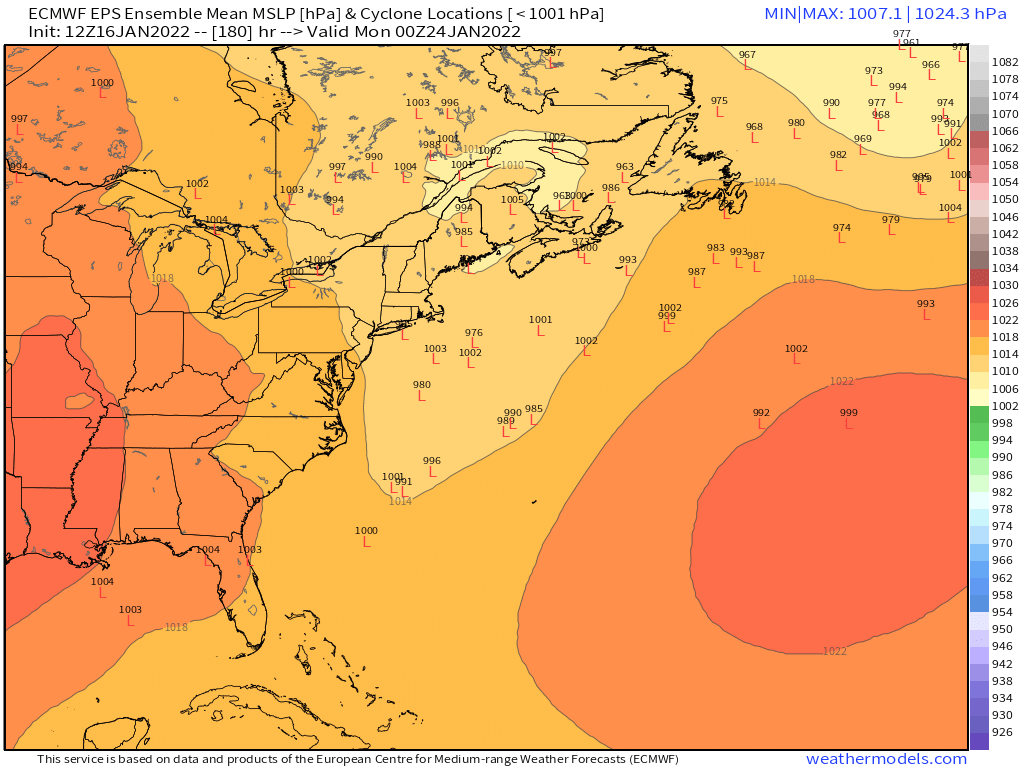
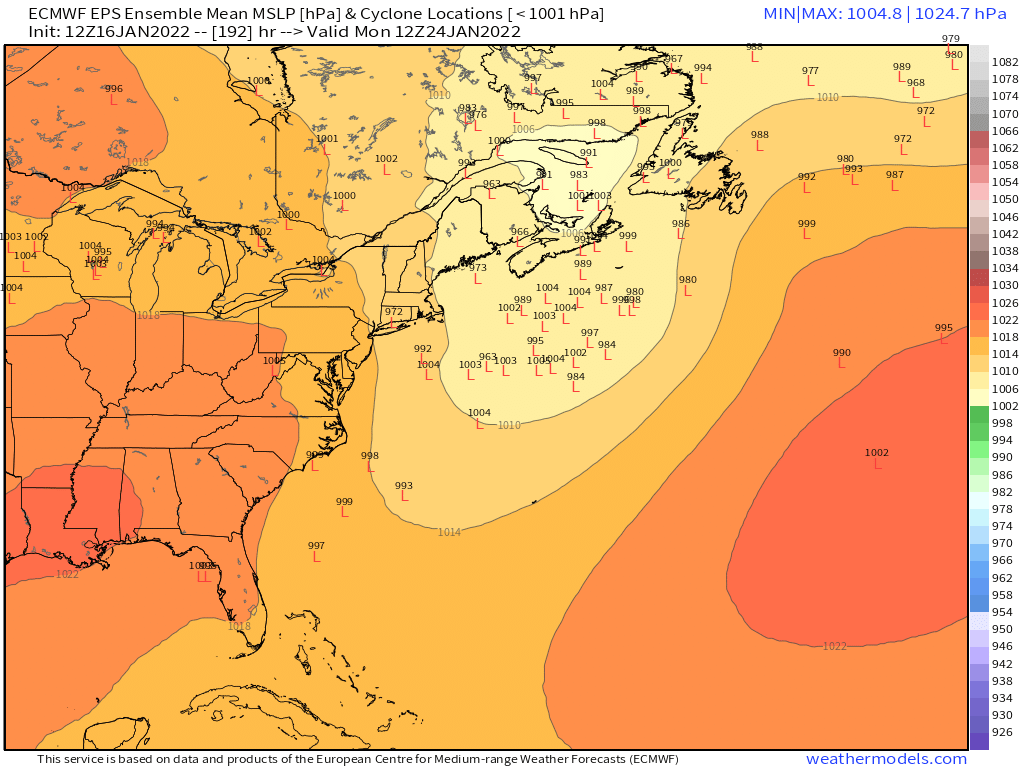
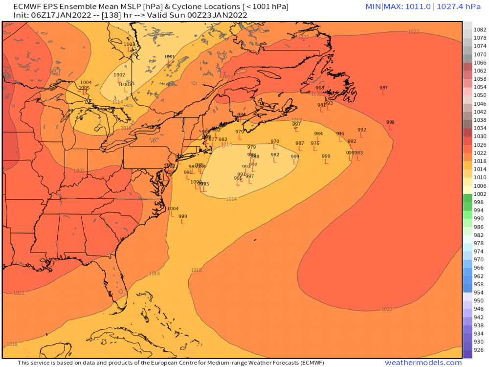
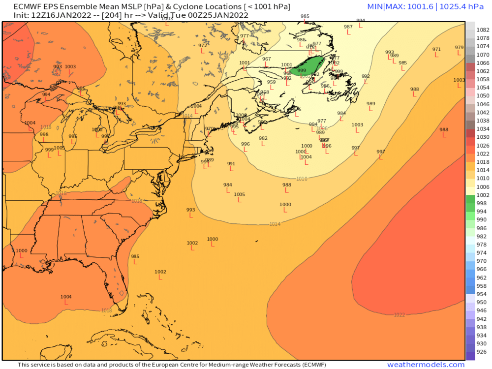
EPS has a weak signal for any time between 1/23 and 1/26


-
Yeah it was really inside of 6 days. More like 132 hours or so. But even this past system was an exception to the rule. You typically won’t see model guidance honing in with such small Run to run changes 5 days out.
-
Yeah euro is zilch.
-
May have to watch for wave along the front Wed night/early Thu.
-
Monitoring a potential important TV to East Coastal storm: Jan 17
ORH_wxman replied to Typhoon Tip's topic in New England
Dover NH -
Monitoring a potential important TV to East Coastal storm: Jan 17
ORH_wxman replied to Typhoon Tip's topic in New England
Yeah N ORH county will prob do decent…they will have some assist on the east flow too with a little bit of orographic cooling. I don’t think it’s going to be that good south of there. I’m expecting maybe a couple sloppy inches…but wouldn’t be surprised if I end up with less than that. I’d consider it a huge win if I scored more than 3”. -
Monitoring a potential important TV to East Coastal storm: Jan 17
ORH_wxman replied to Typhoon Tip's topic in New England
No, I don’t think ZR/IP will be much of a big deal at all in SNE. The warmth between 925-sfc comes in before it does aloft. So I think it goes almost straight to rain from snow…maybe a very brief period of ZR/IP for a few spots. -
Monitoring a potential important TV to East Coastal storm: Jan 17
ORH_wxman replied to Typhoon Tip's topic in New England
This likely becomes very elevation-dependent in the final couple hours before the flip to rain. We could see a scenario where after 2” of snow, I get 2 hours of 0.20” QPF/hour of massive wet aggregates at 34F but it only adds another inch or less while ORH grabs another 3” of paste in that same 2 hour span. -
Monitoring a potential important TV to East Coastal storm: Jan 17
ORH_wxman replied to Typhoon Tip's topic in New England
Correct. At least for most of SNE/CNE (different story back in interior NY and PA) Very little sleet in this as the warmth comes in at the low levels first. -
Monitoring a potential important TV to East Coastal storm: Jan 17
ORH_wxman replied to Typhoon Tip's topic in New England
Honestly not sure what to make of this. There’s arguments both ways. Synoptically this is pretty awful for snow with that rapid high pressure retreat and the pressure falls mostly being to the west rather than southeast when redevelopment is attempting my to take place when we get a typical front ender…however, this antecedent airmass is really strong so there’s a case to be made for the models trying to flush that high a little too quickly. If it hangs back even a couple hours longer than models think, then it’s going to bust positive for snow. I’d prob still hedge mostly on the lower side of guidance but I would put a little bit of weight on the HRRR/3km type solutions. I do think there should be a few hours of moderate to heavy snow even down in CT at the start. Sfc temps may dictate how well that accumulates. If the heaviest stuff is at 33-34F then it won’t be that efficient obviously. It’s a semi-interesting nowcast. We can see how the short term guidance keeps trending today. Esp this afternoon. I will say that the last 4-5 cycles of HRRr keep slowing the high retreat. 15z coming in right now is doing it again. -
Monitoring a potential important TV to East Coastal storm: Jan 17
ORH_wxman replied to Typhoon Tip's topic in New England
Yeah it’s not really that exciting unless we score 5-6”+ but I guess it’s slightly better than all rain. Mostly useless stat padder when you get 2-4” that’s wiped out a few hours later. But who knows, maybe we’ll get a positive surprise given the cold antecedent airmass. But usually this synoptic setup isn’t conductive to the positive bust…feels more like negative downside is the skew. You want to see a high being slower to move out than modeled to have a chance. -
Monitoring a potential important TV to East Coastal storm: Jan 17
ORH_wxman replied to Typhoon Tip's topic in New England
Seems like a solid map. I doubt I would change much.