

ORH_wxman
-
Posts
93,092 -
Joined
-
Last visited
Content Type
Profiles
Blogs
Forums
American Weather
Media Demo
Store
Gallery
Everything posted by ORH_wxman
-
OBS/DISCO - The Historic James Blizzard of 2022
ORH_wxman replied to TalcottWx's topic in New England
Yeah the QPF will likely be underdone a bit this afternoon in the deformation band (prob sets up over E MA…maybe as far west as central areas if lucky)….but I also don’t think this is a major short term model bust incoming elsewhere. The low being elongated is real and will prevent the monster solutions we saw a couple days ago. That said, those putrid rgem solutions are going to be wrong too. Reality in the middle. -
OBS/DISCO - The Historic James Blizzard of 2022
ORH_wxman replied to TalcottWx's topic in New England
Yeah I think it’s coming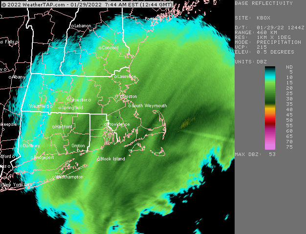
-
OBS/DISCO - The Historic James Blizzard of 2022
ORH_wxman replied to TalcottWx's topic in New England
Those aren’t the same time. Need the one on the right to be 18 hours. -
OBS/DISCO - The Historic James Blizzard of 2022
ORH_wxman replied to TalcottWx's topic in New England
Yeah I’m not seeing stuff way west at all….otherwise it should be absolutely pounding into central CT. Eastern MA was always going to look really good…they were in the cross hairs of the CCB on most of the runs last night and that’s exactly what the radar is showing. -
OBS/DISCO - The Historic James Blizzard of 2022
ORH_wxman replied to TalcottWx's topic in New England
I don’t think it will get that far but we’ll see. The returns are struggling to gain more longitude as you get down into LI and S CT but we’ll see if there’s another push as upper air goes negative. -
OBS/DISCO - The Historic James Blizzard of 2022
ORH_wxman replied to TalcottWx's topic in New England
I do like seeing that WCB stuff south of BID heading on a trajectory to get wrapped into the CCB over E MA and RI. Too bad we couldn’t get that stuff east of the Cape to wrap all the way back. -
OBS/DISCO - The Historic James Blizzard of 2022
ORH_wxman replied to TalcottWx's topic in New England
No because it will tilt more N-S with time. So I think you’ll get into it at some point. Esp as we get into later morning and afternoon. -
OBS/DISCO - The Historic James Blizzard of 2022
ORH_wxman replied to TalcottWx's topic in New England
That far north of the radar you’ll want the leading edge of that band to get like 5-10 miles north of you since we have really strong drift on the potent NNE winds. -
OBS/DISCO - The Historic James Blizzard of 2022
ORH_wxman replied to TalcottWx's topic in New England
You are pretty close to Scott (CoastalWx) and we also have a couple posters in Randolph. -
OBS/DISCO - The Historic James Blizzard of 2022
ORH_wxman replied to TalcottWx's topic in New England
Great band for Ginxy right now. I’m on the northern part of it.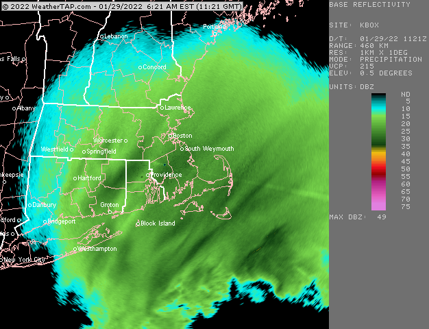
-
06z gfs is getting close to good ice for SNE and mostly snow for NNE. On another note, Feb torch idea in big trouble looking at latest EPS?
-
OBS/DISCO - The Historic James Blizzard of 2022
ORH_wxman replied to TalcottWx's topic in New England
Yeah. We’ll see though…maybe some of that heavier stuff can rotate a little further west than advertised. I think I’m going to be low in BOS. They look primed for something bigger than 18 -
OBS/DISCO - The Historic James Blizzard of 2022
ORH_wxman replied to TalcottWx's topic in New England
Him to PYM will be the jackpot but somewhere prob in E MA down to RI or E CT will be a secondary jackpot with the really heavy deformation band later this morning and afternoon. -
OBS/DISCO - The Historic James Blizzard of 2022
ORH_wxman replied to TalcottWx's topic in New England
A lot of guidance really hammers eastern areas later this morning.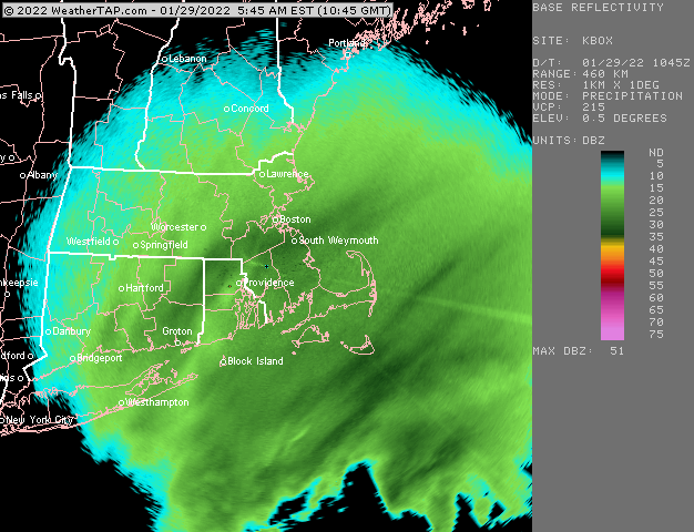
-
OBS/DISCO - The Historic James Blizzard of 2022
ORH_wxman replied to TalcottWx's topic in New England
Getting smoked right now. -
BOS 18” ORH 17” PVD 18” BDL 13” first and last call. There will be a band of 20”+ on south shore and another somewhere 495 or metrowest. I don’t quite think we’re gonna do widespread 2 feet but I admittedly keep staring at H7 and doubting myself, lol.
-
OBS/DISCO - The Historic James Blizzard of 2022
ORH_wxman replied to TalcottWx's topic in New England
Steady light snow here. Been slowly picking up the last hour. Prob a few tenths down on all surfaces. We’ll see how things look in the morning but precip backing in nicely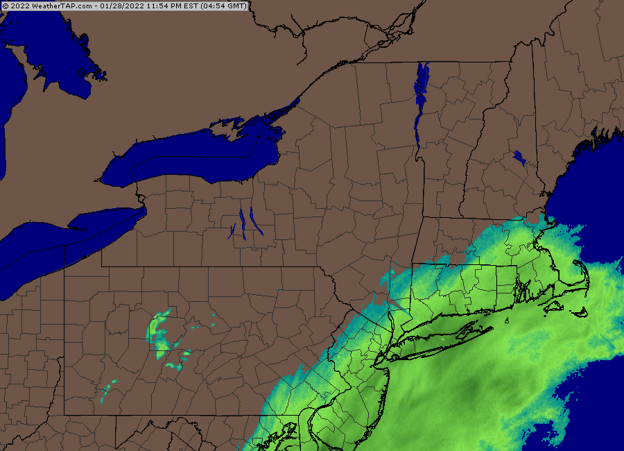
-
That would only be in the band though and not for the whole storm.
-
Because the euro makes small jumps and clown shows like the NAM make large jumps…we’ll go with that
-
This has always looked like a total beast aloft for SNE since early in the week. It’s just that bizarre convective train going fishing in George’s Bank decided to show up late last night/today on guidance.
-
I don't find it very useful outside 12h for verbatim solutions but having it trend for several hours is often a hint.
-
Euro coming back and both HRRR/RAP trending better....this one's gonna be a beast.
-
He’s now like Al Michaels when he will unabashedly talk about sports gambling in the middle of the broadcast…he knows he’s a legend and doesn’t give a shit about playing it safe. That said, Harvey did this in the 2/15/15 storm too. He was basically the only met who stuck to his guns on huge snows in E Ma despite model guidance trying to give us a pedestrian advisory event. Sometimes the upper air is just so overwhelming. I also think he knows that there’s the fluff factor to lean back on….if the storm ends up a bit more seaward, there’s still the exceptional ML/Deformation that will have incredible snow growth and maybe winds not quite as strong in that scenario.
-
Didn’t like York or Ogunquit put up a 24 burger in that? Like 10 miles away had 5”
-
Reminds me a little of the disconnect between sensible wx output and the upper air in the 2/15/15 storm. The model guidance was shoving this massive WCB out east and up into Maine (where blizzard warnings busted iirc) and being paltry over SNE despite obscene height falls south of MVY/ACK


