

ORH_wxman
-
Posts
93,092 -
Joined
-
Last visited
Content Type
Profiles
Blogs
Forums
American Weather
Media Demo
Store
Gallery
Everything posted by ORH_wxman
-
OBS/DISCO - The Historic James Blizzard of 2022
ORH_wxman replied to TalcottWx's topic in New England
Pound town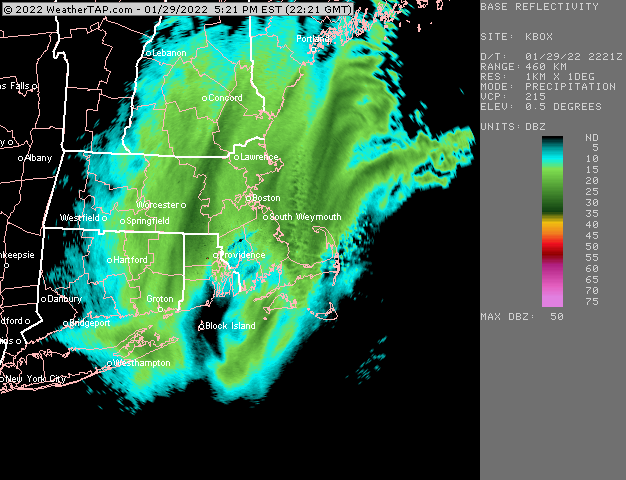
-
OBS/DISCO - The Historic James Blizzard of 2022
ORH_wxman replied to TalcottWx's topic in New England
Wow, this sucker is intensifying too. Tip might be in the best of it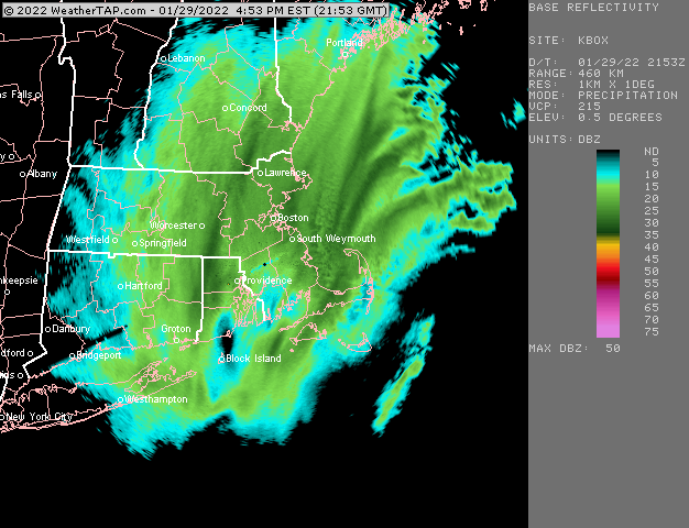
-
OBS/DISCO - The Historic James Blizzard of 2022
ORH_wxman replied to TalcottWx's topic in New England
Might be the best snow growth all day because the wind is lower now. Even when we had good growth this morning/midday, some of them were def getting shattered from high winds. But this is pure arctic fluff. I might be able to fake my way to 18 with a layer of jspin cotton candy on top. (Ok a little bit of exaggeration since the wind is still blowing…just not as hard) -
OBS/DISCO - The Historic James Blizzard of 2022
ORH_wxman replied to TalcottWx's topic in New England
Haven’t measured in a while but we’ve gotta be around 14-15ish now? I didn’t think we had a shot at 18 but I’d this band can stay parked for an hour then we have a chance. This is legit 2-3” per hour stuff in the past 15 min. I’ll be outside again in a bit.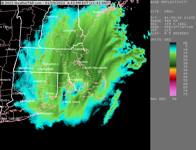
-
OBS/DISCO - The Historic James Blizzard of 2022
ORH_wxman replied to TalcottWx's topic in New England
Wow really ripping even harder now. This is really impressive. -
OBS/DISCO - The Historic James Blizzard of 2022
ORH_wxman replied to TalcottWx's topic in New England
Check radar I just posted above. You’re in that intense mesoband now. -
OBS/DISCO - The Historic James Blizzard of 2022
ORH_wxman replied to TalcottWx's topic in New England
Back to legit heavy snow now. Would be nice to get another hour under this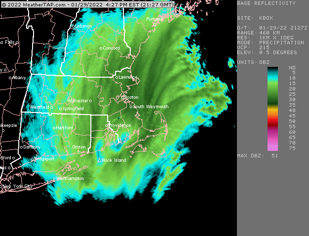
-
OBS/DISCO - The Historic James Blizzard of 2022
ORH_wxman replied to TalcottWx's topic in New England
Wow nice. Yeah he’s been under banding almost all day. There’s a narrow corridor there that got smoked. -
OBS/DISCO - The Historic James Blizzard of 2022
ORH_wxman replied to TalcottWx's topic in New England
Ginxy with another band. Gotta be near 20 now there?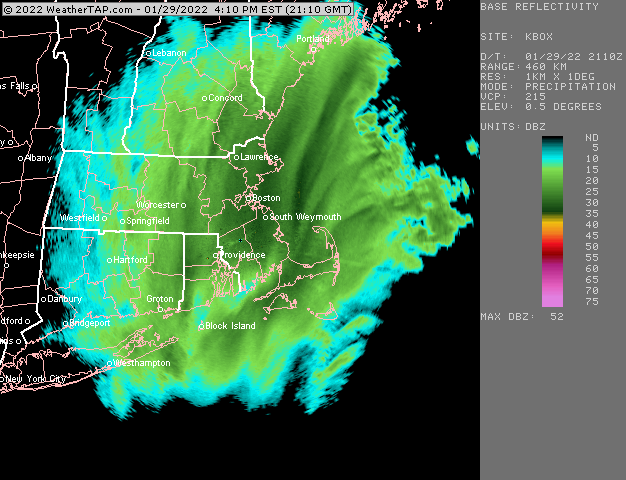
-
OBS/DISCO - The Historic James Blizzard of 2022
ORH_wxman replied to TalcottWx's topic in New England
That’s all in newtonville? Wouldve thought at least 15 there by now. Must’ve been a local subby maybe just west of that band earlier. -
OBS/DISCO - The Historic James Blizzard of 2022
ORH_wxman replied to TalcottWx's topic in New England
That stuff rotating southwest from SE NH is helping out…but it looks like the echoes are starting to open up south of PVD so we’ll have to watch if that starts trying to chew away the echoes from the south over the next hour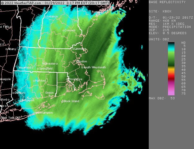
-
OBS/DISCO - The Historic James Blizzard of 2022
ORH_wxman replied to TalcottWx's topic in New England
Is their an objective standard for “frequent”? I used to just look to see if it gusted to 35 each hour but not sure if there is a more stringent standard. -
OBS/DISCO - The Historic James Blizzard of 2022
ORH_wxman replied to TalcottWx's topic in New England
Amazing right now for BOS area down into SE MA Coming down borderline heavy again here.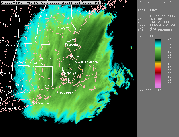
-
OBS/DISCO - The Historic James Blizzard of 2022
ORH_wxman replied to TalcottWx's topic in New England
ORH has been rotting under an outer band for like 2 hours now. I’m sure Ray will be happy about that. -
OBS/DISCO - The Historic James Blizzard of 2022
ORH_wxman replied to TalcottWx's topic in New England
Man that cape Ann to scooter band intensifying again a little. It just won’t quit. Awesome storm there. Snow growth has drastically improved here which is kind of weird because I’m right on the edge of the darker echoes and I figured drift would cause it to stay east but something is helping out….maybe the boundary layer continuing to cool is putting some of the lower level lift into the DGZ.
-
OBS/DISCO - The Historic James Blizzard of 2022
ORH_wxman replied to TalcottWx's topic in New England
Definitely some bands trying to fill in over central areas but the peak goods look like they are pivoting now near BOS. Not gonna get much further west. -
OBS/DISCO - The Historic James Blizzard of 2022
ORH_wxman replied to TalcottWx's topic in New England
Yeah right as it tries to pull east there is one final pulse with H5 closing off pretty good. -
OBS/DISCO - The Historic James Blizzard of 2022
ORH_wxman replied to TalcottWx's topic in New England
You can see the latest image I posted has it surging a bit more to the west so you’re prob just getting back into it -
OBS/DISCO - The Historic James Blizzard of 2022
ORH_wxman replied to TalcottWx's topic in New England
Come to papa…trying to push west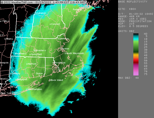
-
OBS/DISCO - The Historic James Blizzard of 2022
ORH_wxman replied to TalcottWx's topic in New England
Maybe another 2-3” in central areas? Unless someone gets stuck under one of those thin bands. Best forcing is well east at this point… -
That’s a good image and shows how the elongated low helped keep the best fronto banding pinned to the coast. If that midlevel center is not as elongated, then that fronto get shoved back much further west.
-
OBS/DISCO - The Historic James Blizzard of 2022
ORH_wxman replied to TalcottWx's topic in New England
Nice subby zone just opened up here. Vis definitely up near half a mile for the first time since predawn. Hopefully that heavier stuff just to the east gets here as it looks like it’s trying to make another surge….death band will never make it but that 25-30dbz stuff could.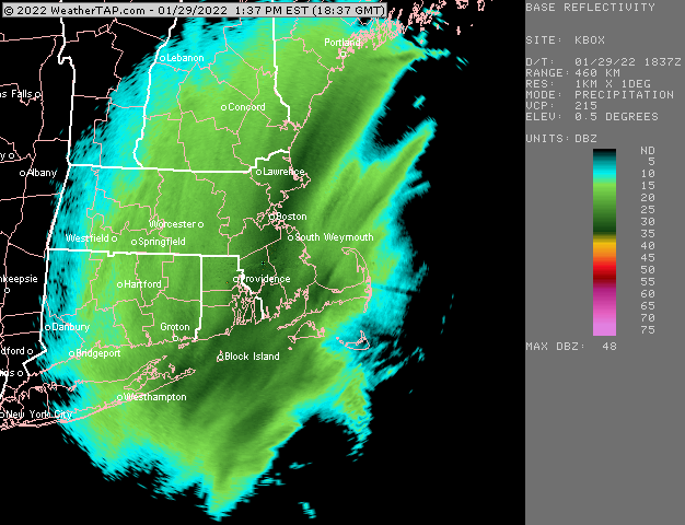
-
Yeah the Asos QPF is going to be horrific and even melting down won’t be super easy since you gotta find a spot that isn’t drifted too bad. I may cut a biscuit at the end of this just to see. Thankfully there’s a lot woods around the house so it limits the drifting some.
-
OBS/DISCO - The Historic James Blizzard of 2022
ORH_wxman replied to TalcottWx's topic in New England
Getting a few dendrites mixing back in with the baking powder. Noticed the echoes slightly darkening again…hopefully we can pull off another couple hours of better growth but we seem to be right on the edge of the baking powder/dendrite line right now. Seems like 25 dbz or so on the box radar is the magic number. -
Yeah the amped runs were definitely horrible. But it’s hard to ignore some of those GFS runs that we’re struggling to give BOS 8-9” too and might have failed to give me warning amounts. Though I think if we look solely at the midlevels, the GFS may have been better…but its dry bias in these coastals showed up for sure which probably made some of the solutions look worse than they actually were.

