ORH_wxman
-
Posts
93,098 -
Joined
-
Last visited
Content Type
Profiles
Blogs
Forums
American Weather
Media Demo
Store
Gallery
Everything posted by ORH_wxman
-
Congrats BOS on borderline warning snowfall on 18z Euro.
-
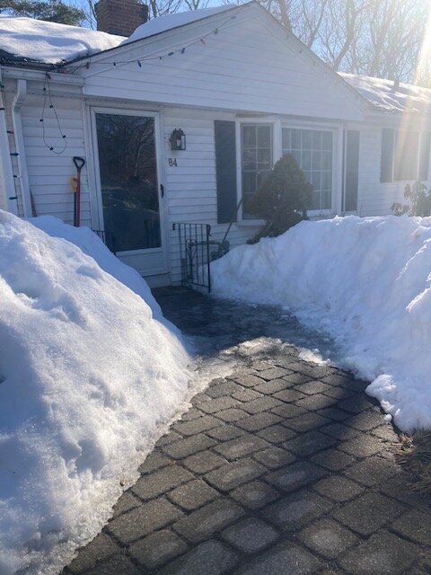
Lot of dripping in the sun today but kind of shocked at how pathetic it was in the shade (as evidenced by the ice not melting on my walkway in my picture)…I assumed at least my walkway would get cleared regardless of sun exposure.
-
All about the sun…damned walkway is still a sheet of ice where the sun didn’t get to it this afternoon.
-
It has a pretty legit ice storm near the pike and into S NH. Snow north of that.
-
Goofus is frigid....basically a warning snow event for BOS after some sleet. Gets ZR into most of CT
-
The real test is how long does the sun today take to melt off the 1.7" of snow from yesterday evening on top of existing snow.
-
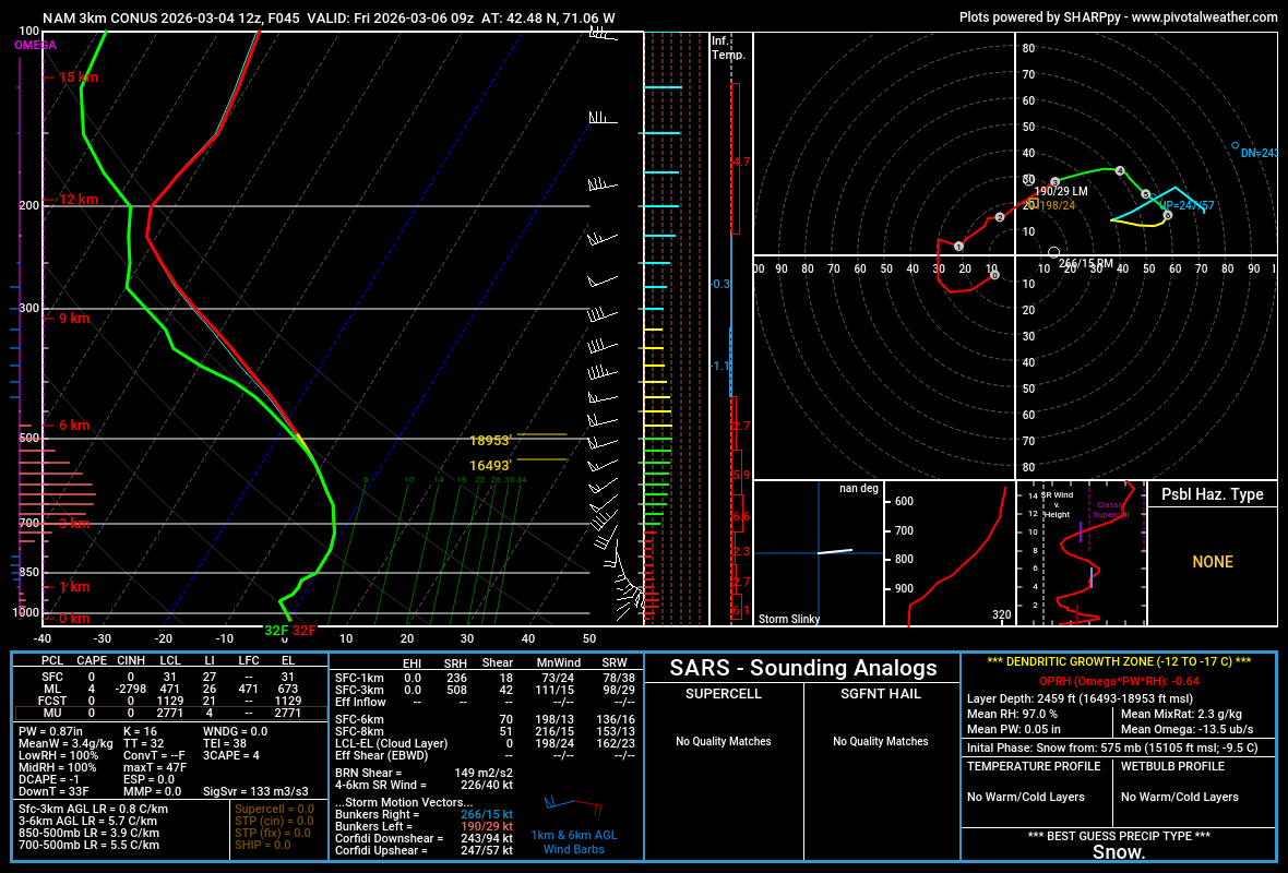
3k NAM near BOS. Mini snow bomb? Lol

-
Yeah it’s gonna take a beating this weekend and early next week. Esp if overnight mins are coming in solidly above freezing. I feel like the damage will be relatively minor until after Friday system passes. Maybe tomorrow gives it a bit of a hit if we can get enough sun and 50s.
-
Is 51 vs 46 really that different? If there’s enough sun and some mixing I bet we’ll spike 50 but if we hang onto low clouds longer and mixing is crap, it could get stuck at like 40-42F in places.
-
Depends on mixing. Ironically a place like BDL is more likely to be stuck in the upper 30s or low 40s than Tolland. There could actually be a mild sea breeze too so Scooter might get shot back into the 30s if that occurs.
-
Account from yore in a 12/16/07 event back then: ”We endured 4 hours of blinding snow in the northeast gale. Up to thy knickers by the finis. The courier was dumbfounded to find a snow tempest in Plymouth MA after riding through heavy ice in Tolland CT.”
-
Looks like pingers about to RT 2 in ORH County and N of the RT 2 further east. About to Lowell now. That was a good event though for Rt 2 and northward....even here overperformed my own expectations.
-
Radar looks good for you and Ray’s area for the next couple hours before you flip. Easily should reach advisory snow totals.
-
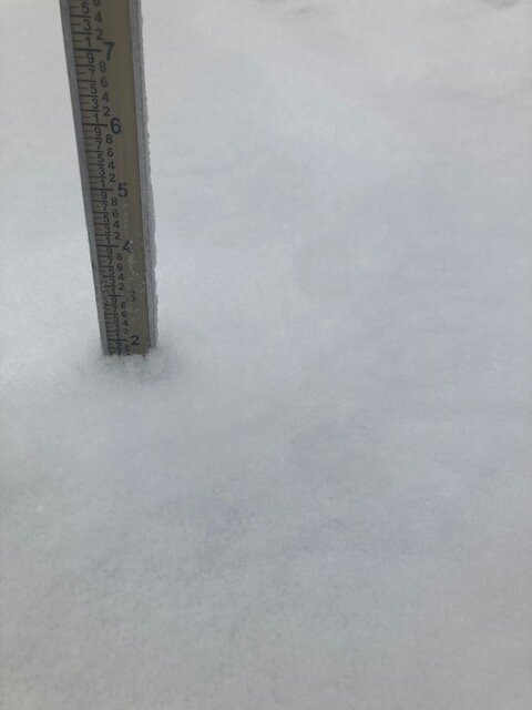
Getting pingers now. 1.7” final snow before the flip.
-
Trying to make a run at 2” anyway, won’t quite make it, but for basically 75 minutes of snow, that is solid
-
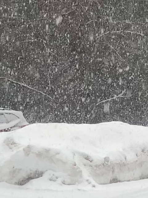
Ok right on queue…parachutes increasing in size.
-
Just took this…def some aggies in there but it’s not the classic silver dollar parachutes right before you flip I’m sure those are coming soon
-
Looks like we’re maxing out now on the rates. Heavy snow and 28.7F Those yellow echoes from BOS to my hood are all snow right now
-
Too bad we missed a lot of the stuff between 1-330pm. Otherwise we maybe could pull out 2”. But these rates right now are a good consolation. We live for the rates.
-
Wonder if you’ll flip back for a bit when the best echoes come back in soon.
-
Absolutely pounding right now. Closing in on an inch.
-
Sleet line
-
Absolutely nuking right now CC has the IP line down near MA/CT border right now. We aren’t getting huge aggies here yet. More like dime-sized
-
must be silver dollars falling near ORH.
-
Man, this is the type of stuff that would give us a quick 6” in 4 hours if we stayed all snow. Good ratios and growth right now with temps in upper 20s.