

ORH_wxman
-
Posts
93,092 -
Joined
-
Last visited
Content Type
Profiles
Blogs
Forums
American Weather
Media Demo
Store
Gallery
Everything posted by ORH_wxman
-
Yeah it’s not raining above 1500-2000 feet there unless it’s for like 15 minutes at the beginning.
-
I don’t see the problem with snow instead of cold rain. It’s going to melt in like 4 hours. No leaf out yet so no tree damage either.
-
It’ll cut over your Fanny. We enjoy 40F rainstorm. Maybe you sector for an hour.
-
Nah, you’ll get smoked probably unless this trends into cutting up the CT valley (which is unlikely)
-
Yeah down below 200 feet you can prob just completely eliminate accumulations. Esp if outside the CCB intense banding. If you are under that, then I could see a few sloppy inches at 33-34F. But this isn’t a typical setup for late season snows. The ageo flow is too much out of the east. The antecedent airmass is pretty good though so can’t discount it altogether…esp in the interior elevations that are halfway decent with CAD.
-
I’d take it even further. You can prob even cut amounts by 60-80% in the blues…and more like 40-50% in the pinks/reds lower than 1500 feet elevation.
-
Yeah I’m tossing that solution for now but I’m hoping it verifies. Much rather have a bit of sloppy snow than a 40F rainstorm.
-
NAM’d at 18z. Nice 8-12 incher for ORH county.
-
Awesome news. Glad to hear he made it.
-
We bought our place in 2017 for 345k, could easily sell for 550-600k now. It’s asinine. But all the houses we would upgrade to are ridiculously expensive too now.
-
Even 3 weeks earlier this would be a nice setup I’m betting. Baroclinicity would be a lot stronger and hence the CAD.
-
I edited my post. Back to back years post-4/15…LOL….already 3 craft wine coolers in and he’s done. Ready to pull over the explorer on I-84
-
We had a warning snow event in the interior last year on 4/18…lol. edit: it was 4/16 last year. The 4/18 storm was in 2020.
-
There’s usually better baroclinicity in the winter too which helps intensify secondary mid-level centers which thwarts the SE flow and starts turning it more E and ENE. We don’t have that here.
-
Hopefully it keeps trending colder. It’s already doomed to be a dogshit day Tuesday. Might as well get some snow out of it. My guess is it ends up as mostly a frigid rain though.
-
That departing shortwave ahead of Tuesday’s system needs to slow down to give a good chance of snow over interior. It lifts out a little too fast which allows the Tuesday system to tuck in too tight and bring the low level flow out of the east and southeast.
-
At least we had yesterday
-
There aren't many birds that color around here that are also small, so I'd be surprised if it was something else. But yeah, Ginxy cell phone pixels FTL....too much white to be a black and white warbler. I guess it could be a lightly-colored mockingbird, but body type doesn't quite match.
-
Scooter gets revenge finally.
-
Looks like a snow bunting that hasn't migrated back north yet.
-
We don't have any Norway maples in this neighborhood, so my area always looks like a nuclear crater until at least the 3rd week of April, and often later. We have forsythia budding out and some of those thorny bushes starting to green, but basically no trees.
-
Was nice late morning but since then we’ve had a lot of clouds and wind has picked up. Temp has fallen about 4F off its high too. Back into the upper 40s.
-
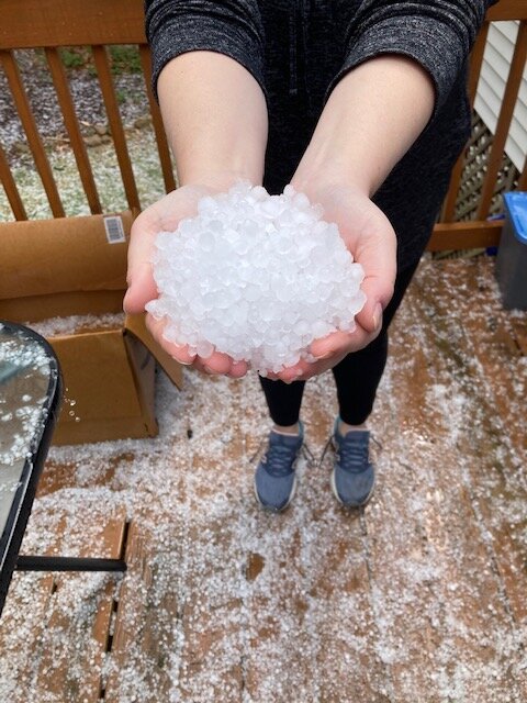
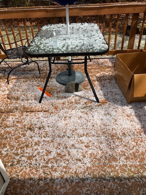
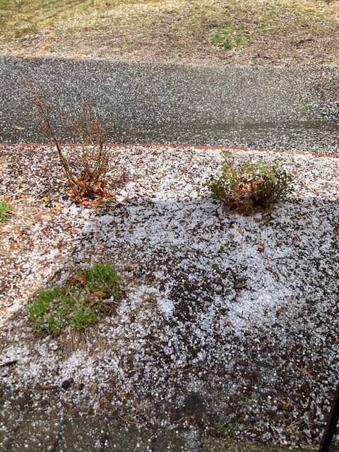
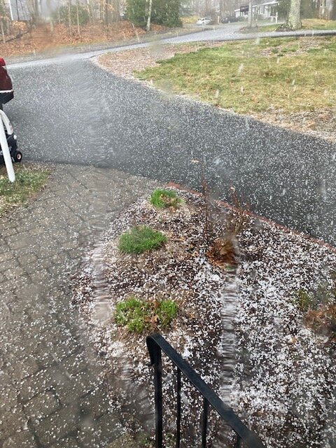
That wraps up severe season here…we won’t top that one the rest of the season. Hail was really impressive for a few min.
-
Just got smoked with hail
-
Yeah we’re due for some good Decembers. We’ve paid back our surplus from the 2000s at this point. It’s kind of like how we had a pretty long stretch of lousy Marches until 2013 broke it and then we had a bunch of good ones. I’m feeling a december turn-around at some point here soon. The funny part though is on paper, the interior had great snow Decembers in 2019 and 2020 but the cutters rendered them pretty mediocre for sensible wx. 2019 did keep pack most of the month but it had the same feel as this winter where it was often thin and icy because it was leftovers from a cutter. Last really wintry December here was 2017.


