ORH_wxman
-
Posts
93,095 -
Joined
-
Last visited
Content Type
Profiles
Blogs
Forums
American Weather
Media Demo
Store
Gallery
Everything posted by ORH_wxman
-
Yeah that would be ideal....but if the 3rd is better for most others, that is fine and I'll organize another one that I can definitely make later this winter.
-
We caught one on our trail cam in the woods behind my house. They are sneaky....hard to ever see, but they are around....esp in areas that have any type of undisturbed woods that are greater than like 10 acre chunks which is pretty common in the Holliston/Sherborn/Hopkinton stretch.
-
I'm not going to be here on the weekend of the 3rd, but I can make the 10th I think.
-
I’ll take a repeat of 2020. It didn’t ruin winter either. I could do without the tropical gales from Havana on Christmas though.
-
They probably aren't very good because the composites look like this..
-
Dec 2021 is the most negative PNA on record for a monthly value....so yea, people shouldn't be associating a conventional -PNA with December 2021. It's like people associating a conventional -NAO with February 2010. Euro's -PNA is a pretty good look for us since the Aleutian ridge is very poleward and it's couple with a -NAO/AO.
-
I would say the Pacific doesn't look like Dec 2000....that's a -PNA look with the huge heights near the Aleutians and some subtle troughiness near western Canada. But that is still a great look with big poleward Aleutian ridge and -NAO....reminds me a bit more of Dec 2010, though obviously 2010 had pretty extreme blocking.
-
One reason 1965 was so bad is that it was the lowest precip total on record.....but it was already following 2 years of low precip. By itself, it would have been pretty bad, but the fact it came on the heels of back to back very low precip years already made it so much worse. BTW, 1965 is so anomalous, that the 2nd driest year (1910) is closer to 14th place (2016) than 1965's total.
-
1960s was like a 4 year drought which is why it got so bad. That's hard to do around here though which is why all the subsequent "droughts" haven't been able to match it. They have trouble lasting more than a year. 1963-1966 was the last time BOS had 4 consecutive sub-40 inch precip year. IIRC, I don't think we've even had 3 in a row since then. It's difficult to avoid precip around here.
-
Still gotta watch out for some localized heavy downpours through afternoon. There will be more stuff rotating off the ocean.
-
The TDWR radars were installed in the 1990s in response to the Delta 191 flight that crashed at DFW in 1985 due to low level wind shear from a storm. But the current iteration of what we see I think was from the mid/late 2000s so I think Scott is correct on the rough date of when we started being able to view them on radar sites for reflectivity, etc.
-
http://www.meteo.psu.edu/fxg1/NARR/1995/us1114.php http://www.meteo.psu.edu/fxg1/NARR/1995/us1115.php We actually had a period of snow on the front end of that one in ORH, but it only lasted about an hour or two and got a few tenths. Then it was just a howling cold rainstorm. I was jealous watching TWC and seeing central PA up to central NY get buried.
-
First measurable that year was 11/13 i think...maybe half an inch to an inch. It was like 2 days before the monster nor' easter that buried BGM/IPT. Then 11/29 was the system that started the continuous pack.
-
NAM gone wild
-
I think it will spread west a little as the easterly anomalies look to continue for the next week or two and push 3.4 down some, but the eastward shift is good imho. I don’t think a slightly stronger Niña is really anything to worry about anyway. When it’s not likely to exceed low end moderate. Esp in New England. Maybe further south might sweat it a bit more.
-
Eastern regions definitely seeing some of that cooler subsurface starting to upwell.
-
Money can’t buy you love.

-
Years ago on eastern (maybe 2007?), I made a list of required features to get advisory snows or greater in Boston in November (this would apply to October too), and one of the features always present was a high in Ontario or western Quebec.....you have to have the ageostrophic component more northwesterly (and actual sfc winds north or NNW)....if that wasn't present, then BOS got skunked every time and you'd see the accumulating snows limited to like 128 belt or 495 belt and N&W. Lack of that high placement doomed BOS in the 11/6-7/12 event and the Octobomb 2011 and even the 11/15/18 event....each time the high was more toward CAR/eastern Quebec/western Nova Scotia which was enough to screw the immediate coast....but even like 5-10 miles inland was fine.
-
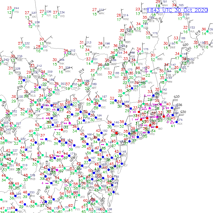
Look at those dewpoints and wind direction on the sfc plot I posted....that is always key in very early season snow events...esp for coastal plain. You want to see those cold dewpoints just feeding into the precip to constantly create evap cooling to offset any diurnal heating or WAA. Dews in the teens just feeding down the S ME and SE NH coast.
-
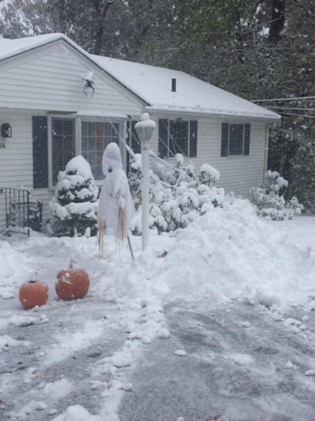
Hopefully we get this again

-
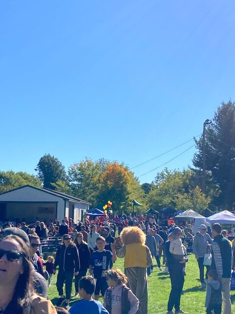
Pretty much perfect bluebird fall day at town festival. Low/mid 50s and not a cloud
-
850 temps moderate rapidly today so we’re not going to get a good radiational cooling night in this airmass. Looks like we’ll get multiple calm nights in the colder airmass next week though. I suspect there will be a lot of first frosts down into CNE with that one.
-
Looks like the high at ORH was 56F....that's pretty good for 9/23 with full sun.
-
You can see the verification above how the easterly anomalies basically got stopped at the dateline in early September.....the current prog has them getting further east, but if verification is like last time, then this one will prob rot around -1C. The one difference though is that the negative anomalies have risen closer to the surface than we had in mid/late August, so it won't take much for them to cool the sfc by several ticks. I'm really only focusing on the next 4-5 weeks or so....anything after October typically is getting too late to really affect the season from an ENSO standpoint....I suppose it could still affect late Feb into March, but there are a million other active variables that get stronger throughout the winter which can affect the season-end versus early on.