ORH_wxman
-
Posts
93,092 -
Joined
-
Last visited
Content Type
Profiles
Blogs
Forums
American Weather
Media Demo
Store
Gallery
Everything posted by ORH_wxman
-
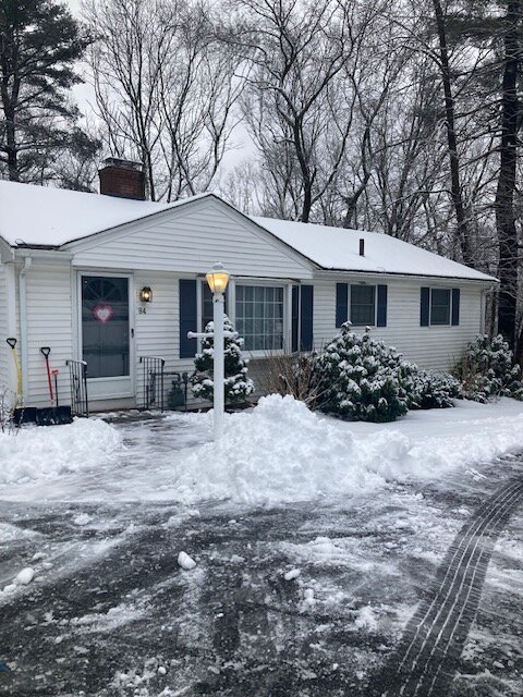
Crunchy under foot on the deck tonight grilling. Winter feel. Trees still have some snow on them while down at bottom of hill it’s all off the trees.
-
It was a Flop... February 2024 Disco. Thread
ORH_wxman replied to Prismshine Productions's topic in New England
Yeah there’s def gonna be some model fantasies out of that pattern shown. Might be several. A few whiffs in a powderkeg setup near the end of the season should do well on here. -
It was a Flop... February 2024 Disco. Thread
ORH_wxman replied to Prismshine Productions's topic in New England

-
It was a Flop... February 2024 Disco. Thread
ORH_wxman replied to Prismshine Productions's topic in New England
One final shot I think we’ll have to get a big dog…and I think Ray’s window makes sense when you look at the MJO progression and general seasonality of ENSO. Hopefully we can get one. Maybe we will repeat the 1957-58 timing again like we did in January. (For refresher, in 1957-58, the first big snow of the season here was 1/7….then there were additional smaller events but also a huge rainstorm with a bit of interior wet snow on a benchmark track around 1/23-1/25….sound familiar yet?) The pattern turned significantly colder during the 2nd week of February in 1958 and then we got the first big dog on 2/16/58. There was a reload during the 2nd week of March and we got the monster storm around the equinox too. This year is obviously not going to run as cold as Feb ‘58 since that was an exceptional arctic outbreak, but I could see some good storm chances. -
Yeah I remember. Once the CCB got cranking, a lot of guidance had this airmass get entrained and we saw output dropping it into the 20s on the coast and even some upper teens inland. But that high trended north and arrived later as we got closer.
-
It was a Flop... February 2024 Disco. Thread
ORH_wxman replied to Prismshine Productions's topic in New England
Doesn’t matter in this context since 2 inch soil temps are around freezing across most of MA (a bit below in higher terrain). You’re not gonna melt really anything bottom-up with that. If it was still in the high 30s to low 40s then you would. Pretty much all melting once past very early winter is going to come from top-down…once ground is exposed nearby then you’ll get lateral assist…esp as sun angle increases and heats the exposed sfc nearby. -
It was a Flop... February 2024 Disco. Thread
ORH_wxman replied to Prismshine Productions's topic in New England
Yeah one thing that has been nice is I’ve had ground covered for most of the month since 1/7. We lost it after the second cutter but only for a few days prior to the 1/15 event. Then we lost it again last week but only had to wait about 3 days. -
It was a Flop... February 2024 Disco. Thread
ORH_wxman replied to Prismshine Productions's topic in New England
Sure wet ground from 33-35F rain that preceded it. But if that didn’t fall first, the ground wasn’t prohibitively warm. That’s the point everyone else is making. -
Drove into Quincy and saw the fresh coating. The existing snowpack actually decreased quite a bit between my house and the east side of Sherborn near the Dover line. They had like maybe an inch with grass blades sticking up in that area while back home was like 2.5-3” of dense snow/sleet. Then the new snow last night became more noticeable near Blue Hill
-
It was a Flop... February 2024 Disco. Thread
ORH_wxman replied to Prismshine Productions's topic in New England
It was melting not because of ground temps but because it was like 33F outside when that crap was falling. -
It was a Flop... February 2024 Disco. Thread
ORH_wxman replied to Prismshine Productions's topic in New England
December means more where higher snowfall averages are. For a place like ORH, if you essentially punt December, it’s hard to recover though not impossible. El Niño years are the best way to do it…Ala 1957-58, 1965-66, and even 1982-83 (finished near average that year). Fo even snowier to a place like Maine where Tamarack is, essentially punting November/December (let’s call it less than 5” of snow) is going to be even harder to come back from. It can still happen but not as easily as a place that might only average 7-10” in Nov/Dec combined. -
It was a Flop... February 2024 Disco. Thread
ORH_wxman replied to Prismshine Productions's topic in New England
It actually looks like the late 50s to early 1970a are the outlier. Very consistent AN snowfall. I’ve mentioned it before but that was 17 consecutive seasons of normal or AN snowfall at ORH. Completely abnormal for the climate record going back to late 19th century. But since so many datasets like to start in the 1950 time range and the older generations grew up in that era, many falsely think that was “normal” baseline climate. It wasn’t. edit: scott beat me to it, lol -
It was a Flop... February 2024 Disco. Thread
ORH_wxman replied to Prismshine Productions's topic in New England
2012-13 as well. I think there’s plenty of examples since the correlation is prob something like a few tenths. -
It was a Flop... February 2024 Disco. Thread
ORH_wxman replied to Prismshine Productions's topic in New England
The record 2 year futility is actually 34.8" in 1979-80 and 1980-81....amd since last year had 12.4", this year would need 22.3" to set a new record. So BOS needs to have less than or equal to 13.2" the rest of the way to set a new record. -
It was a Flop... February 2024 Disco. Thread
ORH_wxman replied to Prismshine Productions's topic in New England
Its around the time the MJO is going into phase 8....I think there's a pretty good chance for a decent pattern in 2nd half of February, but obviously nobody will care if ti doesn't produce a big dog, lol -
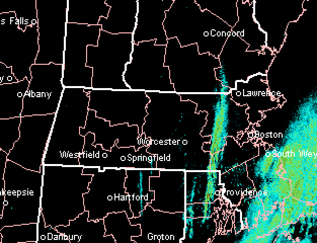
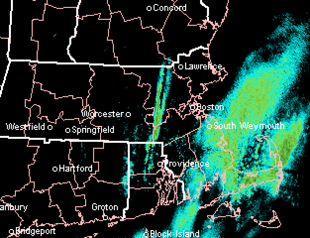
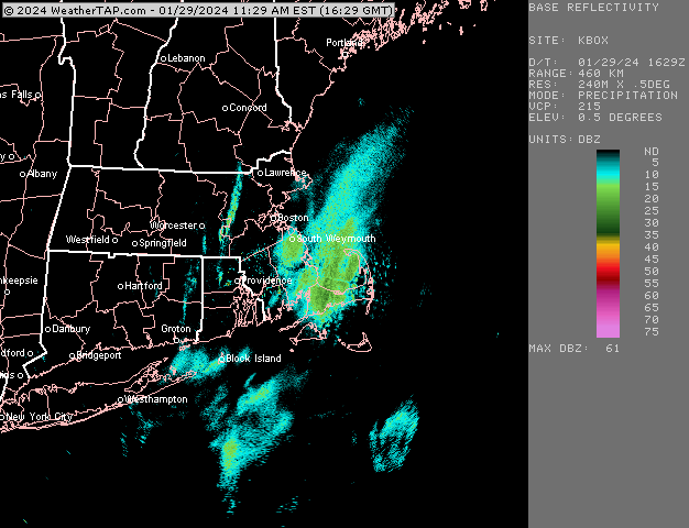
Yeah its really unstable aloft with the ULL/trough almost over us and at the sfc, we have a bit of an inverted trough producing some slight convergence helping form a few bands....and the colder advection at 925/850 is producing the OES on the south shore/Cape.
-
Temp has actually fallen about 1.5 degrees here in the past 60-90 min down to 31F. Snow is sticking to pavement now.
-
N ORH county elevations into monads were the one lock in this system to do well....too bad we didn't get a solid positive bust elsewhere in SNE. Still, it looks and feels like winter today around here with a very dense 2.5-3" OTG and steady snow faling. So, we take the little things this winter. Yeah see above in my reply....at least it's a wintry day today. I have a mini snow globe out there right now with this band....you even have a little band in your area too
-
Nice steady snow here for a while with that little band. Not sticking to any dark surfaces at peak insolation of the day here. But it’s refreshing the piles and existing snow and on bushes.
-
Getting my own little coke line here.
-
Yep, I said that when they were posted....they'd be too light in elevated interior which they were. But they weren't bad elsewhere.
-
It was a Flop... February 2024 Disco. Thread
ORH_wxman replied to Prismshine Productions's topic in New England
I actually find it funny that their second place streak on 4"+ got broken because of an April snowstorm.... -
It was a Flop... February 2024 Disco. Thread
ORH_wxman replied to Prismshine Productions's topic in New England
I don't have strong thoughts on Feb....it is typically our best month in El Nino, but the first week looks pretty quiet unless that D4-5 threat somehow comes back in more amped. Then who knows...pattern looks like it wants to reshuffle to favorable by mid-month, but we'll see. We do look like we're going from phase 7 to phase 8 on MJO which should help constructively interfere with the pattern....amp up that aleutian low to spike heights out west....but again, I wouldn't be confident until we're closer. -
It was a Flop... February 2024 Disco. Thread
ORH_wxman replied to Prismshine Productions's topic in New England
Yeah but the sample size on that is exceedingly small, isn't it? I don't see how that would be predictive unless someone can illustrate a physical attribtution. -
Picked up another inch and a half overnight. Total starting from yesterday morning a bit shy of 3” but that first round compacted before last night. Looks like we got at least double that amount on the piles though because of how dense it is