ORH_wxman
-
Posts
93,092 -
Joined
-
Last visited
Content Type
Profiles
Blogs
Forums
American Weather
Media Demo
Store
Gallery
Everything posted by ORH_wxman
-
New England Winter 2024-25 Bantering, Whining, and Sobbing Thread
ORH_wxman replied to klw's topic in New England
Ok yes, the record was set on Feb 4, 2023…just looked it up -
New England Winter 2024-25 Bantering, Whining, and Sobbing Thread
ORH_wxman replied to klw's topic in New England
Yeah I’m surprised the record would be set this winter. We haven’t had obscene arctic cold. -
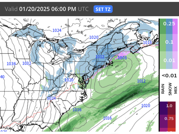
Yea it is. Which isn’t saying a whole lot with the dearth of big threats this season….but this one seems to be showing up on all medium range guidance. In one sense, the fast flow makes things a bit nuanced but on the flip side, this is a pretty large longwave trough over the east so guidance is pretty confident in its location and the storm is really just from an embedded vort/jet streak that is just riding the gradient…which is why maybe most guidance is similar. They all agree on the longwave trough…exception might be Canadian which does the whole thing in a bit different evolution (more positively tilted with overrunning look).
-
It’s interesting that despite a fairly precarious high-speed flow, all the major global models (GFS/Euro/GGEM/Ukmet) have an event hitting us as a plowable snowfall next week. Maybe just a coincidence but it’s been semi-consistent for 2-3 runs now.
-
Pacific has been vastly different so far this winter than the last few. We’ve obviously been screwed for snowfall but it isn’t because there’s been a severe lack of cold around. It hasn’t been frigid (that might change soon) but we don’t need frigid to snow here. Just lots of seasonal cold which has been present.
-
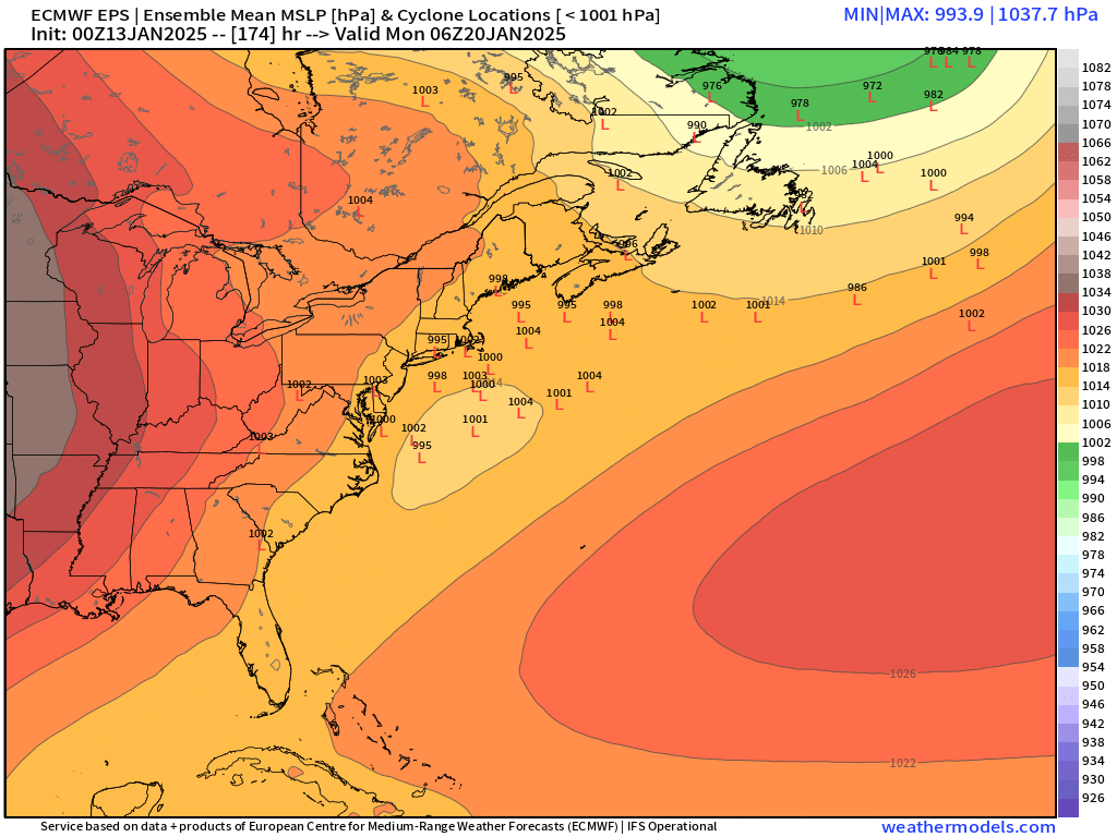
Yep that’s not far off the EPS. There’s quite a few hits on there. Still relatively low probability at the moment but it looks better than it did yesterday

-
EPS has a decent signal for MLK. There’s risk for suppression after this weekend, but I’m not totally convinced it will play out given the WAR that develops on pretty much all ensemble guidance.
-
Nothing like a 5.5” blizzard. Sounds like the Dakotas.
-
Keep in mind BDL is prob running almost 2F too warm. But even that almost +4 should get wiped out if guidance is anywhere close to correct…it could always be overdone, but I’d be surprised if the next two weeks are near normal instead of solidly below.
-
EPS has a signal for next weekend but it’s weak. There’s a lot of uncertainty which isn’t surprising with the faster compressed flow there.
-
Yep unless guidance flips big time for late month and gets very warm, january is going to end up solidly BN.
-
I remember Jericho. Closed down after the ‘95-96 winter. I was in high school. Had a T bar lift there. Too bad it closed…not like there was a shortage of good winters in the following 20 years. Pine Ridge in Barre lasted even longer. 2006 it had to close because the wheelhouse room at the bottom of the lift caught fire and destroyed the whole base of it.
-
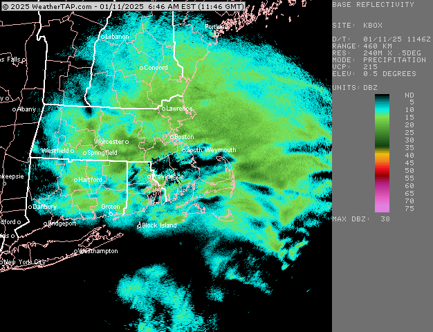
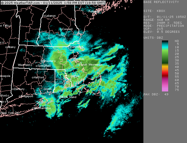
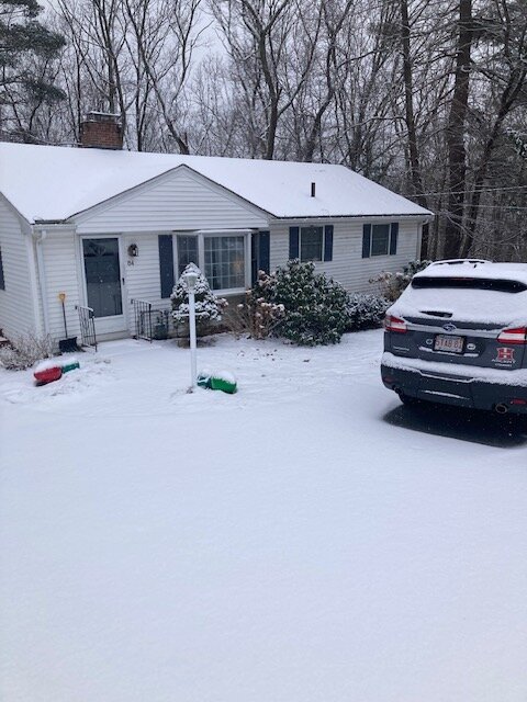
Right around 3” here
-
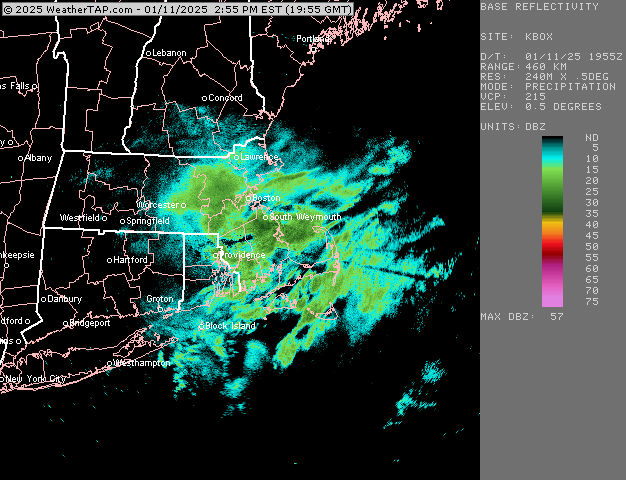
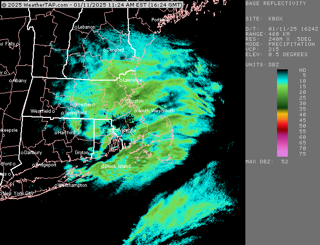
South shore should be starting to stack it a bit for anywhere that was struggling earlier. Really good echoes
-
Roads had mostly gone wet during the lull combined with peak insolation but they are snow covered again.
-
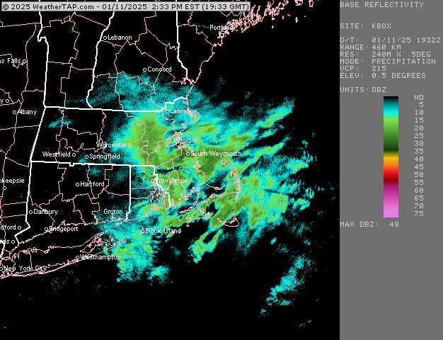
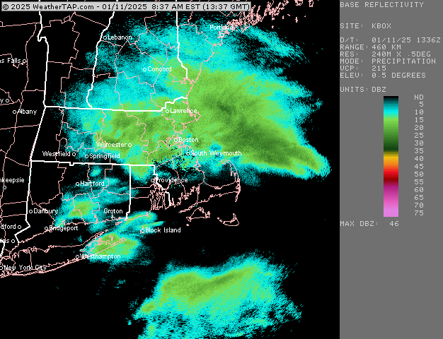
Really good snow growth again. These stuff could prob go 20 or 25 to 1 to end it.
-
Breached 2” here. Coming down very nicely again. Good flakes. Looks like south shore is getting hammered
-
It’s the first time I’ve ever seen that because I would never even consider looking at a D10 ensemble freezing rain output. Way too nuanced of a ptype to consider that far out.
-
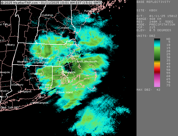
Yep ramping up here again. Been pretty good snow growth most of the day too.
-
Someone may pull a 4 or 5 spot in Essex if that can keep up for a couple more hours
-
Yep. Ripping again. Should be able to get 2”+
-
Prob good burst for Ginxy coming
-
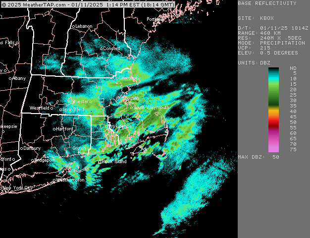
About 1.4” so far
-
Ripping right now. Def have over an inch eyeballing.