

ORH_wxman
-
Posts
93,099 -
Joined
-
Last visited
Content Type
Profiles
Blogs
Forums
American Weather
Media Demo
Store
Gallery
Everything posted by ORH_wxman
-
It’s the first time I’ve ever seen that because I would never even consider looking at a D10 ensemble freezing rain output. Way too nuanced of a ptype to consider that far out.
-
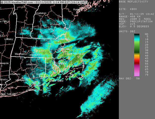
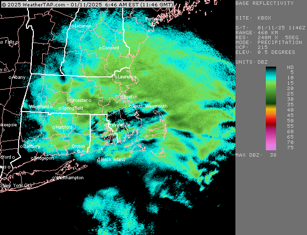
Yep ramping up here again. Been pretty good snow growth most of the day too.
-
Someone may pull a 4 or 5 spot in Essex if that can keep up for a couple more hours
-
Yep. Ripping again. Should be able to get 2”+
-
Prob good burst for Ginxy coming
-
About 1.4” so far
-
Ripping right now. Def have over an inch eyeballing.
-
Weenie run for NE MA. Maybe someone can grab a 3 spot.
-
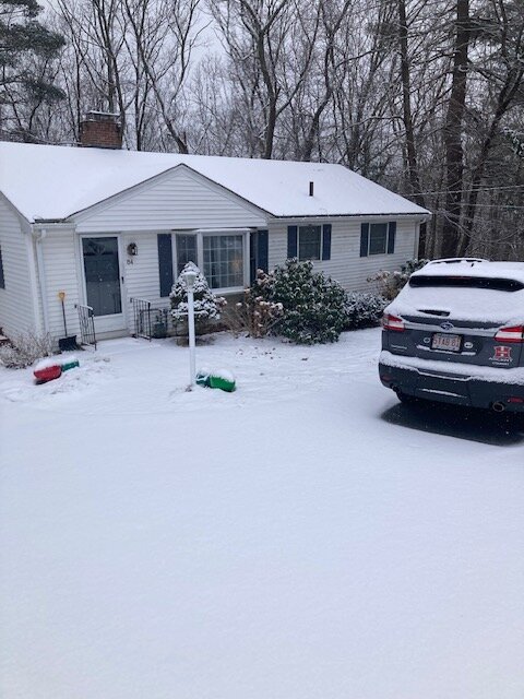
Yeah that’s the way it is around here. The smaller ponds with taller trees around them are solid. Drove past the small pond on Springdale ave in Dover today on way home from work and it’s pretty sheltered in a low area…not surrounded by tall trees like some others but it’s low laying….totally frozen with kids playing hockey on it.
-
We’re warmer than the mid-Atlantic today. Lol
-
Why is rain in the forecast?
-
Let’s see how many southern stations can have more snow than the Jetport by the end of next week. Lol
-
Would be nice to trend that 1/19 threat into a SWFE. There’s a lot of cold in the northern tier around that time.
-
Yeah I’m wondering if maybe we go like +2 in February instead of the usual Niña +4 or +5 that has happened in recent years.
-
3k NAM was pretty good around here and up into NH. I’d take a couple inches and run at this point since the cold isn’t going anywhere. Might as well look like winter on the ground. Still not convinced we get much, but there’s definitely an outside chance as a 2-3” zone for someone. Lot of instability aloft so maybe we can tap into that for a lucky surprise. Nothing else has really broken in our favor the last 2 weeks.
-
Weeklies try to torch us in February but I’ve noticed a pattern as we get closer that it’s no longer trying to put lower heights over AK/Bering. It’s keeping the WPO negative which may mitigate some of the expected warmup in February. I’m sure when the SE ridge flexes, we’ll have a 65F orgy for a couple of days with the usual suspects both on and off the forum pronouncing the beginning of spring (ala 2017 and 2018) but there could easily be a lot of cold just lurking to the north and advecting into our region at various intervals.
-
New England Winter 2024-25 Bantering, Whining, and Sobbing Thread
ORH_wxman replied to klw's topic in New England
Probably the most accurate way to build a classification model would also be the most labor-intensive. I’d probably take frequency thresholds into account at first order stations and start from that point. I know it’s easier for ORH to get a 12” storm than BOS or PVD. I know it’s easier for BOS to get one versus PHL or DCA. So you might calibrate the scale based on historical frequency of such events at each location…might kind of look like one of those maps of climate for plant hardiness. “You’re in zone 3 where you can’t plant tomatoes until this date, but if you’re in zone 4 you can do it a couple weeks earlier.” -
It can plausibly happen but we have to dodge a lot of storms between now and the end of February. Even imperfect setups in January and February can produce front enders and such. With so much cold around, there’s a decent chance we just run a system right into it at some point. Or maybe we’ll try and go ‘88-89 and keep whiffing, lol.
-
Most of the small ones I’ve seen here are frozen all the way but def some larger ones are open in the middle. The reservoirs in Southborough were open in the middle 2 days ago. But these smaller ponds near here that are nestled in basins with tall trees around them seem to be totally frozen.
-
I need to find a local pond to take the kids skating on. At least this weather is good for something.
-
BOS had almost 6” in the 12/20 event so they are BN but not horrifically like other spots further west. Just south of BOS is really bad on the south shore right on the coast.
-
Both can be true. We have a faster flow which maybe makes certain types of setups less frequent….but that maybe only explains a small percentage. Getting a +EPO might explain the majority of it. It’s like the snowfall argument…it’s an empirical fact we warmed between 1950-2020 but our snowfall empirically increased as well. So something else was offsetting the warming…was it extra water vapor? Yes, that explained prob a small percentage of it…but most of it was likely explained by natural variability and we just managed to get into a nice pattern of -AOs and -EPOs during that 2000s/2010s snow blitz. The extra 7% of water vapor in the atmosphere probably enhanced the nice pattern but it didn’t cause it.
-
That’s called a Miller B. We had about a century’s worth of them in the 2000s/2010s. Definitely not as many the last 3-4 winters.
-
GFS tries for a SWFE at D10. I almost forgot what those look like.
-
Yeah E Wareham is decent. Not close to pristine but pretty solid. I think their avg is around 39-40” since the turn of the century but long term avg is likely closer to about 35-37”. Much of the cape is likely low 30s and trending to upper 30s near the canal for longer term averages.


