ORH_wxman
-
Posts
93,092 -
Joined
-
Last visited
Content Type
Profiles
Blogs
Forums
American Weather
Media Demo
Store
Gallery
Everything posted by ORH_wxman
-
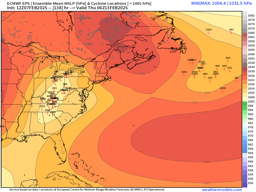
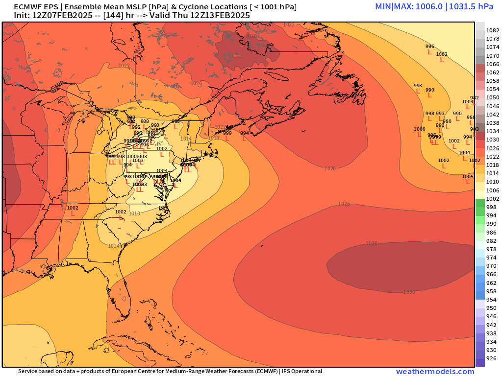
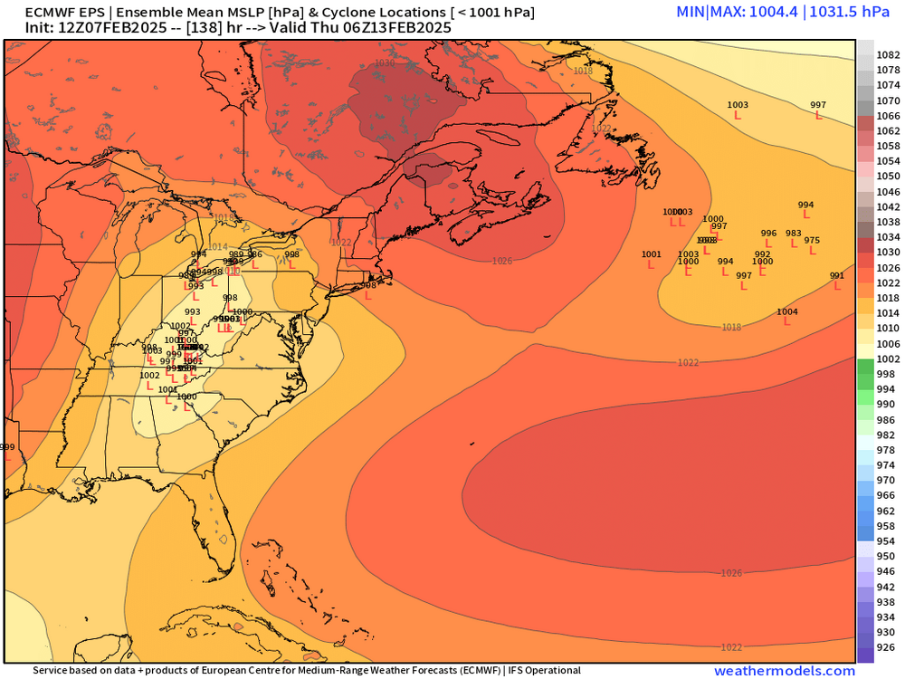
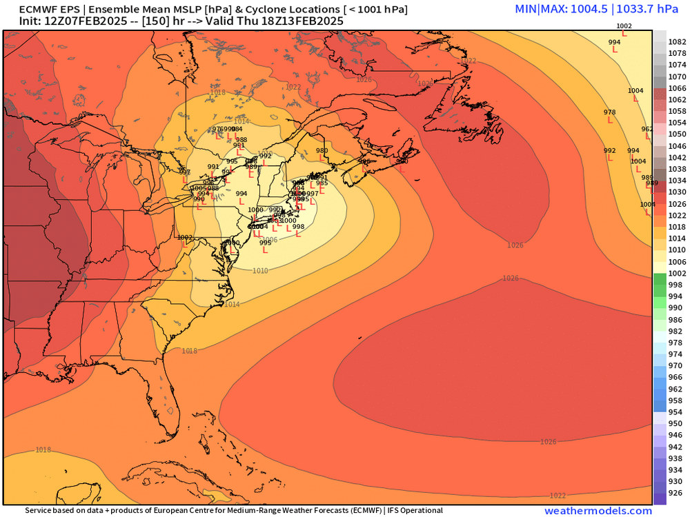
I don’t think this is bad reasoning at all by you here…the problem is you can’t really be the messenger for it because you burnt your credibility already by being the forum Debbie-downer even when things looked great in the past. So people will see you being a Debbie and just roll their eyes…”he’s at it again”. There are both positive and negative variables for next Thursday…the positive is we have a solid high anchored north of CAR as the storm approaches which may provide some resistance (esp as we get closer on modeling this tends to be the case). The negative is the track of the primary low…and the million dollar question is how fast do we get redevelopment.

-
Hey I’ve always pushed back when people claim big ice storms and the look isn’t there…but I’m pointing out that there was a bit of a look there with a high in Quebec and a mesolow oriented more NE to SW instead of the more typical ENE/WSW which produces a more in-situ icing…if you’re pointed more NE with a high in Quebec then you have active advection of lower dewpoints. But as mentioned, it was clown range so not worth going crazy at this time…but that’s what you’re looking for on future solutions if you are looking for prolonged icing.
-
It’s clown range but if you get closer-in and still see the orientation of that mesolow out near Cape Cod and BOS facing northeast like that instead of ENE…red flag for big icing in interior.
-
Yeah that high was in a very good climo position next weekend. Prob better climo position than Thursday. But Thursday could have some issues too after the initial snow…prob gonna be a lot of back and forth on guidance for those threats.
-
Might need to watch for siggy ice over interior next Thursday.
-
12-18 lollis to 24
-
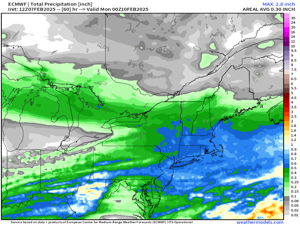
Pretty solid event. 4-8 with maybe some higher lollis in any higher ratio banding
-
Euro looked a little juicier up in this area…but not a huge shift from 06z
-
There will be lighter synoptic snows well north due to the vort tracking through NY state and CNE.
-
Seems too light unless you are assuming guidance is wrong and this will trend a solid tick south in the next 24-36h
-
The Thursday system has a pretty good high anchored N of CAR so even if that tries to amp, I’d think decent front ender. The 00z OP euro was on the northwest edge of the ensemble envelope…it’s possible it’s correct but there’s plenty of huge hits in the ensemble suite. This type of pattern will produce the threat of some messier systems. Even during the barrage of 1994 we had two…MLK weekend storm was messy and the 1/28 storm was basically a full cutter.
-
Epic melt mere days prior to the 2015 snow blitz…shall history repeat itself a decade later?
-
Doubt NAM is correct anyway with that vort track.
-
Dec and Jan laid monster turds…but we did get a decent finish in second half of Feb and early Mar…we had several clippers/smaller events in late Feb and even early Mar before the bigger one on 3/4. Had good snow cover for well over a month from 2/12-onward. It would be nice to put together a good Dec/Jan combo for once. Haven’t had that in eons. 2017-18 was prob the last time.
-
That was a great storm because at least up in interior MA, it stuck around for over a week through Tday. I think I had 7.5” in that and it was pure powder until it was topped off with a little sleet before dryslot. What a frigid stretch that was and Tday itself was the coldest November day on record for a lot of New England sites.
-
Many of them also overperformed...the 2/2 event looked like a typical 6-10 SWFE until the RGEM kept insisting on faster redevelopment and continuing the snow all afternoon and it turned into a 12-18" for many. The overrunning storm from Feb 7-9 didn't really materialize on guidance until pretty close in (maybe 5 days out or closer?)....and of course we all remember the mid-level magic storm on 2/15 that was kind of a disaster on models.
-
What did HVN get in the 1/21/12 storm? I remember an intense band on the south coast while the rest of us got mostly crap advisory amounts.
-
Trying to show a weenie fronto band further north this run too into S VT/S NH.
-
Tracking February 6. Light to moderate event potential
ORH_wxman replied to Typhoon Tip's topic in New England
Slowly sinking south. We got to 31 but then now back to 28.5…but the real cold tuck is a little north just north of Sudbury and between 495 and 128 where it’s dropping into the low/mid 20s. Should try to push a little more in the next couple hours before weakening. -
Scooter is on tilt. He’s pulling out the Kevin reverse psychology or getting taken to the woodshed so many times since 2022 has turned him into Tblizz. Once he grabs 8-10 on the weekend he will be back to his normal self.
-
Yeah let’s rip 4 feet in February and then go March 2018 except not bust on two storms.
-
I remember the NAM used to show whiffs in 2007-08 on SWFEs when it was more than 48h out. Then it would amp up and get in line quickly once we were around 36h to go. GFS usually performed very well in SWFE back then but lousy in coastals.
-
Esp in eastern and southeastern areas....so you'd prob add more to those regions versus elsewhere.
-
@CoastalWx and @40/70 Benchmark, 50mb split complete by D5 now. Looks like a lock. Wonder if we can prolong the blocking longer than weeklies think due to this.
-
It did bump north...still on the southern envelope but not as egregious as 12z. Synoptically, it actually has a really nice midlevel look from about the pike up into NH border region even though its not totally reflected on QPF.