-
Posts
93,092 -
Joined
-
Last visited
Content Type
Profiles
Blogs
Forums
American Weather
Media Demo
Store
Gallery
Everything posted by ORH_wxman
-

Sunday Evening/Night Light snow event Disco/Obs
ORH_wxman replied to Sey-Mour Snow's topic in New England
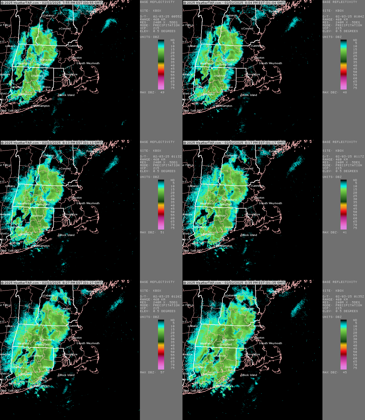
A couple of decent bands already..one going from ORH county to NE CT and another in the CT river valley -

Sunday Evening/Night Light snow event Disco/Obs
ORH_wxman replied to Sey-Mour Snow's topic in New England
Yep. My back porch is “3 season” except when I make it 4 seasons with the Woodstove. It’s nice though because that wood stove helps heat the rest of the house too when I have it going strong so the furnace gets a bit of a breather. Keep the nat gas bill down. Thinking 1-3” here. I expect any lollis to 4 to be further west and southwest of us. -

Tracking February 6. Light to moderate event potential
ORH_wxman replied to Typhoon Tip's topic in New England
Yeah it did. I’d like to see another tick but it did give a couple of inches on the front. This isn’t a very juicy system anyway though, so I’m mostly hoping we can get a few inches and triple point the sfc low so we get a net gain. I’m not setting the bar very high on this one. But there’s def a model war. GFS doesn’t even come close to sniffing freezing over interior…even where the snow flips to sleet/ZR. -

Tracking February 6. Light to moderate event potential
ORH_wxman replied to Typhoon Tip's topic in New England
Yeah looked a bit colder. Not buying it verbatim but maybe we can tick euro a little colder and at least get a bit of snow on the front end. -

Sunday Evening/Night Light snow event Disco/Obs
ORH_wxman replied to Sey-Mour Snow's topic in New England
Weenie flakes here for the past 10-15 min. Really tiny. Almost didn’t notice them until I was outside getting firewood and saw them very diffuse in the spotlight. -
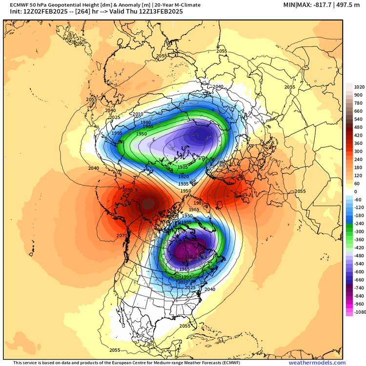
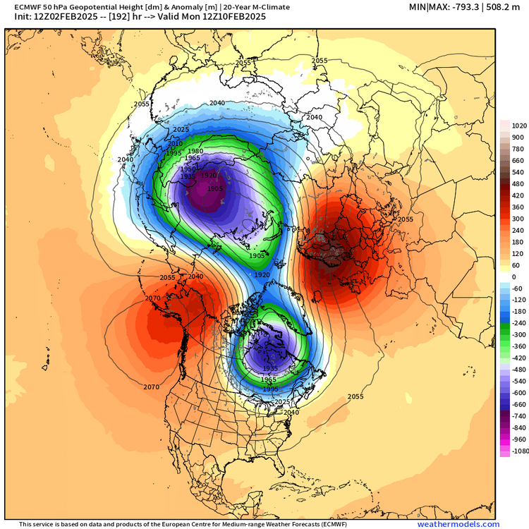
It actually has our side strengthening after the split happens. That said, I don’t necessarily need -30C 850s over our noggin.
-
-

Sunday Evening/Night Light snow event Disco/Obs
ORH_wxman replied to Sey-Mour Snow's topic in New England
-
OP Euro is much colder next weekend than 00z as well…nice thump in front end with the classic bent back ML WF
-
Anyone who has tracked these types of events for more than a few years should know what the deal is. It’s on them if they think it’s going to be 2015.
-
They can also trend colder too when you have these type of airmasses in place and a high trying to hold on near Houlton…good for front enders. Hopefully the sludgy cold airmass wins out.
-
I think as long as people don’t expect Feb 2015 and understand there will be some messy ptype events, then most who like winter will be encouraged with what’s shown. Prob some good front enders and maybe even a legit icing event at some point…we’ll see. Sleet will be in play too of course. But seeing lots of low level arctic cold ahead of these systems is something that has been absent for several winters now. It’s one reason I’ve been fairly optimistic on this pattern since last week….low level arctic cold is hard to move and model guidance often underestimates it. So unlike all these systems the past few winters where we are trying to hold onto an antecedent airmass that has -1C at 925 and -3C at 850 (which will provide very flaccid resistance), we have these much deeper entrenched airmasses with -10C or colder. Much harder to eradicate and your “correction vector” as Tip wound say, becomes biased toward the cold side.
-

Sunday Evening/Night Light snow event Disco/Obs
ORH_wxman replied to Sey-Mour Snow's topic in New England
It spells weenie….each image is a letter. Ya’ll are blind, lol -

Sunday Evening/Night Light snow event Disco/Obs
ORH_wxman replied to Sey-Mour Snow's topic in New England
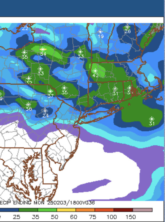
Prob not gonna snow long enough for 5-6” jackpots. I think some narrow areas will rip for about an hour or two but the whole thing shuts off fairly quickly so that will limit the upside. So I think 3-4” lollis will do it inside a more general 1-3” swath…maybe someone gets super lucky with a 5” fluff jack…maybe Litchfield county or someone who can enhance the precip slightly on southerly flow. -

Sunday Evening/Night Light snow event Disco/Obs
ORH_wxman replied to Sey-Mour Snow's topic in New England
Yep max is going to be in CT and maybe adjacent western RI in the southerly facing hills there I bet. I’m expecting 1-2” in eastern areas but once you get back to those more favorable spots, I could see some more 3-4” amounts. -

Tracking February 6. Light to moderate event potential
ORH_wxman replied to Typhoon Tip's topic in New England
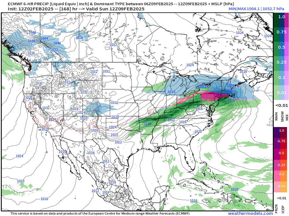
Euro punches rain all the way into NNE but it’s after some snow/ice on the front end. A Euro/GFS compromise would prob stay below freezing there though and even prolong it in SNE. Still think this system is the ugliest out of the identifiable threats…it’s also not particularly juiced. Don’t think anyone is seeing an inch of QPF out of this one…euro struggles to get most people to half inch of QPF. -

Sunday Evening/Night Light snow event Disco/Obs
ORH_wxman replied to Sey-Mour Snow's topic in New England
There’s actually very solid southerly lower level inflow in this event relatively speaking compared to the strength of the system. We get about 40 knots out of the south between 850-925. Someone is going to get a weenie stripe of 3-5” IMHO. The NAM has a crosshair sig too over a chunk of SNE. -

Sunday Evening/Night Light snow event Disco/Obs
ORH_wxman replied to Sey-Mour Snow's topic in New England
Def a min on the east coast of MA it seems in this one. Central and western areas are the places that would see the higher lollies -

Sunday Evening/Night Light snow event Disco/Obs
ORH_wxman replied to Sey-Mour Snow's topic in New England
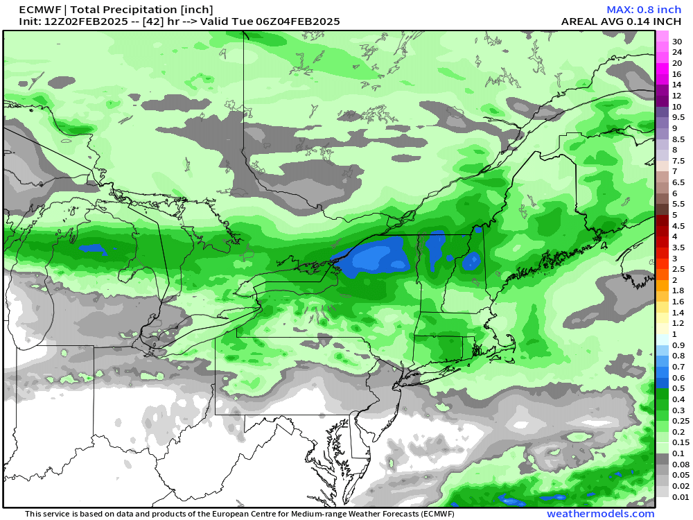
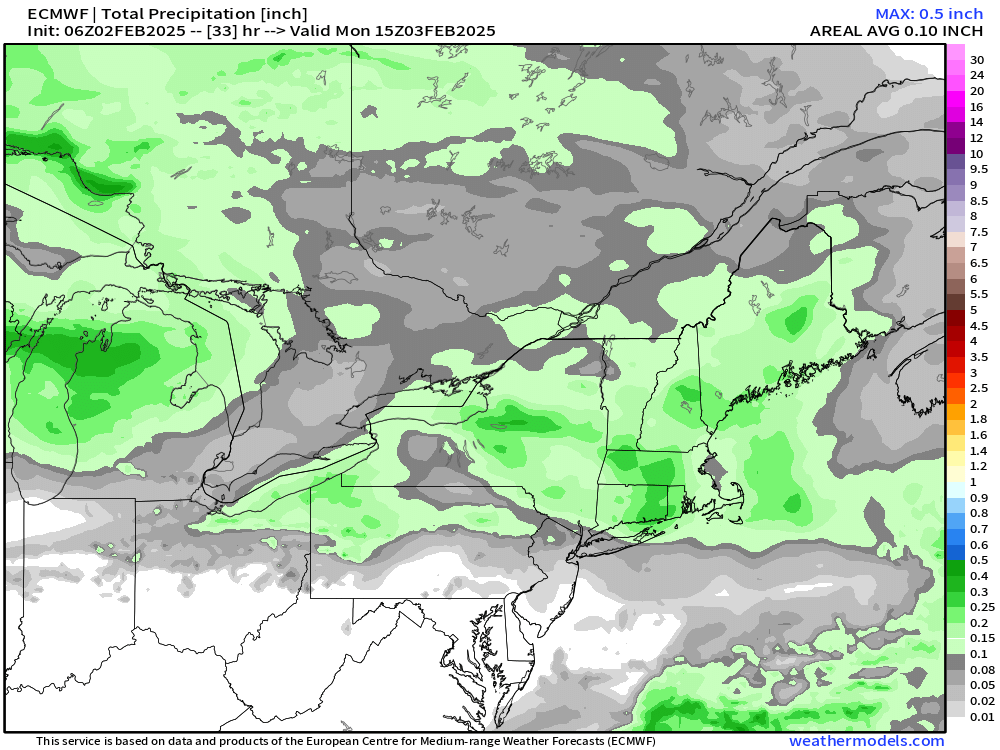
That’s a pretty nice swath of 0.25”+ on the 06z Euro and GFS is pretty similar…even more robust. So if you’re grabbing 15 to 1 on that it’s gonna produce a lot of 3-4” amounts…and maybe even a 5 spot -

Sunday Evening/Night Light snow event Disco/Obs
ORH_wxman replied to Sey-Mour Snow's topic in New England
I could see some 3-4” lollis easily if the snow growth is there. Good airmass for this one. -

Tracking February 6. Light to moderate event potential
ORH_wxman replied to Typhoon Tip's topic in New England
Euro still the warmest on this threat but it looks like it ticked colder at 06z with a little more snow/ice on front end and better CAD reflection at sfc. Still think the threats after this one are more favorable for winter precip but this one could easily continue to tick colder. -
18z euro did cool a bit for midweek…still warmer than GFS but more sleet and ice on the front end (after pretty brief snow in SNE)…18z EPS does have some snowier members in there too so while my bet is GFS is too cold, we may see the OP euro cool at least a bit in the future.
-
Little mini-Montreal Express this afternoon and tonight. Despite the colder airmasses at times this winter, we haven’t had many on this type of delivery. These are the ones that bite a bit. We were falling even with the sun trying to poke out midday.
-
I mean, it doesn’t take too much imagination to see how the next 15 days leaves us with 4” of snow total that was all subsequently washed away in multiple amped systems where the primary is tracking through Ottawa. My gut though (and it’s not purely gut since it’s sort of supported by guidance) is that we cash in on a couple of these…they seem to get progressively more favorable the further out in time we go too…probably because the PV is slowly being pushed southward making it harder and harder to sustain warmer solutions the deeper in time we go.
-
Lol…the reason it’s funny is because zooming in on an EPS 15-day mean is completely worthless in value. It’s already pretty smoothed out too due to having 51 members so it’s not like the zoomed-out version is hiding intricate details.


