Cary67
-
Posts
1,555 -
Joined
-
Last visited
Content Type
Profiles
Blogs
Forums
American Weather
Media Demo
Store
Gallery
Everything posted by Cary67
-
Snowing nicely 1.5" on the ground already
-
Can't watch. Too much disappointment over the years
-
Will go with 1.5" to break the 20" barrier for seasonal totals
-
-
Euro looks spot on
-
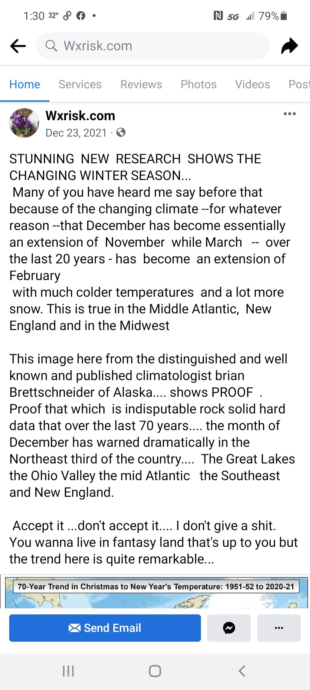
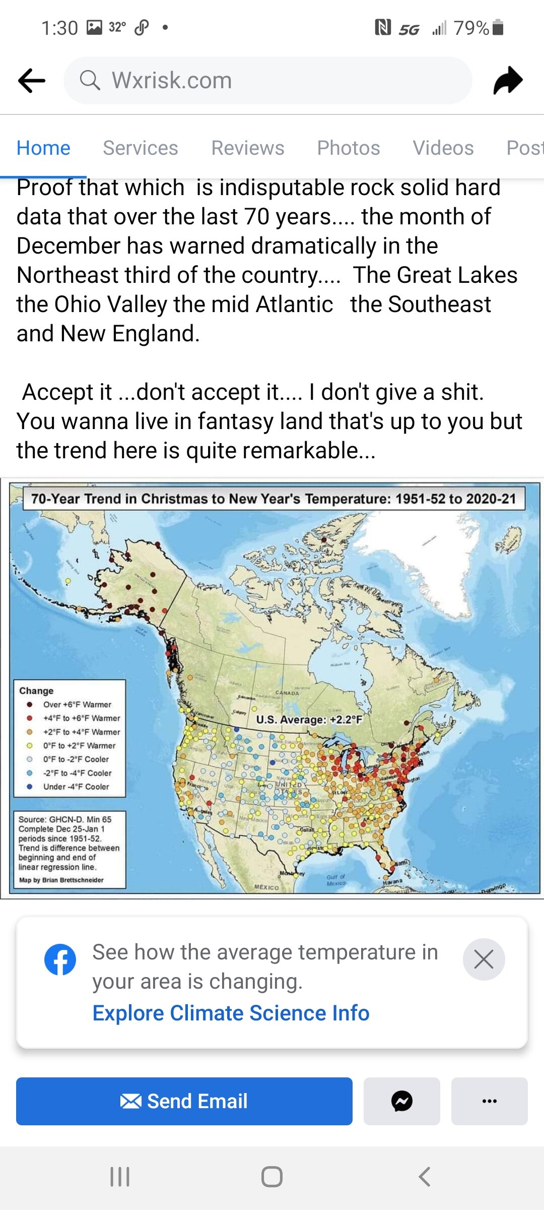
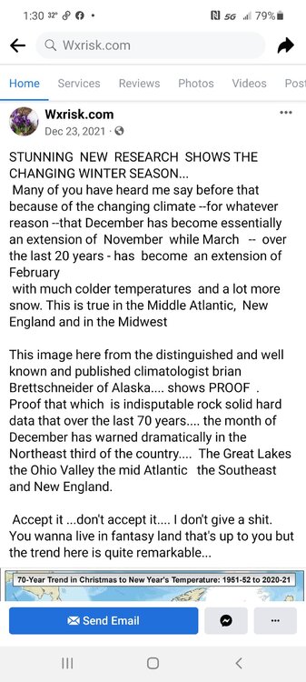
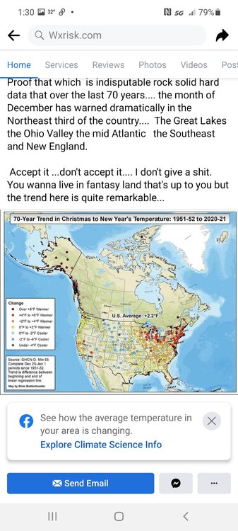
Take this with a grain of salt and not sure about the scientific method that arrived at these numbers or conclusions. But an interesting take from Wxrisk DT. Although he can be controversial and a bit hot headed.
-
Inside 120hrs look to the Euro runs for your answer
-
Xmas will have to be moved to Jan.25th to account for the seasonal shift of winter due to AGW
-
February Snow Bonanzas - the new norm in SE MI?
Cary67 replied to michsnowfreak's topic in Lakes/Ohio Valley
Madwx, Cyclone77,and McHenrySnow have no idea what your talking about -
Maybe central and southern Wisconsin. Northern parts have fared ok this winter
-
2.75" here, maybe 3" being generous. Nice and fluffy but sadly one of the deepest snows on the driveway this season. Since no big snows seem destined for my area this winter ready for pseudo spring
-
Yes we received a coating overnight and then had mood flakes all day
-
Snow falling
-
Pitching shut outs for the month of December I think hurts NW burbs and RFD moreso than metro LOT and further SE. Most winters we generally jump out to a head start due to the warm lake being a negative influence for you. ORD catches up and surpasses RFD due to lake enhancement and LES as winter progresses. Also the fact we haven't had any classic amped up,negative tilt storms deepening as they track through Indy into lower MI that bring mixing up to southern LOT but heavy snow further NW has been somewhat unusual
-
A new low..We're getting punked by a respected LOT met
-
A young man's place to live. A significant percentage of your life during the winter is just dealing with the amount of snow that disrupts your daily life.
-
Getting the glazy look on trees but roads and walkways still just wet
-
Was 33F in the car dropping my kid off at school this morning
-
Only 8 weeks till spring. ^Have to admit the more he talks about how snowy the winters really are over the last decade the more it seems to verify in his backyard
-
Tstorm in progress

-
That looks like an active pattern that could ease some drought concerns over far N.IL
-
Bring it on. Have to go through the slugfest of pseudo spring anyways. Rockford has only 1.7" of snow for entire month of February.
-
Lake effect ZR
-
Rain over ice anytime
-
Expect downstate Peoria, Springfield areas may set or come close to Feb. monthly snow record with this system.