Cary67
-
Posts
1,572 -
Joined
-
Last visited
Content Type
Profiles
Blogs
Forums
American Weather
Media Demo
Store
Gallery
Everything posted by Cary67
-
Midwest/Ohio Valley/Great Lakes Snow January 24-26
Cary67 replied to Baum's topic in Lakes/Ohio Valley
Still riding 1.5" Might have mood flakes for Sunday Norgi ski jump event. -
Midwest/Ohio Valley/Great Lakes Snow January 24-26
Cary67 replied to Baum's topic in Lakes/Ohio Valley
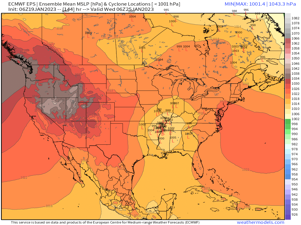
980mb over Lafayette -
Cincinnati may qualify
-
Midwest/Ohio Valley/Great Lakes Snow January 24-26
Cary67 replied to Baum's topic in Lakes/Ohio Valley
Despite the outlier NW 12Z GFS track; main snows still stay SE from Central IL over to DTW. As Euro seems fairly locked in will go 1.5" far NW, 2-3" downtown and southside, 5" Kankakee -
The Appetizer: Light Snow general 1-2 " event 1/22-1/23
Cary67 replied to Baum's topic in Lakes/Ohio Valley
Interesting will like to see some NW totals. -
Midwest/Ohio Valley/Great Lakes Snow January 24-26
Cary67 replied to Baum's topic in Lakes/Ohio Valley
Southside and downtown may reel something in yet. -
The Appetizer: Light Snow general 1-2 " event 1/22-1/23
Cary67 replied to Baum's topic in Lakes/Ohio Valley
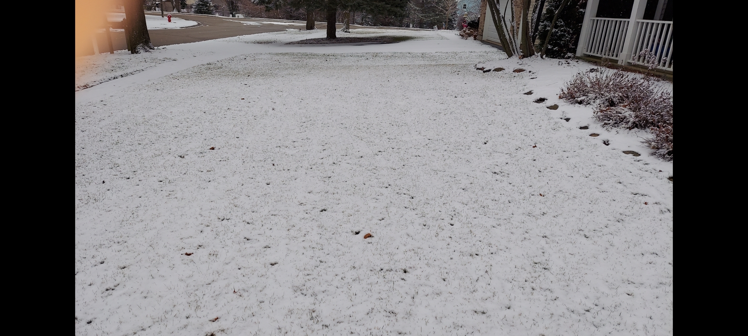
Covered the grass. Edit: Grass tips still showing. Maybe 1/2" but more than DAB. Looks like Dec events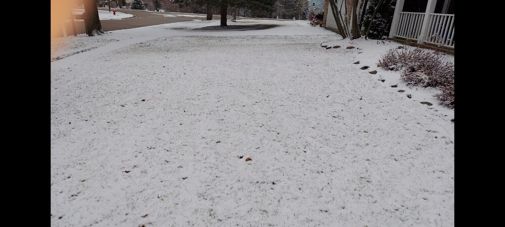
-
Midwest/Ohio Valley/Great Lakes Snow January 24-26
Cary67 replied to Baum's topic in Lakes/Ohio Valley
Definitely in a dead zone. Even Madison has cashed in a little this winter -
Midwest/Ohio Valley/Great Lakes Snow January 24-26
Cary67 replied to Baum's topic in Lakes/Ohio Valley
Even if 0Z CMC verifies that's a southern LOT to DTW track. Seen this rerun too often last few yrs. -
Midwest/Ohio Valley/Great Lakes Snow January 24-26
Cary67 replied to Baum's topic in Lakes/Ohio Valley
As you stated too many pieces all have to fall in place just right. At least the miss SE is showing up early. -
Midwest/Ohio Valley/Great Lakes Snow January 24-26
Cary67 replied to Baum's topic in Lakes/Ohio Valley
fairly sharp cut-offs on the northwest side of the precip shield are common in these synoptic set-ups even with stronger surface lows. NW LOT shaft advisory in effect Wed-Fri next week. -
Midwest/Ohio Valley/Great Lakes Snow January 24-26
Cary67 replied to Baum's topic in Lakes/Ohio Valley
Are the ensembles moving west? -
Midwest/Ohio Valley/Great Lakes Snow January 24-26
Cary67 replied to Baum's topic in Lakes/Ohio Valley
No faith....
-
Midwest/Ohio Valley/Great Lakes Snow January 24-26
Cary67 replied to Baum's topic in Lakes/Ohio Valley
Next....thumb.png.1173fb74a7e80d0a43387cf0ae5e4548.png.069d1e050c60b641e4e2f8974be474ff.png)
-
Midwest/Ohio Valley/Great Lakes Snow January 24-26
Cary67 replied to Baum's topic in Lakes/Ohio Valley
Wonderful reminiscing about storms of the past. Hard to imagine they ever came to fruition given the tenuous timing and pieces that all need to fall in place to produce snow in this region. -
Midwest/Ohio Valley/Great Lakes Snow January 24-26
Cary67 replied to Baum's topic in Lakes/Ohio Valley
Hmm..must have saw that wrong. Thx -
Midwest/Ohio Valley/Great Lakes Snow January 24-26
Cary67 replied to Baum's topic in Lakes/Ohio Valley
I think the ensembles are SE of the OP runs -
Midwest/Ohio Valley/Great Lakes Snow January 24-26
Cary67 replied to Baum's topic in Lakes/Ohio Valley
Definitely. Weaker less phased outcome seems likely given our trends with slide SE. Unless it's targeting MSP this year. -
Midwest/Ohio Valley/Great Lakes Snow January 24-26
Cary67 replied to Baum's topic in Lakes/Ohio Valley
Yikes -
Midwest/Ohio Valley/Great Lakes Snow January 24-26
Cary67 replied to Baum's topic in Lakes/Ohio Valley
-
Midwest/Ohio Valley/Great Lakes Snow January 24-26
Cary67 replied to Baum's topic in Lakes/Ohio Valley
.thumb.png.18aac49e498bd6eb3fefe77d7acff5d5.png.60778d299f3a762f8a7b776bbb82288c.png)
-
Jan 19-20: Hoosier is not allowed to start this thread
Cary67 replied to mimillman's topic in Lakes/Ohio Valley
Can you approximate how much of that is synoptic vs les? -
Midwest/Ohio Valley/Great Lakes Snow January 24-26
Cary67 replied to Baum's topic in Lakes/Ohio Valley
Takes courage nowadays. 6Z GFS backed up at least -
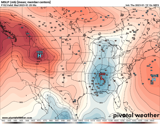
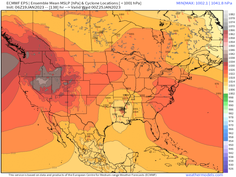
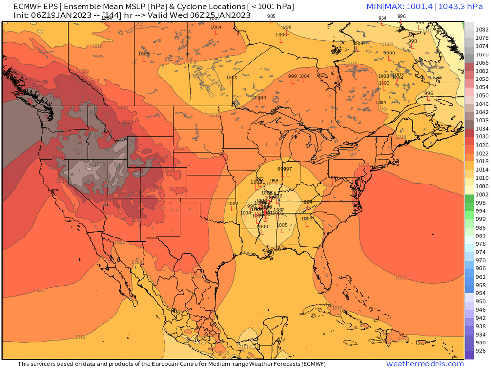
Winter 2022/23 Short/Medium Range Discussion
Cary67 replied to Chicago Storm's topic in Lakes/Ohio Valley
-
Winter 2022/23 Short/Medium Range Discussion
Cary67 replied to Chicago Storm's topic in Lakes/Ohio Valley
Near miss on Wed-Thurs system followed by cold push puts us in no mans land. Wonder if this CAD lasts longer than 12 days like December