Cary67
-
Posts
1,572 -
Joined
-
Last visited
Content Type
Profiles
Blogs
Forums
American Weather
Media Demo
Store
Gallery
Everything posted by Cary67
-
Winter 2022/23 Medium/Long Range Discussion
Cary67 replied to Chicago Storm's topic in Lakes/Ohio Valley
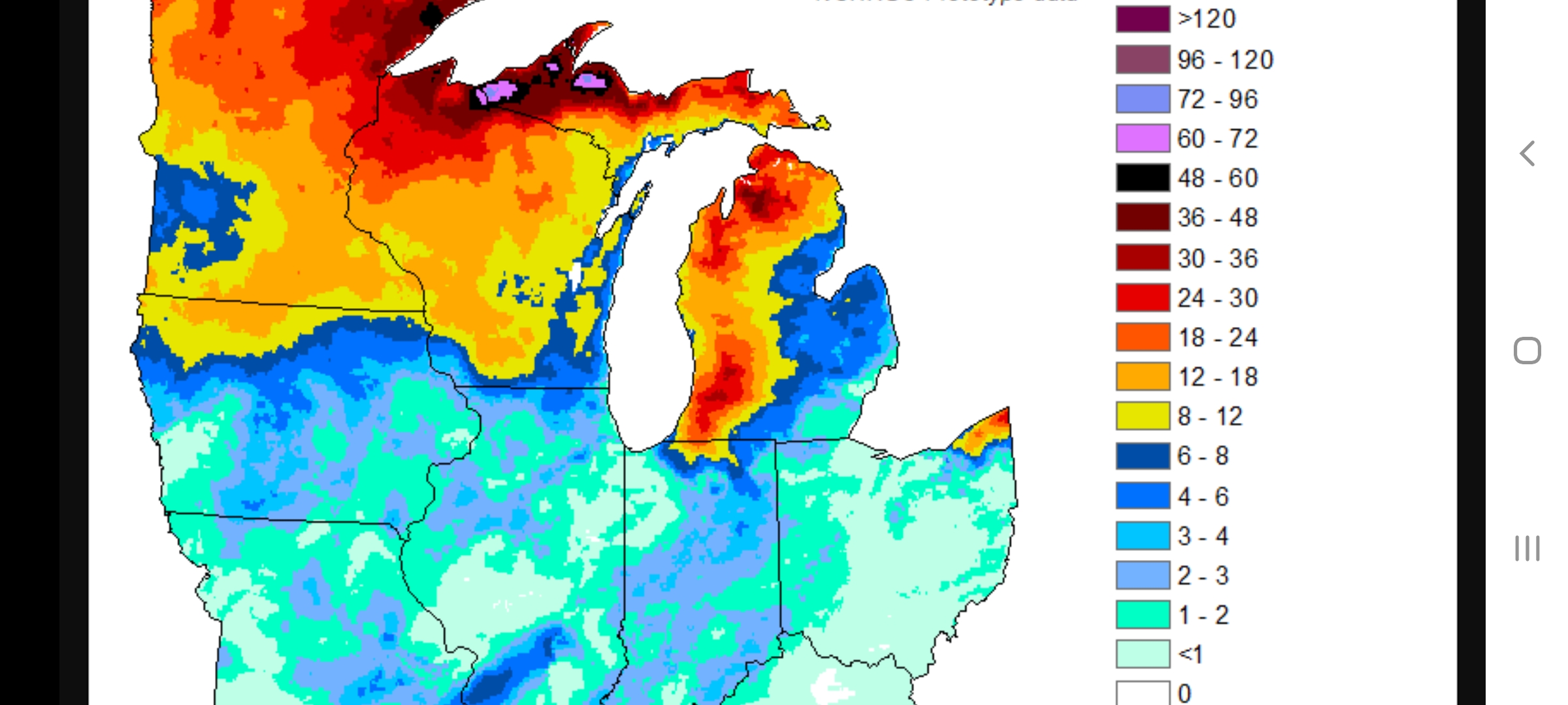
Seasonal snow totals so far.
-
If bored I could always start the unrealistic winter expectations thread. Point out our winters here really are pretty lame. Then have Michsnowfreak come to the rescue with his snow statistics that deny my argument and clearly demonstrate winters are indeed snowier(especially in his backyard)
-

-
Winter 2022/23 Medium/Long Range Discussion
Cary67 replied to Chicago Storm's topic in Lakes/Ohio Valley
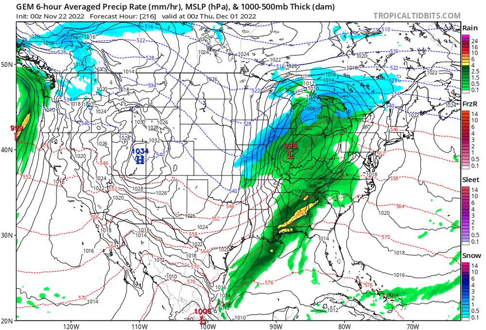
Hopefully get some snow on the front end of this cold push next week. CAD looks in play unless clipper action comes through. -
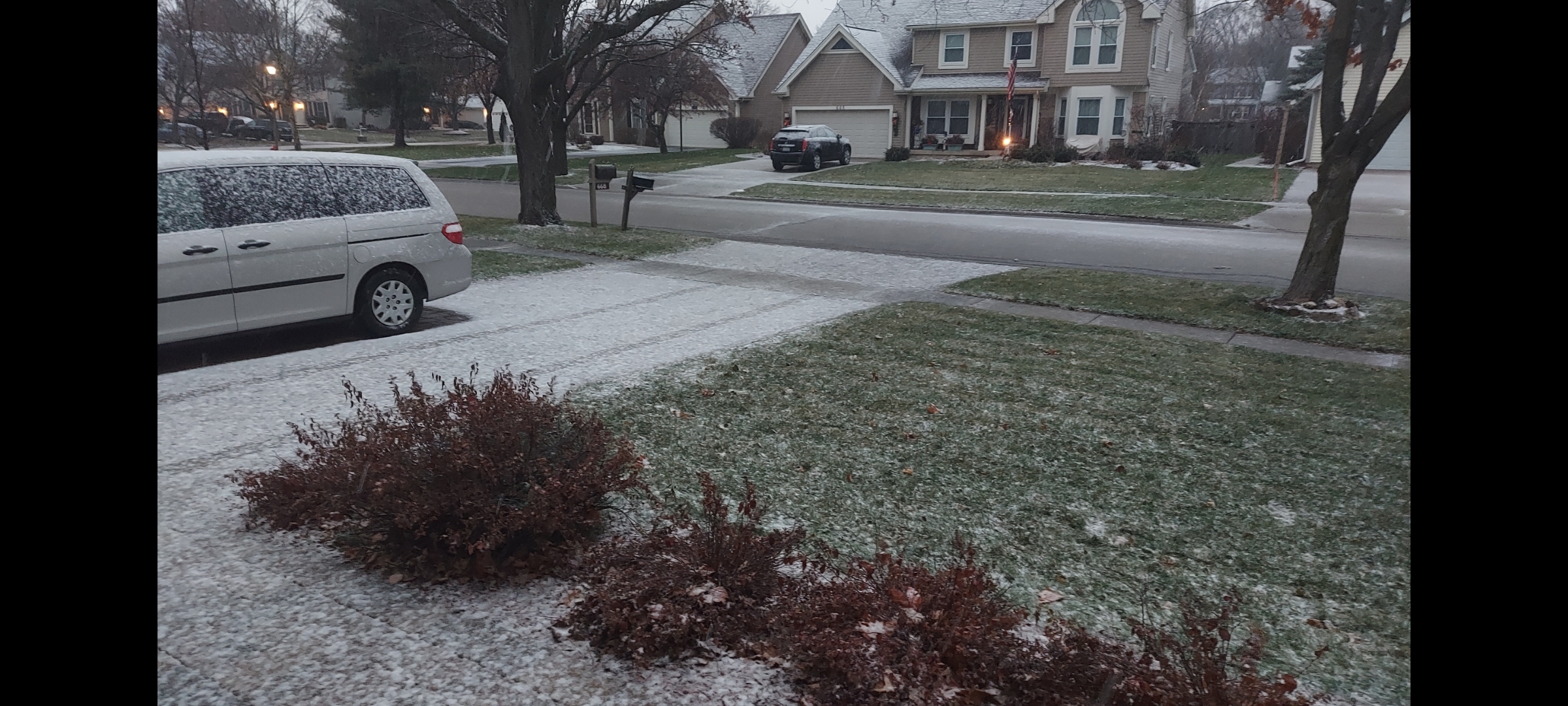
Ripping +SN currently
-
Flip over to wet snow mixed with rain. Big clumps starring to accumulate on driveway.

-
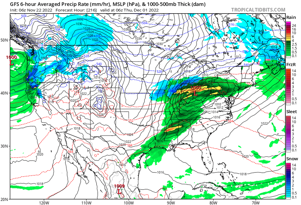
Latest HRRR run backing off on totals for northern burbs. Still think a slushy 1-2" on grass with a sloppy mix possible.
-
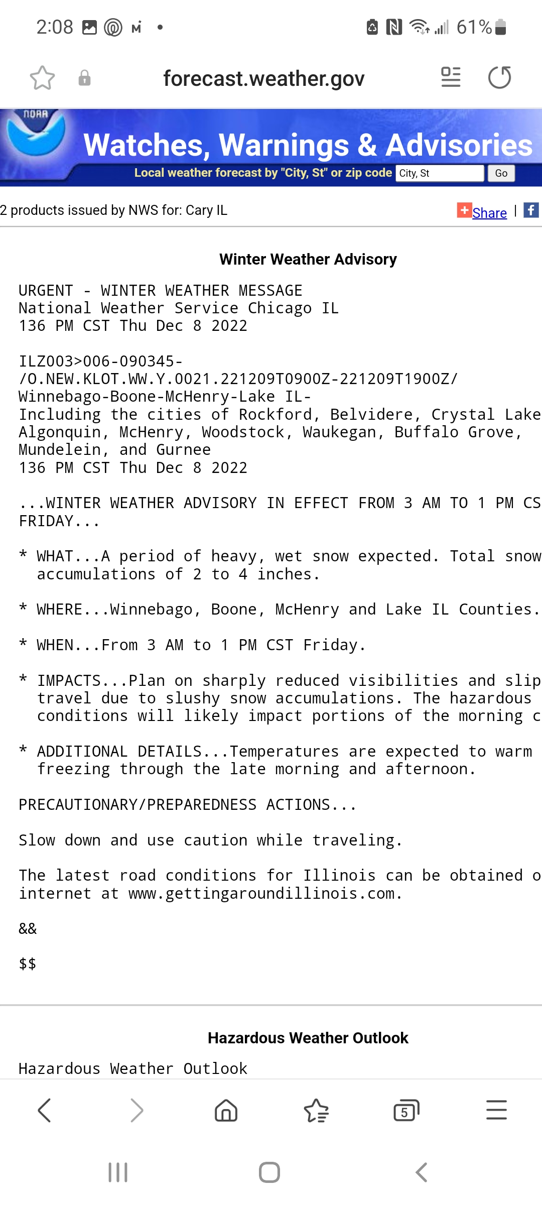
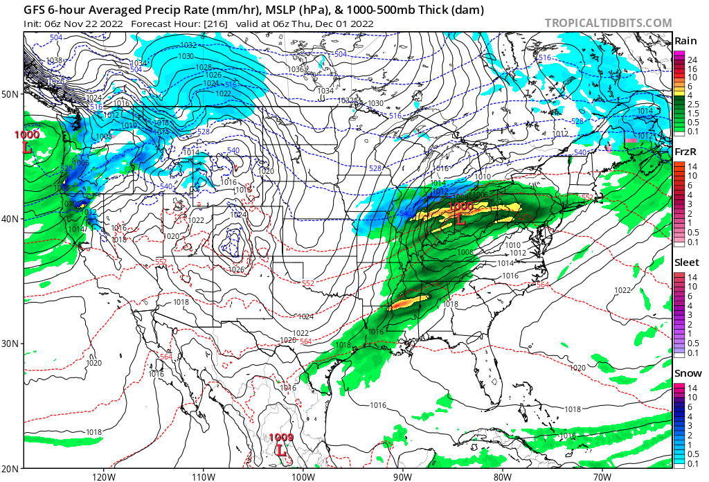
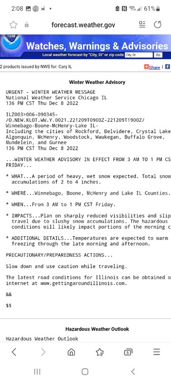
NWS just issued WWA for 2-4"for northern row of counties.
-
1" on grassy surfaces in play
-
Winter 2022/23 Short/Medium Range Discussion
Cary67 replied to Chicago Storm's topic in Lakes/Ohio Valley
A wetter pattern for the Western Great Lakes region seems attainable. -
1" here but southside wins again. Lakefront just a mixy mess
-
Almost November
-
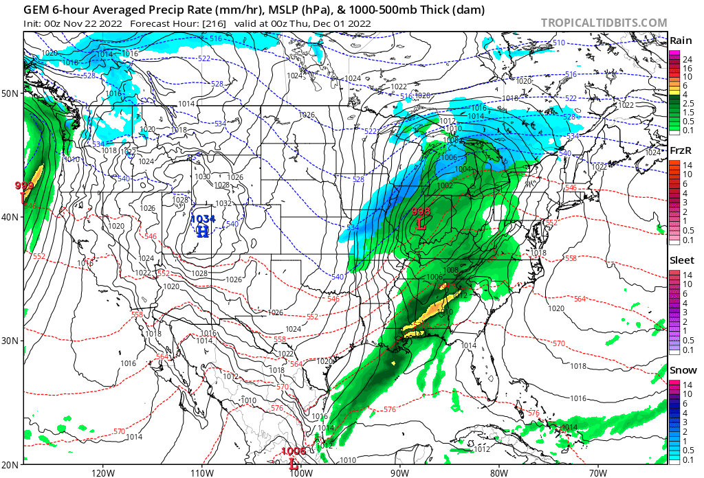
Wreck of the Edmund Fitzgerald type storm. As far as synoptic snow systems go this seems fairly typical for November. Areas NW of LOT like MSP and even MSN get theirs first. Realistically start looking for snow possibilities 1st week of December. Assuming of course the La Nina forecasts of above normal precip for us are realized.
-
Most "normal" winters should include about 3-4 weeks of opportunities where the pattern lines up favorably for the lower Great Lakes. Usually get a heads up about a favorable pattern with nice analysis from RCNYILWX
-
And I was going to run the mower out of gas and bring out the snowblower. Guess there's plenty of time.
-
Maybe an inch here.
-
Time to put distance vs Alek in snow totals
-
Winter 2022/23 Short/Medium Range Discussion
Cary67 replied to Chicago Storm's topic in Lakes/Ohio Valley
Culture has arrived. They even built a new fine arts center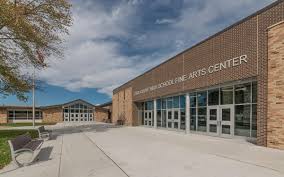
-
2022 Short/Medium Range Severe Weather Discussion
Cary67 replied to Chicago Storm's topic in Lakes/Ohio Valley
Nice. Spent some time at the Iberostar Paraiso Lindo a few yrs back in that area. Enjoy -
2022 Short/Medium Range Severe Weather Discussion
Cary67 replied to Chicago Storm's topic in Lakes/Ohio Valley
Not looking forward to flying out of ORD early tomorrow morning. -

-
Don't recall any significant October or early November snows in these parts leading to great winters but will leave that to the stats guys.
-
Exactly
-
Pulling out Ouija board to conjure up the winter spirit of 2007-08. Mchenry Co. will reign supreme again.
-
2022 Short/Medium Range Severe Weather Discussion
Cary67 replied to Chicago Storm's topic in Lakes/Ohio Valley
Some pea sized hail here