Weather Will
-
Posts
7,604 -
Joined
-
Last visited
Content Type
Profiles
Blogs
Forums
American Weather
Media Demo
Store
Gallery
Everything posted by Weather Will
-
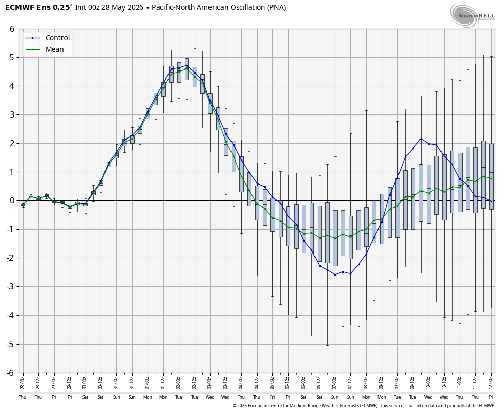
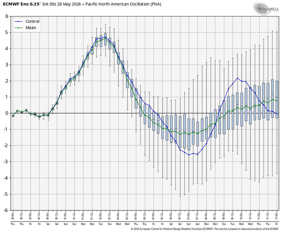
Have not seen a PNA spike like this in quite awhile! (WB)
-
Just had a brief heavy shower; looks like more to come!
-
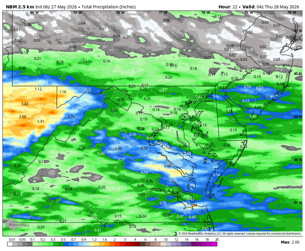
WB 6Z NBM for today....

-
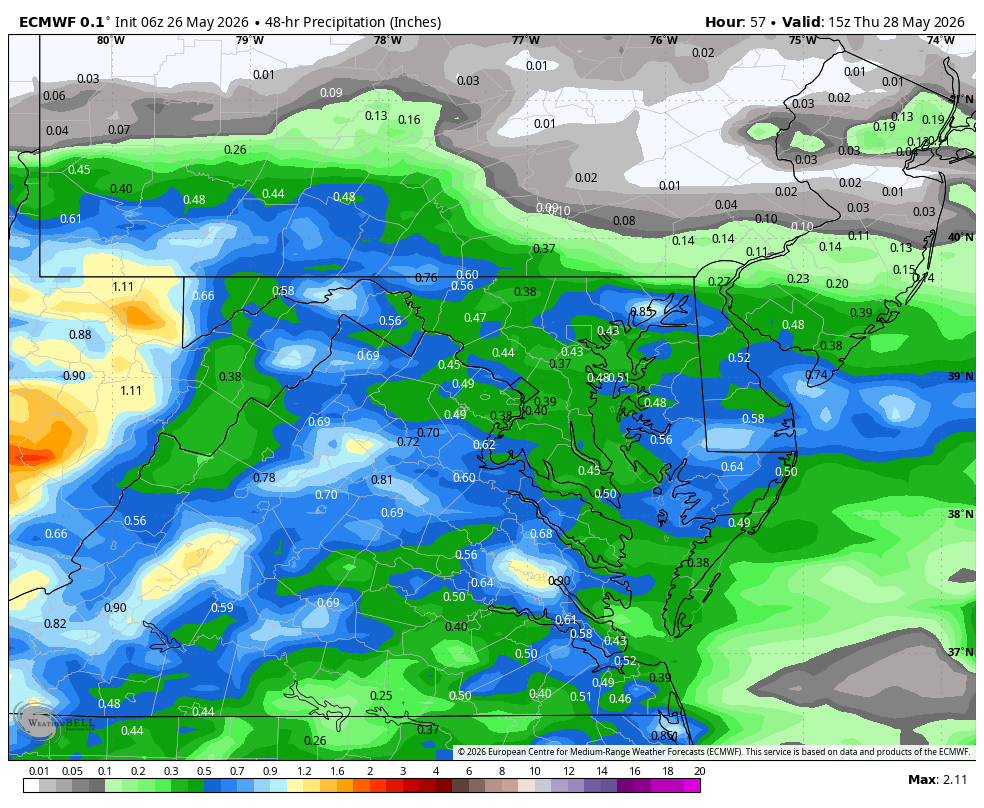
WB 12Z EURO for midweek.
-
WB 6Z EURO. Midweek rain forecast
-
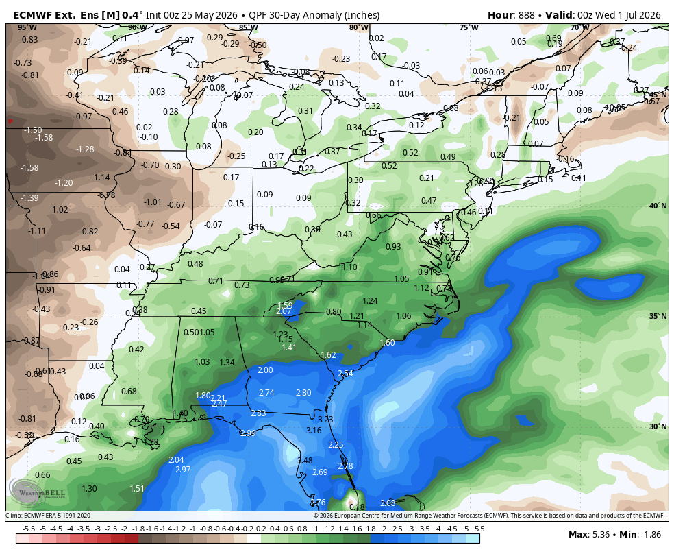
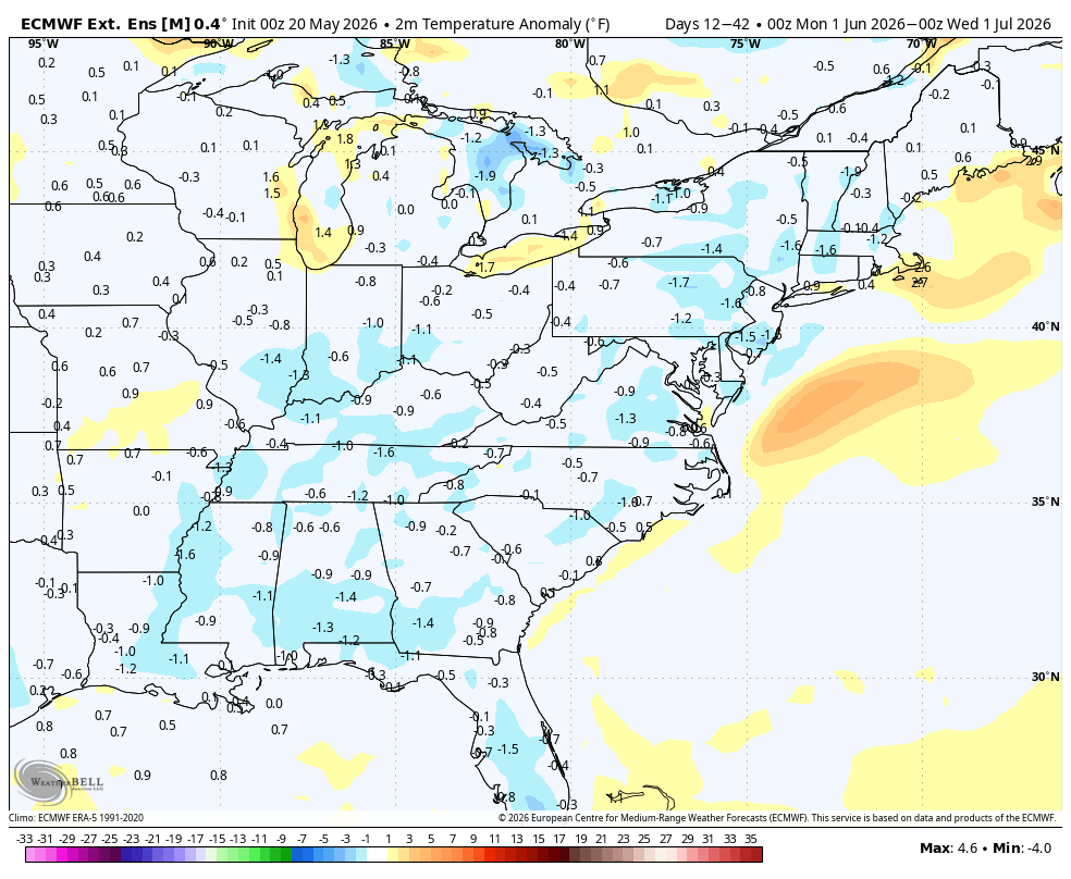
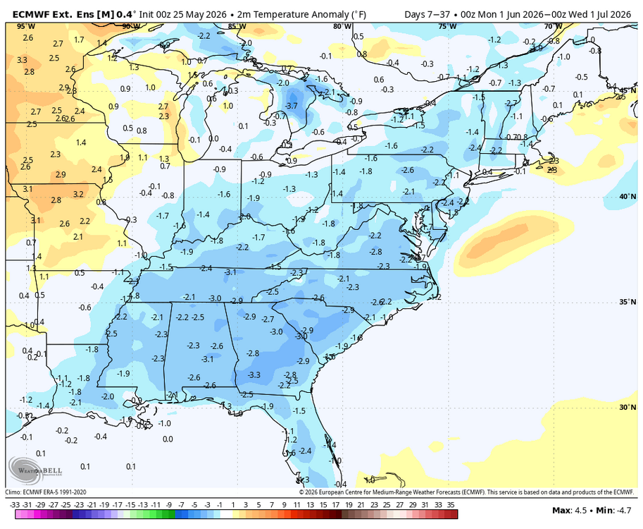
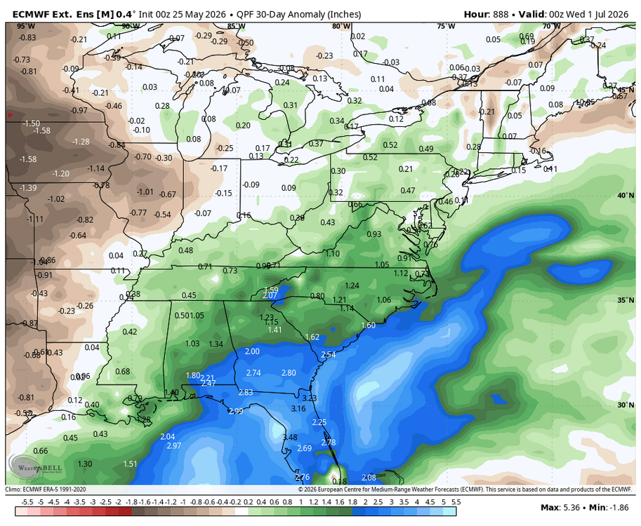
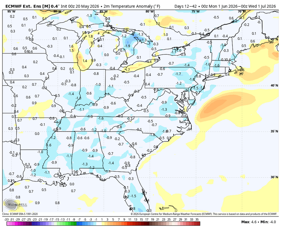
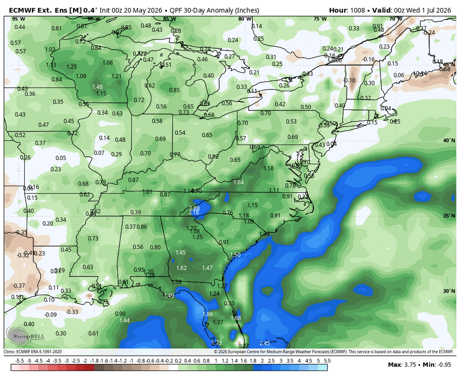
WB latest EURO weeklies for June. No big heat....
- 259 replies
-
- 2
-

-
- we got burned
- rugpull central
- (and 1 more)
-
Just drove 340 between Brunswick and Frederick. Patchy dense fog. Careful driving this am.
-
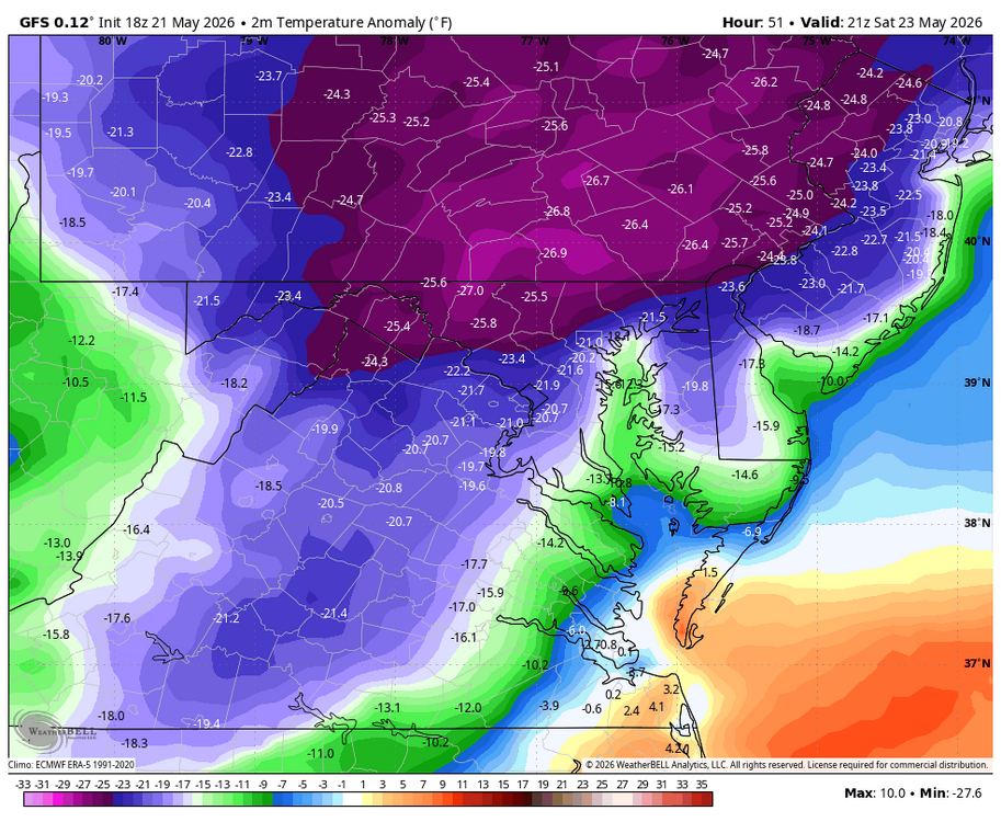
Had to turn the heat on....51 outside. 66 inside.
-
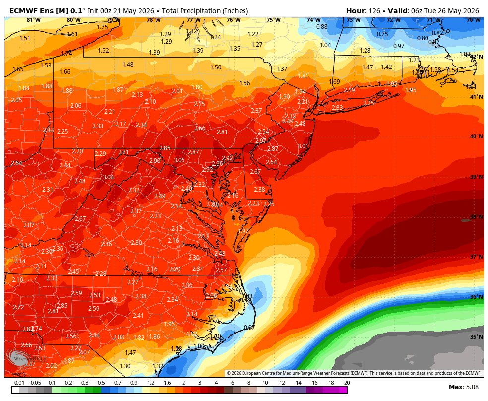
Really beneficial rain and since we are near the head of the Potomac in MD this benefits the entire basin. Perhaps we will remember this weekend as the true beginning of the pattern change toward El Niño. Approaching 2 inches so far. (Pouring right now!)
-
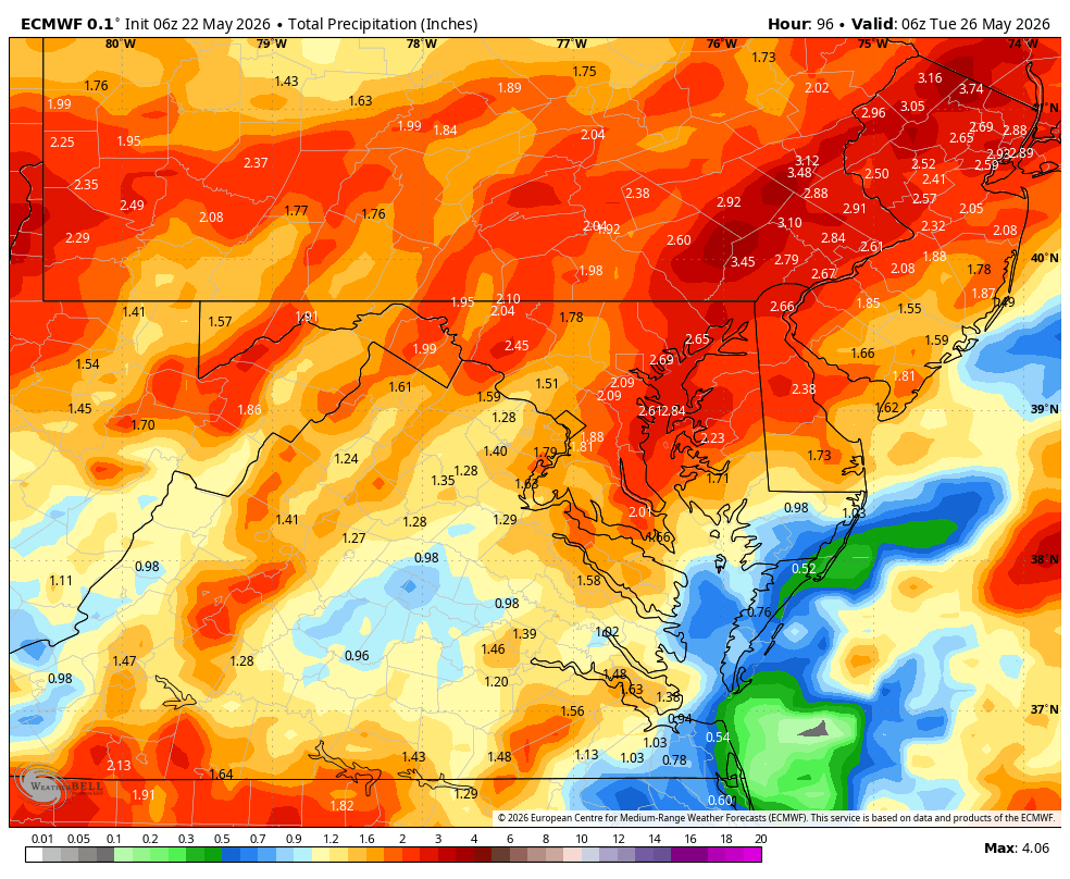
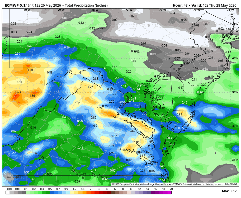
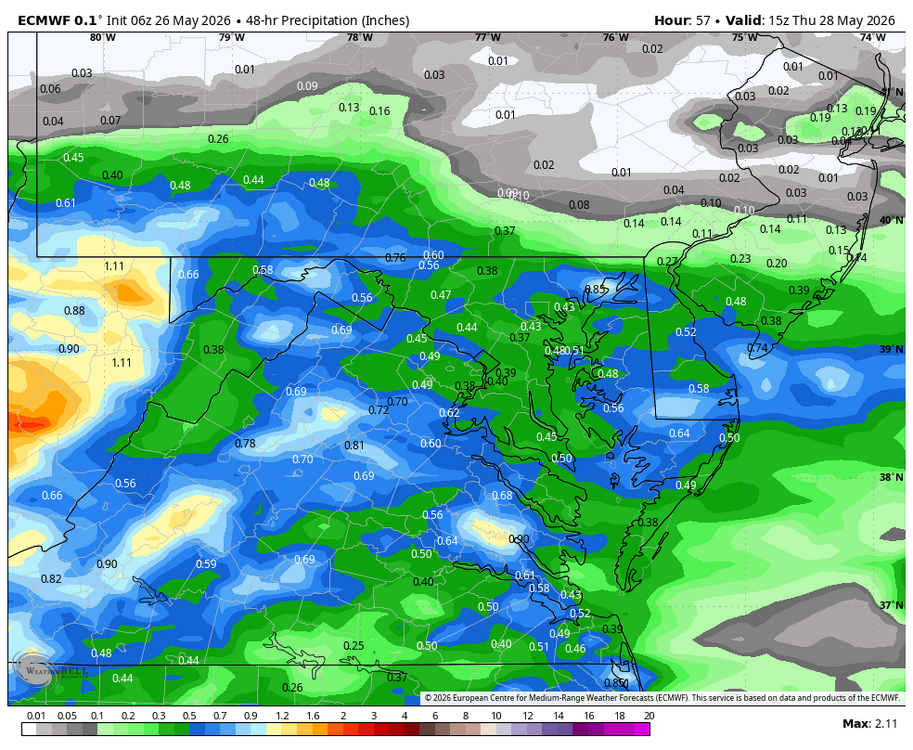
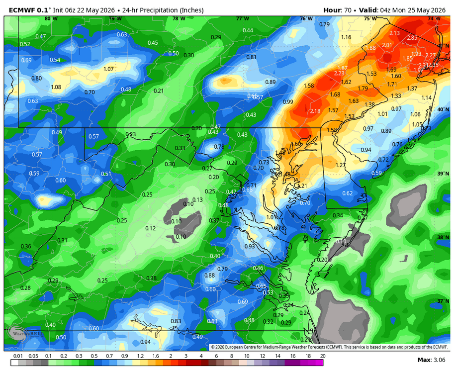
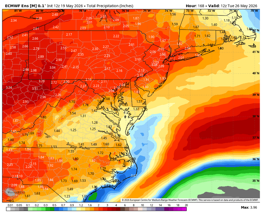
WB 6Z EURO precip. total through Monday.

-
WB 6Z EURO. Sunday is now showing more rain as well.
-
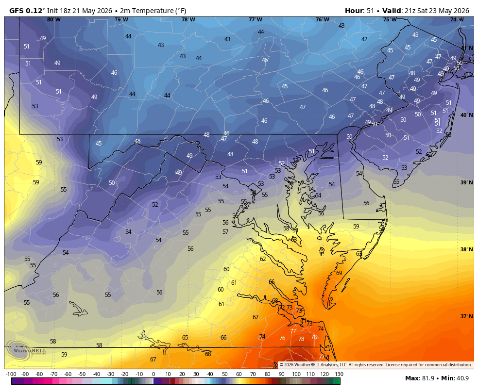
WB 18Z GFS for 5pm Saturday. Chilly!!!

-
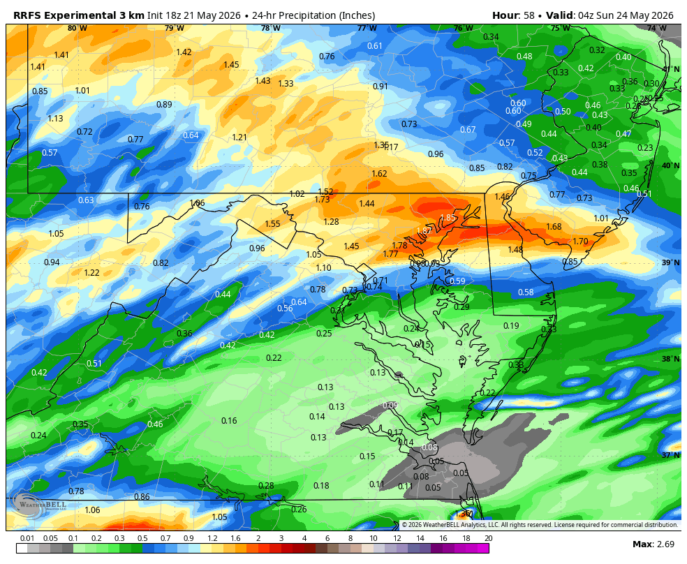
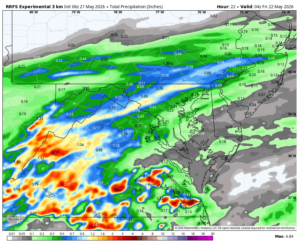
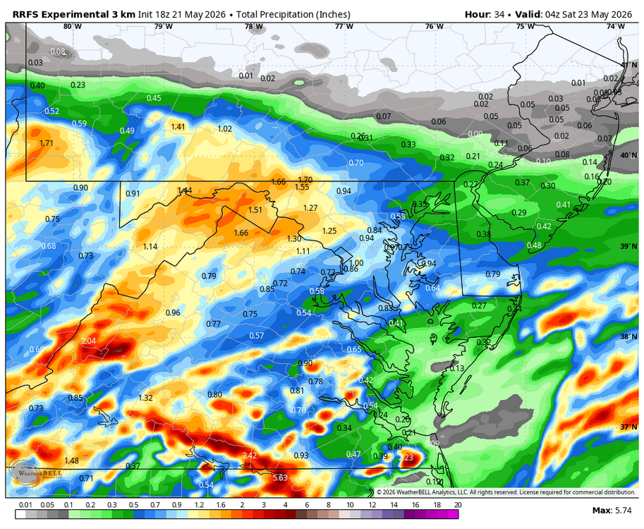
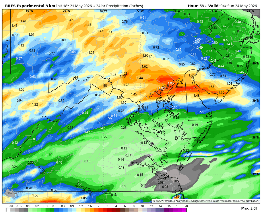
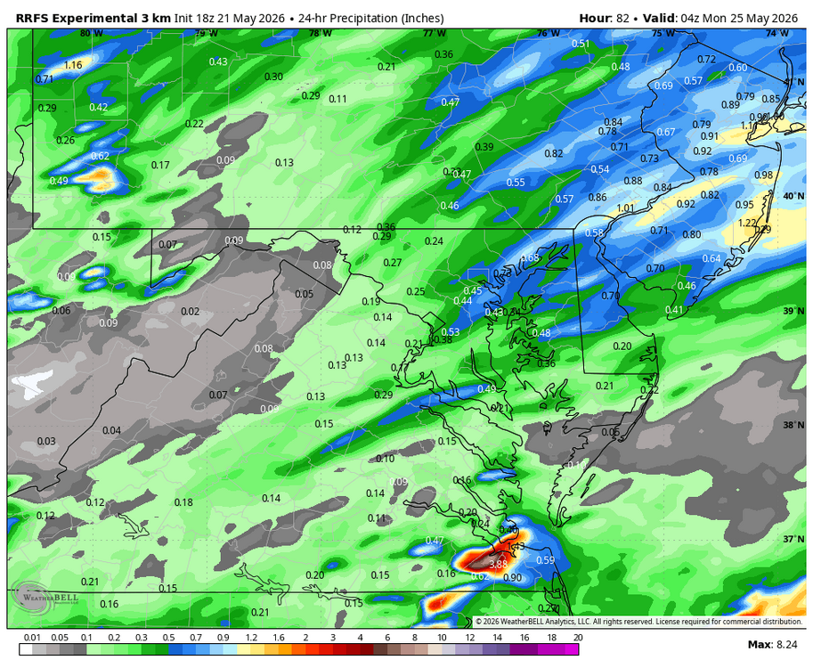
WB 18Z RRFS thru Friday, Saturday, and Sunday.
-
Really nice rain this am. Short term best rain in months in NW burbs.
-
WB latest EURO weeklies for June.
-
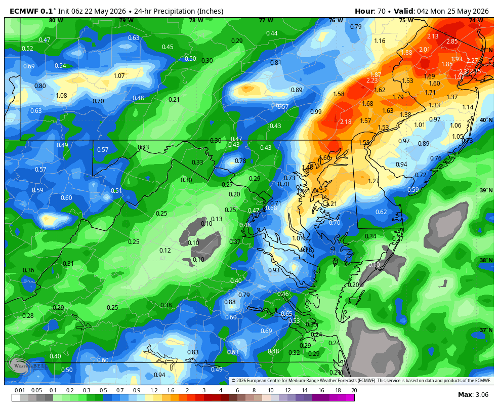
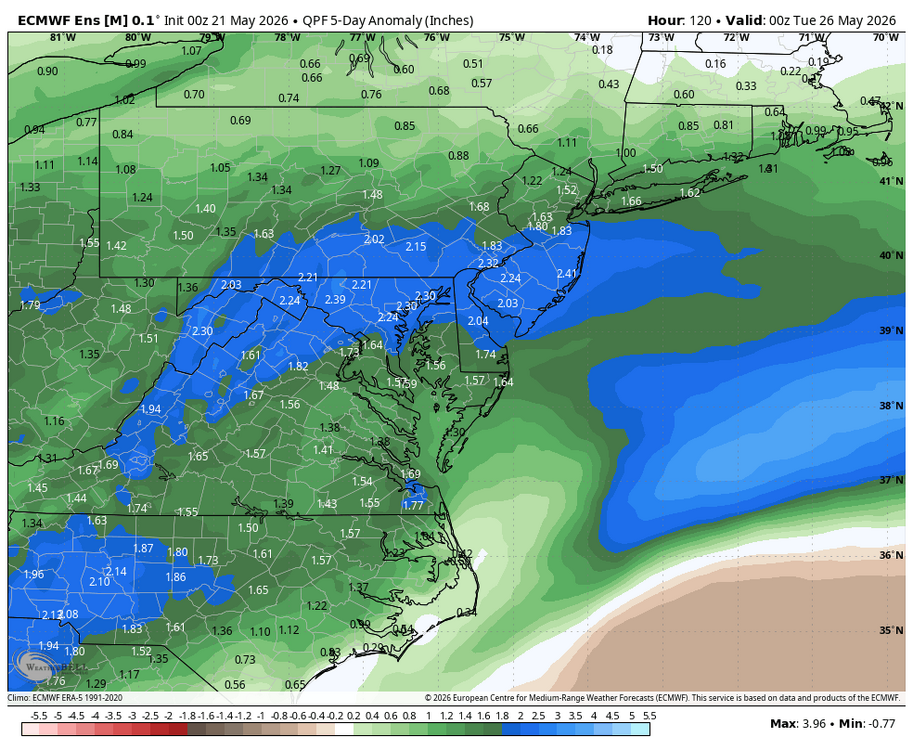
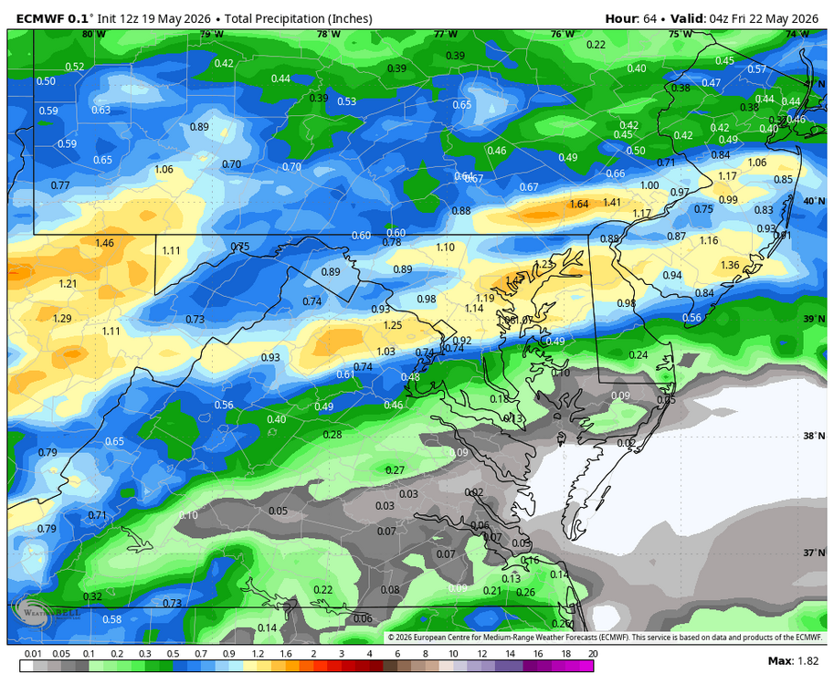
WB 0Z EURO. Rain over the next 5 days. Looks like most of this falls through Saturday. Right now Sunday and Monday look like just light showers. Saturday will be chilliest.

-
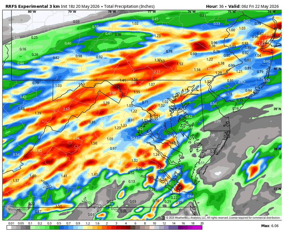
WB 6Z RRFS for today. (did a nice job forecasting yesterday's precip. totals)

-
WB 18Z RRFS thru early am Friday.
-
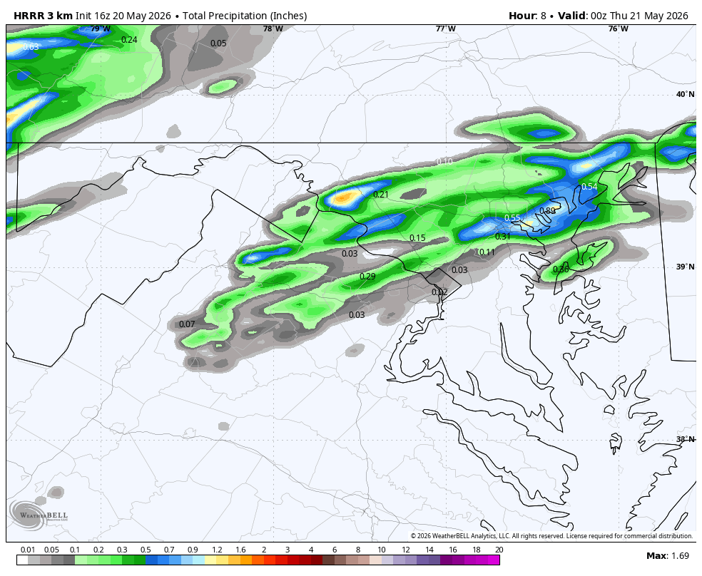
HRRR is well underdone..... lots of rain in Frederick area. I did not post earlier but the WB RRFS from 12Z did very well for this afternoon. Will start using it.
-
Severe Thunderstorm Watch area wide until 8pm. WB 16Z HRRR thru 8pm.

-
Finished up some yard work from last night and it is miserable outside....
-
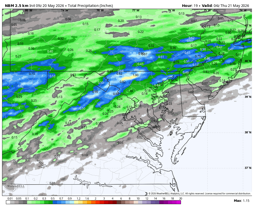
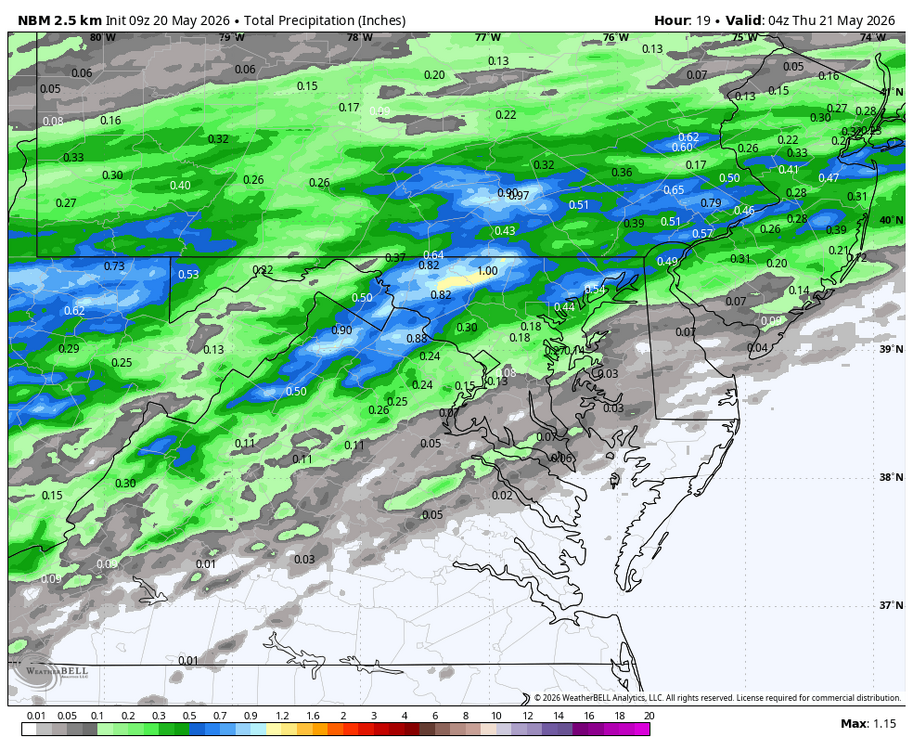
WB 9Z NBM for today.
-
WB 12 EURO thru Th.
-
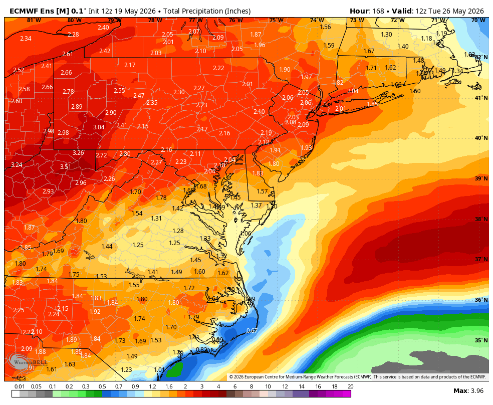
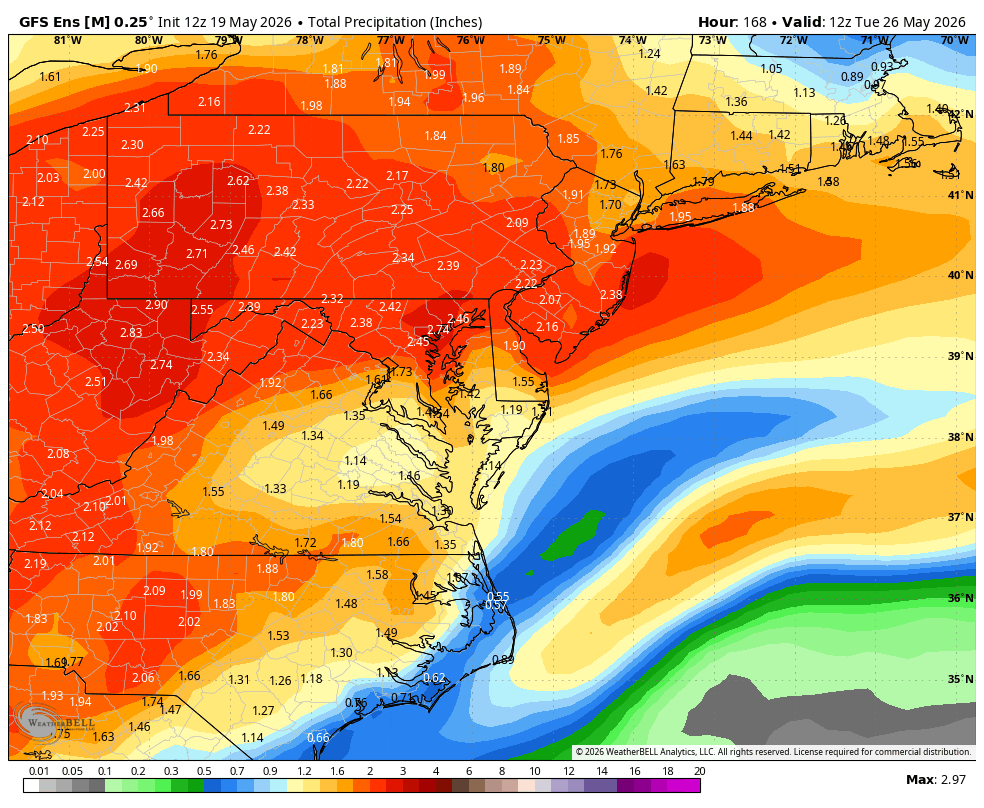
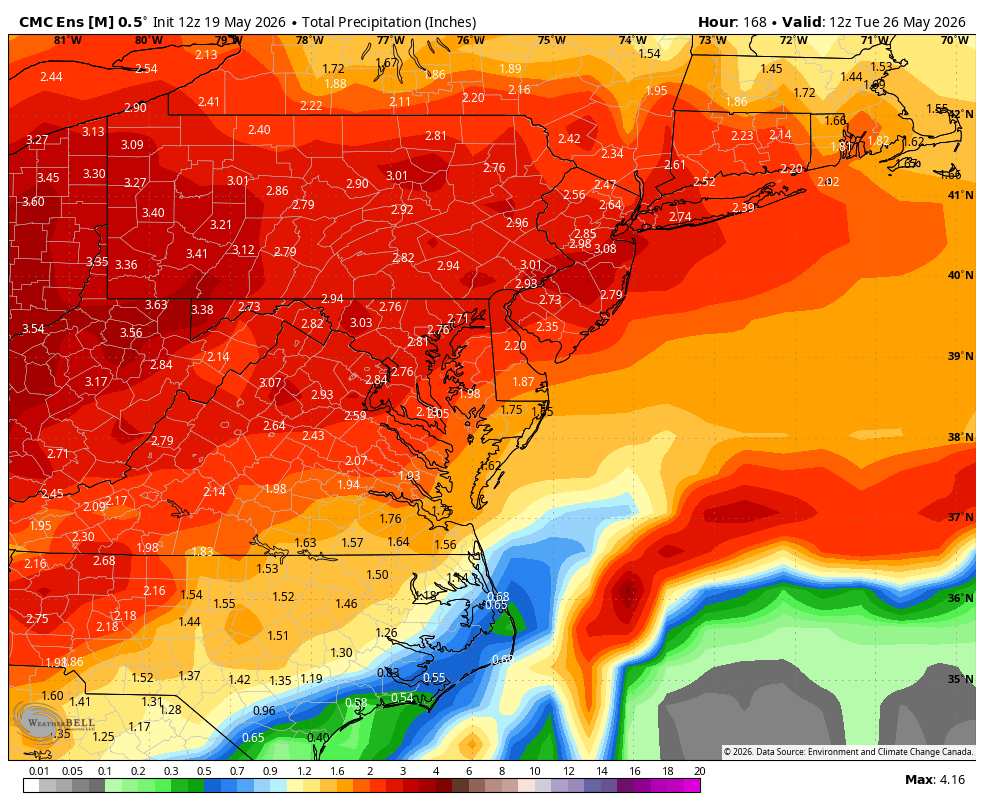
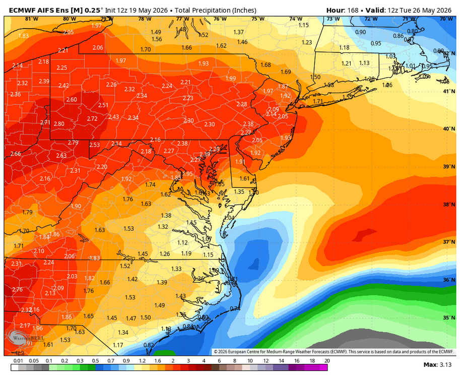
WB 12Z ensembles through Day 7. Hope they verify!


-
12Z HRRR is very quiet for this afternoon and I just finished watering. Hopefully we will start getting some rain tomorrow.