Weather Will
-
Posts
7,604 -
Joined
-
Last visited
Content Type
Profiles
Blogs
Forums
American Weather
Media Demo
Store
Gallery
Everything posted by Weather Will
-
Wet late Monday 6/22 or another Fizzle?
Weather Will replied to Weather Will's topic in Mid Atlantic
Can you pin this thread through Tuesday? Thanks! -
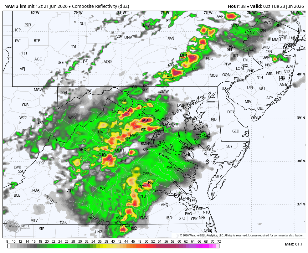
Wet late Monday 6/22 or another Fizzle?
Weather Will replied to Weather Will's topic in Mid Atlantic
Really curious which short range model the Mets use...and is the NAM still being retired? -
Wet late Monday 6/22 or another Fizzle?
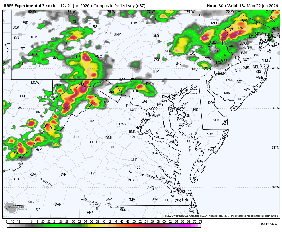
Weather Will replied to Weather Will's topic in Mid Atlantic
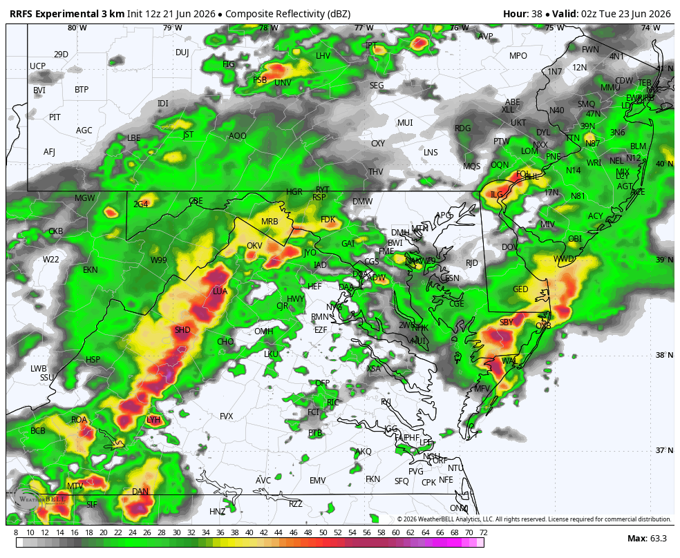
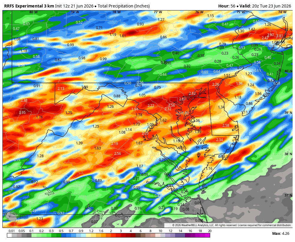
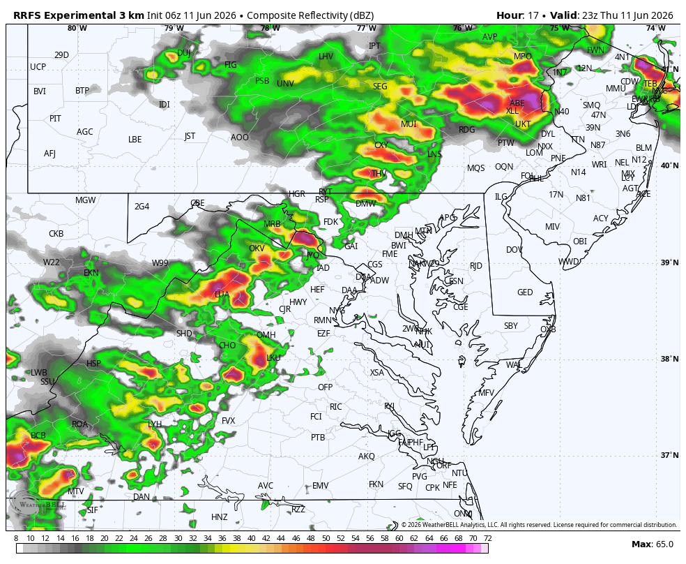
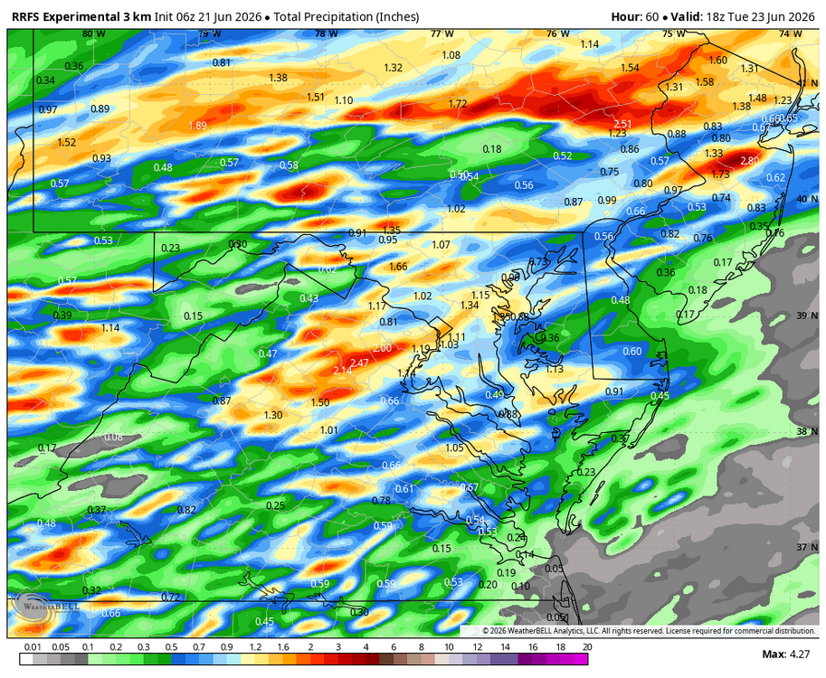
WB 18Z RRFS-Sold!
-
Wet late Monday 6/22 or another Fizzle?
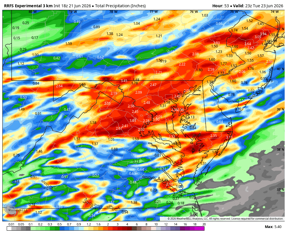
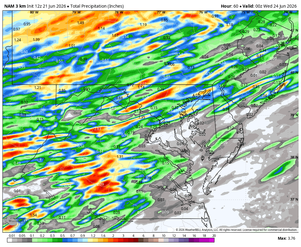
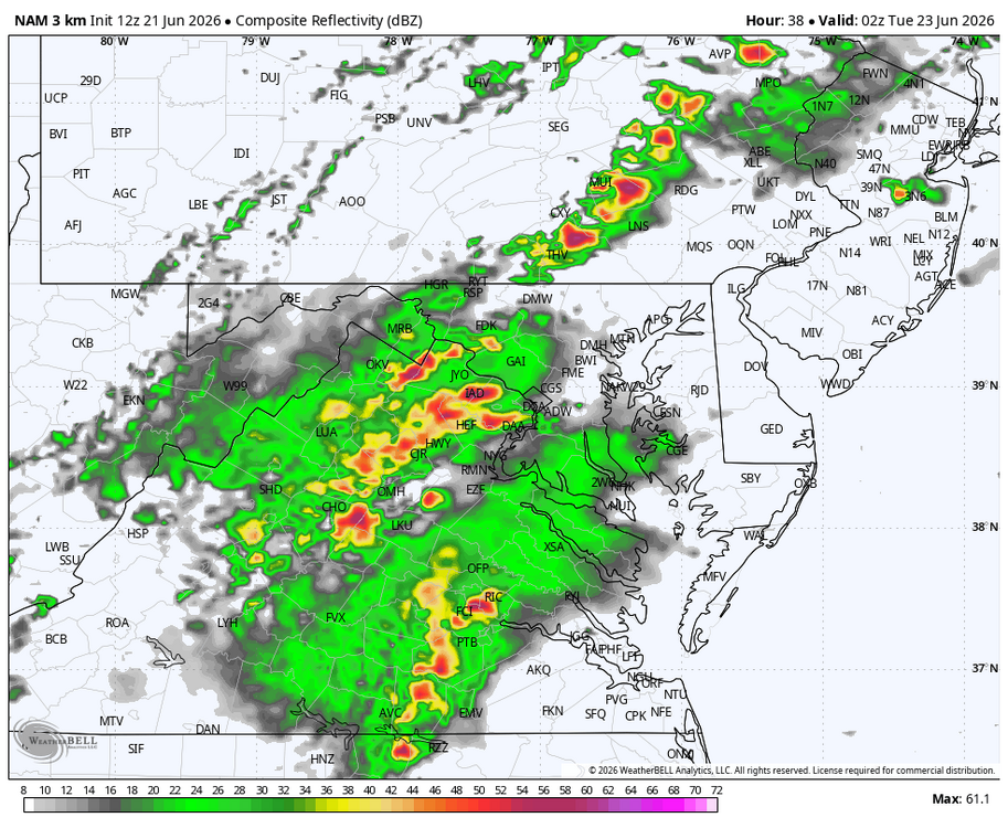
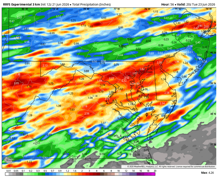
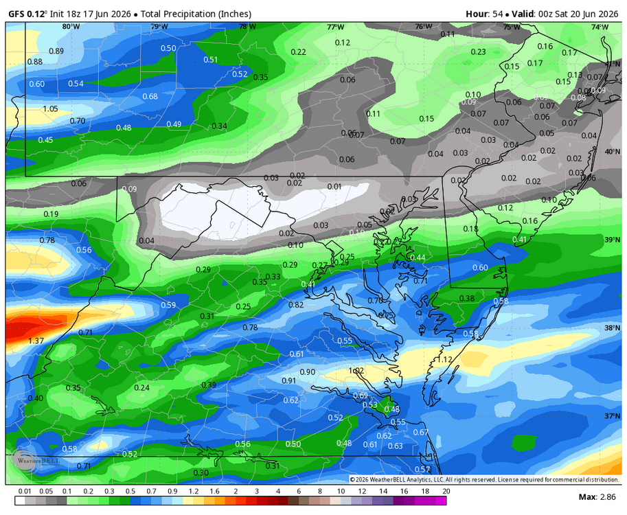
Weather Will replied to Weather Will's topic in Mid Atlantic
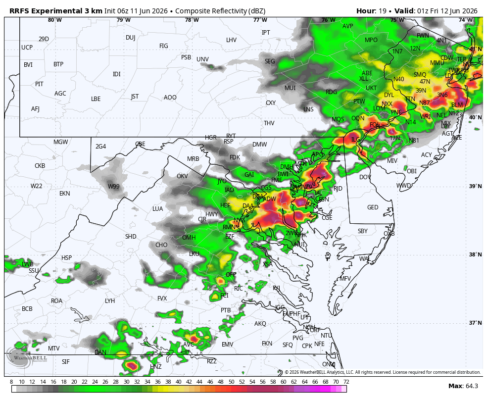
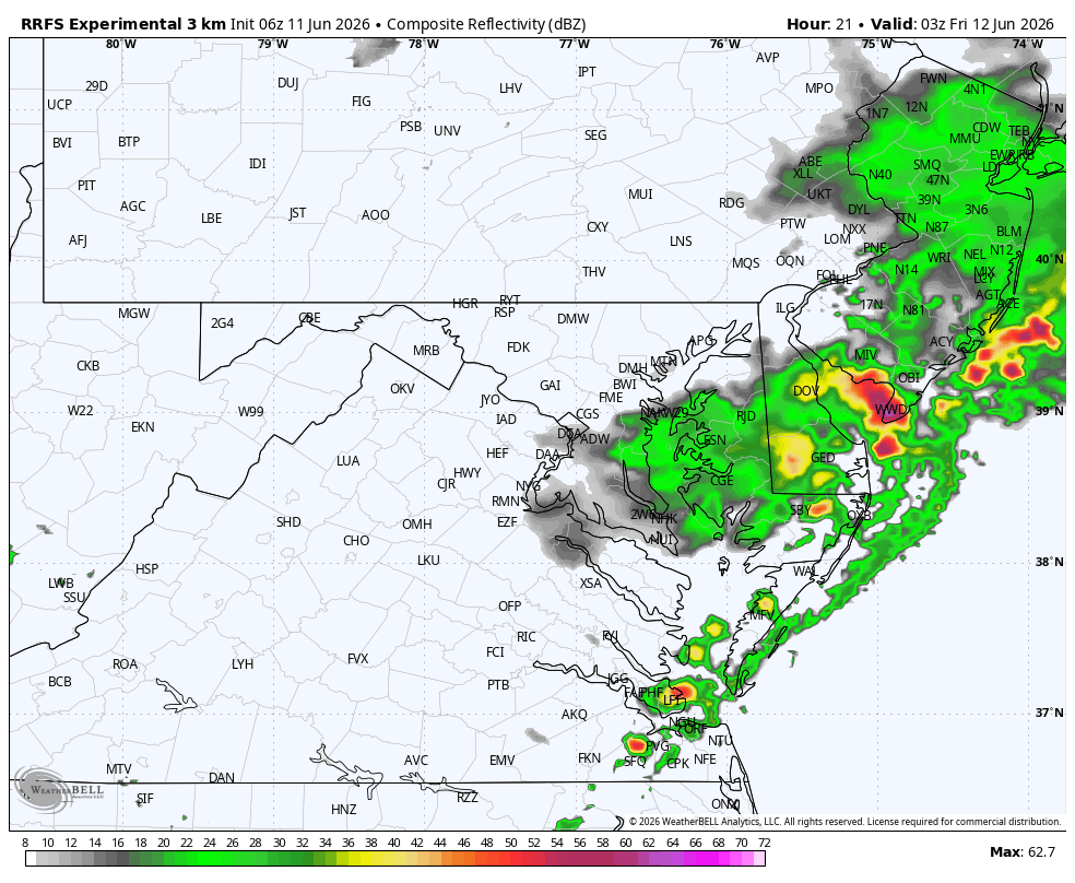
WB 3K NAM at 2 pm Monday. Another round about 10pm. WB 12Z RRFS is similar but an hour or two slower.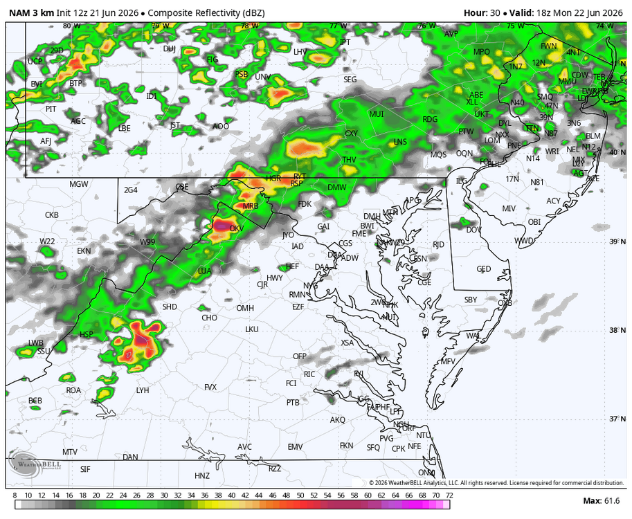

-
Wet late Monday 6/22 or another Fizzle?
Weather Will replied to Weather Will's topic in Mid Atlantic
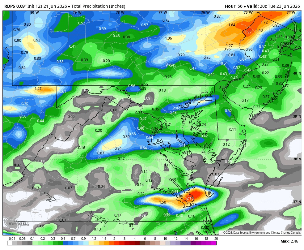
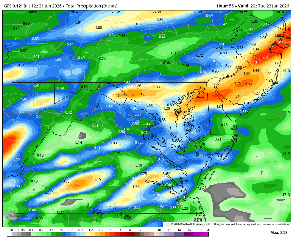
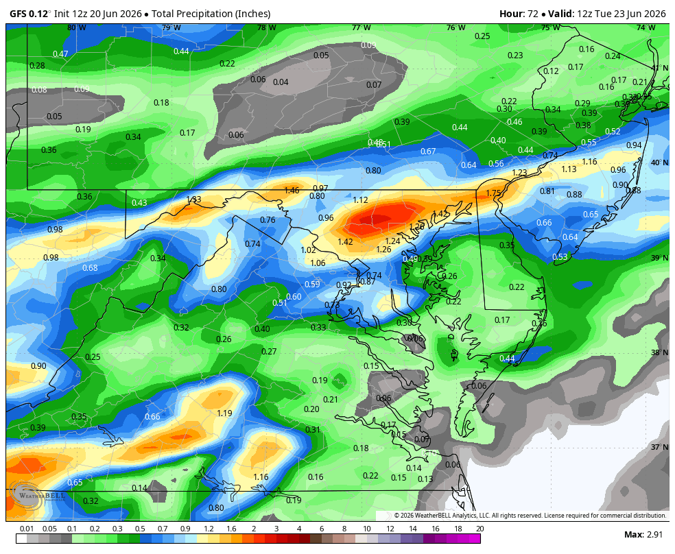
WB 12Z models as they come in: 3K NAM; RRFS (which did well last time); RDPS; GFS


-
Happy Summer! Actually, daylight starts to shorten less than a second today as sun angle heads back toward winter.....sunrise: 5:42am; sunset 8:40pm in Frederick.
-
Wet late Monday 6/22 or another Fizzle?
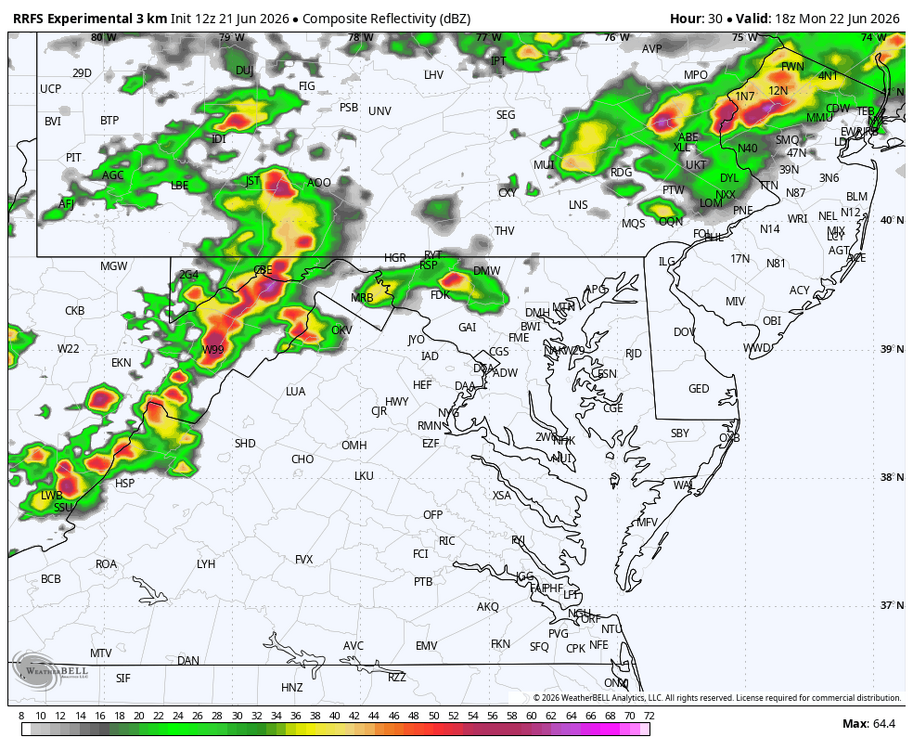
Weather Will replied to Weather Will's topic in Mid Atlantic
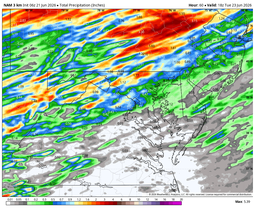
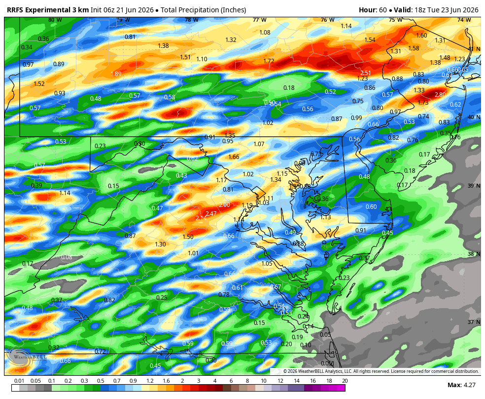
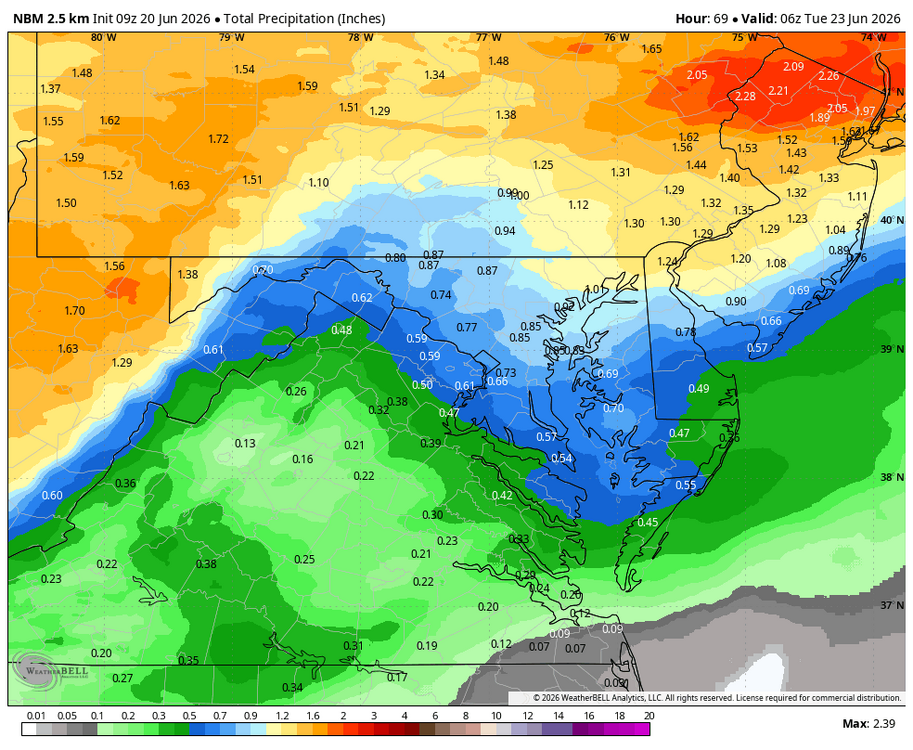
WB 6Z 3K NAM and RRFS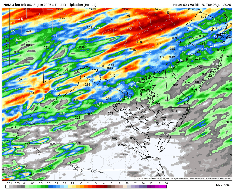
-
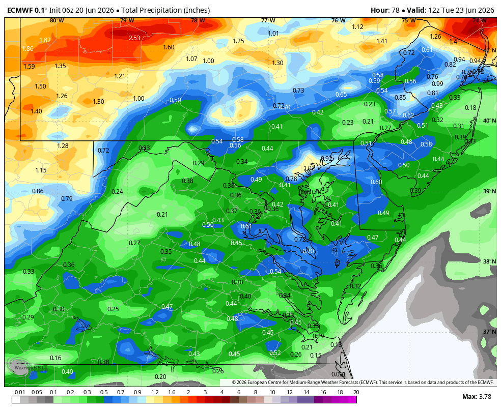
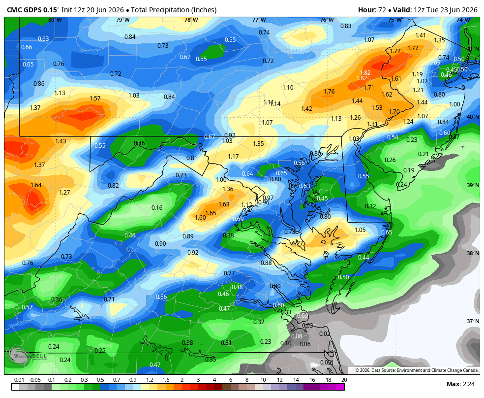
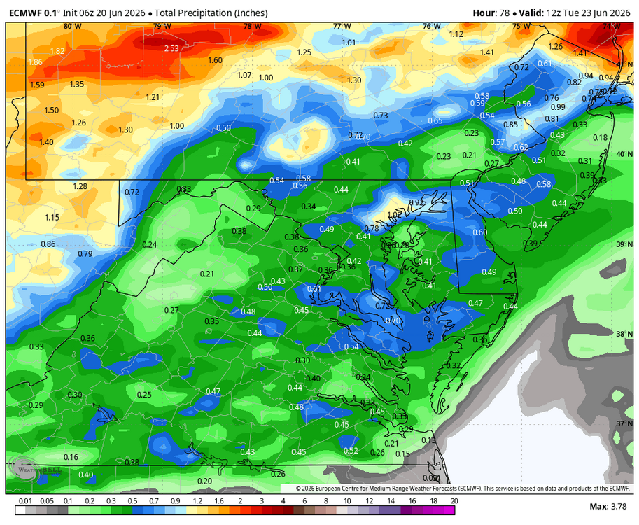
WB 12Z GFS, EURO, Can. And NBM (15Z).


-
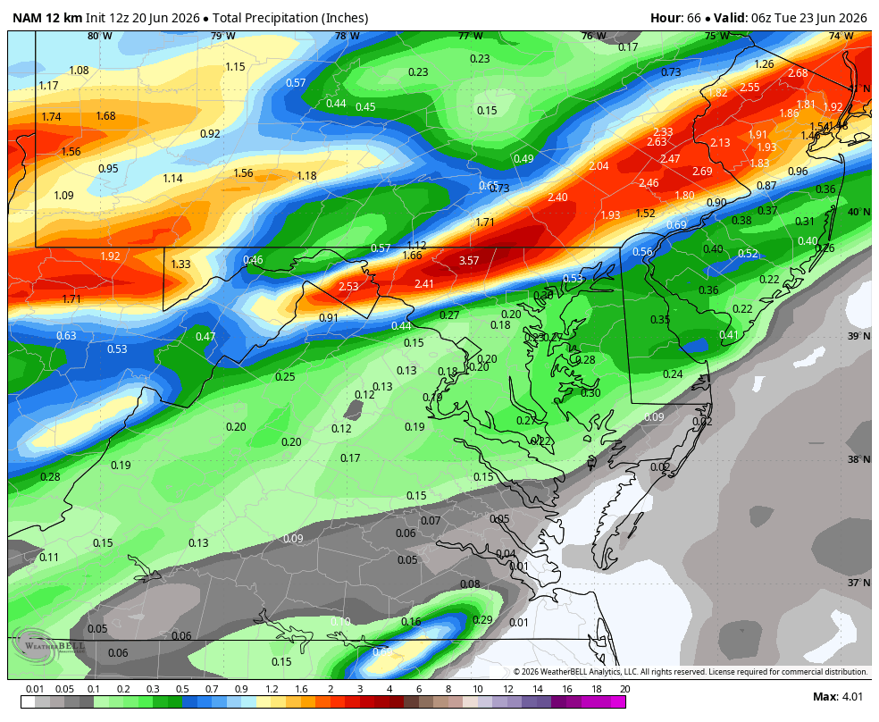
Haven't been Nam'd in awhile.... WB 12Z 12k NAM.

-
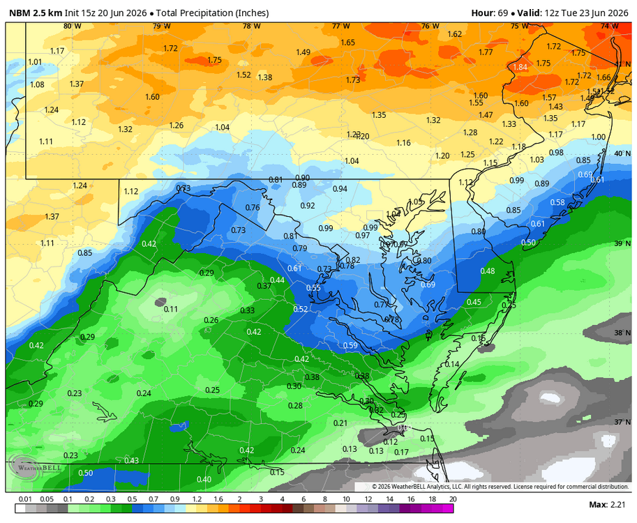
WB 9Z NBM for Monday.
-
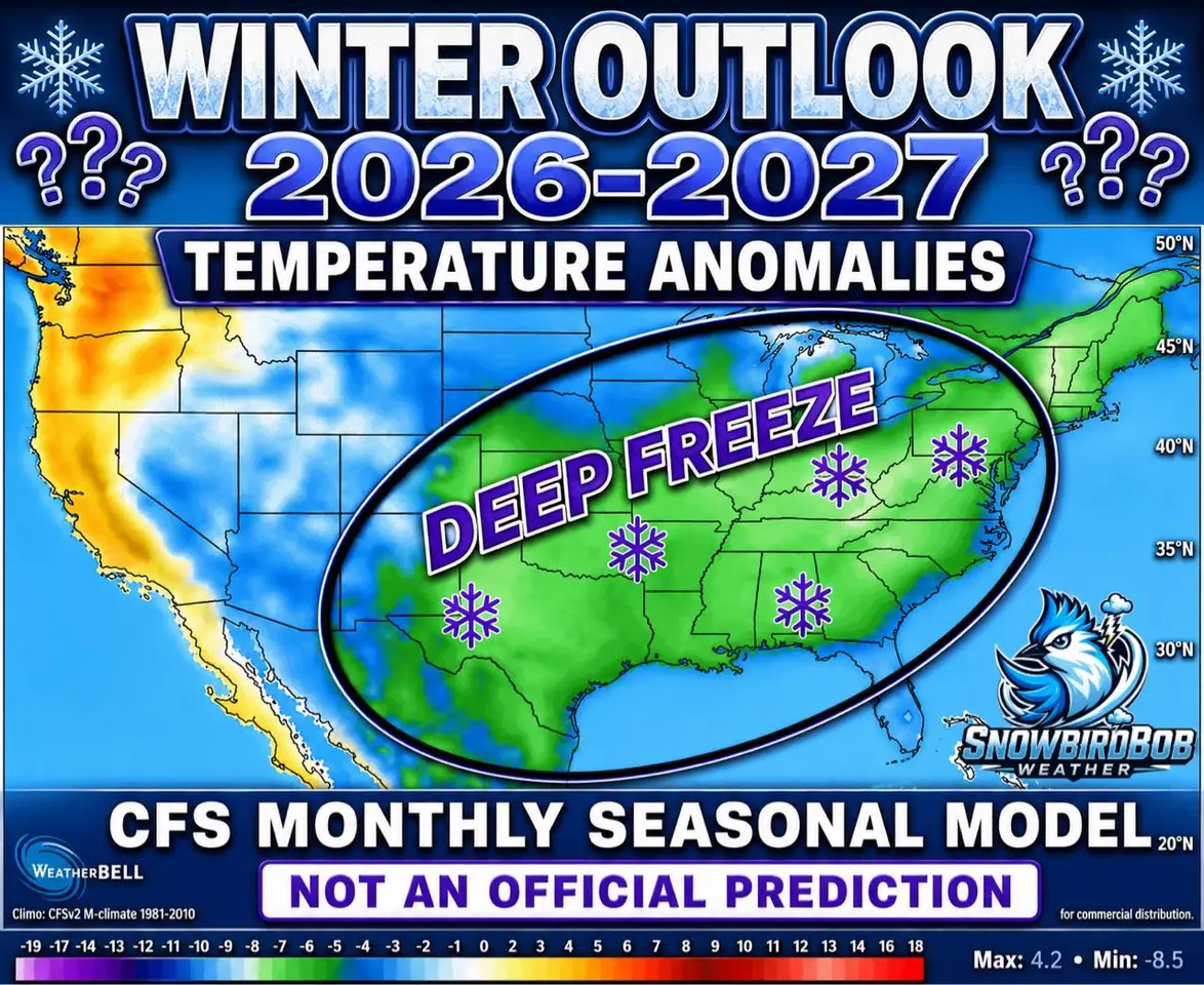
Hey Ji, did you do this graphic?

-
Just like the Commanders, things always look good for winter in June, but I agree, at least we have some hope!
-
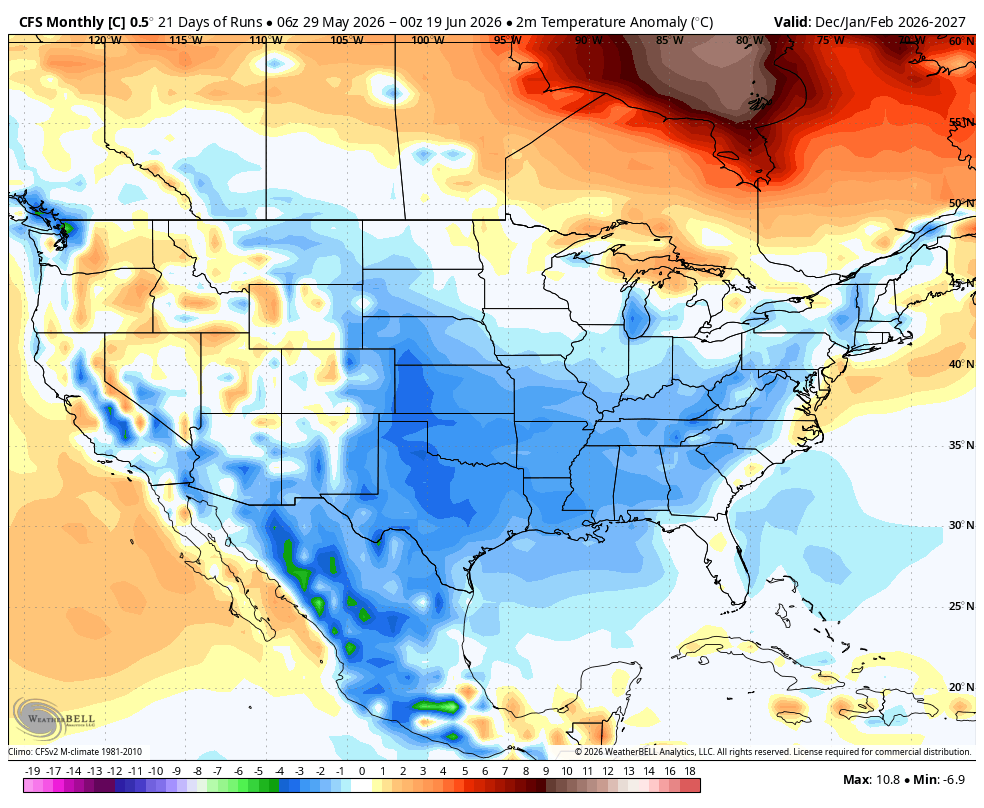
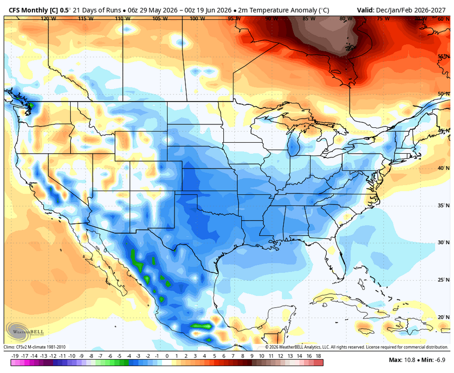
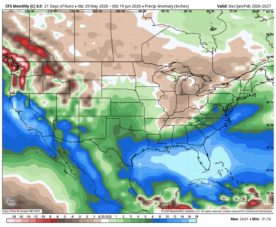
WB last 21 CFS Control runs Dec-Feb.
-
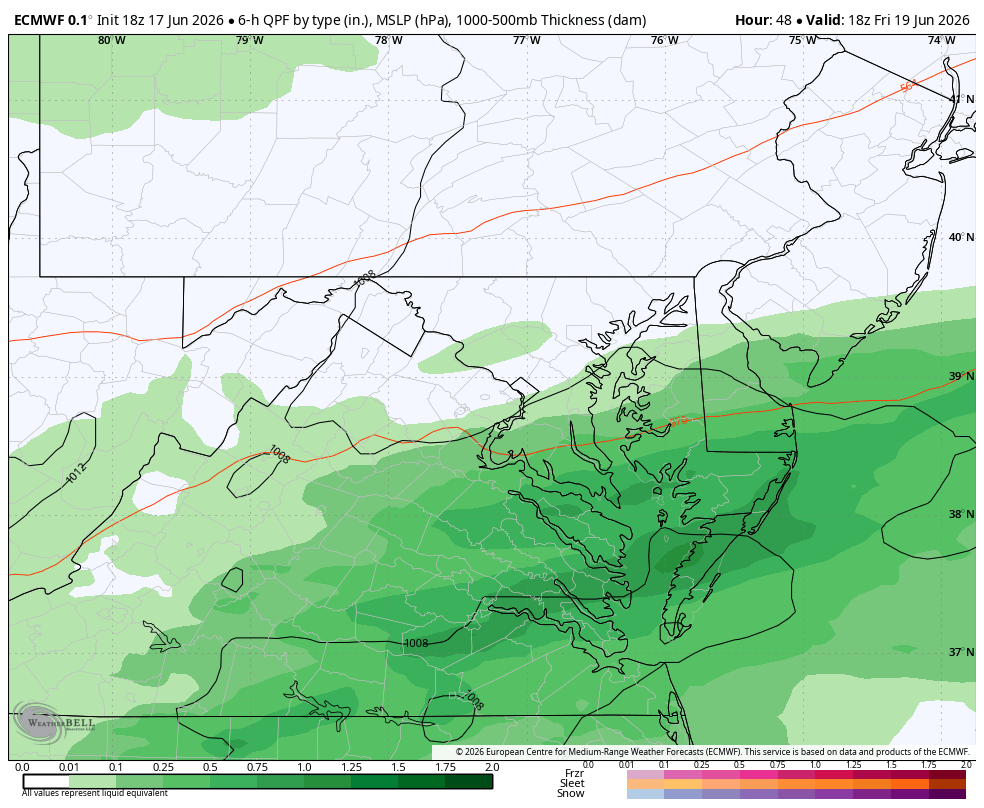
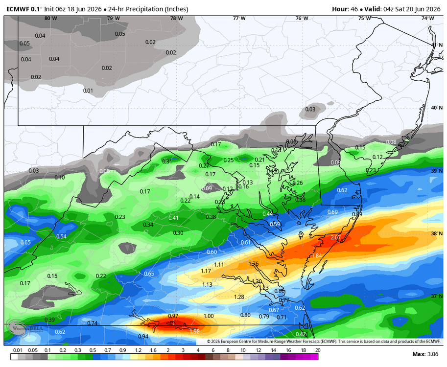
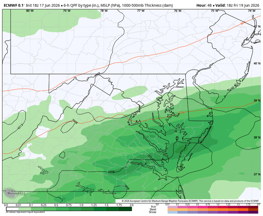
WB 6Z EURO. Hopefully southern and eastern zones will get some much needed rain tomorrow.
-
Heavy downpour! Short range models stunk this am. Approaching .20 with more to come.
-
Pleasant surprise to see rain this am! Will take every drop....radar looks much better than I expected!!!
-
Yes, on the shore.
-
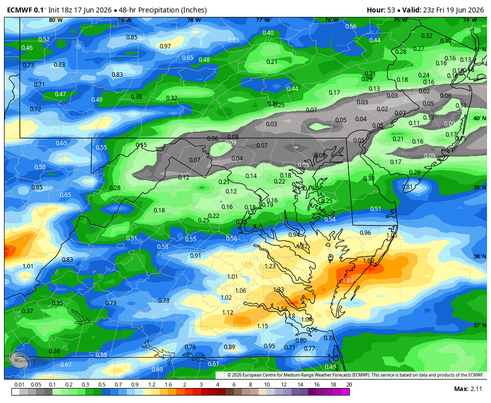
Actually a pretty rainy end of work week on the shore Th-Fri. WB 18Z EURO.

-
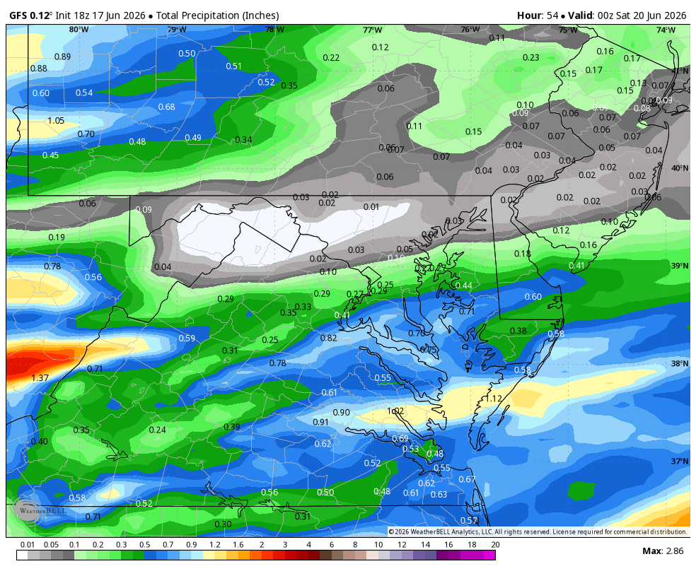
WB 18Z GFS forecasting much needed rain for southern/SE zones by Friday afternoon with frontal boundary and remnants of Arthur.
-
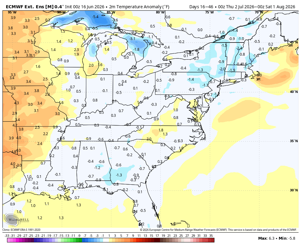
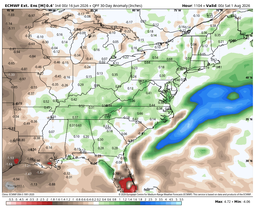
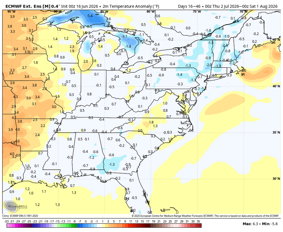
WB latest EURO extended weeklies for July.

- 259 replies
-
- 3
-

-

-
- we got burned
- rugpull central
- (and 1 more)
-
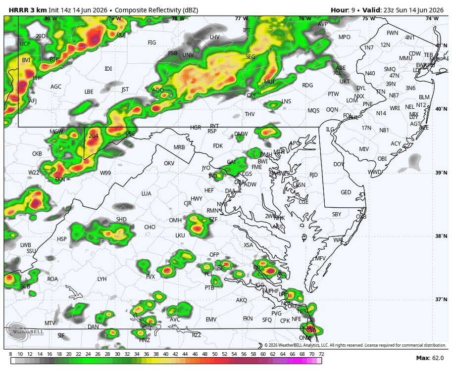
Entire area west of the Bay under a severe thunderstorm watch until 11.
-
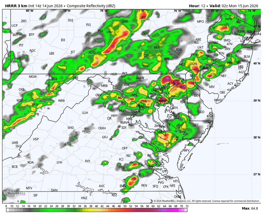
WB 14Z HRRR: not much going on during the day. Thunderstorms hit around sunset east of the mountains.


-
Very bad wind, no rain yet. edit: only about .05.
-
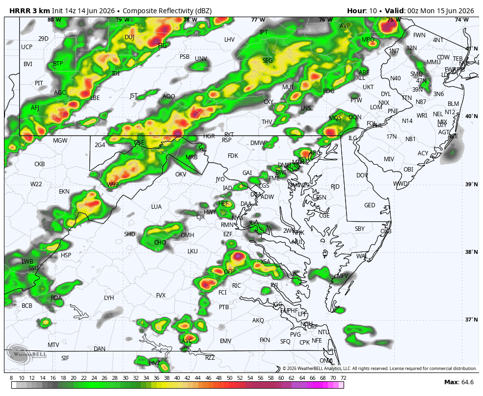
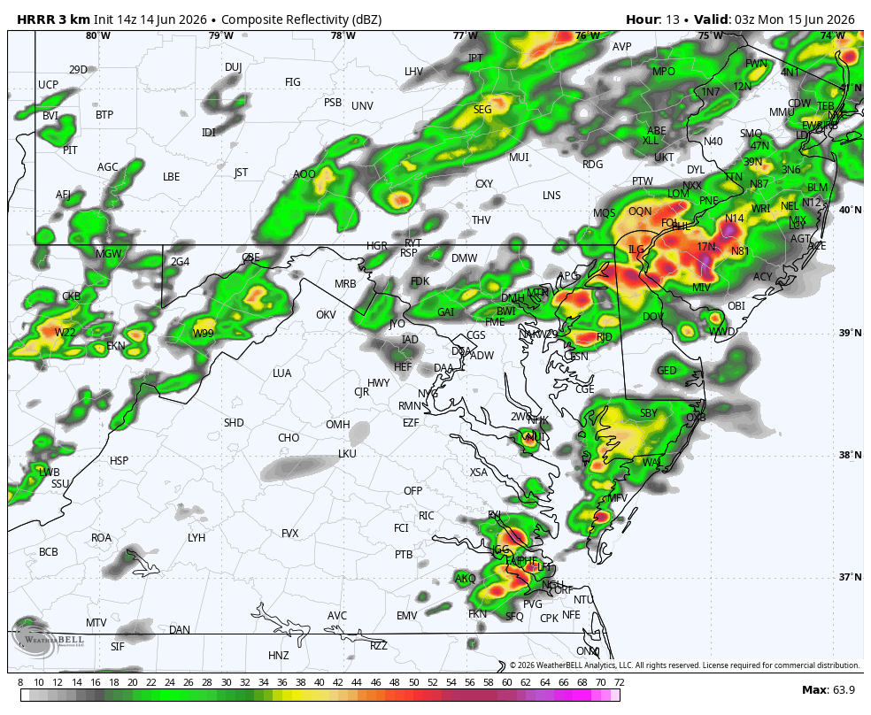
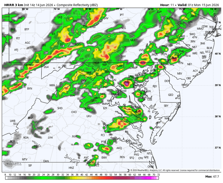
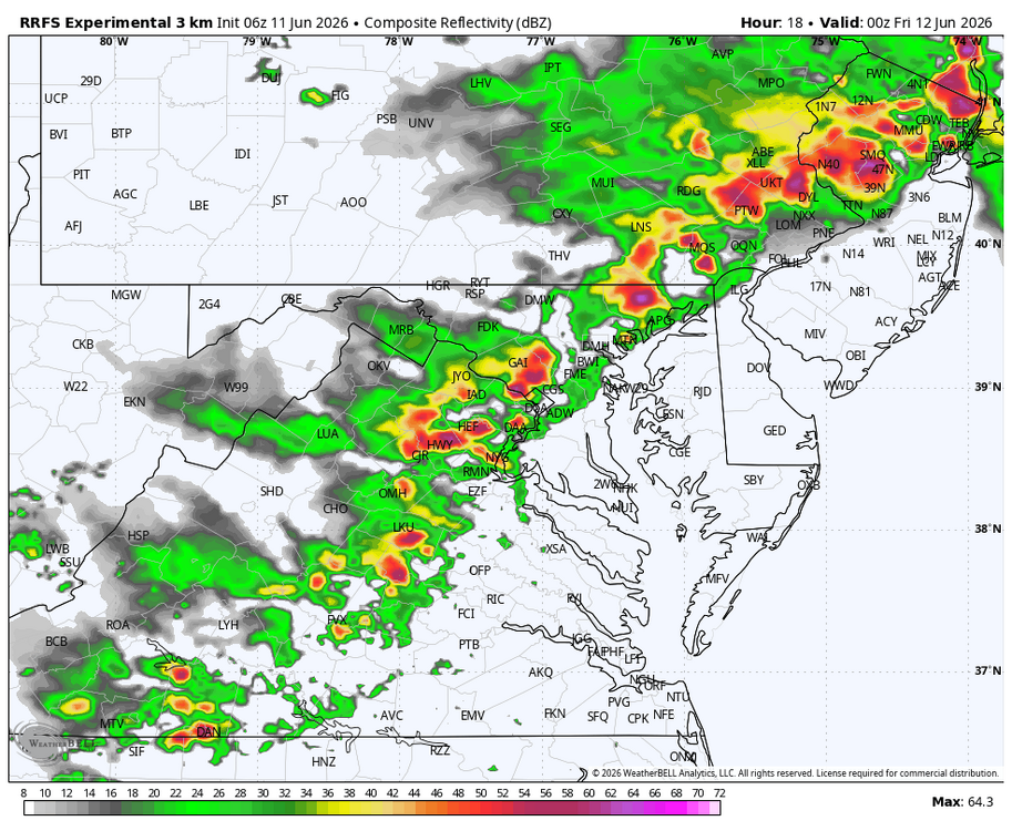
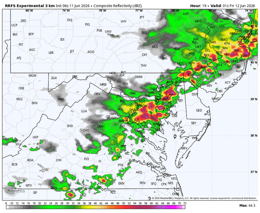
WB 6Z RRFS (been doing well with precip. Totals ). Squall line east of mountains around 7pm.


-
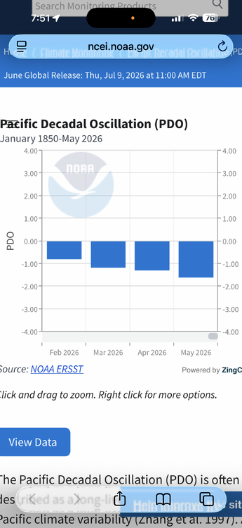
PDO trending in the wrong direction at this time.