Weather Will
-
Posts
7,604 -
Joined
-
Last visited
Content Type
Profiles
Blogs
Forums
American Weather
Media Demo
Store
Gallery
Everything posted by Weather Will
-
Can't remember a June like this with low dewpoints, a refreshing breeze, and clear, blue skies. Get outside everyone!
-
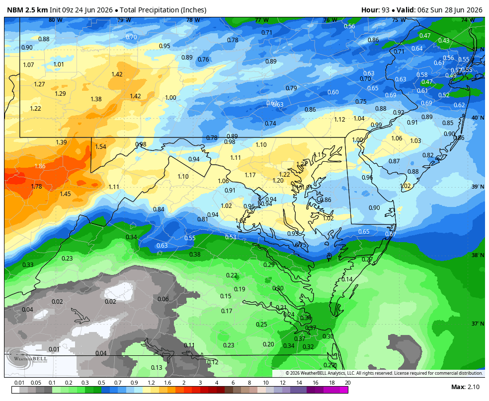
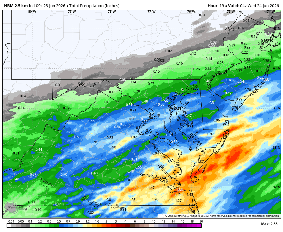
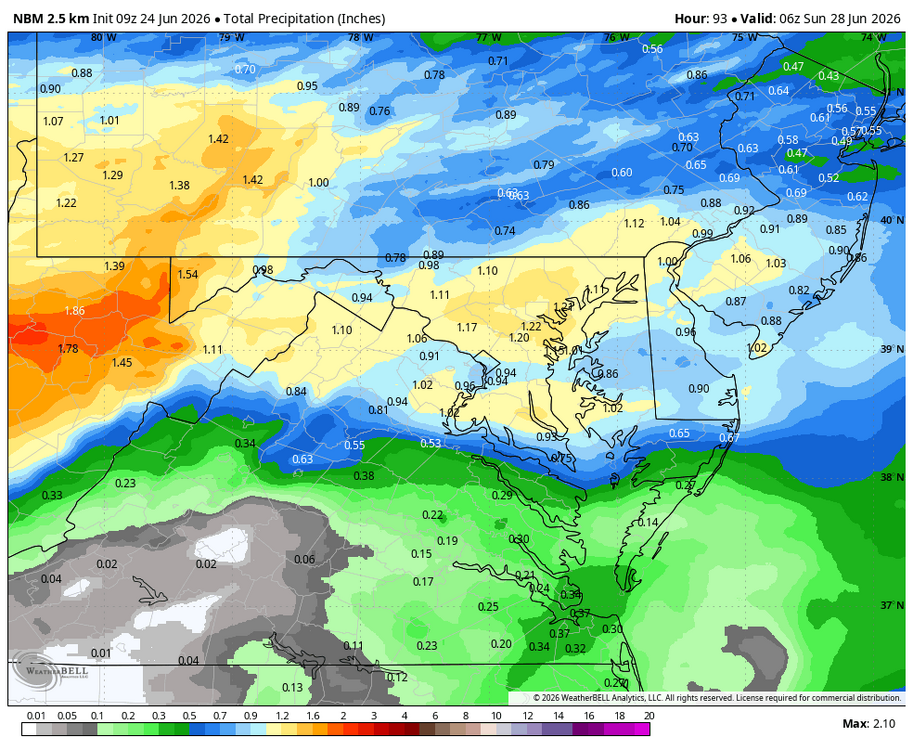
WB 9Z NBM
-
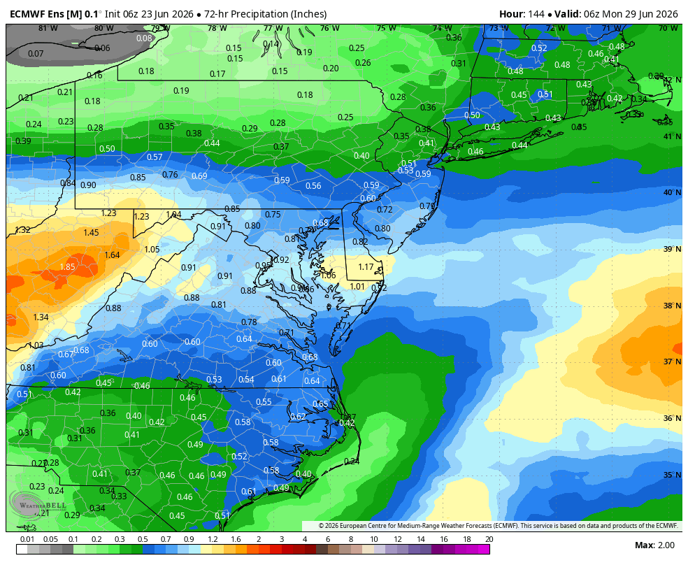
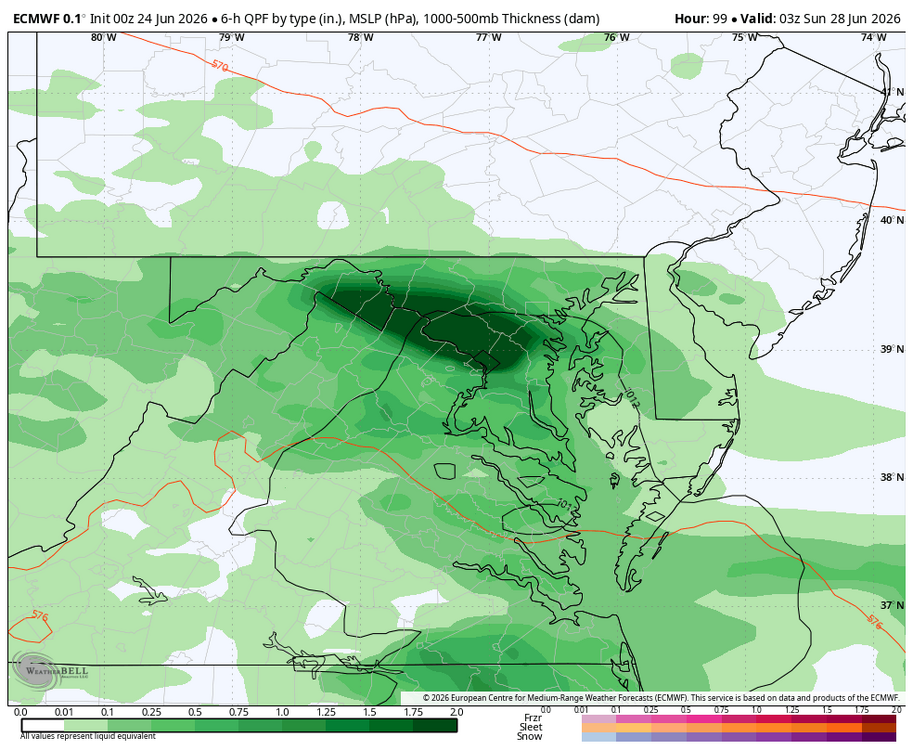
WB 6Z EURO has heavy rain moving through on Saturday.
-
Does everyone like threads for specific events during the summer or is it too much? If the 12Z Th. Runs look solid can open another thread for Saturday.
- 259 replies
-
- 1
-

-
- we got burned
- rugpull central
- (and 1 more)
-
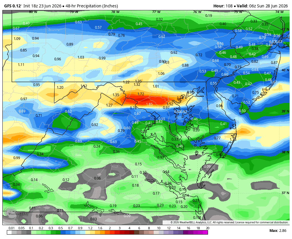
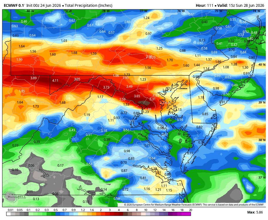
WB 18Z GFS for Friday/Saturday. Perhaps some more beneficial rain....added EURO.

-
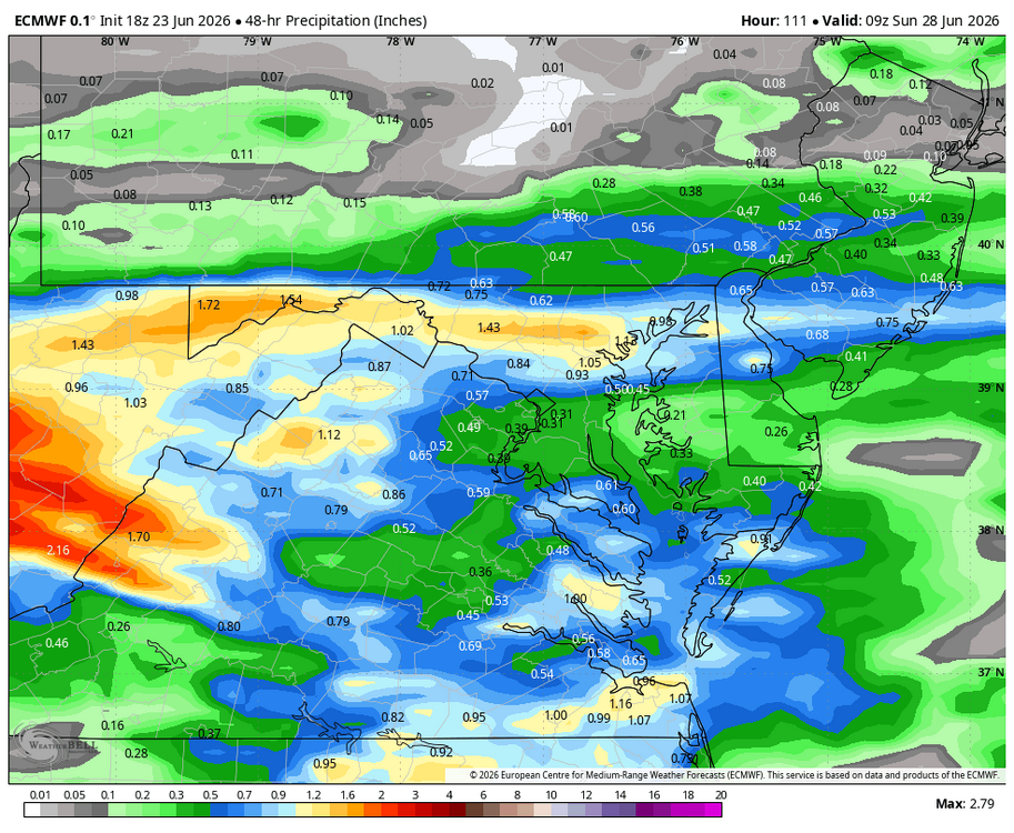
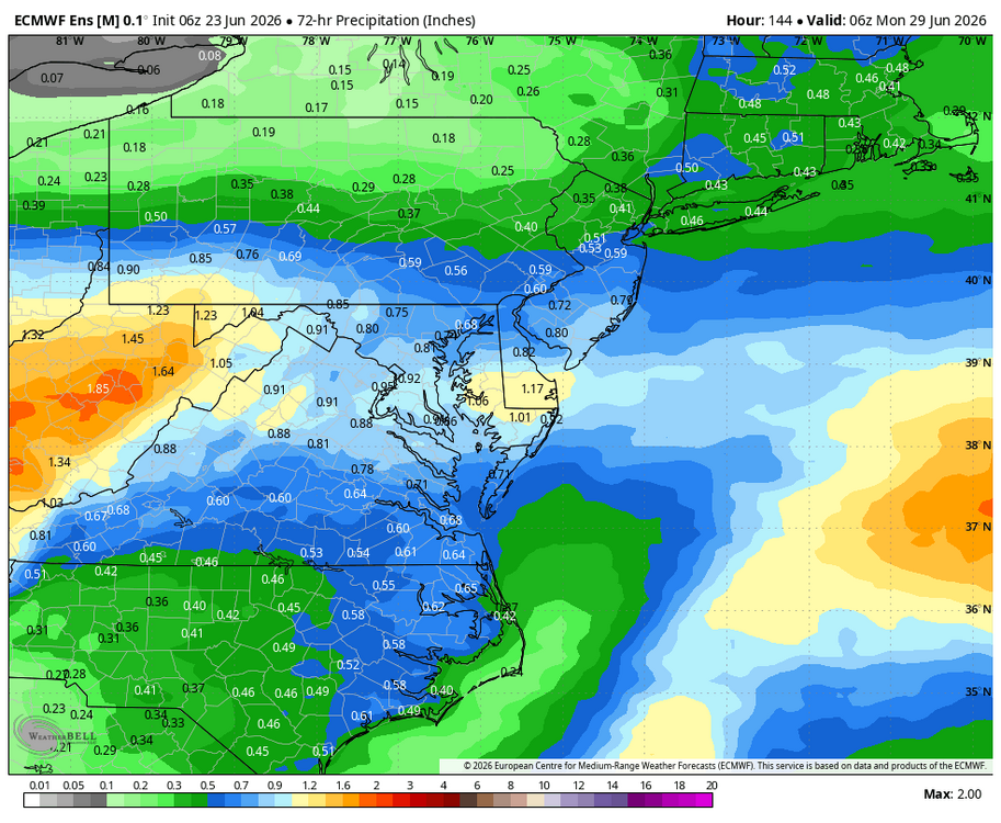
WB 6Z EPS 72 hours ending Day 6.
-
Wet late Monday 6/22 or another Fizzle?
Weather Will replied to Weather Will's topic in Mid Atlantic
.03; steady, light rain. Will take every drop! -
Wet late Monday 6/22 or another Fizzle?
Weather Will replied to Weather Will's topic in Mid Atlantic
You dust yourself off, and look for the next chance. Saturday is still looking like a possible decent rain event. -
Wet late Monday 6/22 or another Fizzle?
Weather Will replied to Weather Will's topic in Mid Atlantic
Light rain showers. -
Wet late Monday 6/22 or another Fizzle?
Weather Will replied to Weather Will's topic in Mid Atlantic
WB 9Z NBM for today.
-
Wet late Monday 6/22 or another Fizzle?
Weather Will replied to Weather Will's topic in Mid Atlantic
Tornado warning in Charles County. -
Wet late Monday 6/22 or another Fizzle?
Weather Will replied to Weather Will's topic in Mid Atlantic
Nothing in my area tonight. Hopefully will get some rain tomorrow. -
Wet late Monday 6/22 or another Fizzle?
Weather Will replied to Weather Will's topic in Mid Atlantic
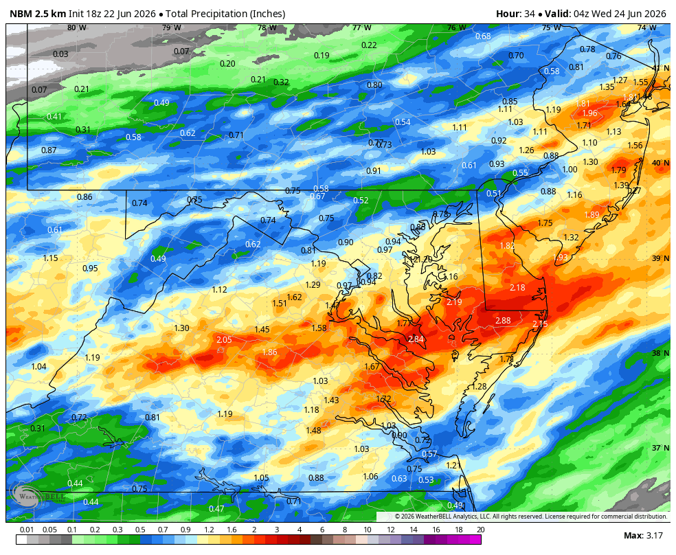
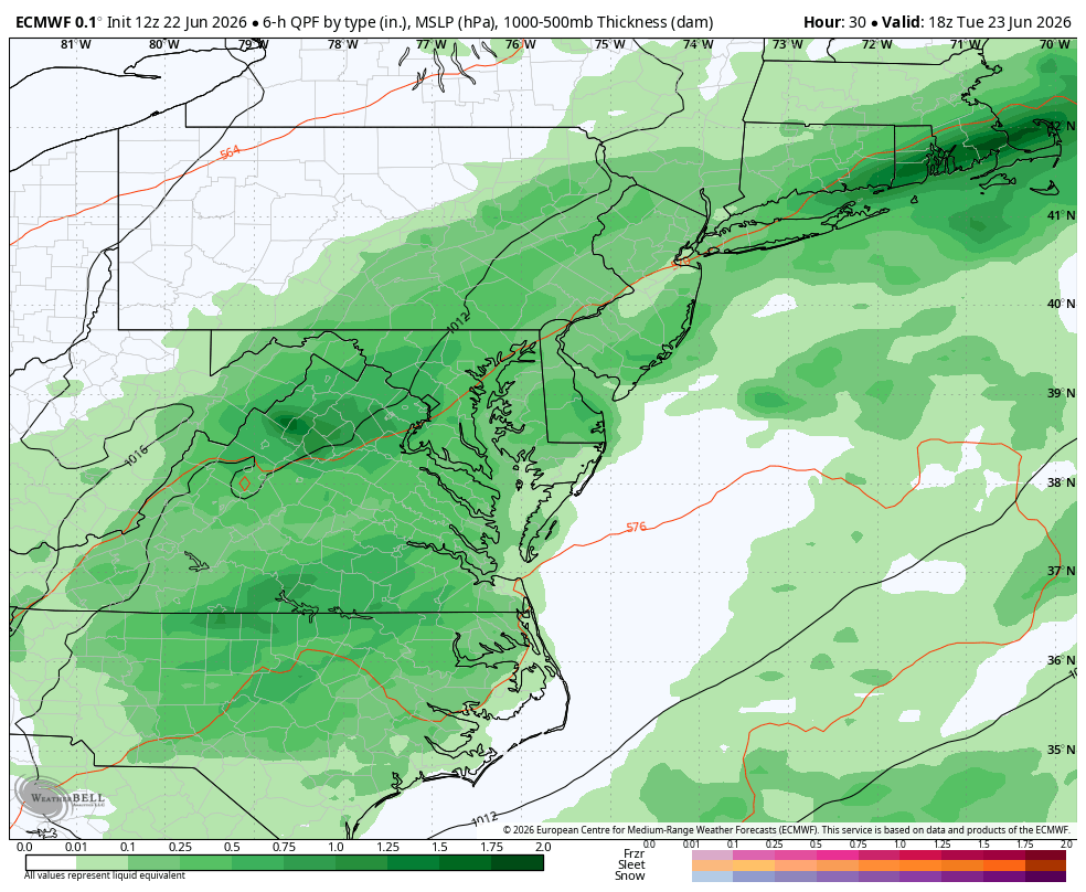
WB 18Z NBM through Tuesday.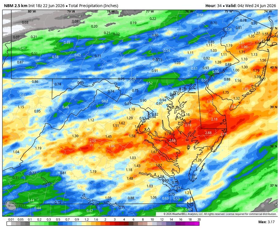
-
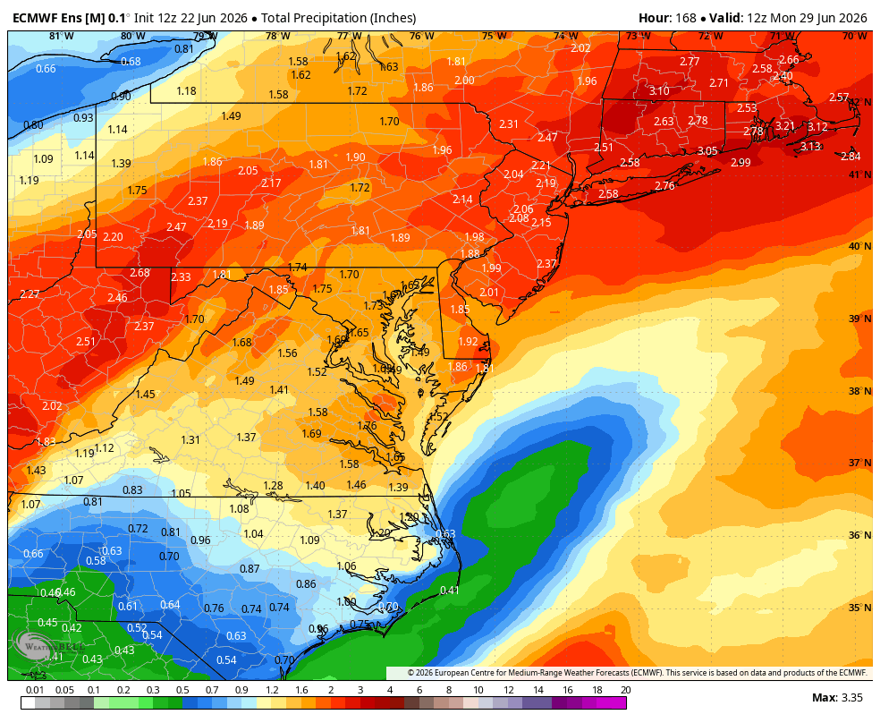
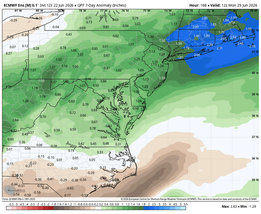
WB 7 day EPS precip. Anomaly: been awhile....

-
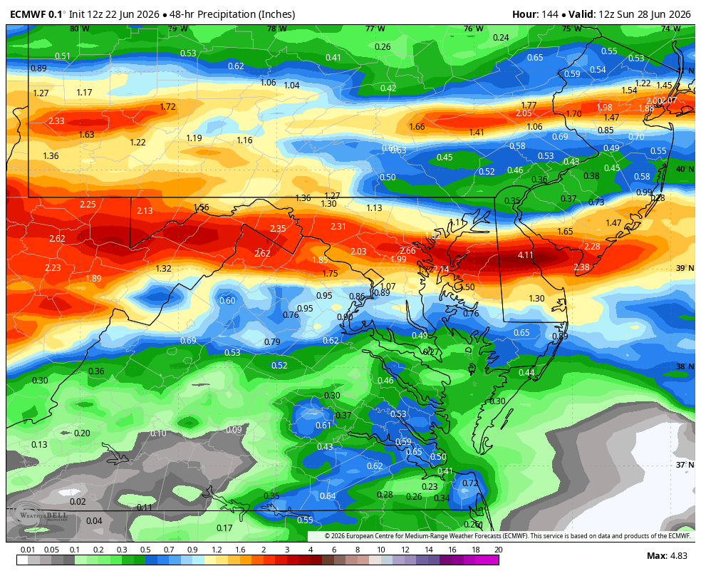
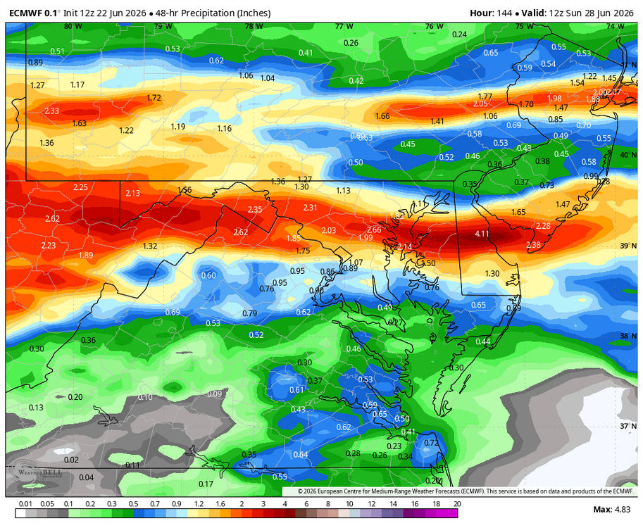
WB 12Z Euro for the weekend....
-
Wet late Monday 6/22 or another Fizzle?
Weather Will replied to Weather Will's topic in Mid Atlantic
WB 12Z EURO compared to 6Z. Dr. No is onboard for some rain!!!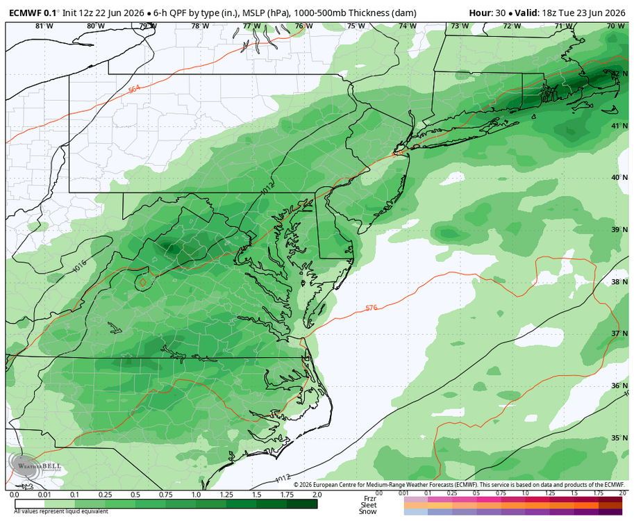
-
Wet late Monday 6/22 or another Fizzle?
Weather Will replied to Weather Will's topic in Mid Atlantic
WB 12Z EURO compared to 6Z. If this were winter, the site would crash!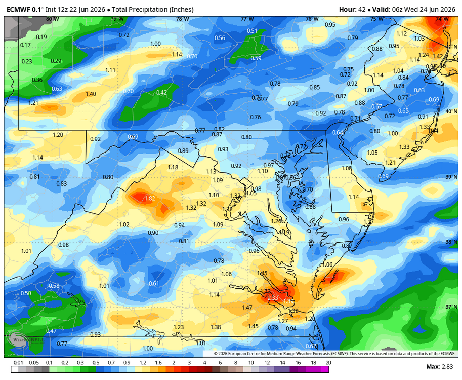
-
Wet late Monday 6/22 or another Fizzle?
Weather Will replied to Weather Will's topic in Mid Atlantic
WB 15Z NBM through Tuesday would be nice .75 to inch for most of us.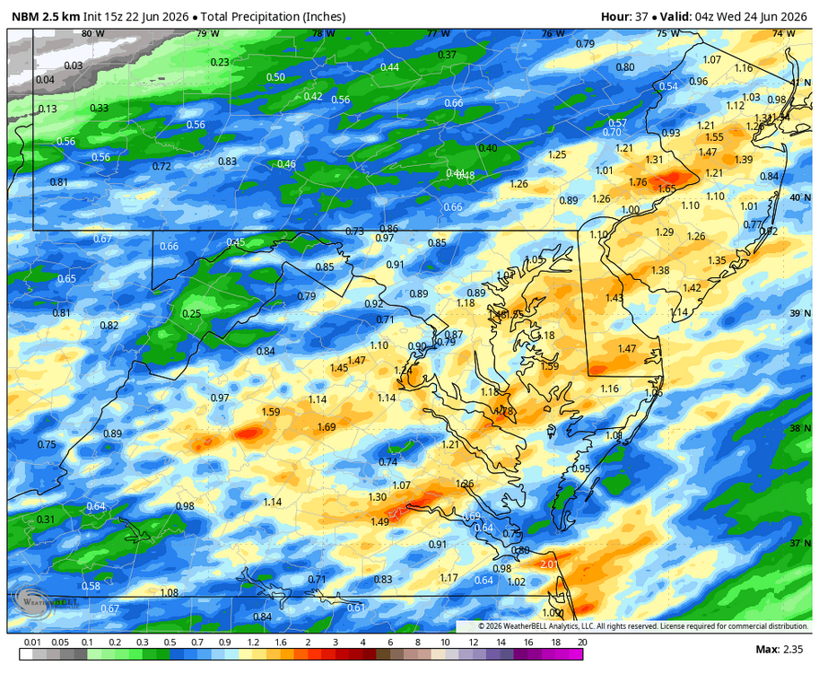
-
Wet late Monday 6/22 or another Fizzle?
Weather Will replied to Weather Will's topic in Mid Atlantic
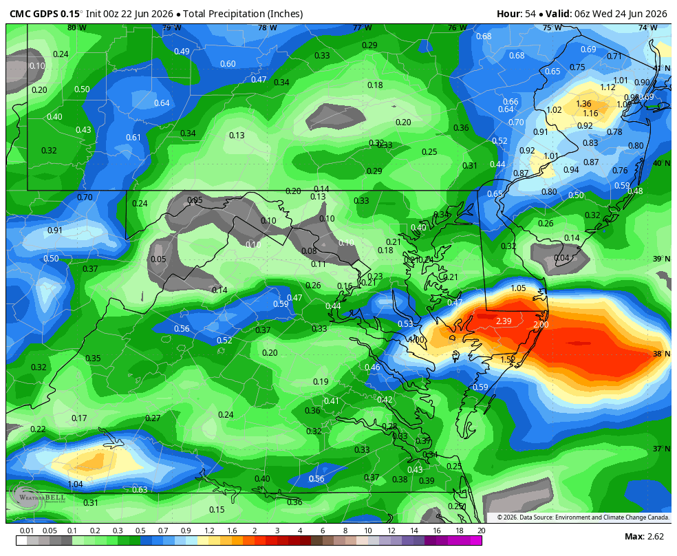
WB 12Z Can. Is also onboard for tomorrow. Much wetter than 0Z.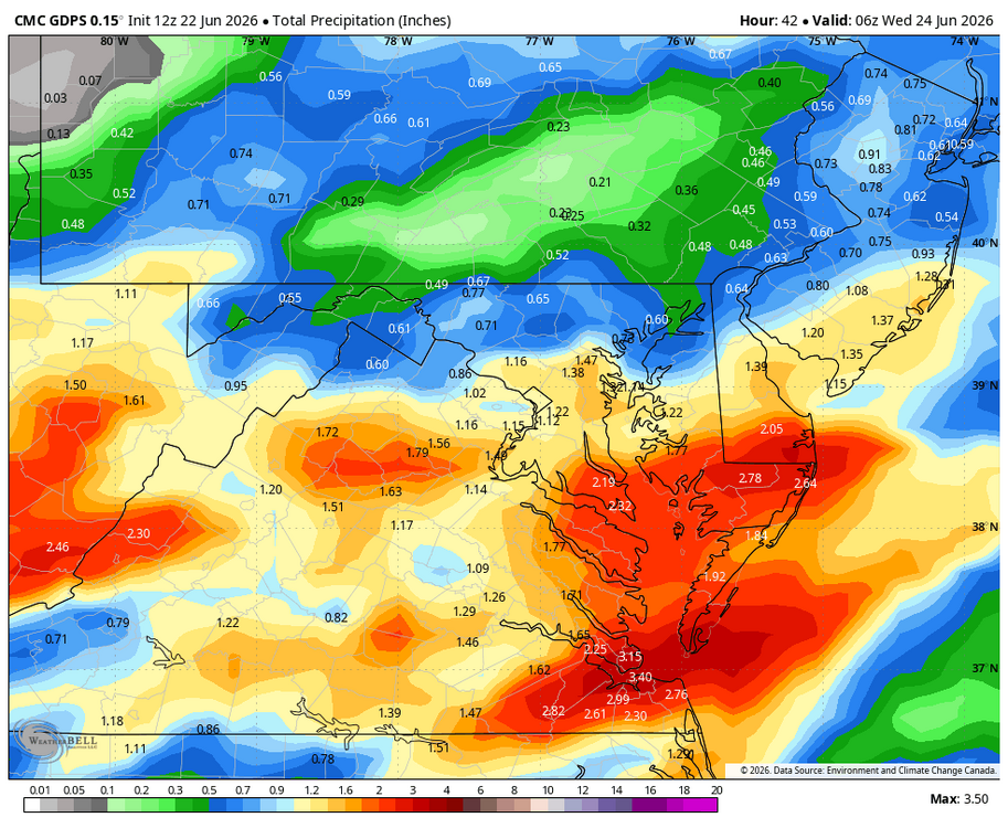
-
Wet late Monday 6/22 or another Fizzle?
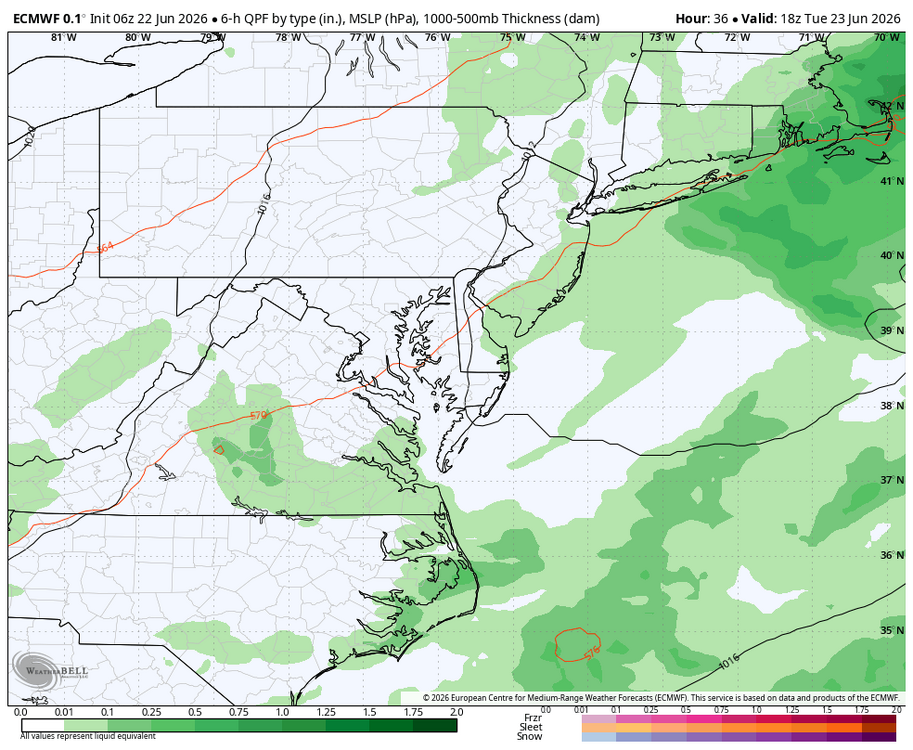
Weather Will replied to Weather Will's topic in Mid Atlantic
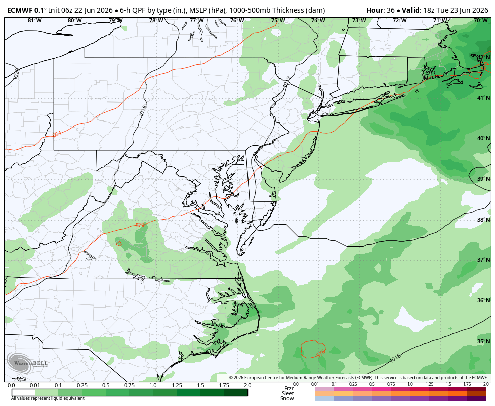
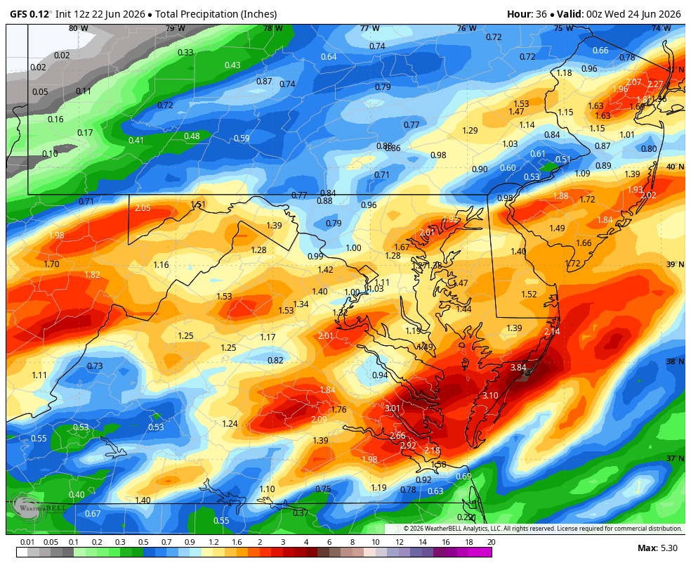
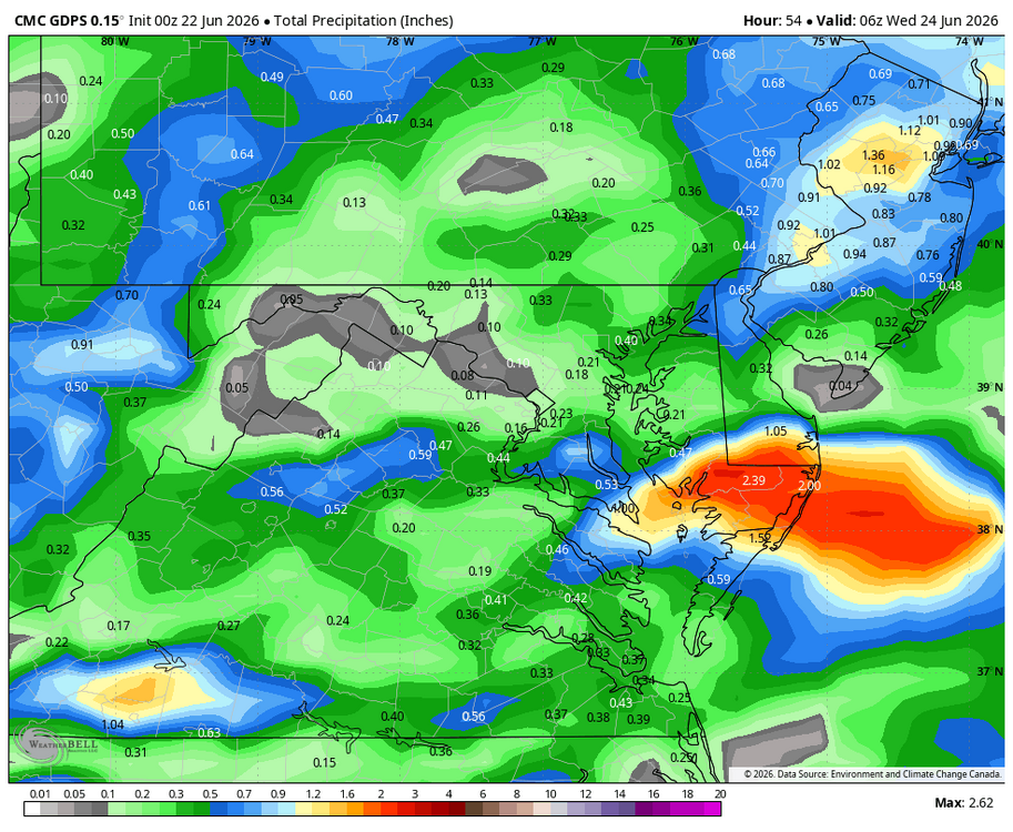
WB 12Z GFS through Tuesday.
-
Wet late Monday 6/22 or another Fizzle?
Weather Will replied to Weather Will's topic in Mid Atlantic
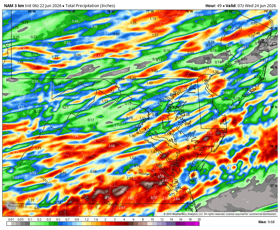
WB 12Z RRFS through Tuesday.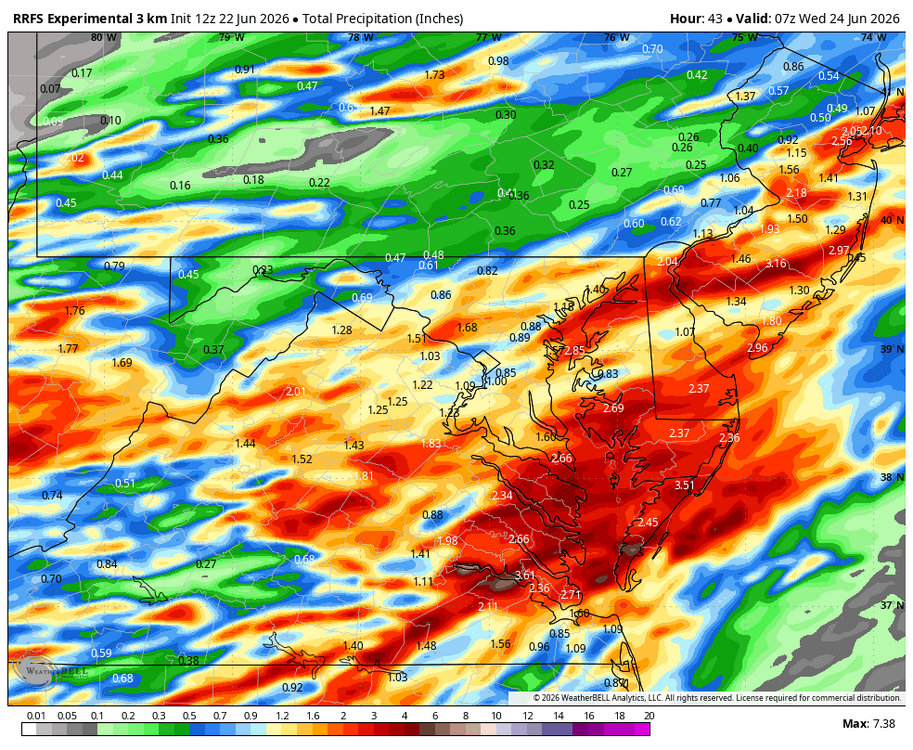
-
Wet late Monday 6/22 or another Fizzle?
Weather Will replied to Weather Will's topic in Mid Atlantic
I just had 20 drops fall on my yard. Heading due east.... -
Wet late Monday 6/22 or another Fizzle?
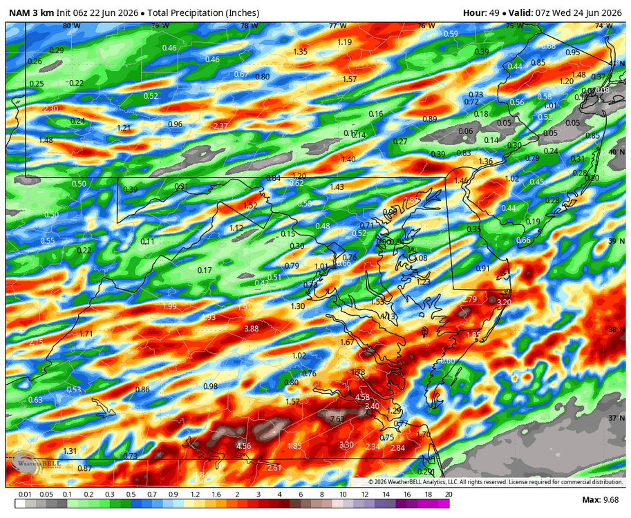
Weather Will replied to Weather Will's topic in Mid Atlantic
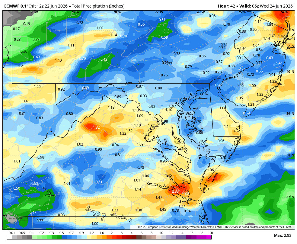
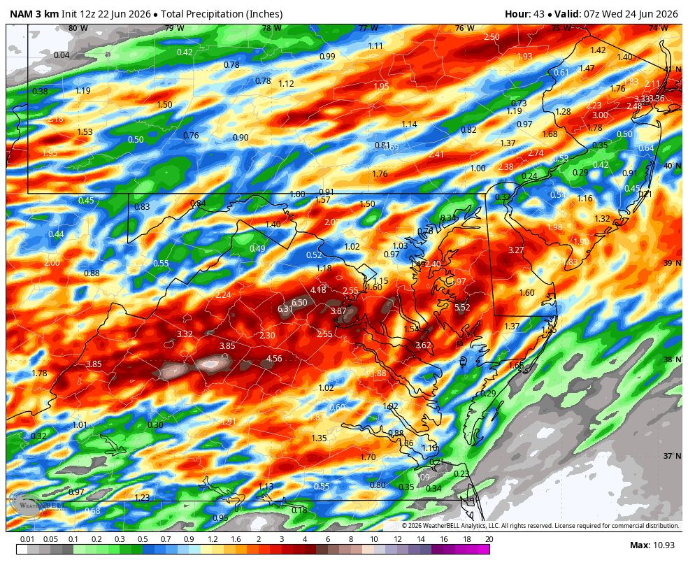
Well, WB 3K NAM now has a Tuesday soaker for southern zones. Significant shift north compared to 6Z. I guess this is why we always go crazy all winter... precip. Field making big shifts inside 24 hours.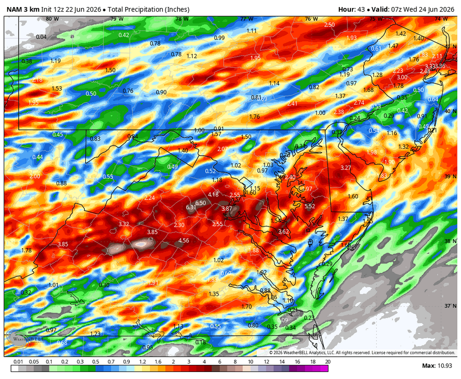
-
Wet late Monday 6/22 or another Fizzle?
Weather Will replied to Weather Will's topic in Mid Atlantic
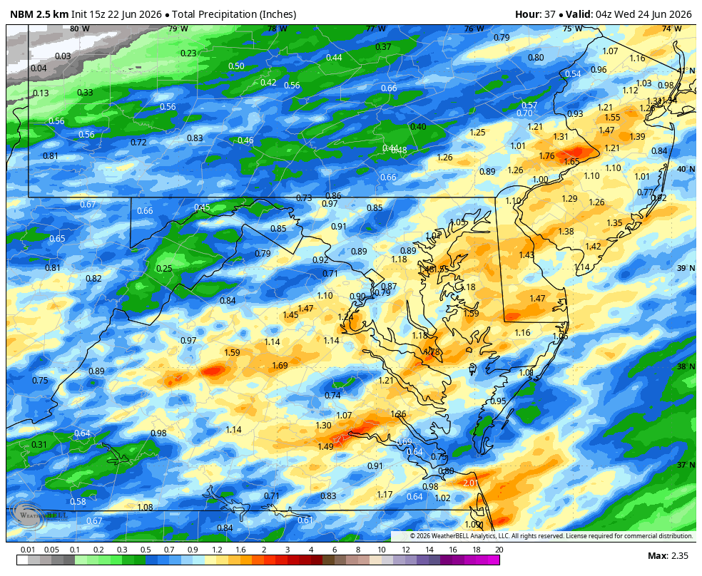
I hope the morning soaker is accurate! I saw it but the HRRR at range... -
Wet late Monday 6/22 or another Fizzle?
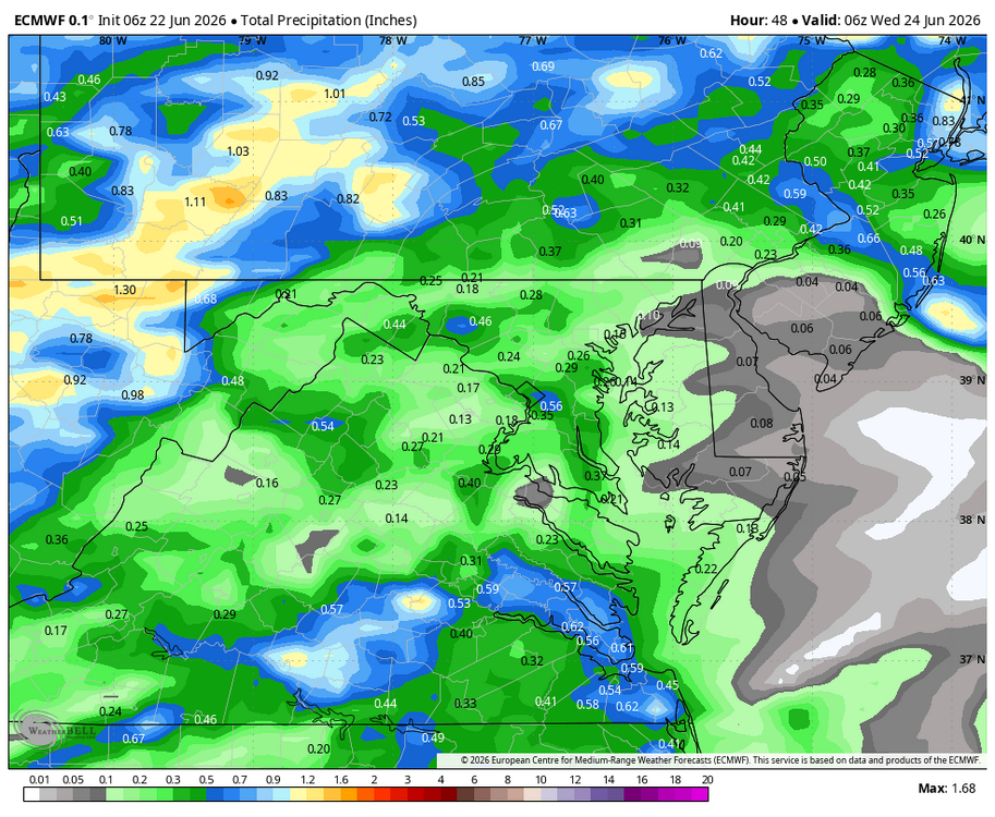
Weather Will replied to Weather Will's topic in Mid Atlantic
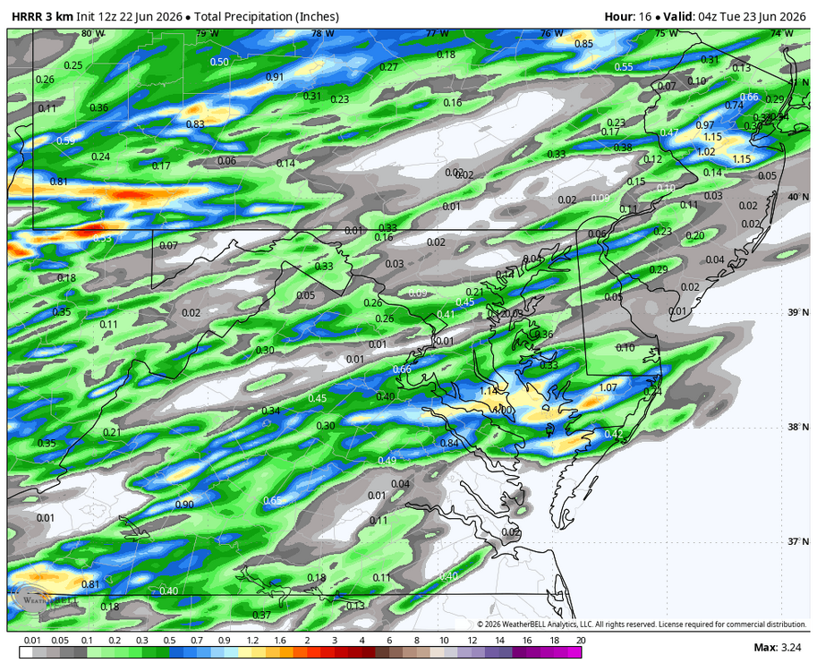
Cloudy again here. WB 12Z HRRR through midnight is not impressive for most of us. More of a fizzle I'm afraid....