Weather Will
Members-
Posts
7,364 -
Joined
-
Last visited
Content Type
Profiles
Blogs
Forums
American Weather
Media Demo
Store
Gallery
Everything posted by Weather Will
-
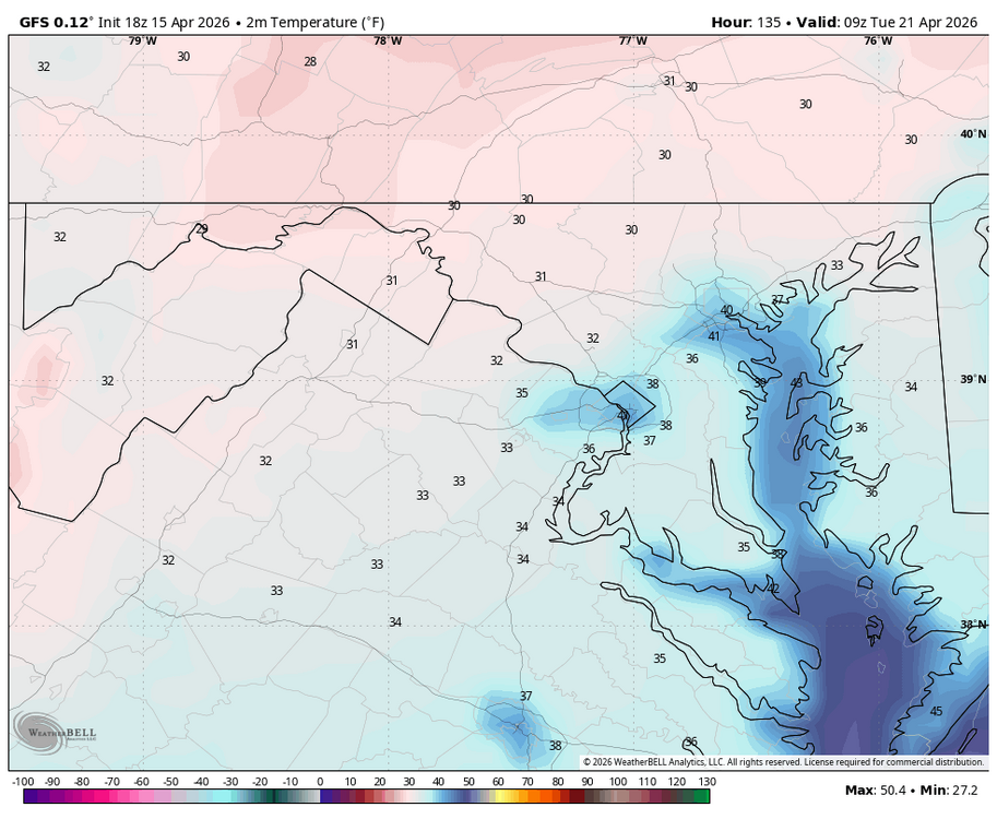
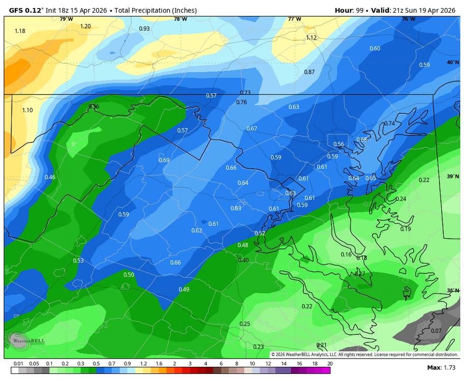
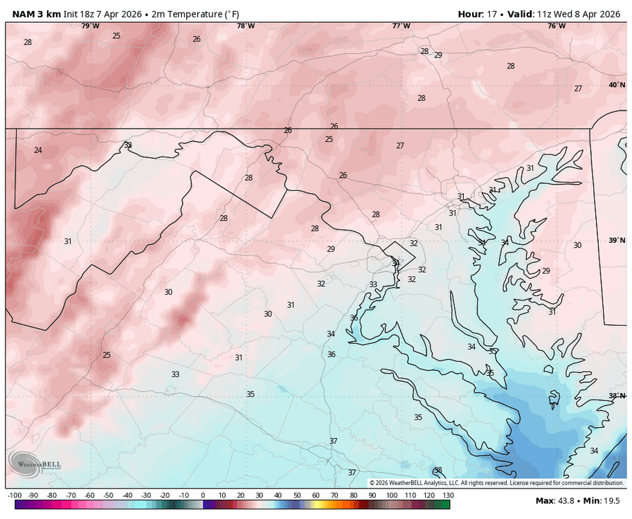
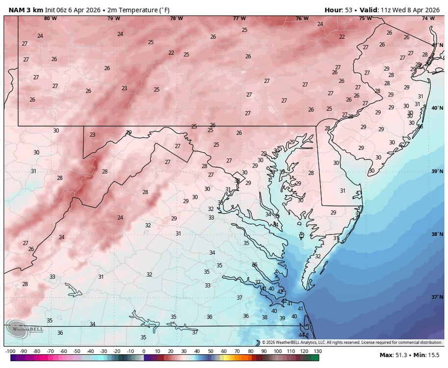
WB 18Z GFS. May want hold off planting annuals in the NW burbs; flirting with freezing Tuesday am after a strong cold front rolls through this weekend with decent rain forecasted....
-
.06 with band earlier today....may miss next batch to my North but glad to finally see some over performing wet weather
-
-
-
Strange light droplets falling out of the sky....anyone know what it is?
-
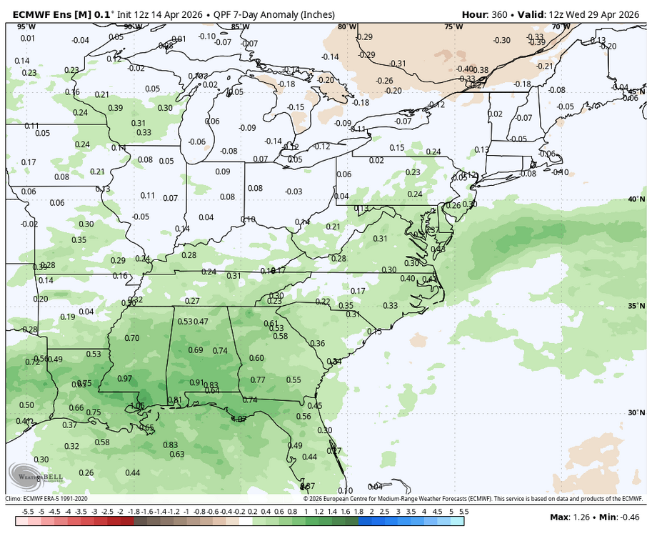
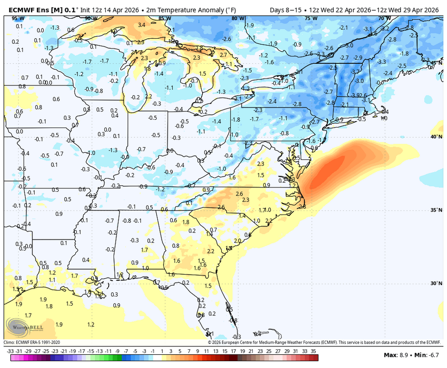
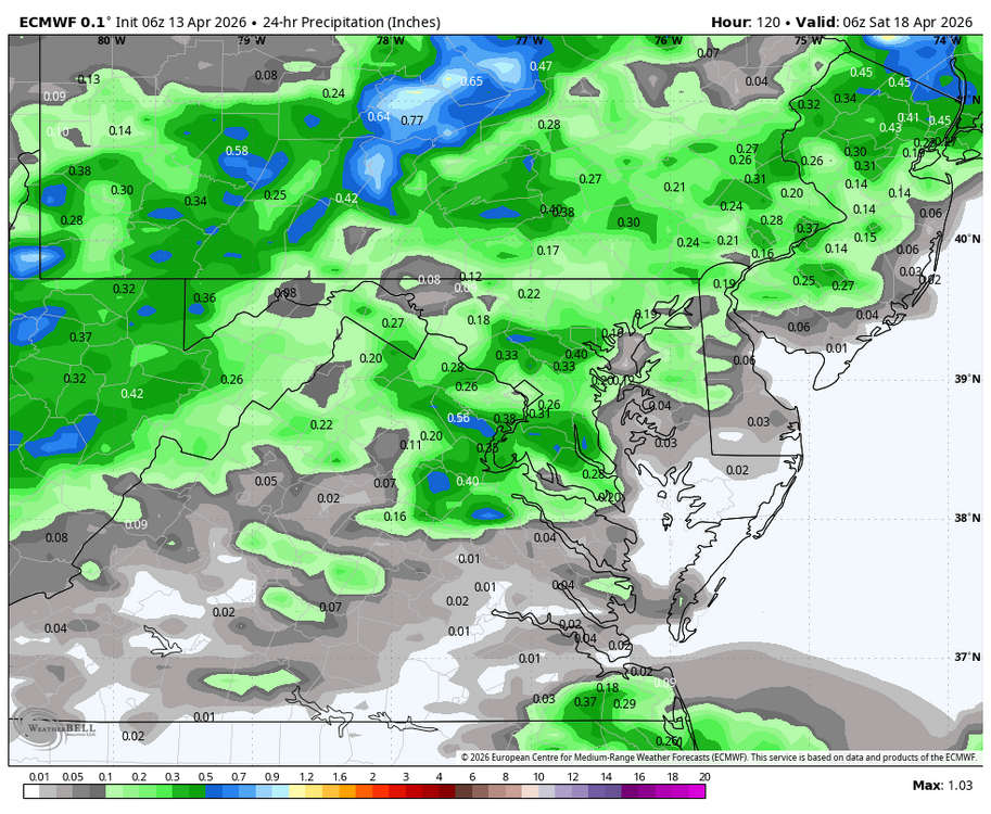
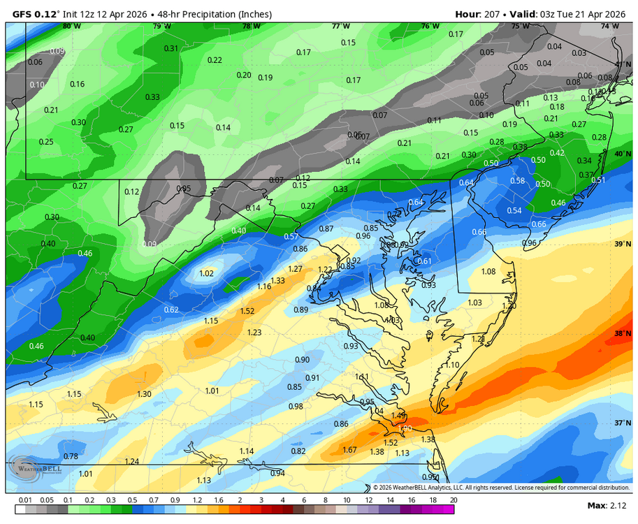
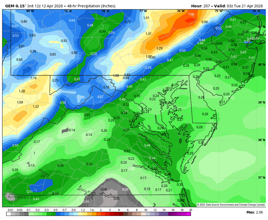
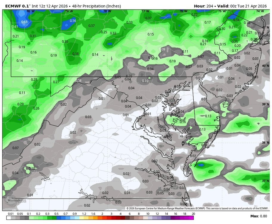
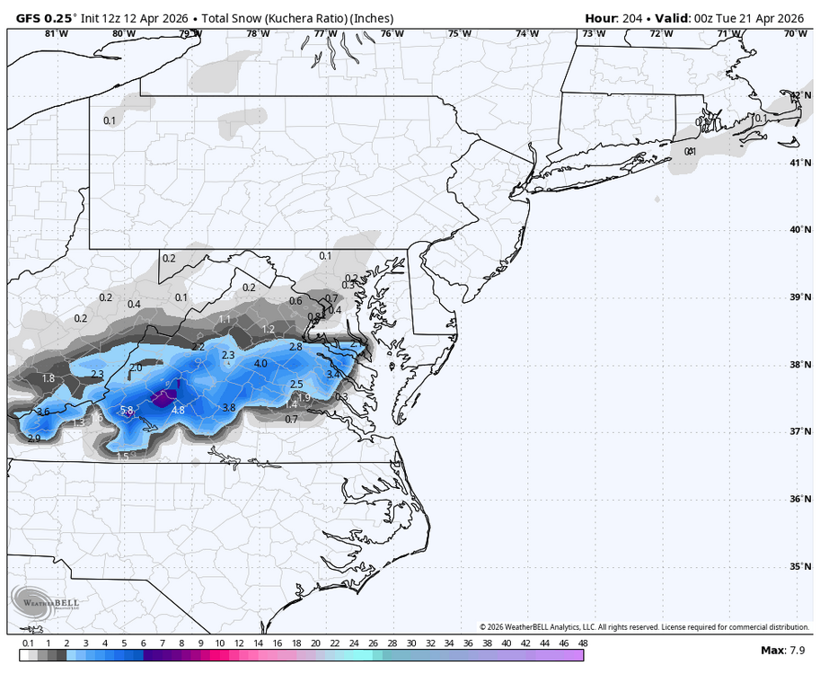
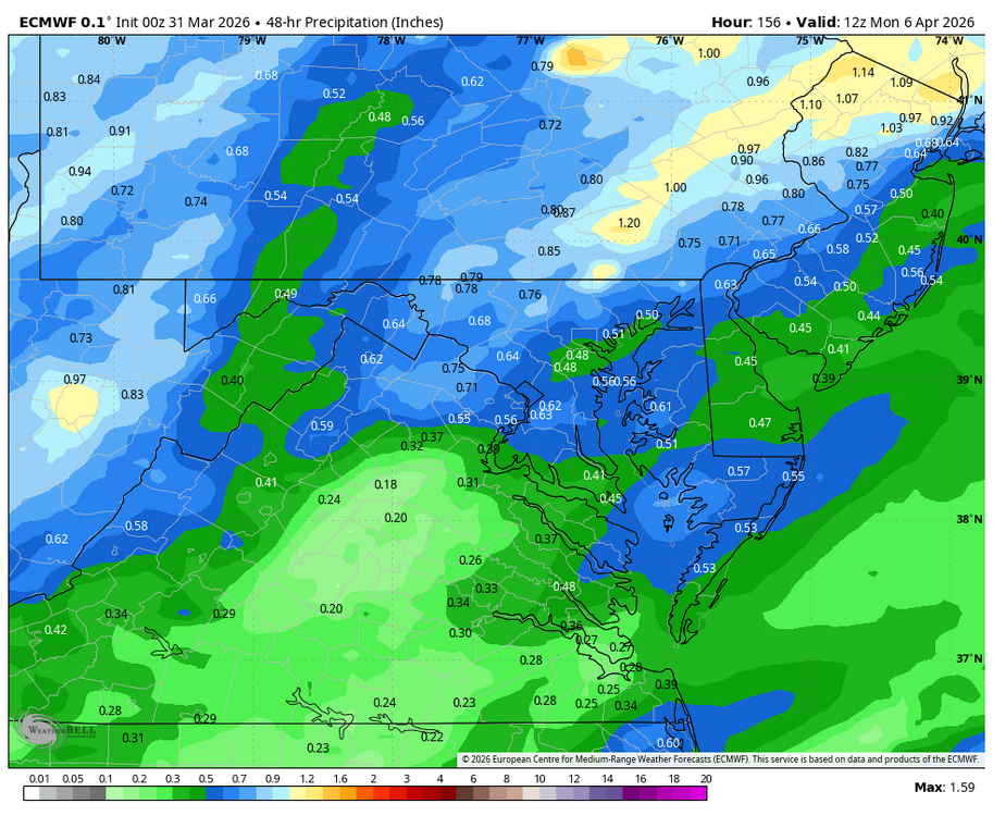
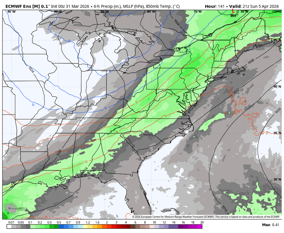
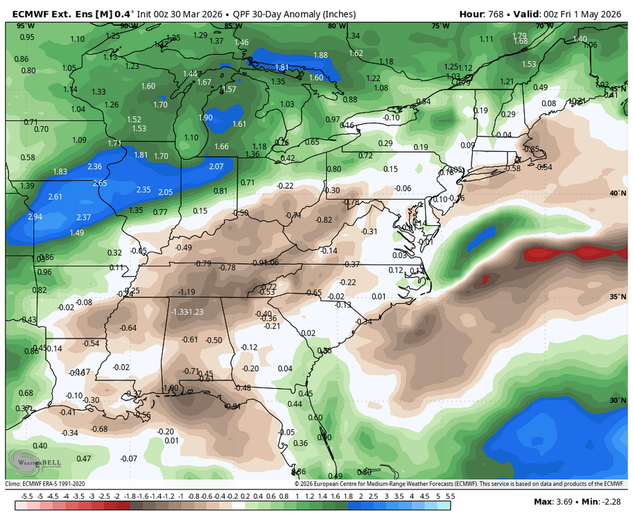
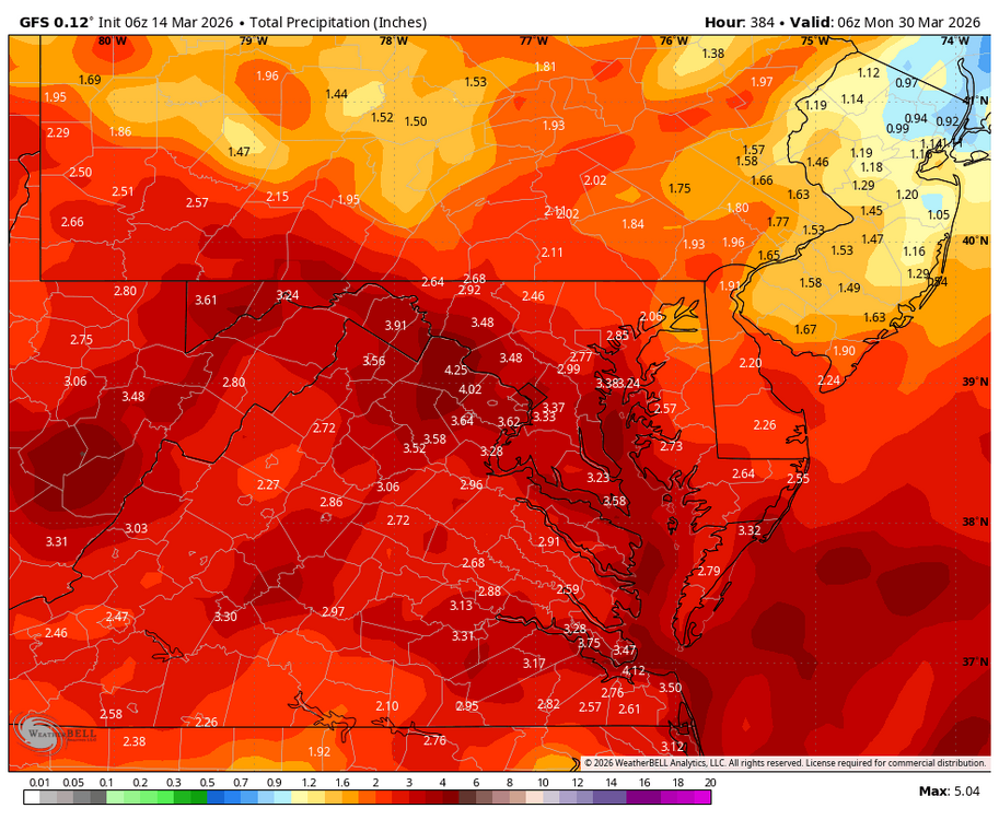
Actually next chance of any widespread rain may be a cold front moving through next Sunday/ Monday. WB 12Z globals:
-
- 63 replies
-
- 13
-

-

-

-
-
Kudos to NWS for the freeze watch!
-
I saw that; think that is not very customer service friendly. The criteria for a frost/freeze watch/ warning should not be some historic average but rather any time in the spring and fall season that a cold night hits that could catch a normal person who is not a weather nerd like us by surprise. I'm sure some people have planted tender vegetation/ flowers already so a headline heads-up makes a lot of sense.
-
-
Someone who feels lucky should go ahead and open and pin a 2026-2027 winter prognostication thread to separate these posts from the medium range...makes it easier to find the winter stuff if that is all you care about.
-
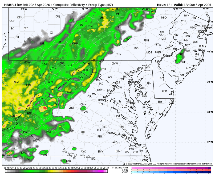
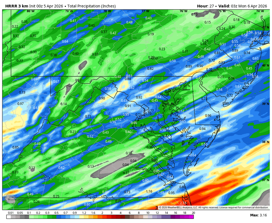
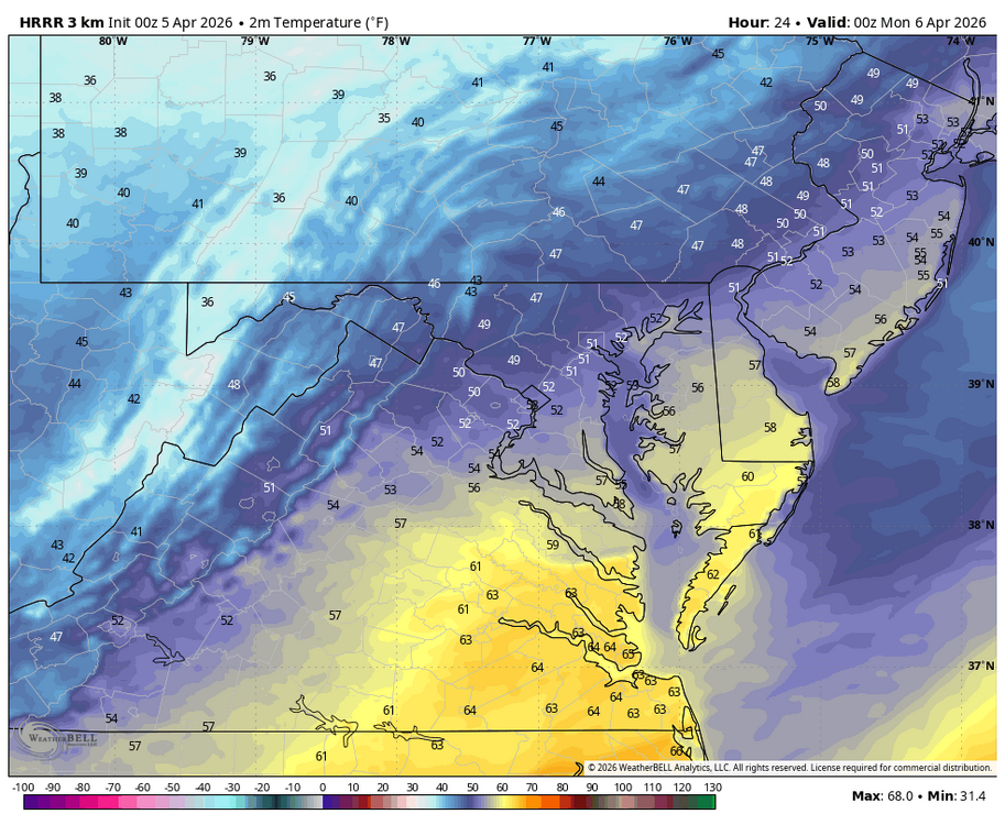
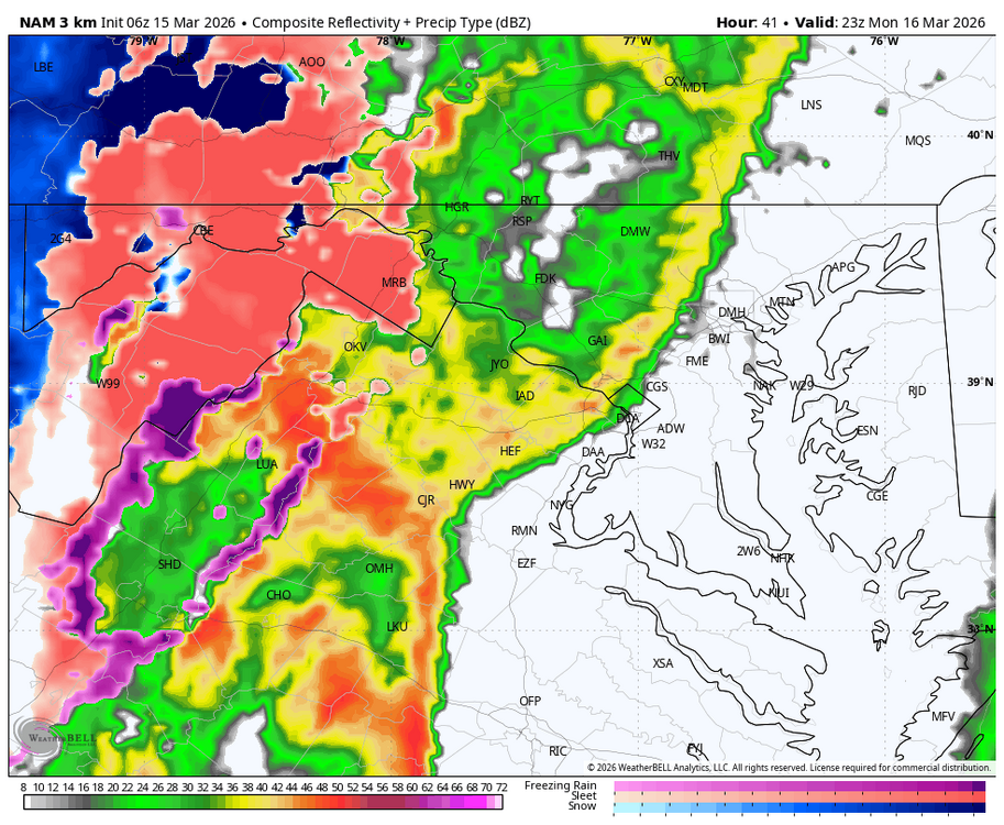
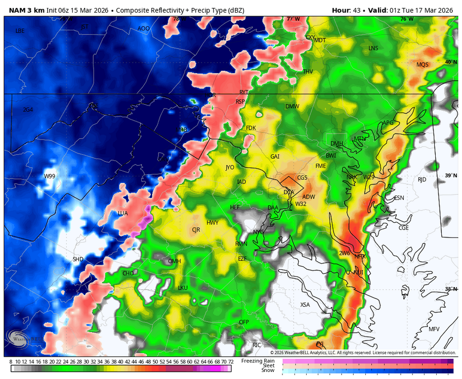
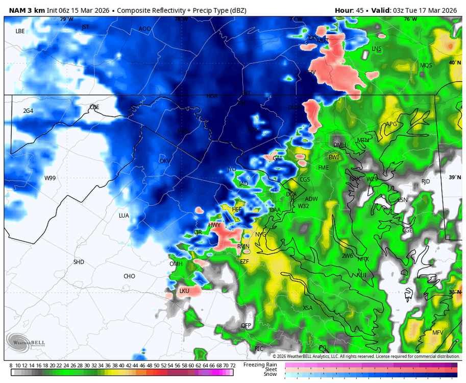
WB 0Z HRRR. Rain moves in by 8 am Sunday east of mountains. Clears west to east starting in the early afternoon. Bad timing but the rain is needed. Potomac already looks low up my way....temps falling back into the lower 50s by sunset.
-
-
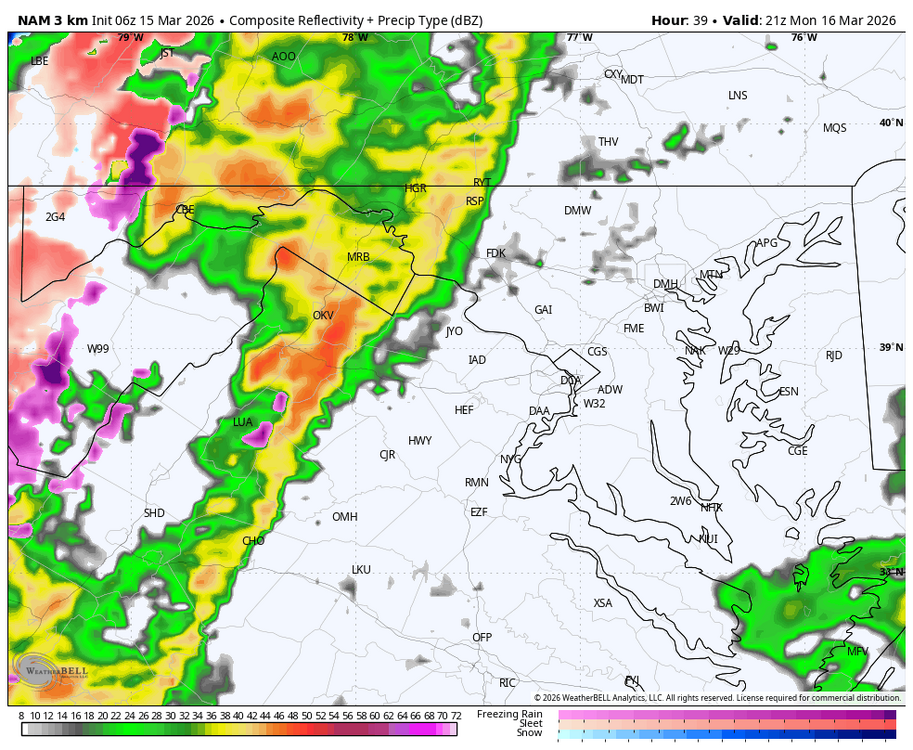
Where is NWS warning? Severe going through Brunswick.....powerful winds and hail.
-
-
-
It's time to grade Winter 2025-26(now that it's actually over)
Weather Will replied to CAPE's topic in Mid Atlantic
Temps: A: reminded me of a 1970s winter. Sustained cold kept the snow we had on the ground for a record breaking amount of time. Snow: B+: only about 16 inches total but since it stayed on the ground a long time I bumped it up. Overall grade: A-. -
Winter cold and grey We wasted another shot of cold air....maybe one more shot next week before a warmup in early April.
-
South Mountain off 340 is white too. Now let's see if we can pull off one more snow event next week...
- 1,093 replies
-
- severe
- thunderstorms
-
(and 1 more)
Tagged with:
-
Deepest sympathies to his family.
-
- 1,093 replies
-
- 3
-

-
- severe
- thunderstorms
-
(and 1 more)
Tagged with:
-
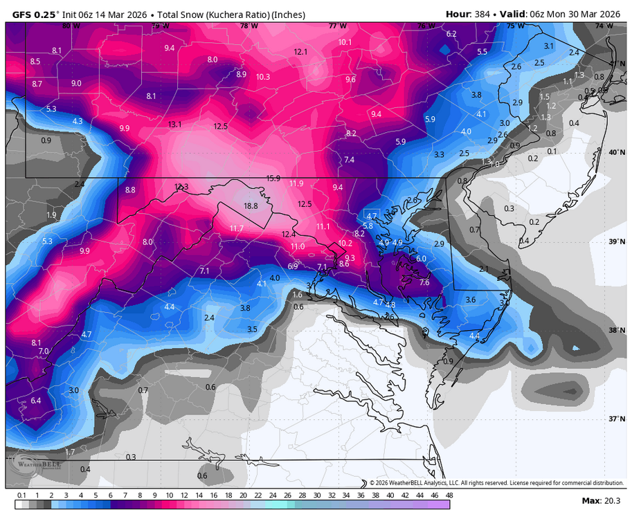
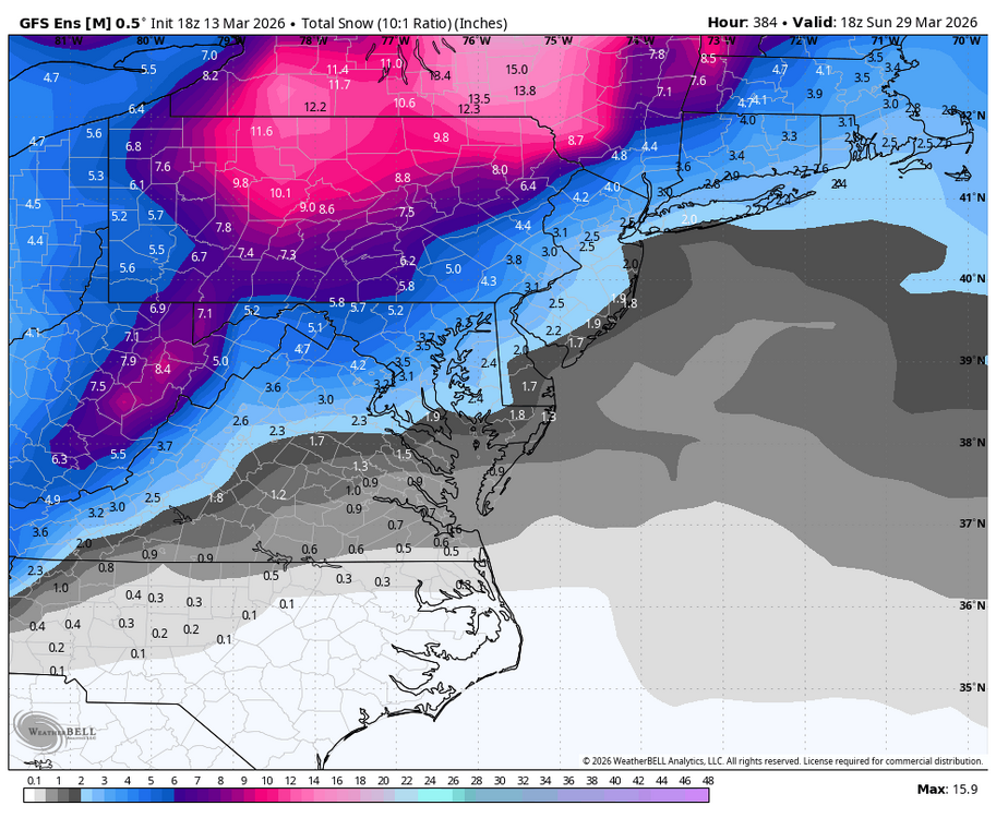
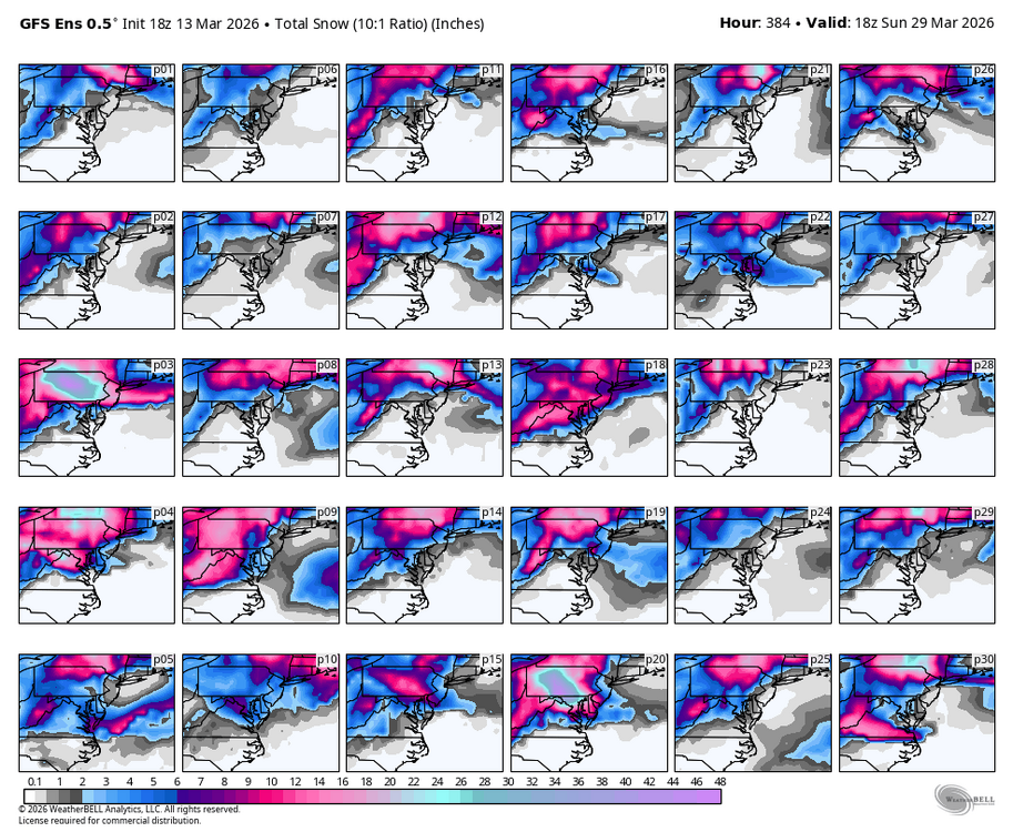
We should start another dead end thread.... in all seriousness, I would be excited for this period if it were not the end of March: teleconnections are decent with - WPO, + PNA, AO neutral, and - NAO; MJO progression 8-1-2; cold air to tap with anomalies 20 degrees plus below normal. It could all fall apart tomorrow but will be watching....
-

