Weather Will
-
Posts
5,811 -
Joined
-
Last visited
Content Type
Profiles
Blogs
Forums
American Weather
Media Demo
Store
Gallery
Everything posted by Weather Will
-
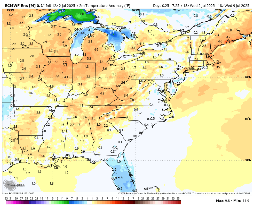
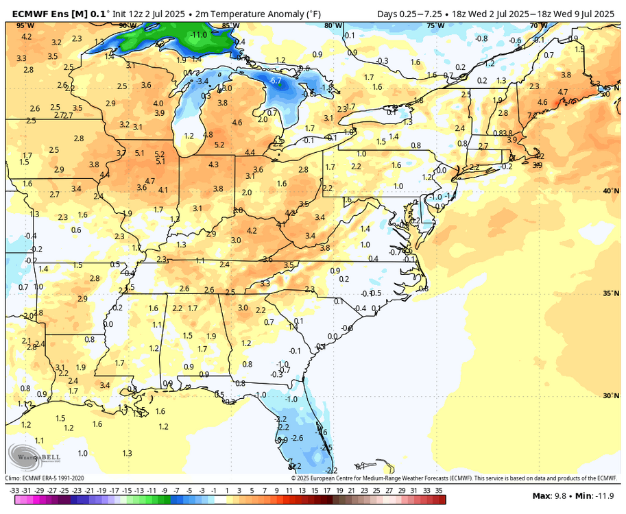
WB 12Z EPS. Dry and seasonably warm the next week. Perfect July 4th weekend!

-
I don't have a great rain gauge so I may be under. Up to 2.20 now. Anyone have suggestions on a model?
-
Steady rain continues. 76 degrees and 2.13 inches at this point. Yard is a soggy, green mess. Much different from last couple of summers. Wonder if we are setting ourselves up for an historic tropical flood event at some point this season.
-
1.75 in less than an hour. (Rain is now light.)
-
Over an inch and still heavy rain.
-
Nice rain shower. .27 so far and coming down!
-
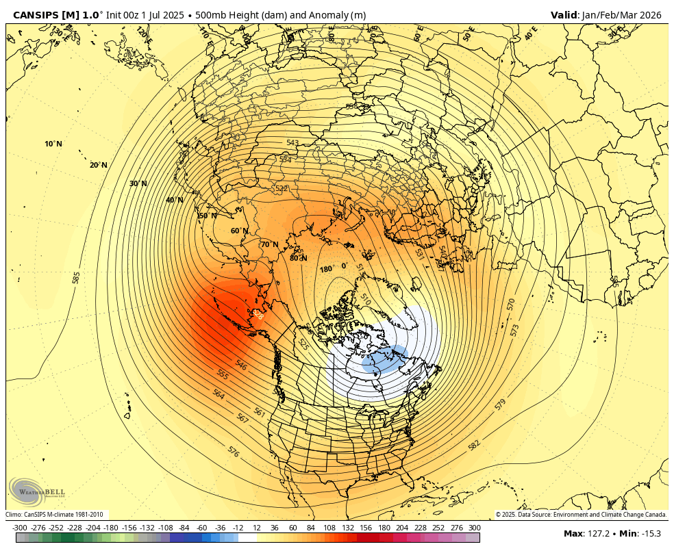
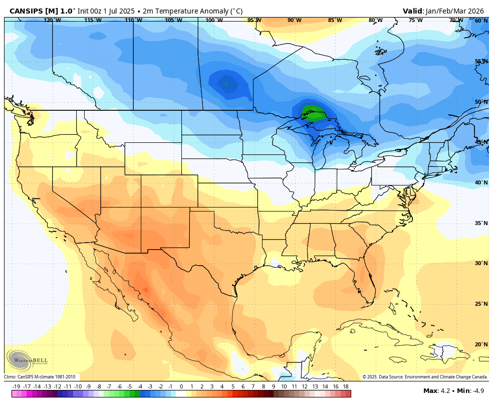
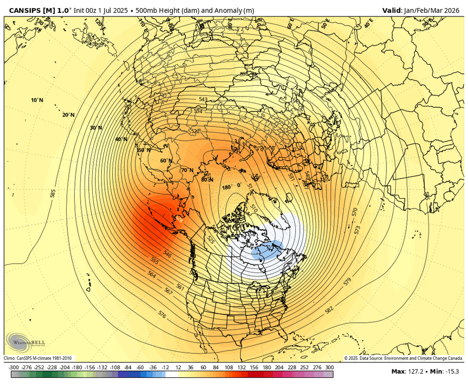
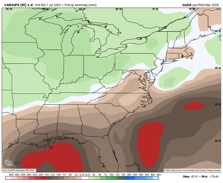
WB 7/1 Can. seasonal Jan. -March. If there is cold air around to the north maybe we will have more luck this upcoming winter...

-
Got three sprinkles on my car. Overcast here now.
-
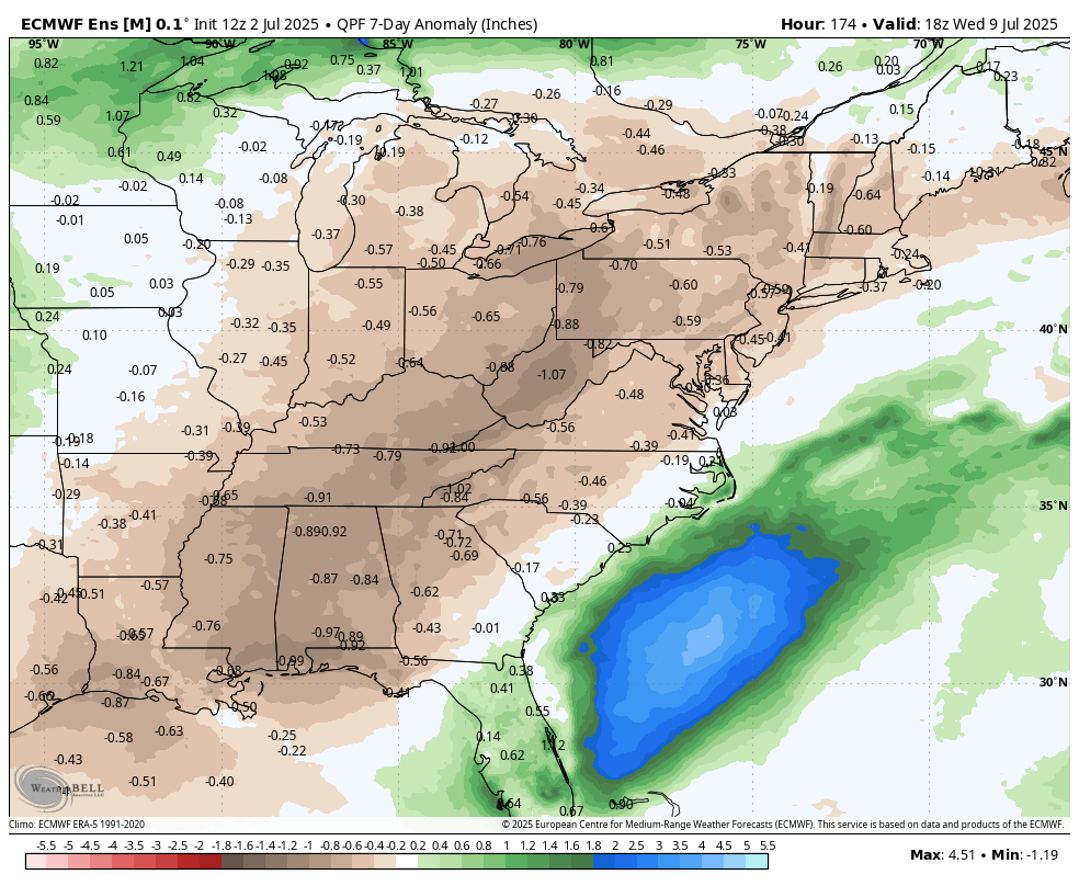
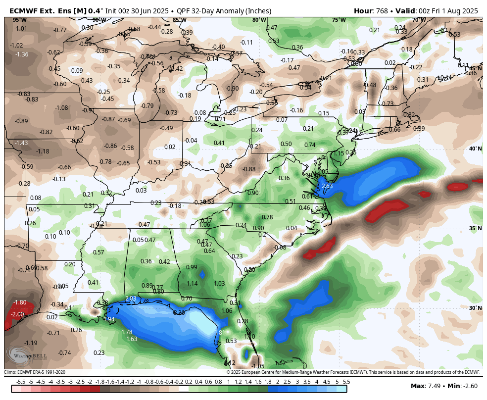
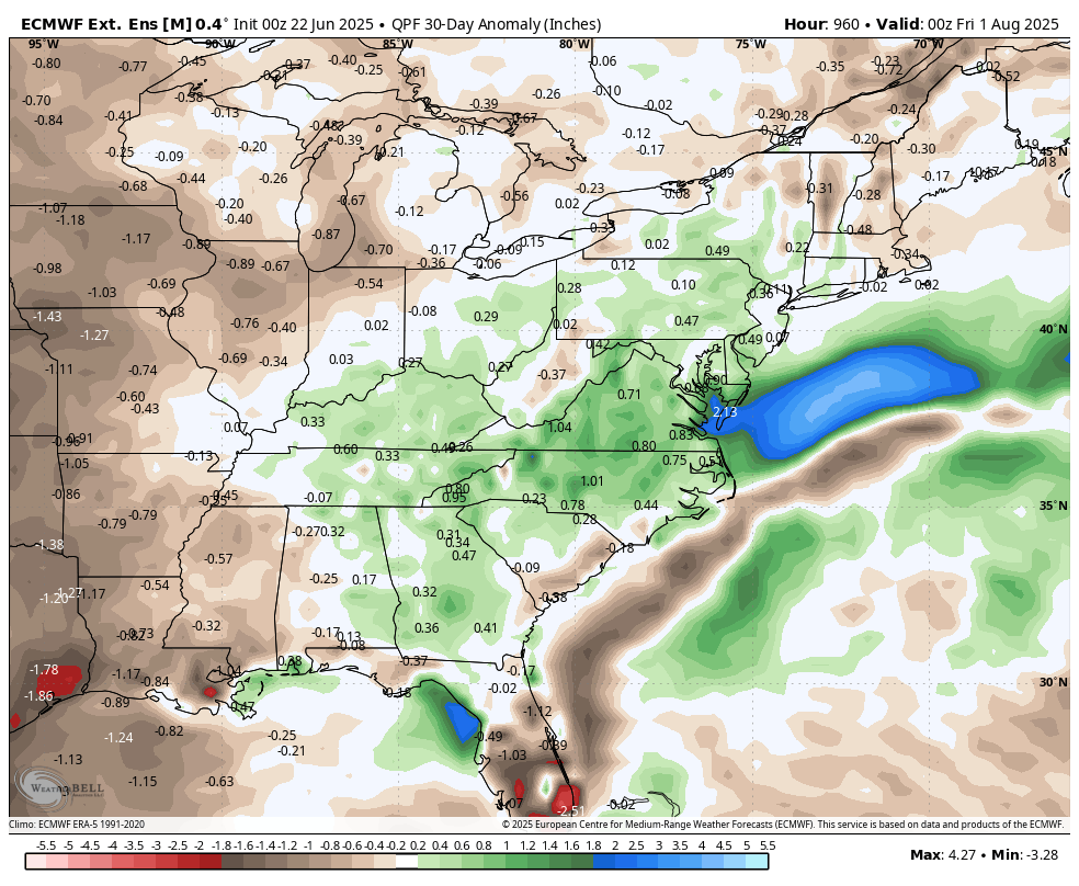
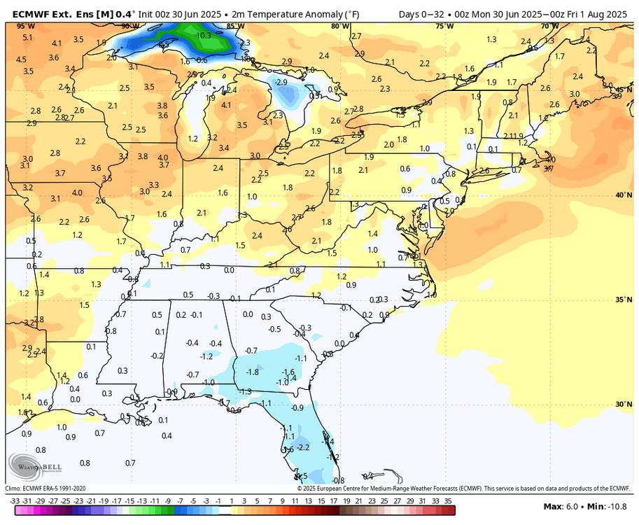
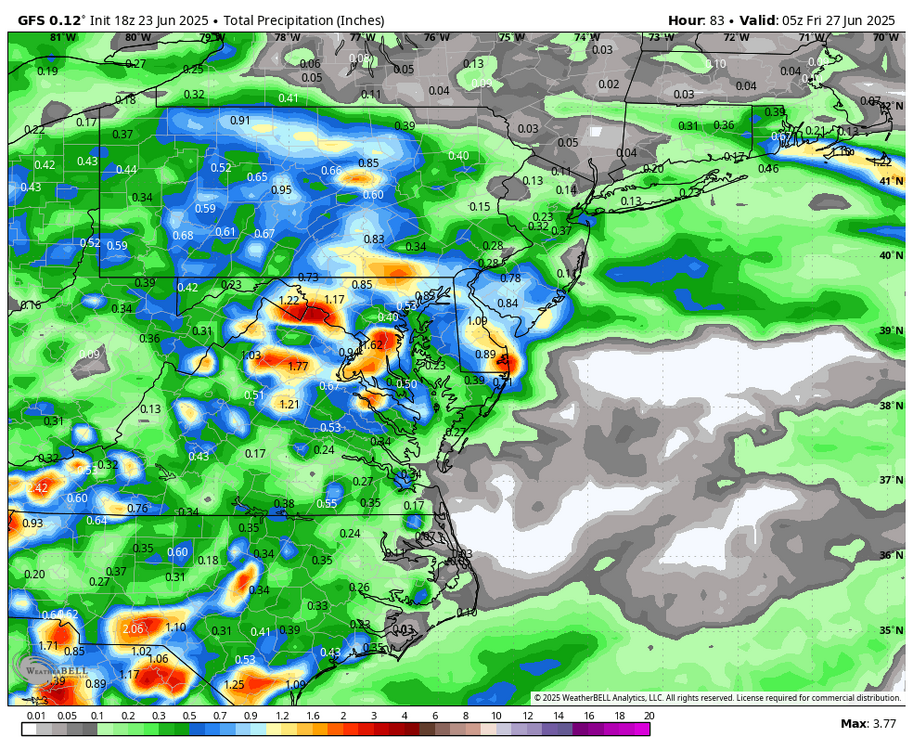
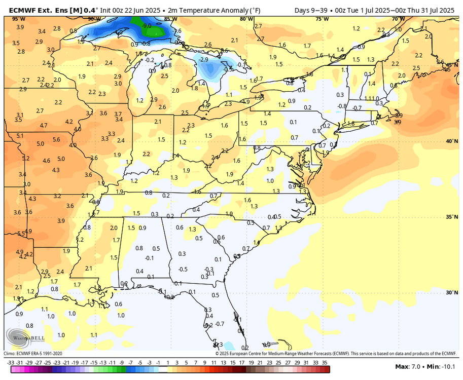
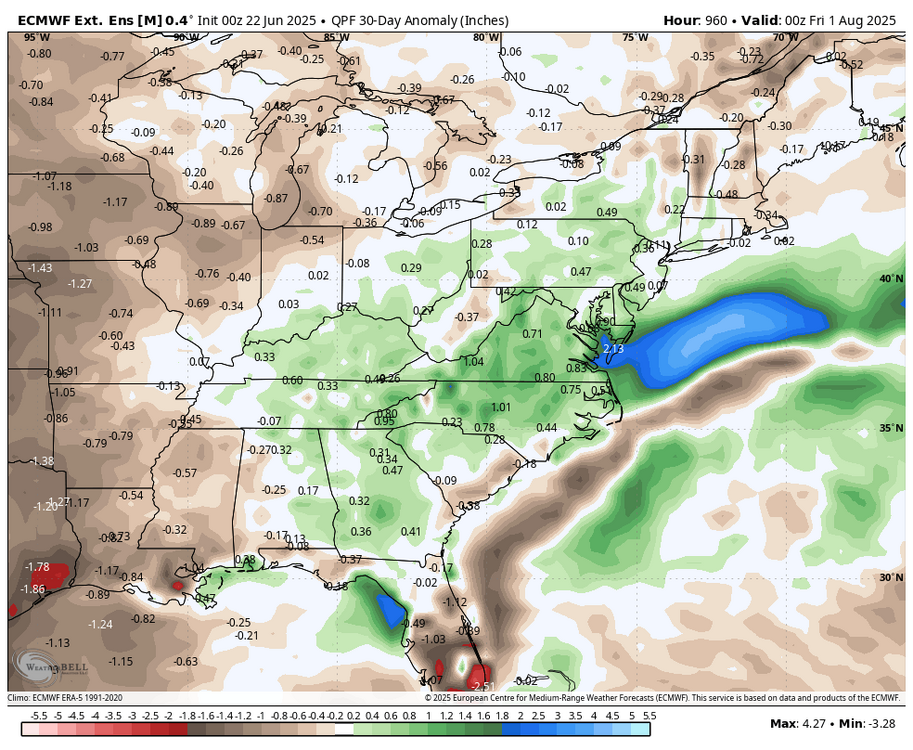
Time is flying.... Latest WB weeklies for July....warm and wet, especially along the coast.

-
District of Columbia-Frederick MD-Carroll-Northern Baltimore- Southern Baltimore-Prince Georges-Anne Arundel-Northwest Montgomery-Central and Southeast Montgomery-Northwest Howard- Central and Southeast Howard-Fairfax-Arlington/Falls Church/Alexandria-Eastern Loudoun- 307 PM EDT Mon Jun 30 2025 ...FLOOD WATCH IN EFFECT UNTIL 11 PM EDT THIS EVENING... * WHAT...Flooding caused by excessive rainfall is possible. * WHERE...Portions of DC, including the following , District of Columbia, Maryland, including the following areas, Anne Arundel, Carroll, Central and Southeast Howard, Central and Southeast Montgomery, Frederick MD, Northern Baltimore, Northwest Howard, Northwest Montgomery, Prince Georges and Southern Baltimore, and northern Virginia, including the following areas, Arlington/Falls Church/Alexandria, Eastern Loudoun and Fairfax. * WHEN...Until 11 PM EDT this evening. * IMPACTS...Excessive runoff may result in flooding of rivers, creeks, streams, and other low-lying and flood-prone locations. * ADDITIONAL DETAILS... - Thunderstorms are expected to develop in the next couple of hours across parts of the Baltimore and Washington metro areas. Storms are expected to be slow movers and be capable of producing intense rainfall rates of 1 to 2 inches per hour, which may result in flash flooding of small streams, creeks, urban and poor drainage areas.
-
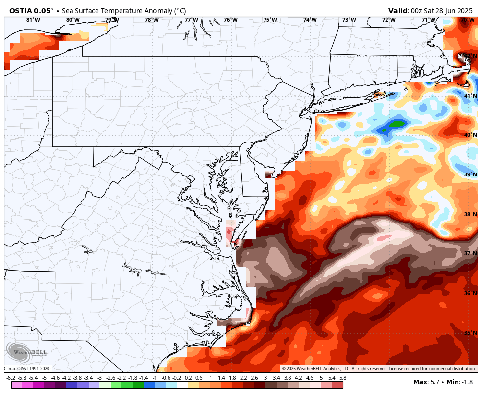
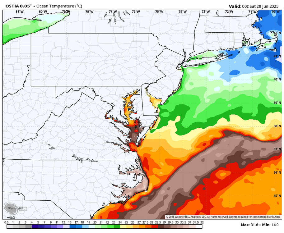
Warm ocean temps (WB), time to head to the beach...

-
Light drizzle breaking out.....update needed to forecast....edit they did!
-
Only .18 for the week here, need to take advantage of a cloudy, calm day and water.
-
Great day to water....sprinkler warning in effect!
-
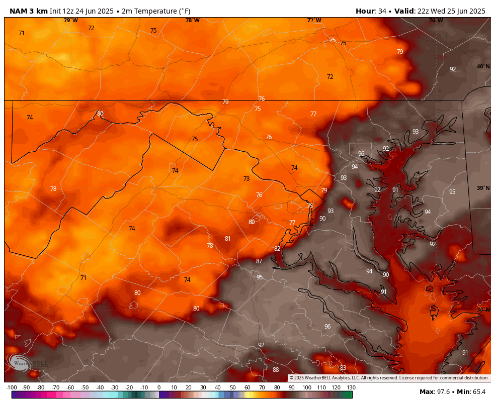
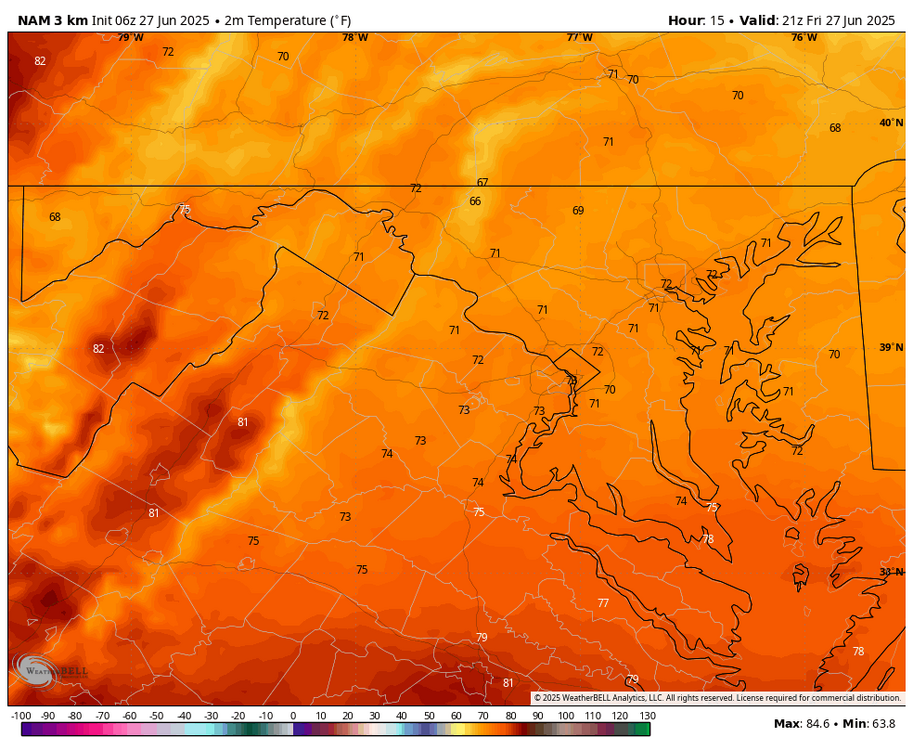
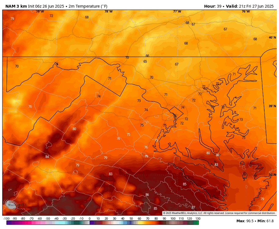
WB 3K NAM aced the temps for today. Hopefully they can incorporate its temp forecast parameters into the other models before they retire it in 2026.
-
WB 6Z 3K NAM. Will the back door front keep us in the 70s tomorrow afternoon?
-
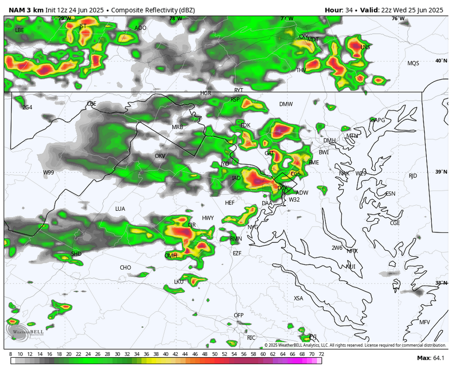
WB 12Z 3K NAM provides thunderstorm relief Wed. Afternoon....if correct today is the last shot at 100 this week.

-
WB 18Z GFS...hopefully some welcome thundershowers on Th.
-
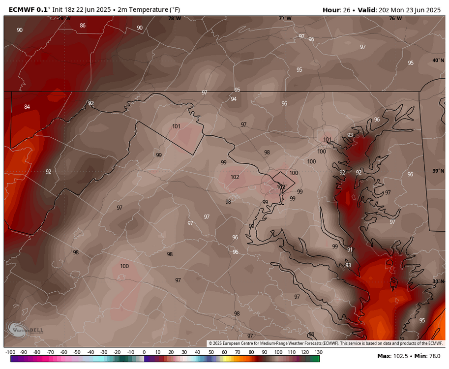
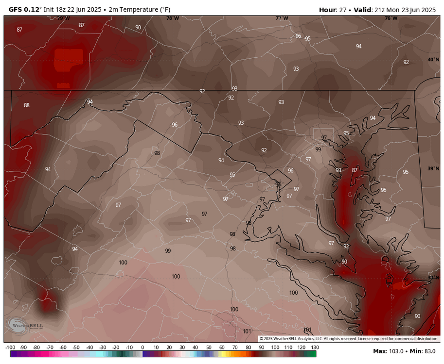
WB 18Z EURO 102 tomorrow; 18Z WB GFS 97 (I looked at 3-5pm).
-
WB latest weeklies for 30 day period (July).
-
.50 so far as rain is letting up now. Perfect on top of the lawn cut this am. Ready for the heat wave now....
-
Torrential rain now. Lighting and thunder are not bad at all.
-
Very windy storm moving in.
-
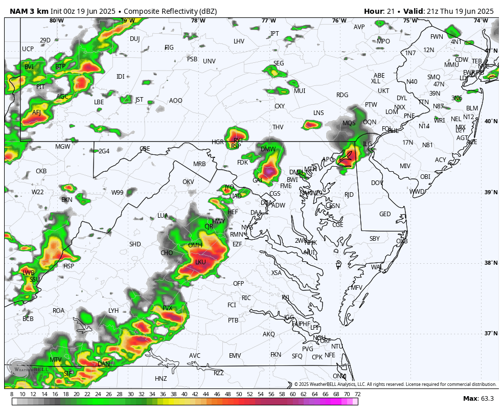
Severe Thunderstorm Watch up area wide. Severe weather breaking out in western counties. Stay safe!
-
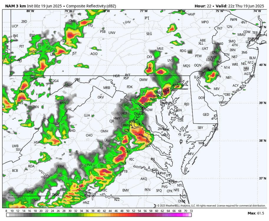
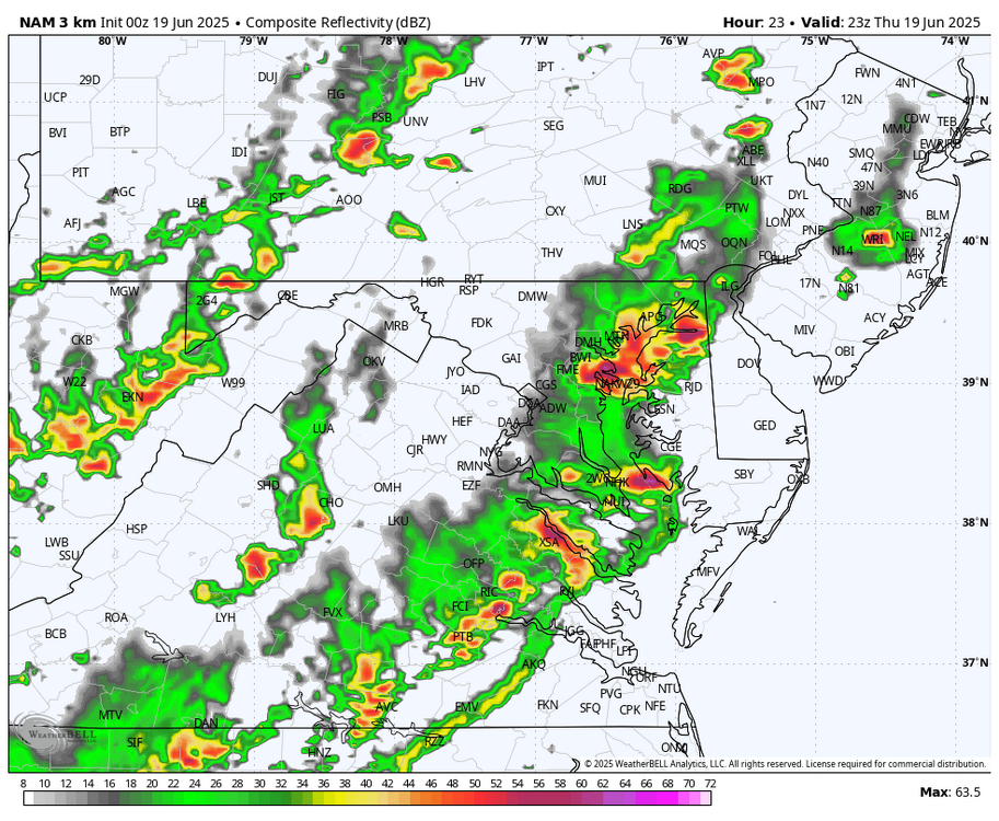
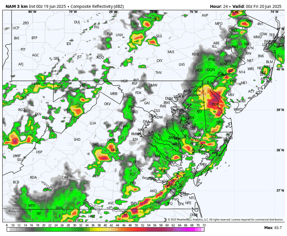
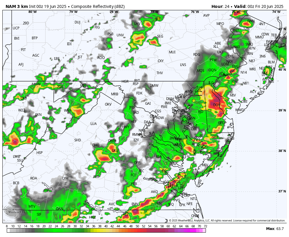
Front seems to be moving at a fast pace....could it go through earlier than forecasted? Does this mean the worst effects may be further east? WB OZ 3K NAM only has a broken line at best west of DC tomorrow evening (5-8pm)