Weather Will
-
Posts
7,604 -
Joined
-
Last visited
Content Type
Profiles
Blogs
Forums
American Weather
Media Demo
Store
Gallery
Everything posted by Weather Will
-
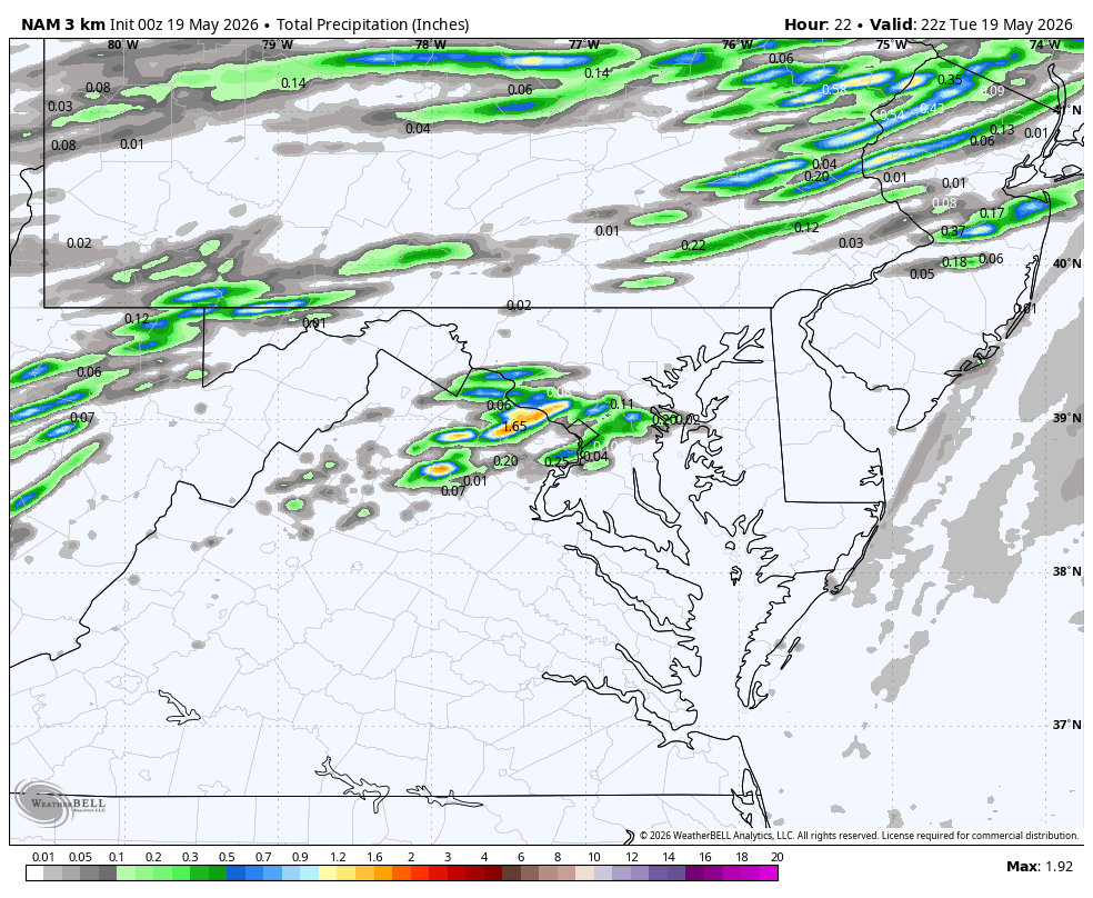
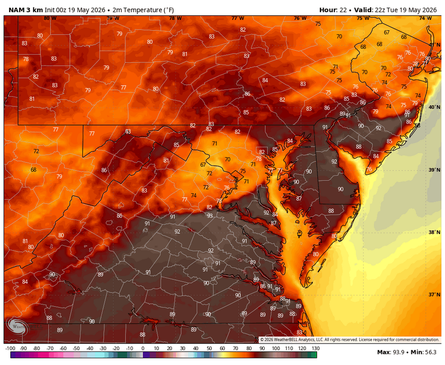
WB 0Z 3K NAM has scattered thunderstorms late Tues. afternoon which knocks down the record heat.
-
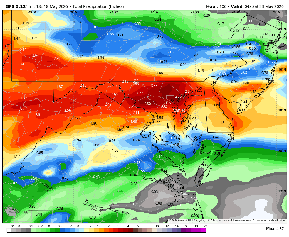
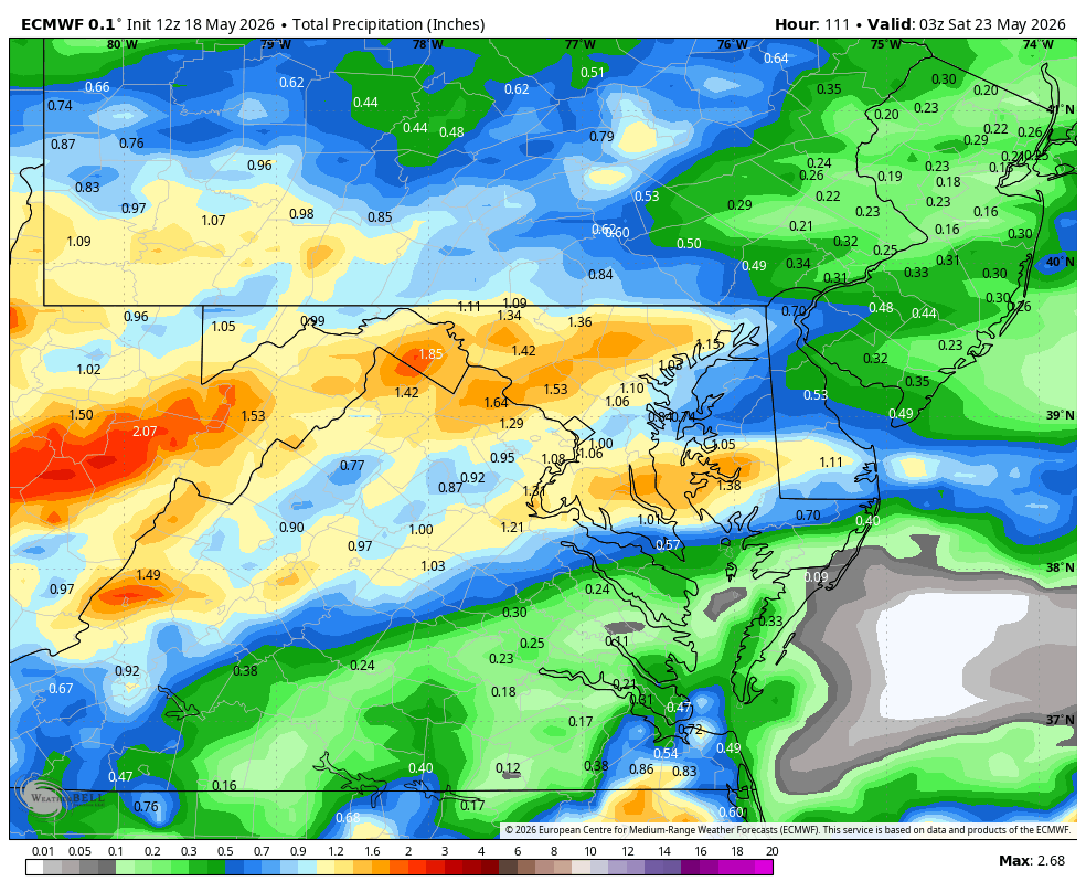
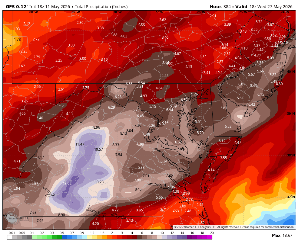
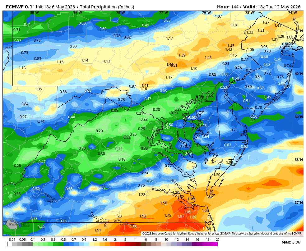
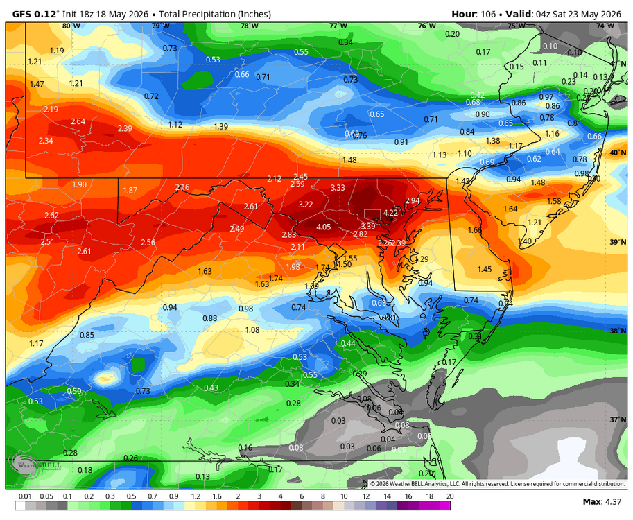
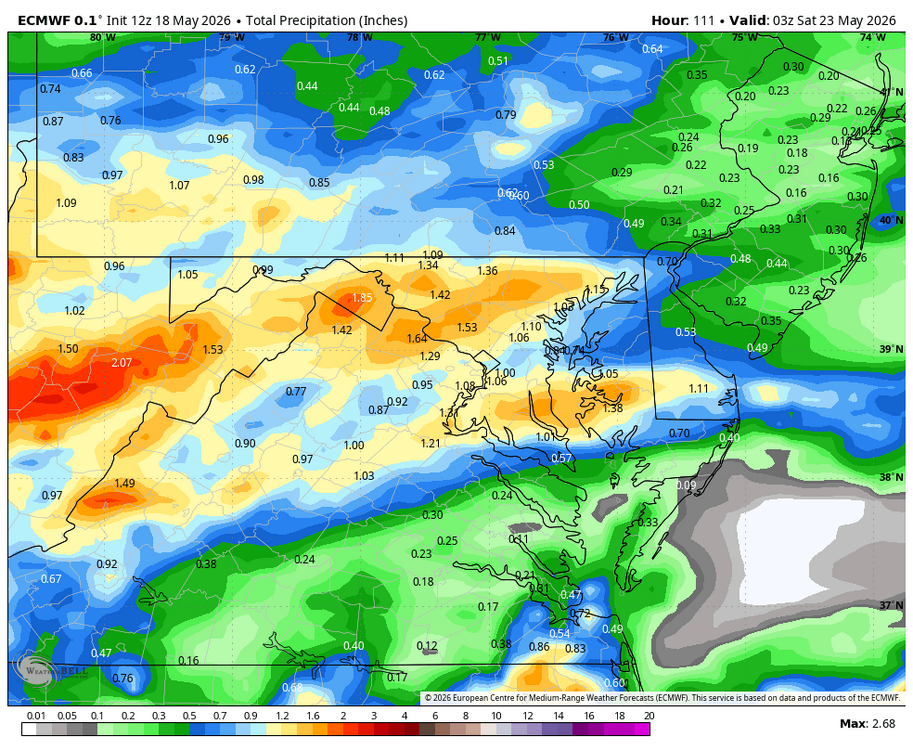
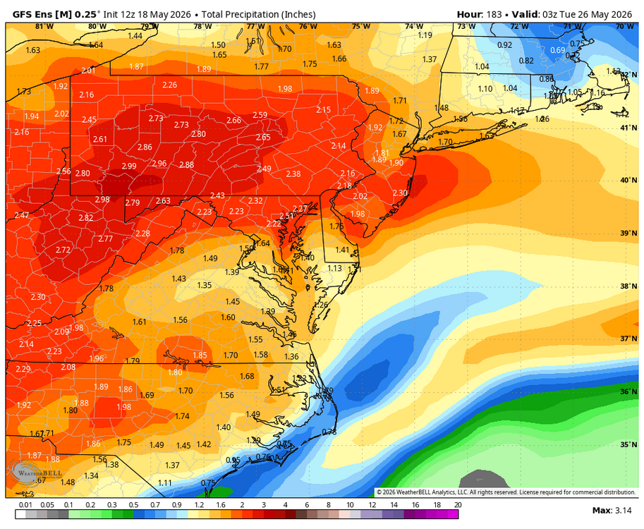
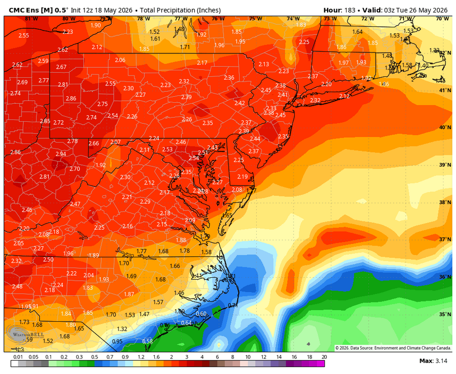
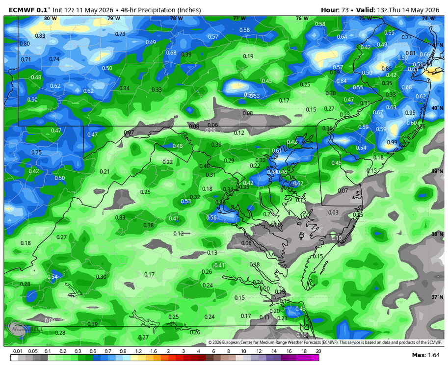
WB 18Z GFS precip. totals through Friday. If only... WB 18Z EURO for same period is wetter like GFS.
-
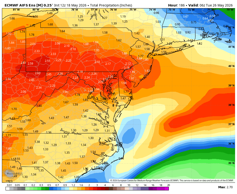
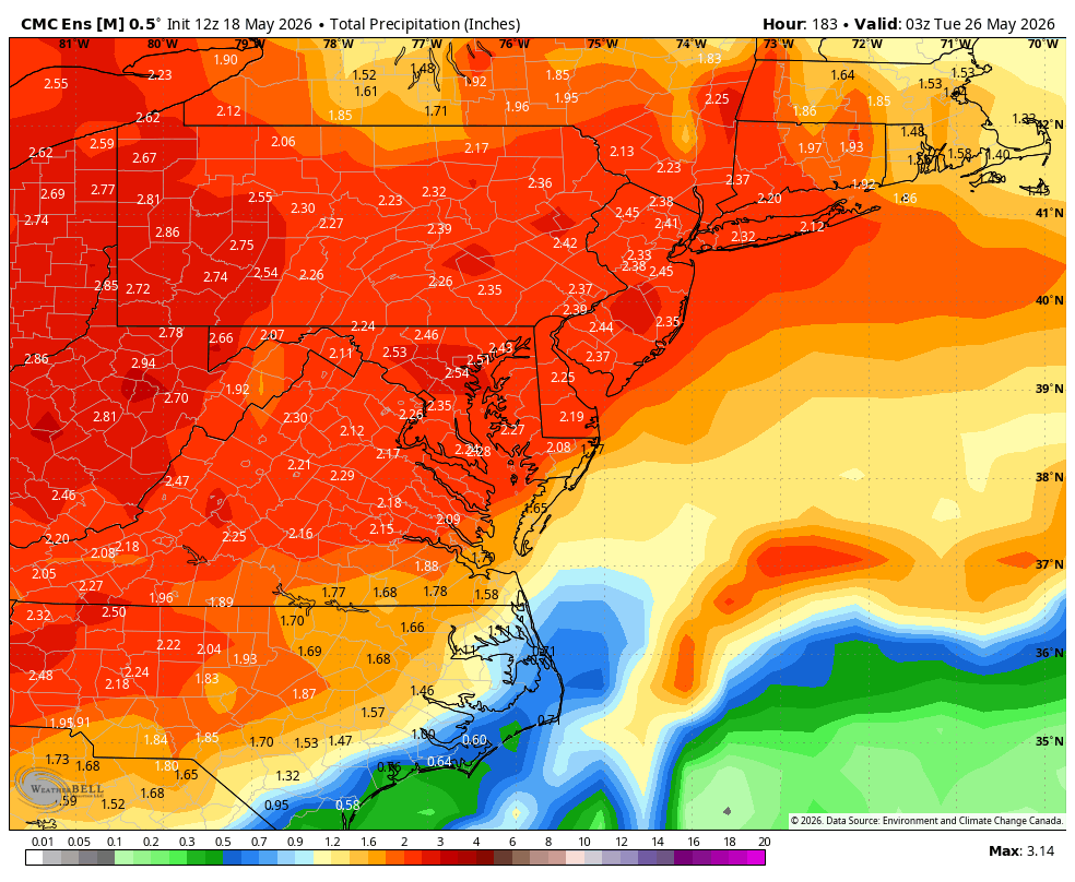
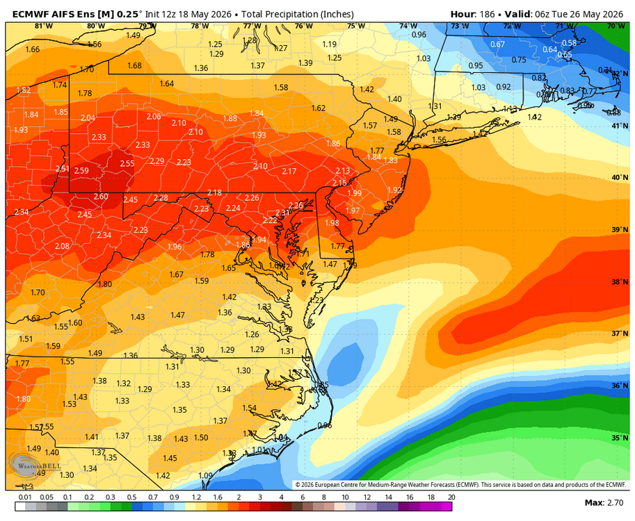
WB 12Z ensemble precipitation means through Monday.


-
Nice little shower event!!!!
-
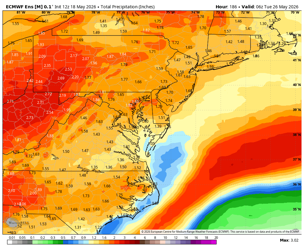
WB 12Z EPS 4 day precipitation mean thru Memorial Day.

-
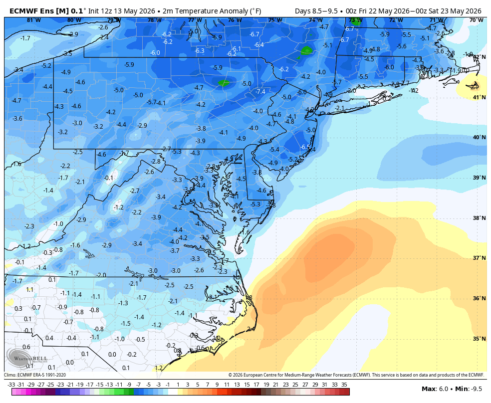
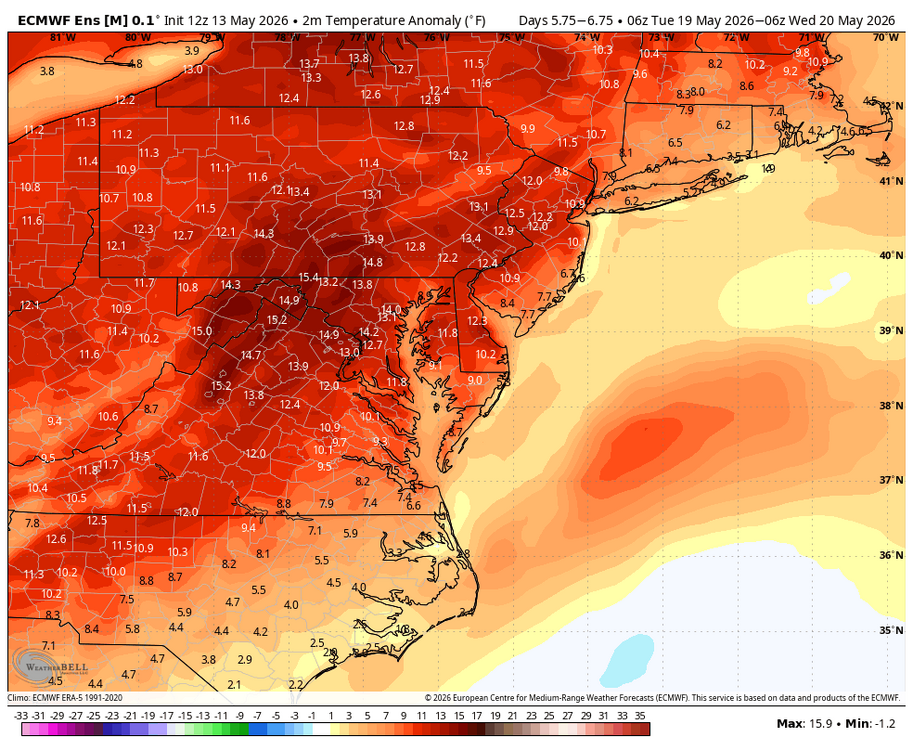
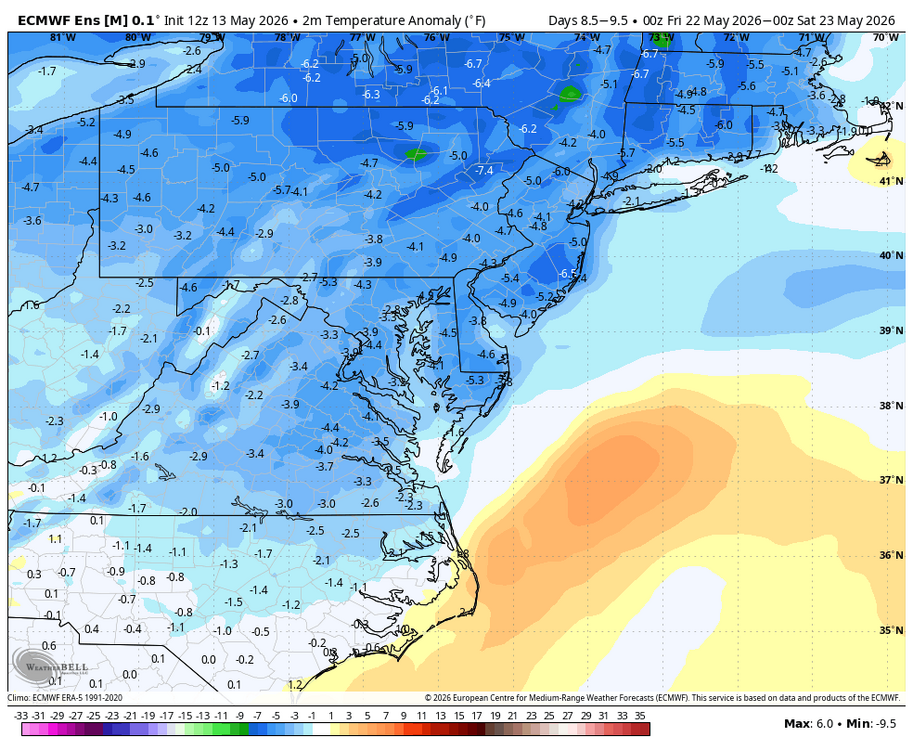
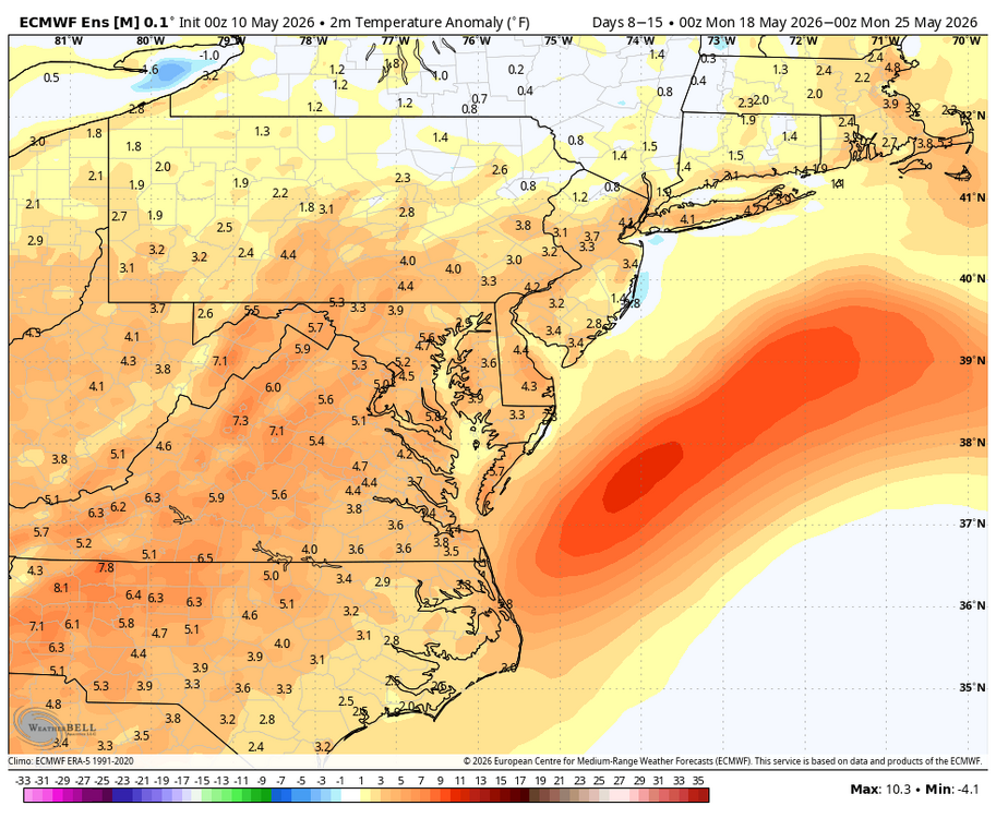
Hot early next week, but it cools down by the end of next week. Hopefully some more rain with the late week cool down. WB 12Z EPS.
-
About .25 with a little rain still falling. Will take every drop...
-
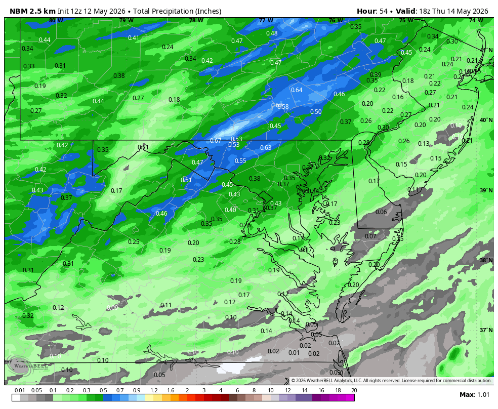
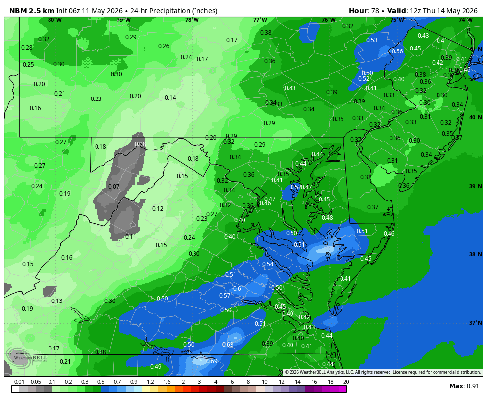
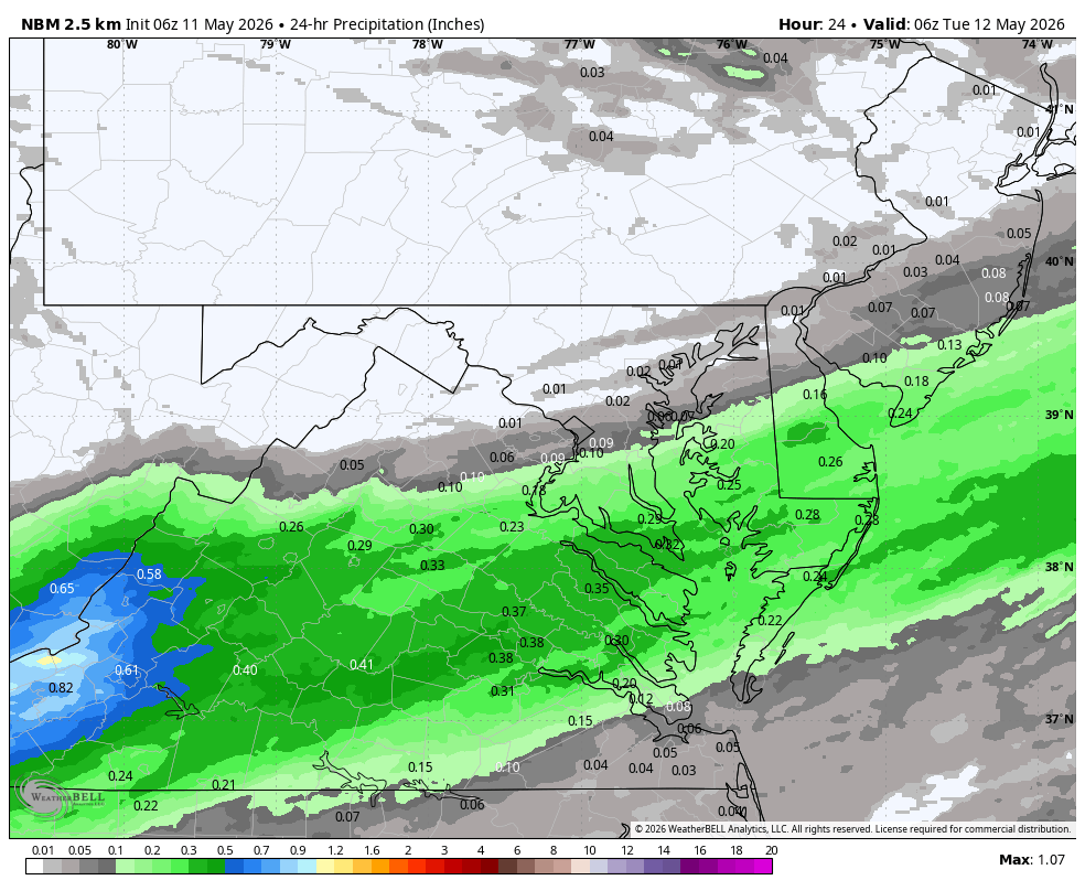
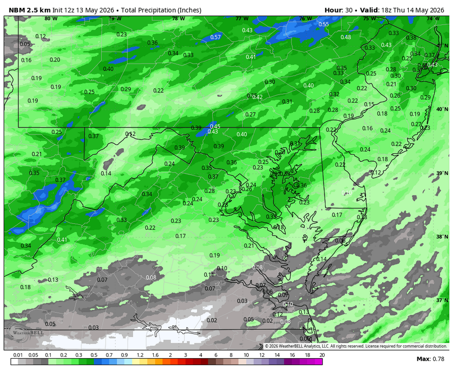
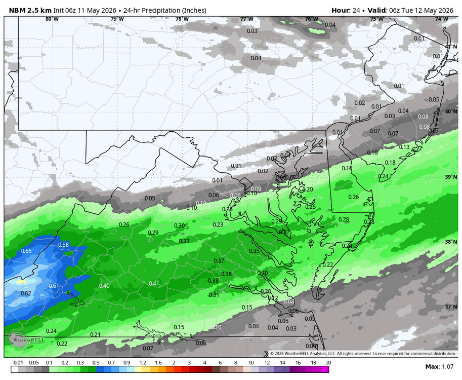
WB 12Z NBM for upcoming "rain" event....
-
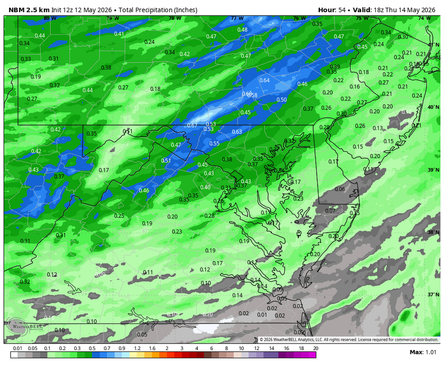
Take a Walk Warning in Effect.....get outside on this beautiful day. Hard to believe the rain forecast for tomorrow but hope it verifies for the NW burbs... WB 12Z NBM for midweek.
-
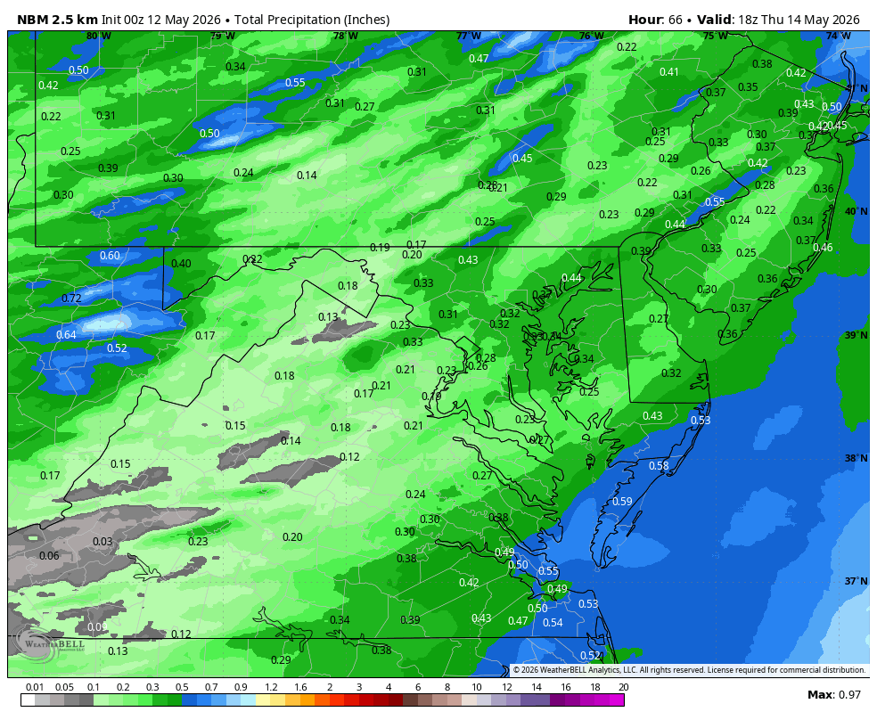
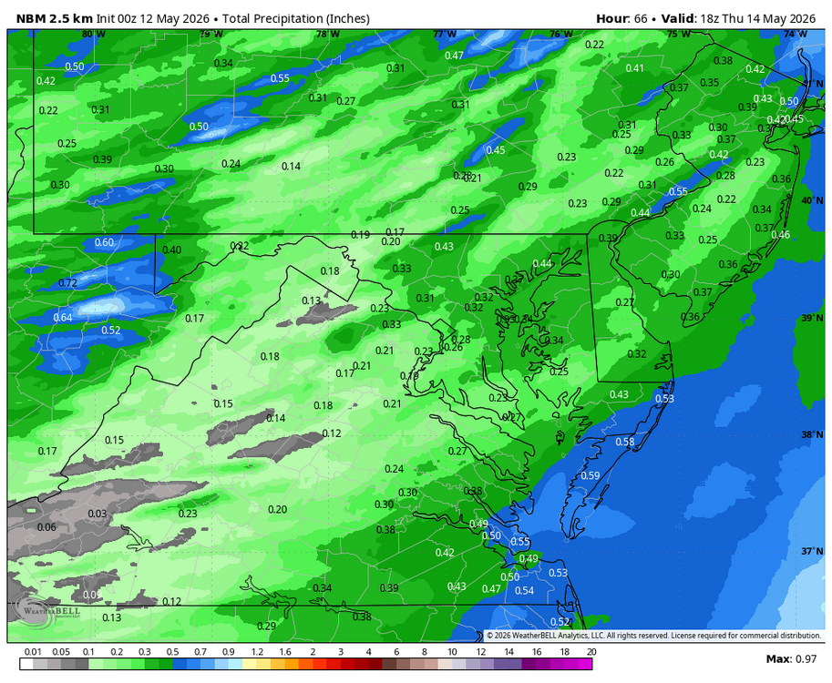
WB 0Z NBM for midweek.
-
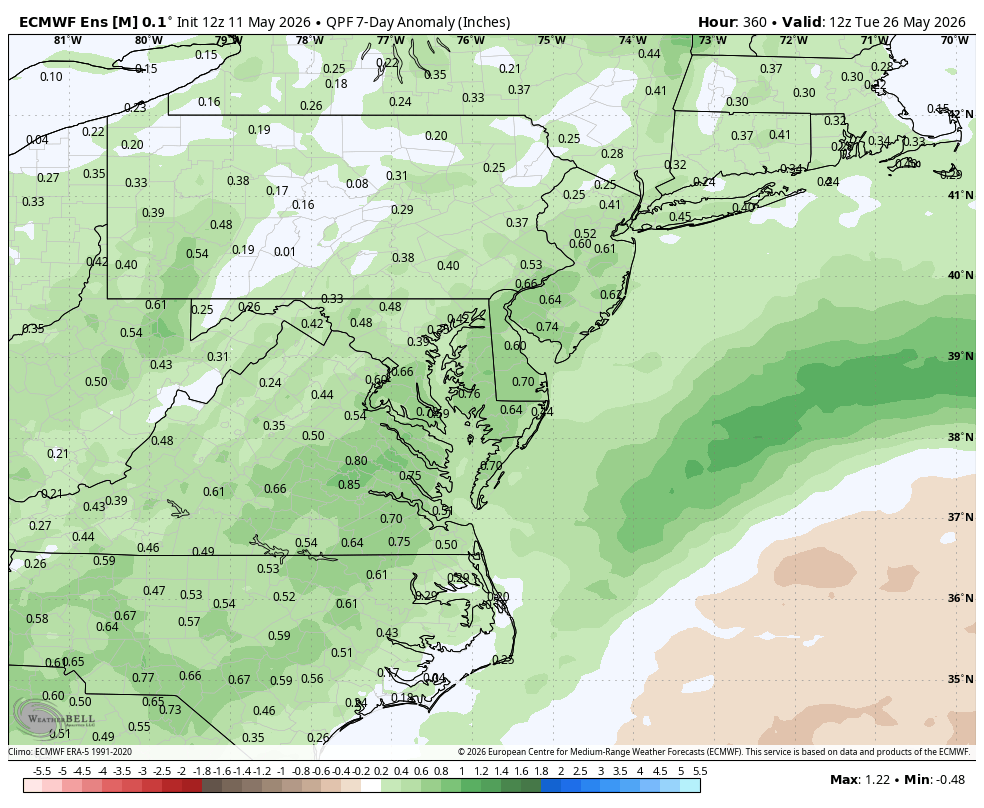
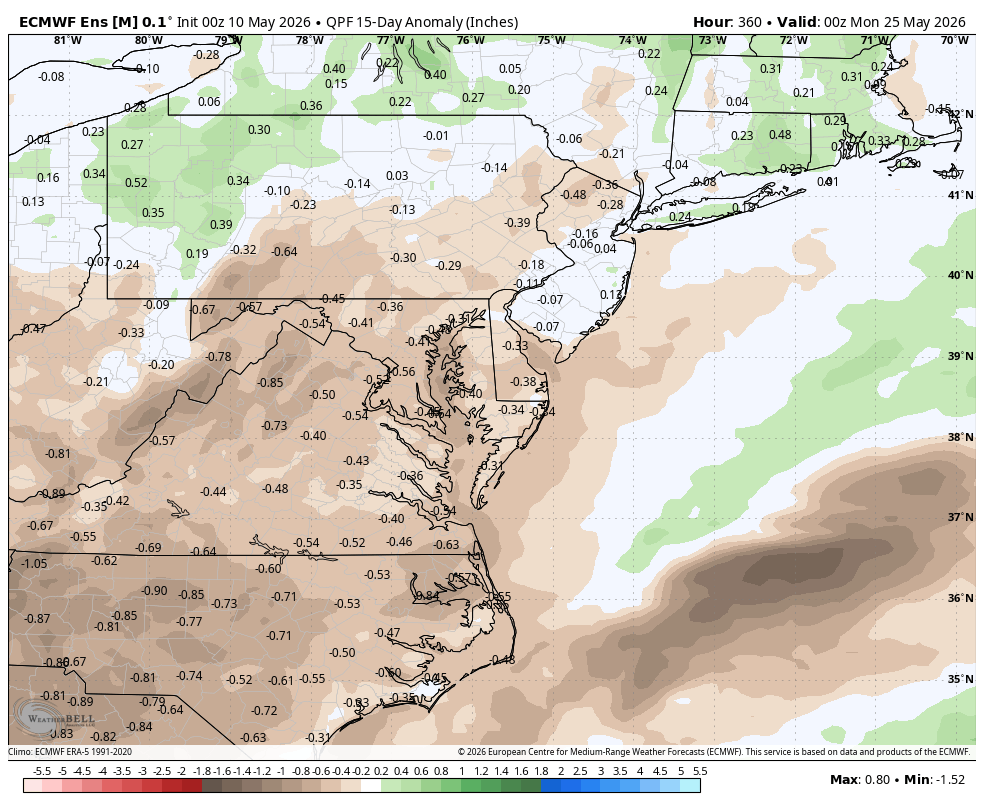
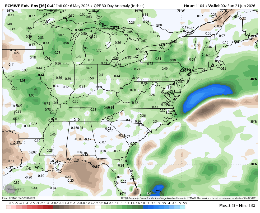
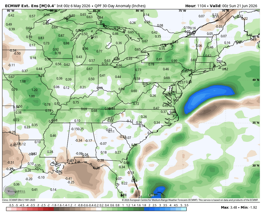
WB 12Z EPS supports a wetter forecast for May 20-26th period.

-
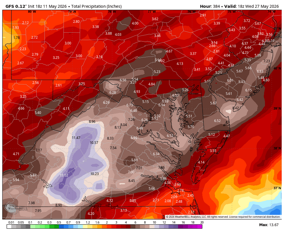
WB 18Z GFS went berserk with rain....maybe early but hopefully a sign of things to come with the El Niño.
-
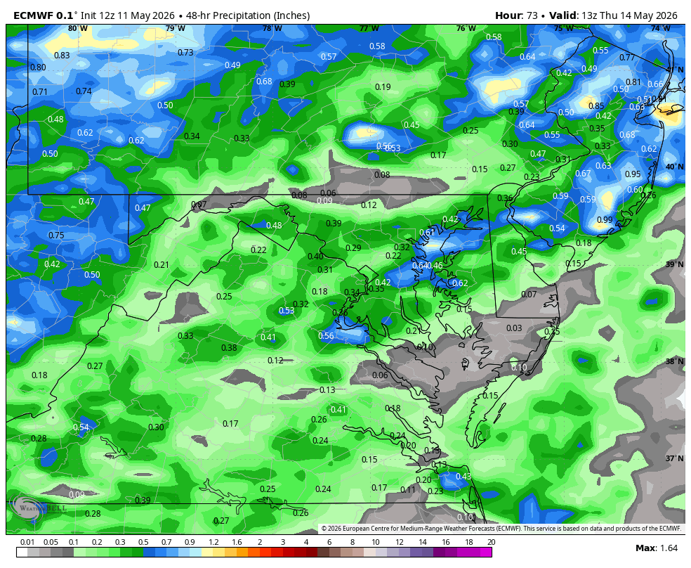
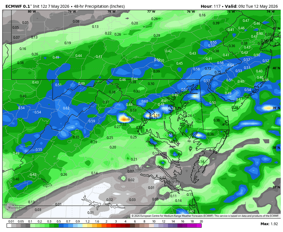
WB 12Z EURO for midweek rain.
-
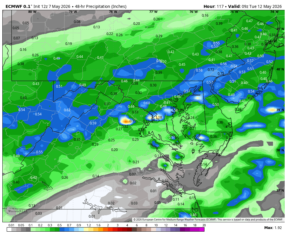
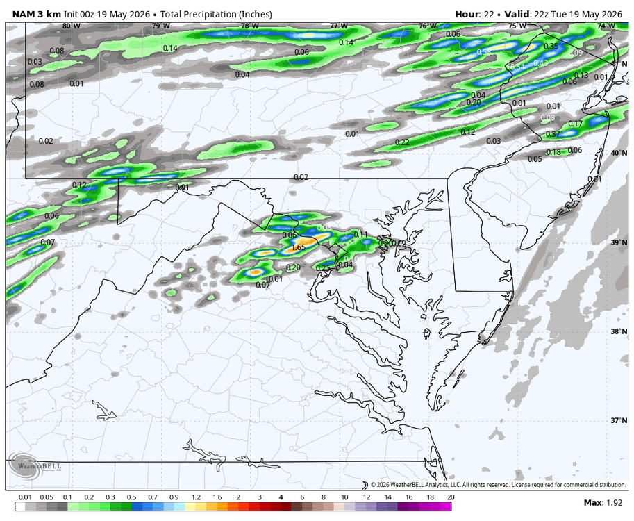
WB 12Z 3K NAM for tomorrow am.
-
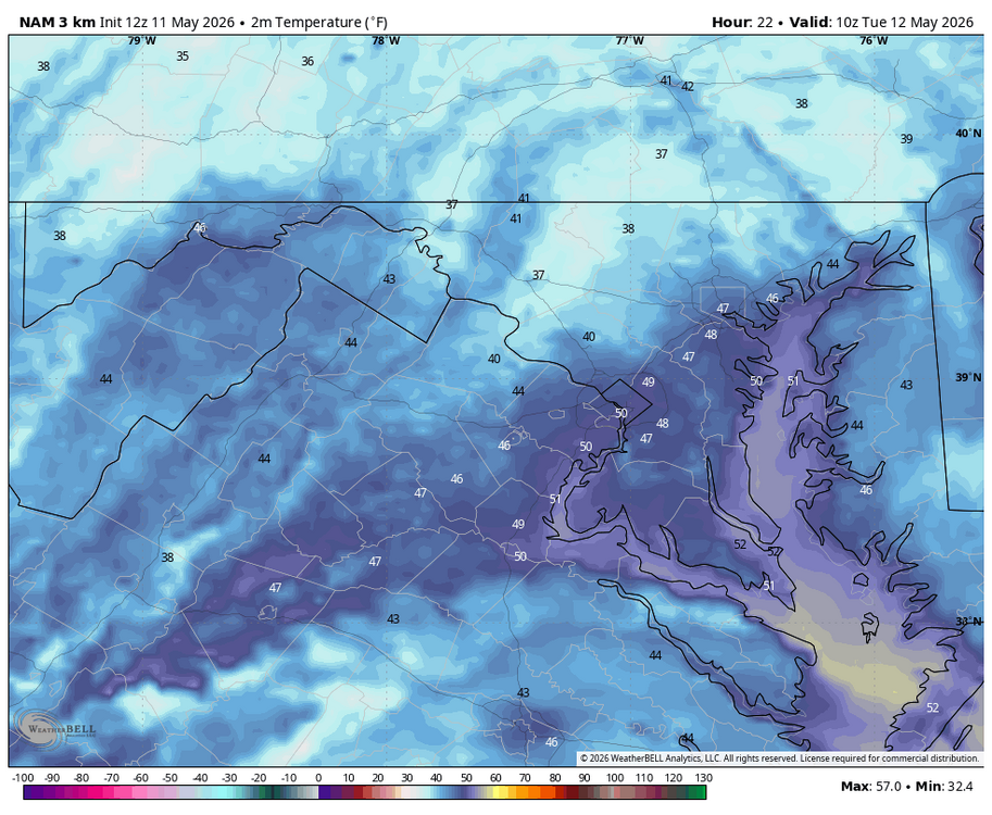
WB 6Z 3K NAM. Chilly overnight with freeze watch for highest elevations. Note latest NAM is a tick warmer.
-
WB 6Z NBM for Wed.

-
WB 6Z NBM for today.
-
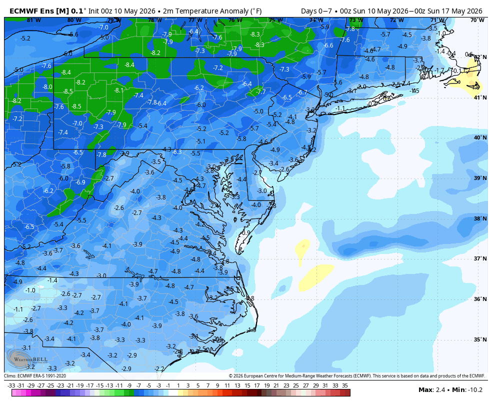
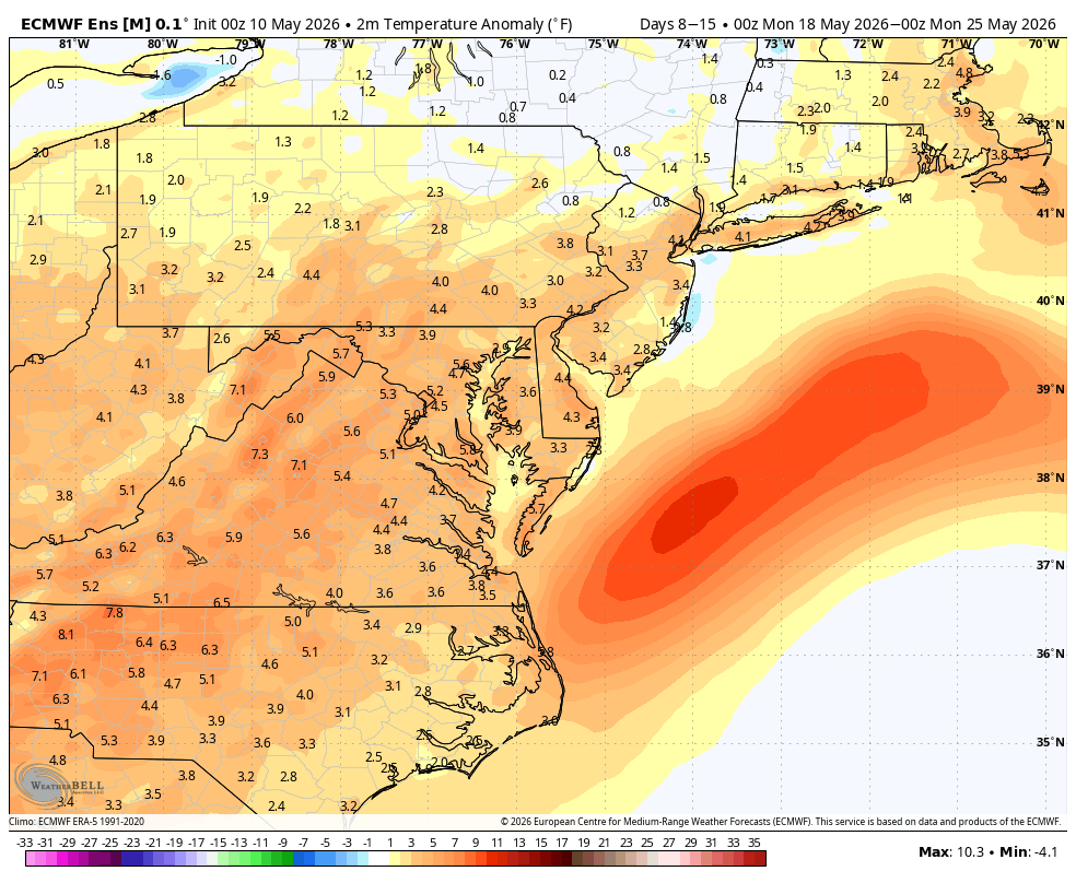
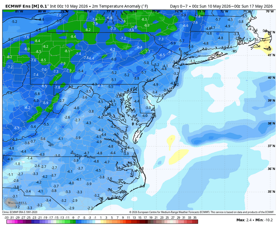
WB 12Z EPS is dry the next two weeks. Cool this week, hot next week.

-
Took Mom out to dinner. Streets are wet upon return. About .10.
-
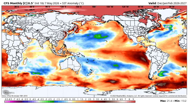
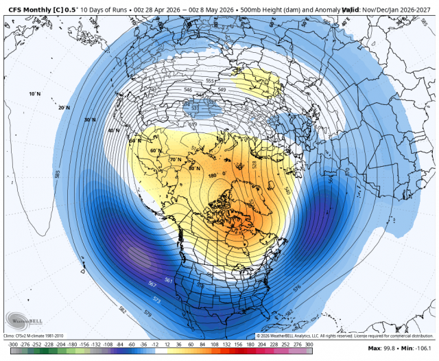
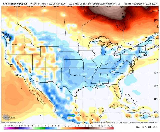
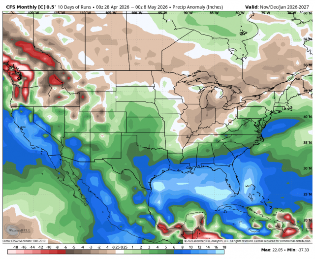
With the rain fizzling out this week (again); thought I'd share some maps from WB JB. WB CFSv2 (control) that even he acknowledges may be wishful thinking for the upcoming winter. If only.... Will keep these maps. If I am understanding him correctly, JB thinks cooler water off Australia is critical for our chances of any East coast cold air this winter. I will be watching that factor.
-
WB 12Z EURO for late Sunday/Monday.
-
We are overdue for something to trend in the right direction...
-
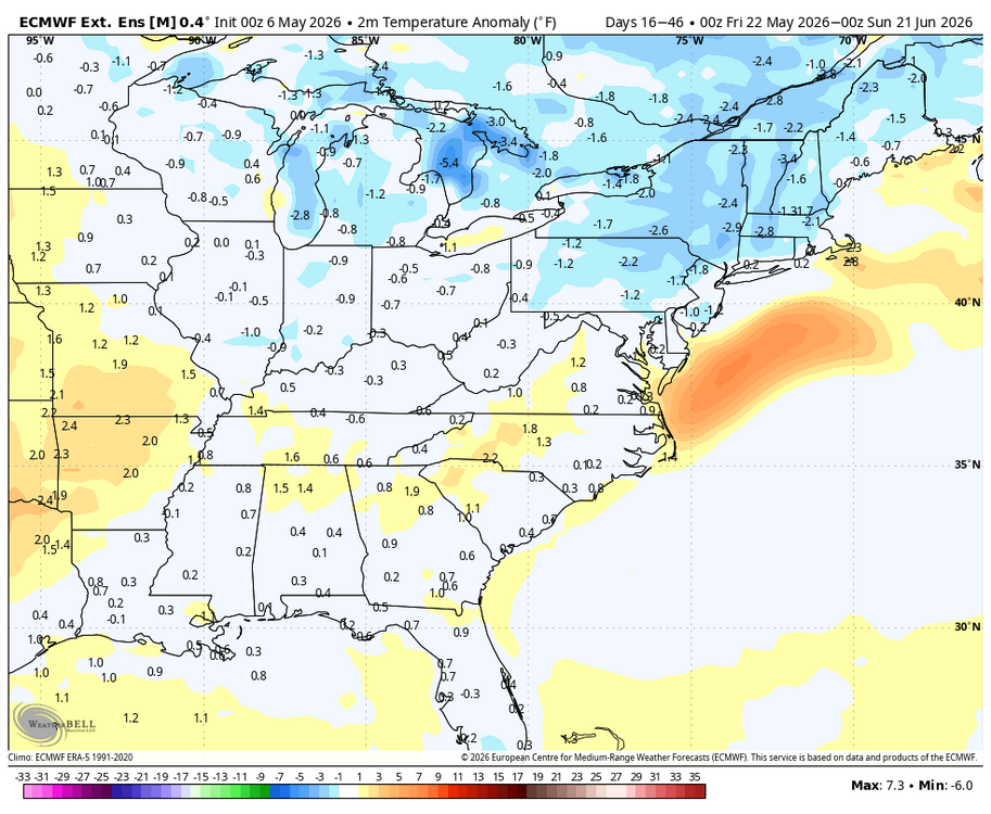
WB latest Euro weeklies: May 20-June 20 hopefully some precip. chances with near normal temps.
-
WB 18Z EURO...sigh...latest runs take Saturday's moisture mostly north and Monday's shortwave south.

-
Glad I cut the lawn last night. Nice little rain. Will take every drop....