Weather Will
-
Posts
7,315 -
Joined
-
Last visited
Content Type
Profiles
Blogs
Forums
American Weather
Media Demo
Store
Gallery
Everything posted by Weather Will
-
Late February/Early March 2026 Mid-Long Range
Weather Will replied to WxUSAF's topic in Mid Atlantic
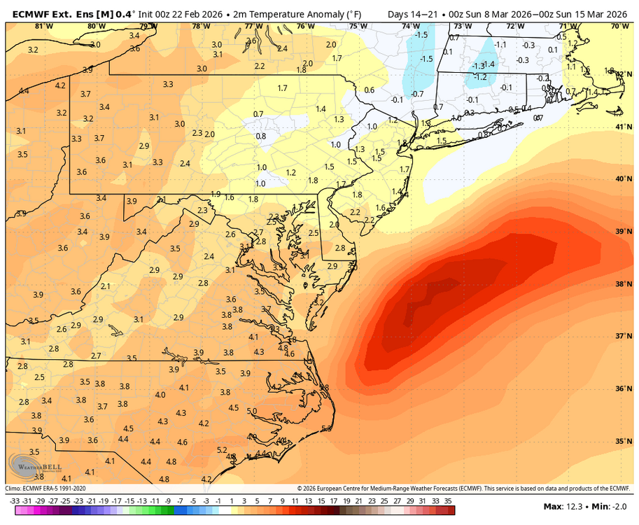
Latest WB EURO weeklies indicate could be cold enough through first week of March to support wintry precipitation. Temps then go above normal second week of March.
-
Feb 22nd/23rd "There's no way..." Obs Thread
Weather Will replied to Maestrobjwa's topic in Mid Atlantic
2-3 inches and waking up to light snow. Solid winter advisory event for sw Frederick county. -
Feb 22nd/23rd "There's no way..." Obs Thread
Weather Will replied to Maestrobjwa's topic in Mid Atlantic
About an inch on my car as I leave Frederick and head home. Parking lot is a little slushy. Mulch is covered. Generous to say an inch on the ground. Very light snow falling. Sad because that might be it for the year. But there is always hope next year!!!!! -
Feb 22nd/23rd "There's no way..." Obs Thread
Weather Will replied to Maestrobjwa's topic in Mid Atlantic
Winter storm warning forecast...
-
Feb 22nd/23rd "There's no way..." Obs Thread
Weather Will replied to Maestrobjwa's topic in Mid Atlantic
Dusting on grass and pavers starting to cave but radar looks pretty sparse out my way right now. Mostly conversational snow. They should consider putting Cactoctins and northern Frederick county in a different zone. -
Feb 22nd/23rd "There's no way..." Obs Thread
Weather Will replied to Maestrobjwa's topic in Mid Atlantic
Drove from Brunswick to Frederick on 340. When I went through the Cactoctins, hit a heavy snow shower. Just light mix in Frederick. -
Feb 22nd/23rd "There's no way..." Obs Thread
Weather Will replied to Maestrobjwa's topic in Mid Atlantic
Flakes mixing in with rain. -
Feb 22nd/23rd "There's no way..." Obs Thread
Weather Will replied to Maestrobjwa's topic in Mid Atlantic
The official NWS forecast for my area is for 3-6 inches. I will be more patient and see if I get 3 on the lawn by am. Lived in the DMV a long time, had a lot of 35 degree rain storms that were supposed to be snow. -
Feb 22nd/23rd "There's no way..." Obs Thread
Weather Will replied to Maestrobjwa's topic in Mid Atlantic
Without heavy rates, even if it starts to snow again, the ground and air are too warm and wet. I was not expecting a blizzard but was hoping for 3-6 inches. Ain't happening unless you are NE of DC with higher elevation and maybe the Cactoctins with the IVT. -
Feb 22nd/23rd "There's no way..." Obs Thread
Weather Will replied to Maestrobjwa's topic in Mid Atlantic
NWS should downgrade the winter storm warning to a drizzle warning for Frederick. I bet I don't get an inch. -
Feb 22nd/23rd "There's no way..." Obs Thread
Weather Will replied to Maestrobjwa's topic in Mid Atlantic
Depending on the Norlun is like depending on the lottery to have enough money to live in retirement. NEXT..... -
Feb 22nd/23rd "There's no way..." Obs Thread
Weather Will replied to Maestrobjwa's topic in Mid Atlantic
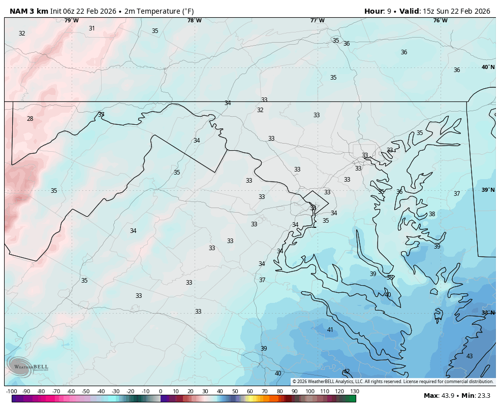
36, very light mix. Actually hope heavier precip. Moves in after 2 as we start to lose sun angle for the day. -
Feb 22nd/23rd "There's no way..." Obs Thread
Weather Will replied to Maestrobjwa's topic in Mid Atlantic
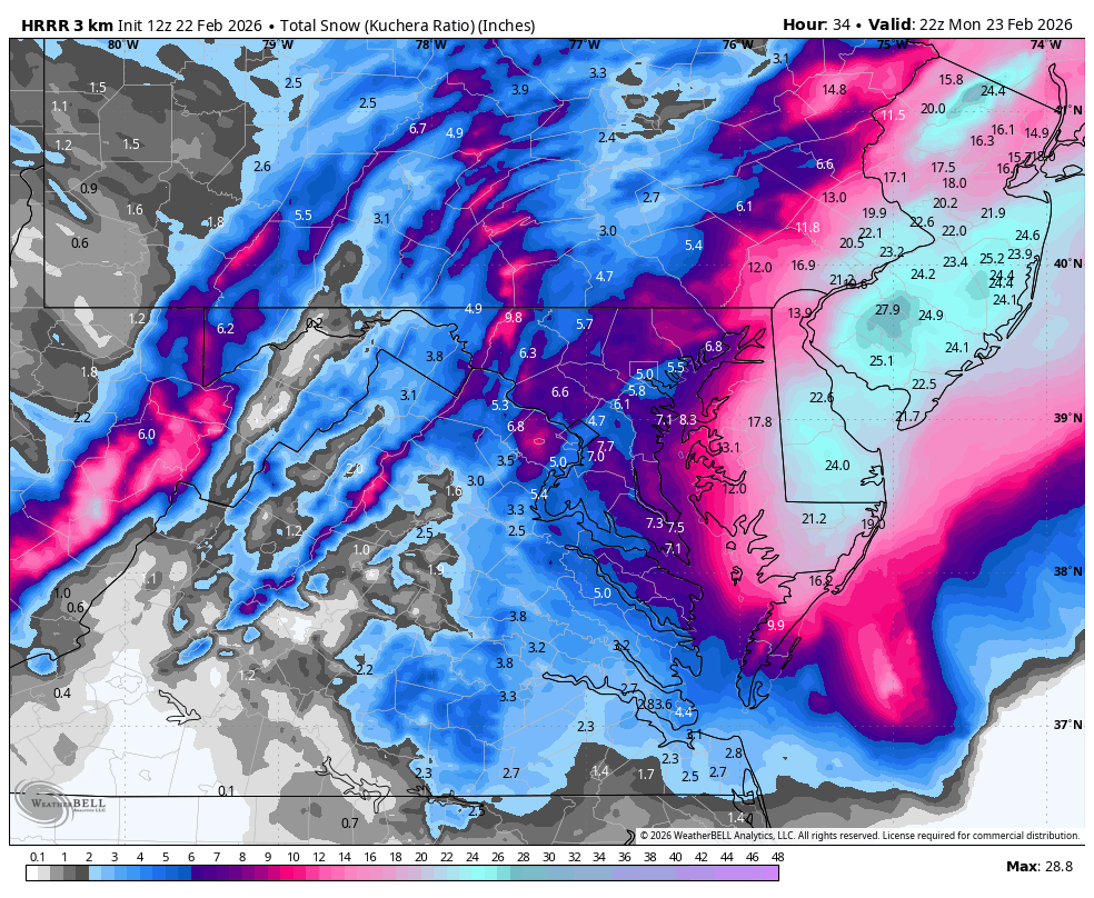
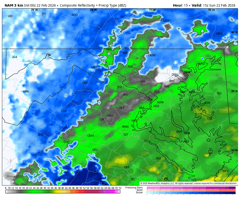
WB 3K BAM simulated radar 1, 3, 5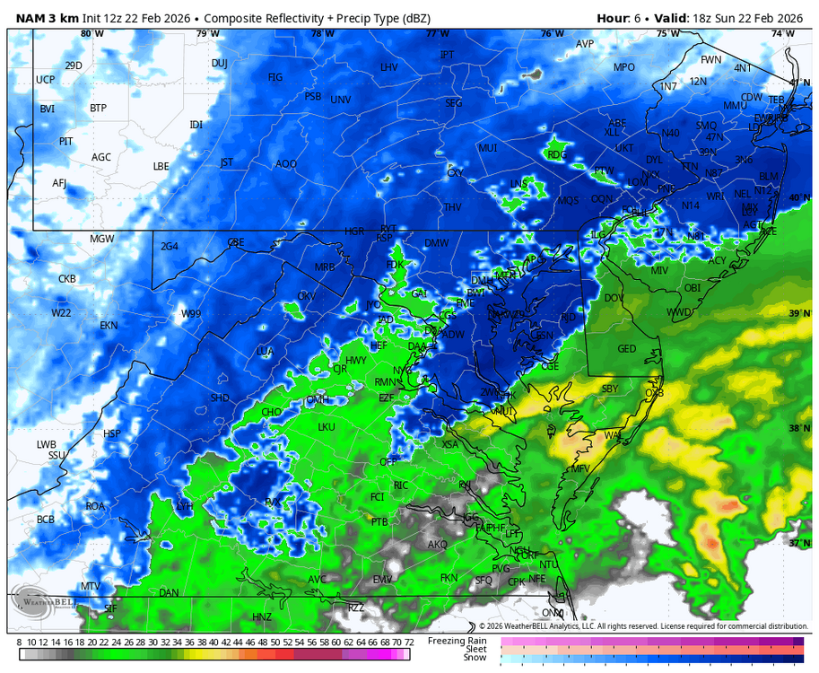
-
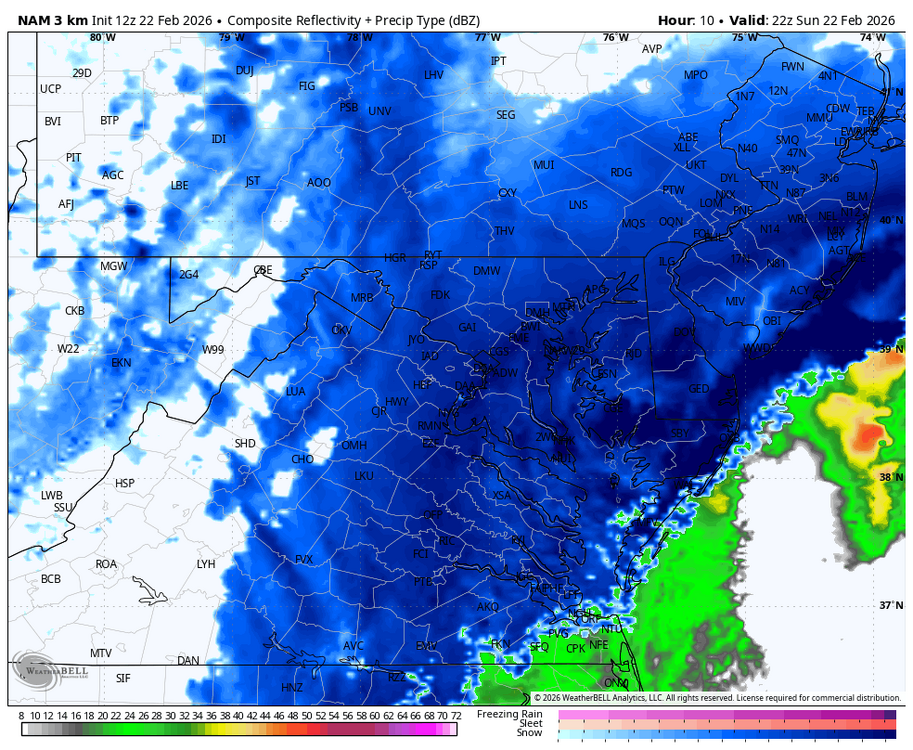
Feb 22nd/23rd "There's no way..." Obs Thread
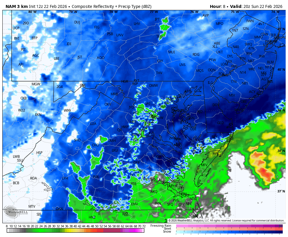
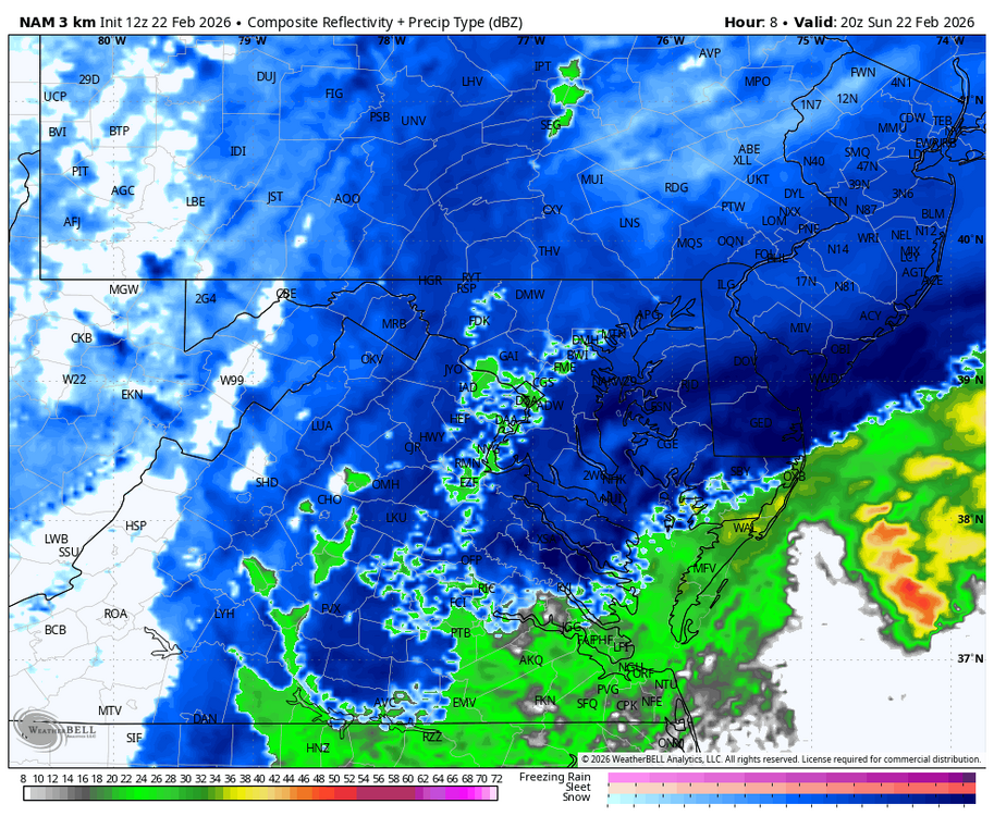
Weather Will replied to Maestrobjwa's topic in Mid Atlantic
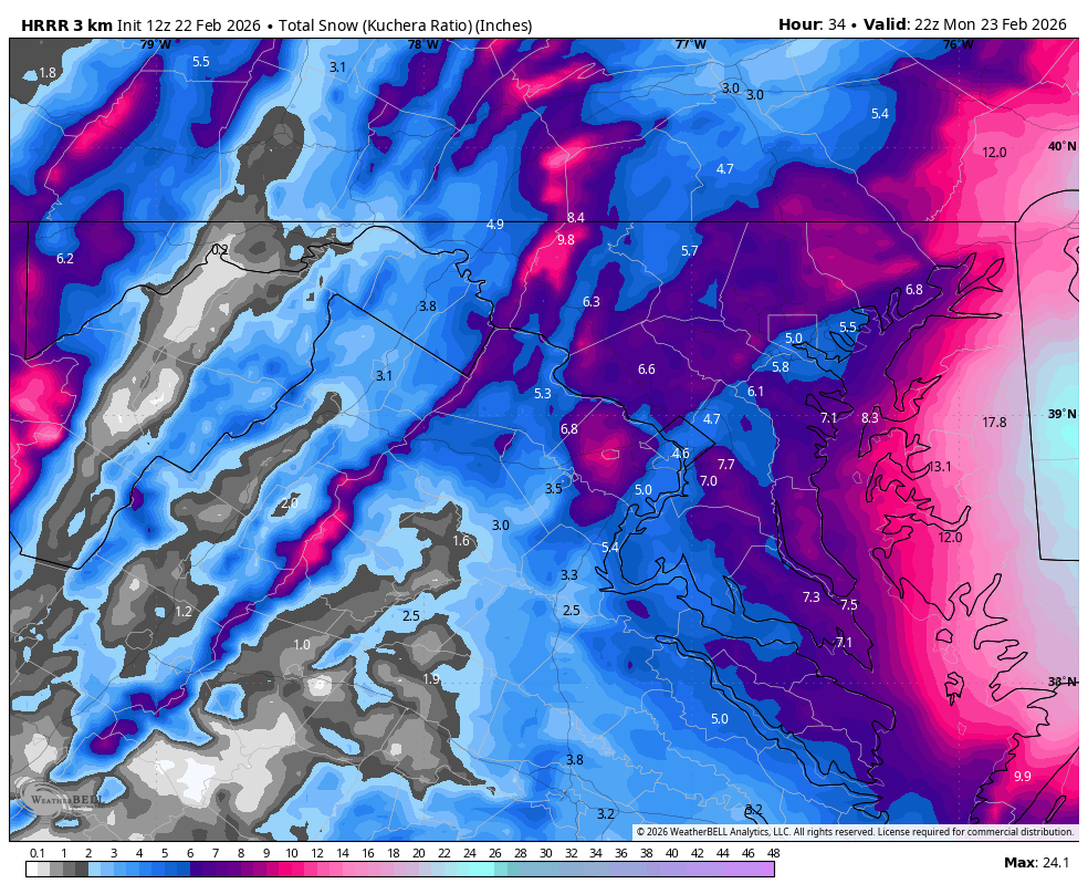
12Z HRRR statewide and zoomed. Area wide changeover takes place between 4-5. NW zones and elevation spots change over sooner. Radar forecast at noon, 4, and 5.

-
Feb 22nd/23rd "There's no way..." Obs Thread
Weather Will replied to Maestrobjwa's topic in Mid Atlantic
It is slowly caving to the 3K especially in NW zones. Anxious to see if I turn to snow before noon west of 15 in Frederick county. -
Feb 22nd/23rd "There's no way..." Obs Thread
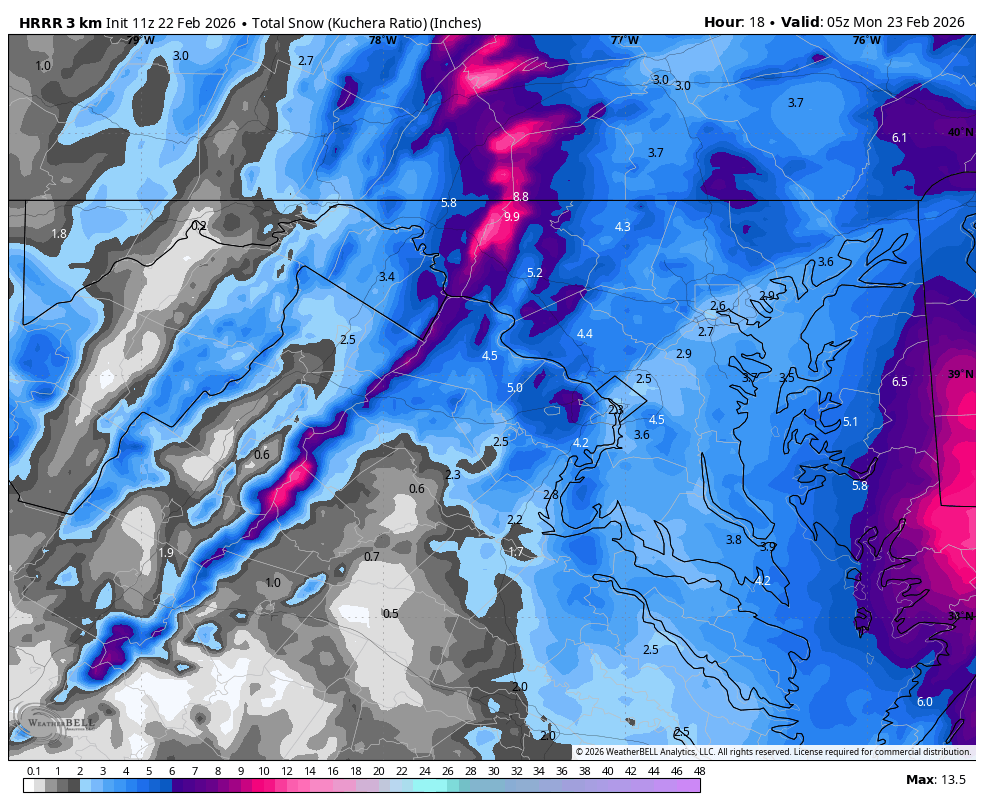
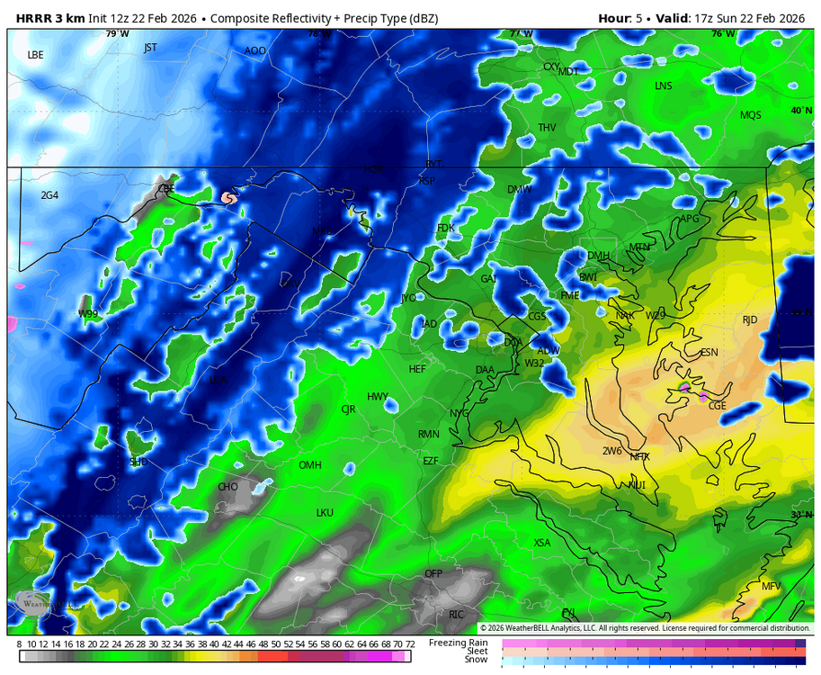
Weather Will replied to Maestrobjwa's topic in Mid Atlantic
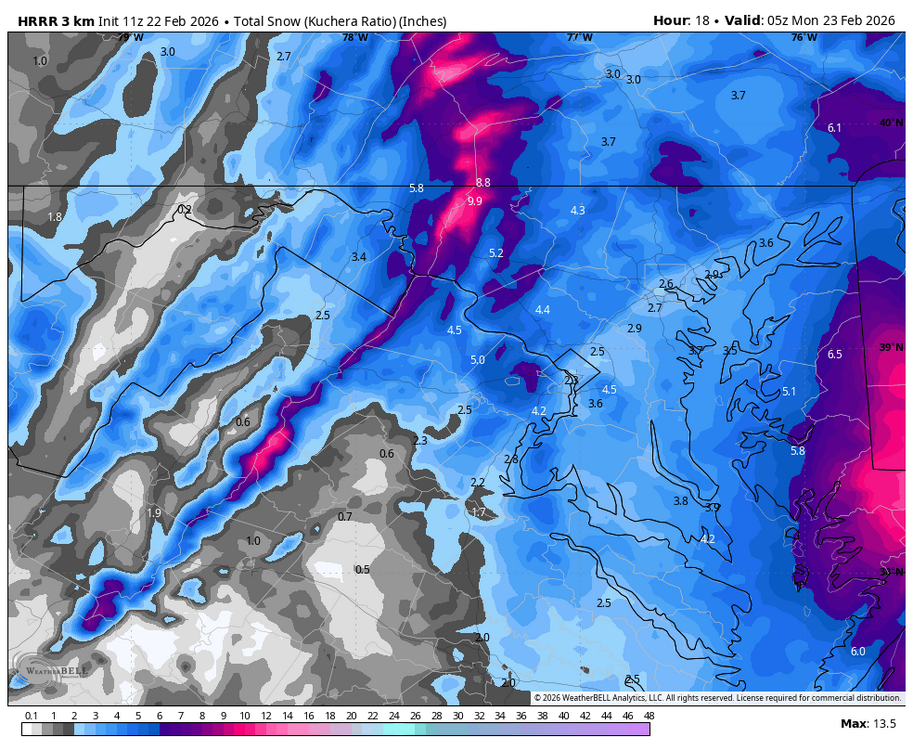
WB 11Z HRRR statewide and zoomed. Note west of Bay it is just light snow by end of run at midnight.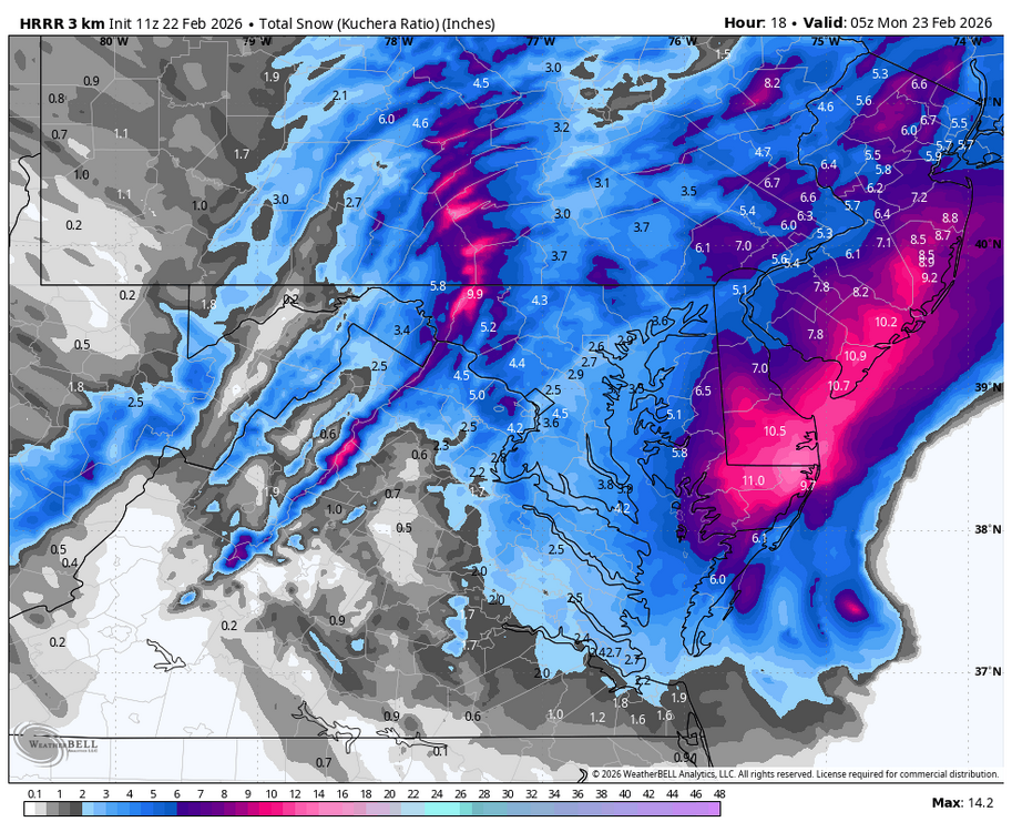
-
Feb 22nd/23rd "There's no way..." Obs Thread
Weather Will replied to Maestrobjwa's topic in Mid Atlantic
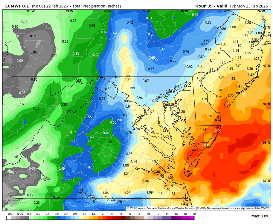
WB 6Z EURO
-
Feb 22nd/23rd "There's no way..." Obs Thread
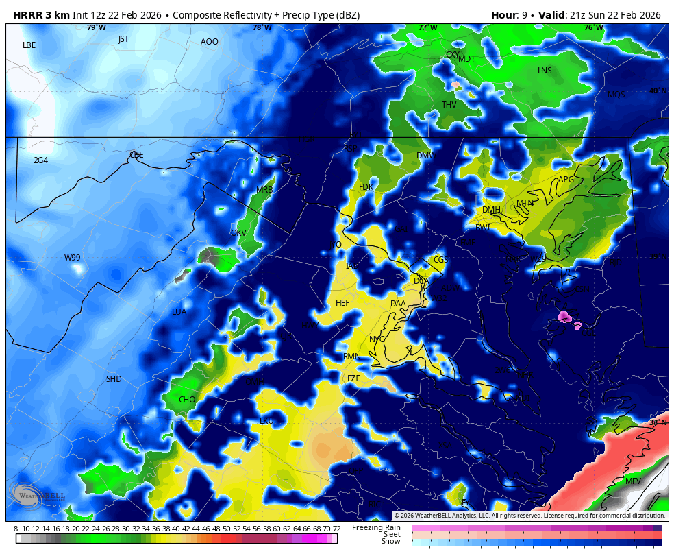
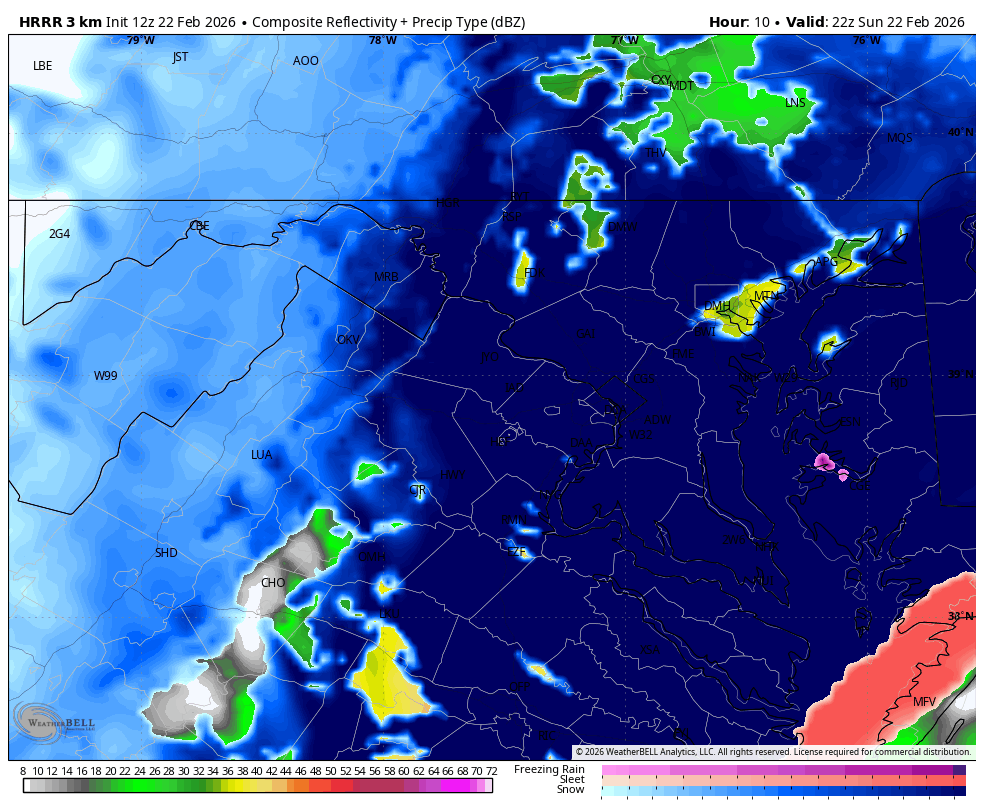
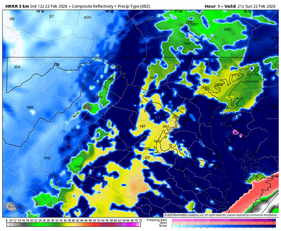
Weather Will replied to Maestrobjwa's topic in Mid Atlantic
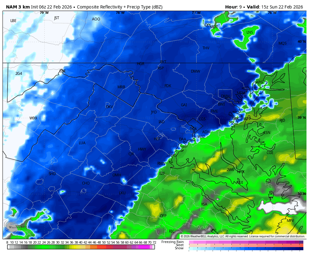
9Z HRRR is still rain throughout the day. Nothing like 6Z 3K NAM. -
Feb 22nd/23rd "There's no way..." Obs Thread
Weather Will replied to Maestrobjwa's topic in Mid Atlantic
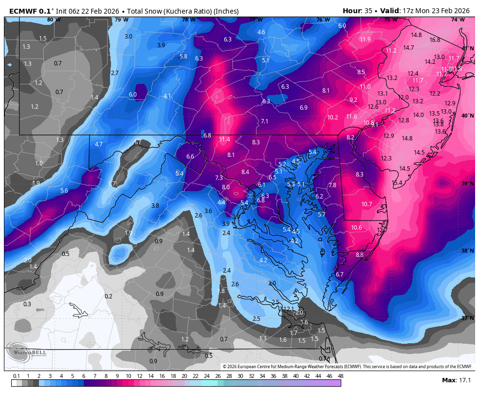
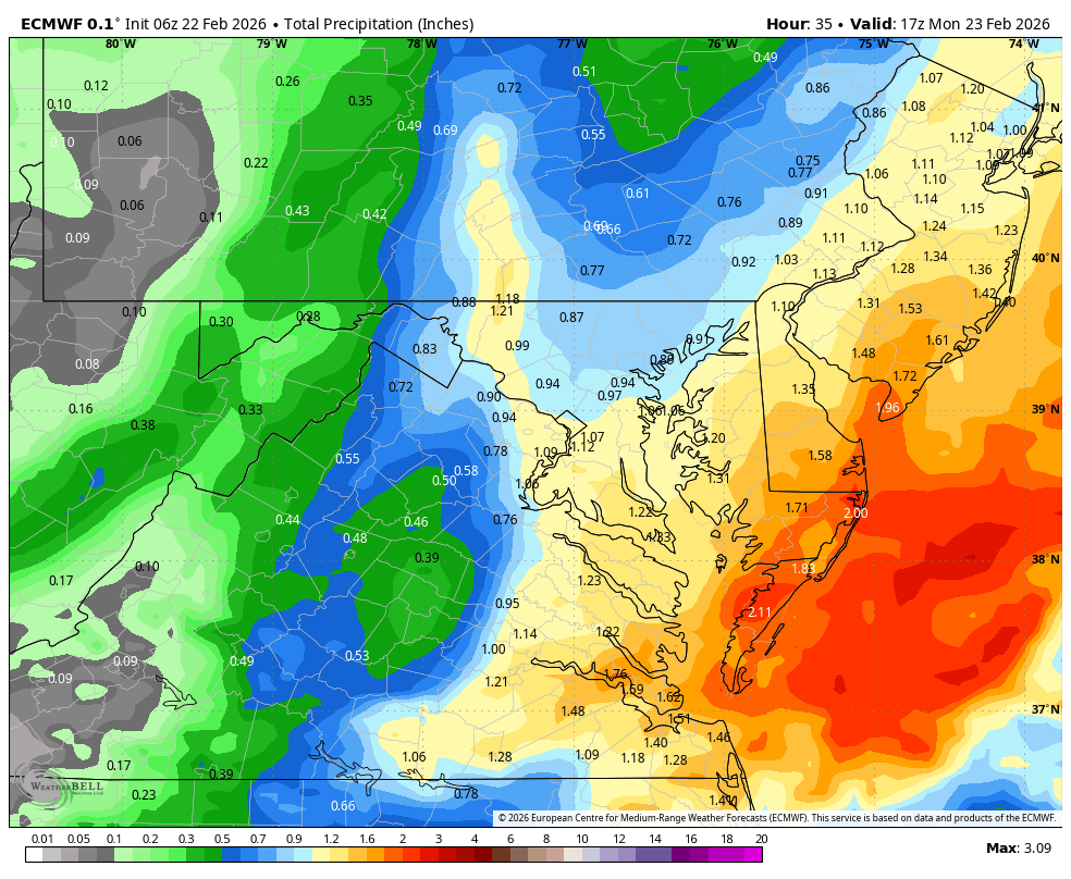
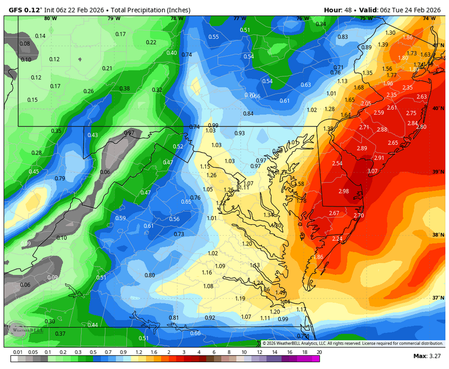
WB 6Z GFS. Nice moderate snow storm from immediate DC burbs to the Bay, Major to the east...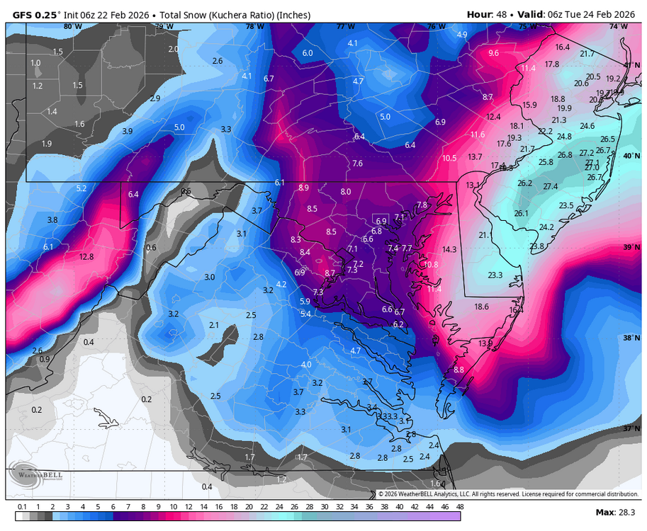
-
Feb 22nd/23rd "There's no way..." Obs Thread
Weather Will replied to Maestrobjwa's topic in Mid Atlantic
Big deal if 3K is correct. Warnings will need to go up for DC and immediate suburbs. Big change. Any comments from the Mets on 3K? Is it out to lunch? -
Feb 22nd/23rd "There's no way..." Obs Thread
Weather Will replied to Maestrobjwa's topic in Mid Atlantic
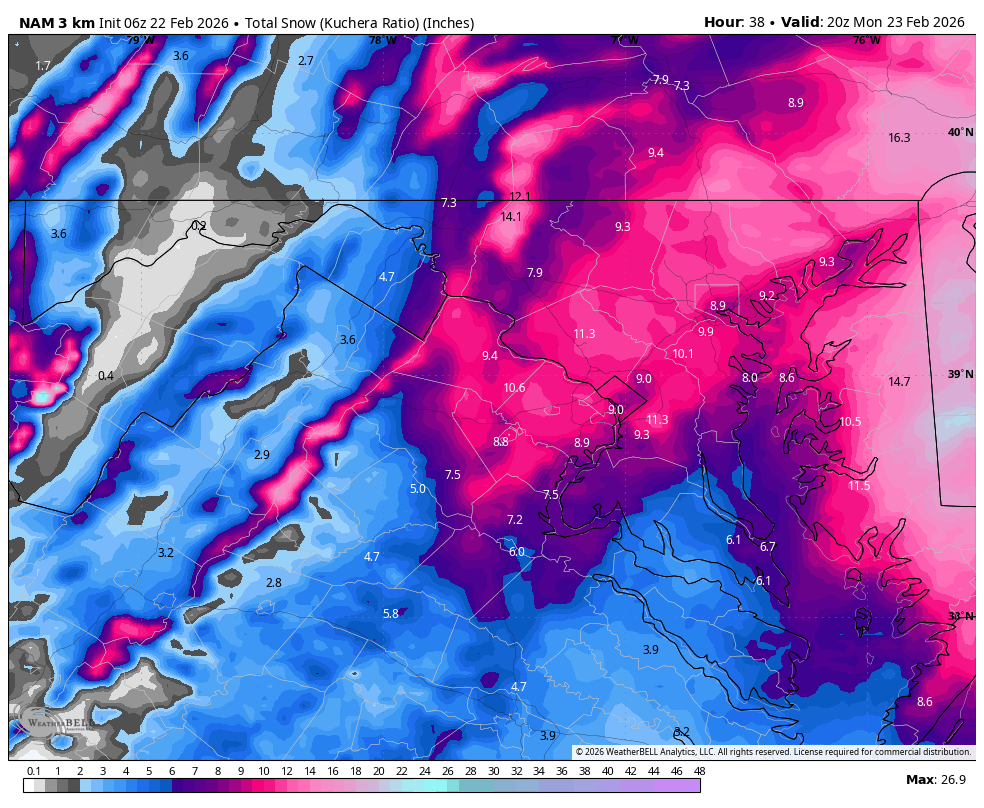
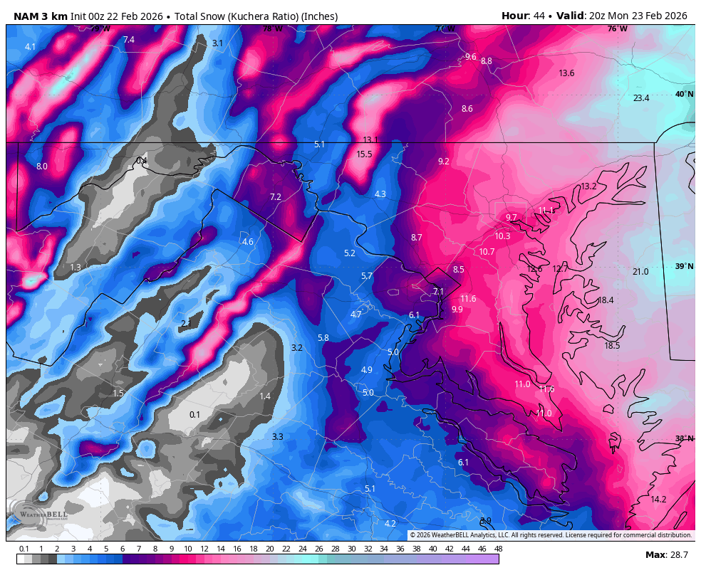
We will know if WB 3K NAM is correct soon. 10 am radar compared to 0Z. 10 am surface temps are colder too do to rates. Big deal


-
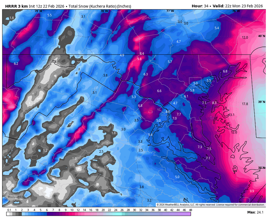
Feb 22nd/23rd "There's no way..." Obs Thread
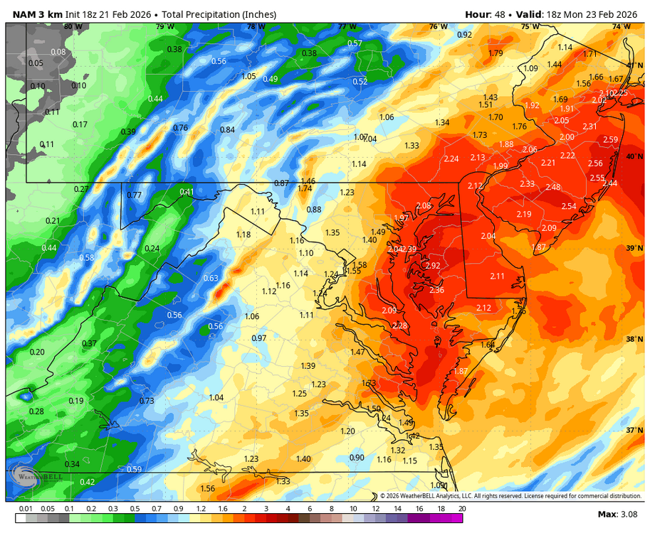
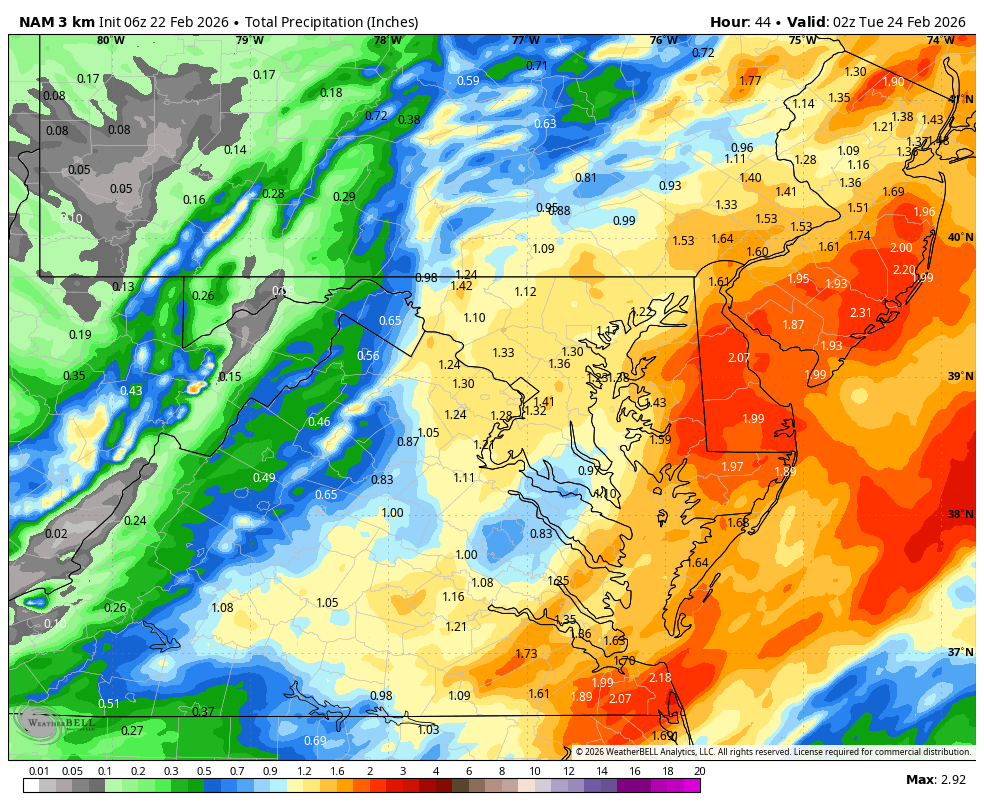
Weather Will replied to Maestrobjwa's topic in Mid Atlantic
WB 3K 6Z NAM zoomed snow map comparison to 0Z.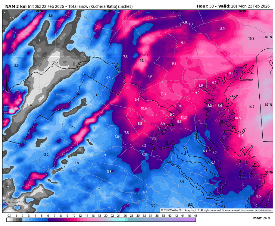

-
Feb 22nd/23rd "There's no way..." Obs Thread
Weather Will replied to Maestrobjwa's topic in Mid Atlantic
WB 6Z 3K NAM gives more moisture to western burbs than 0Z.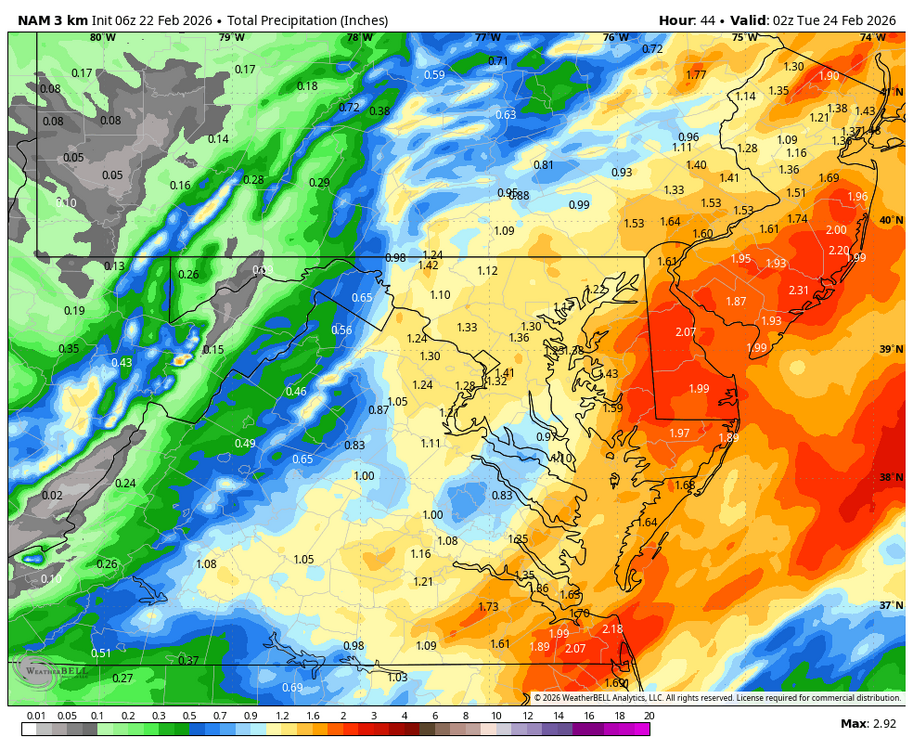

-
Feb 22nd/23rd "There's no way..." Obs Thread
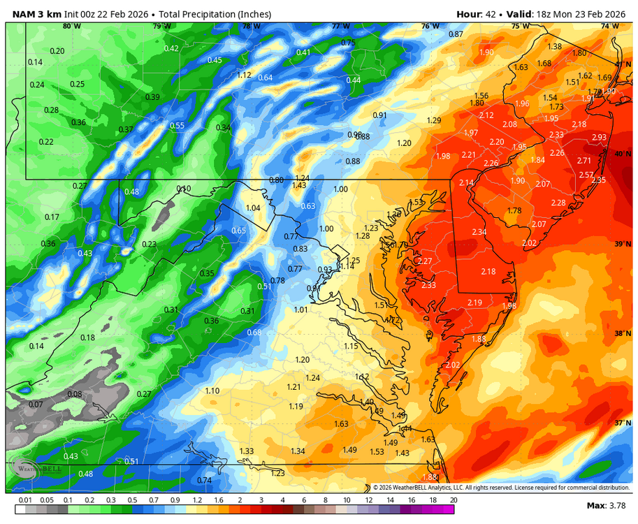
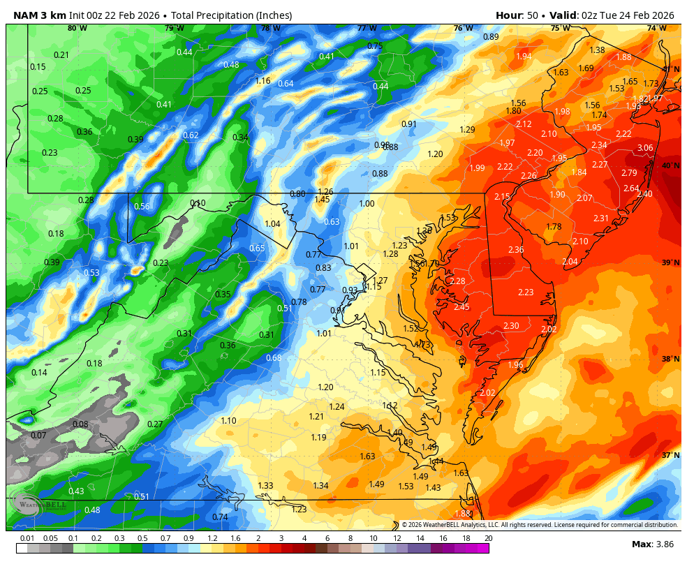
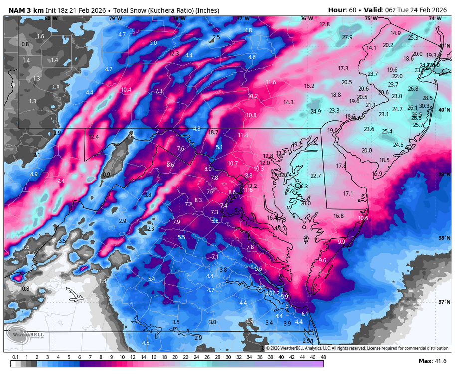
Weather Will replied to Maestrobjwa's topic in Mid Atlantic
WB 0Z snow maps compared to 18Z. Nice storm but nothing major about it in Frederick or Loudon counties except Northern Catoctins on this run.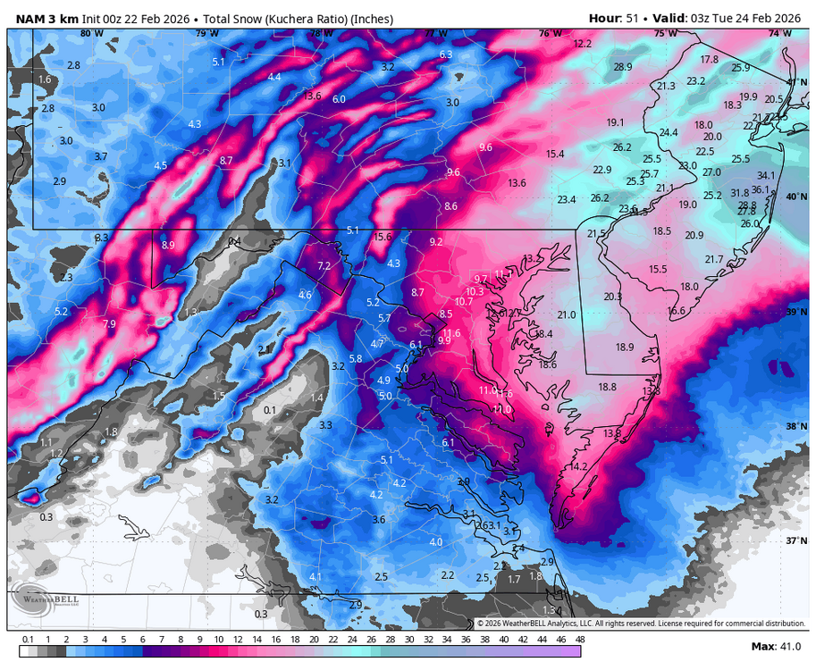
-
Feb 22nd/23rd "There's no way..." Obs Thread
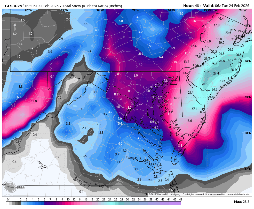
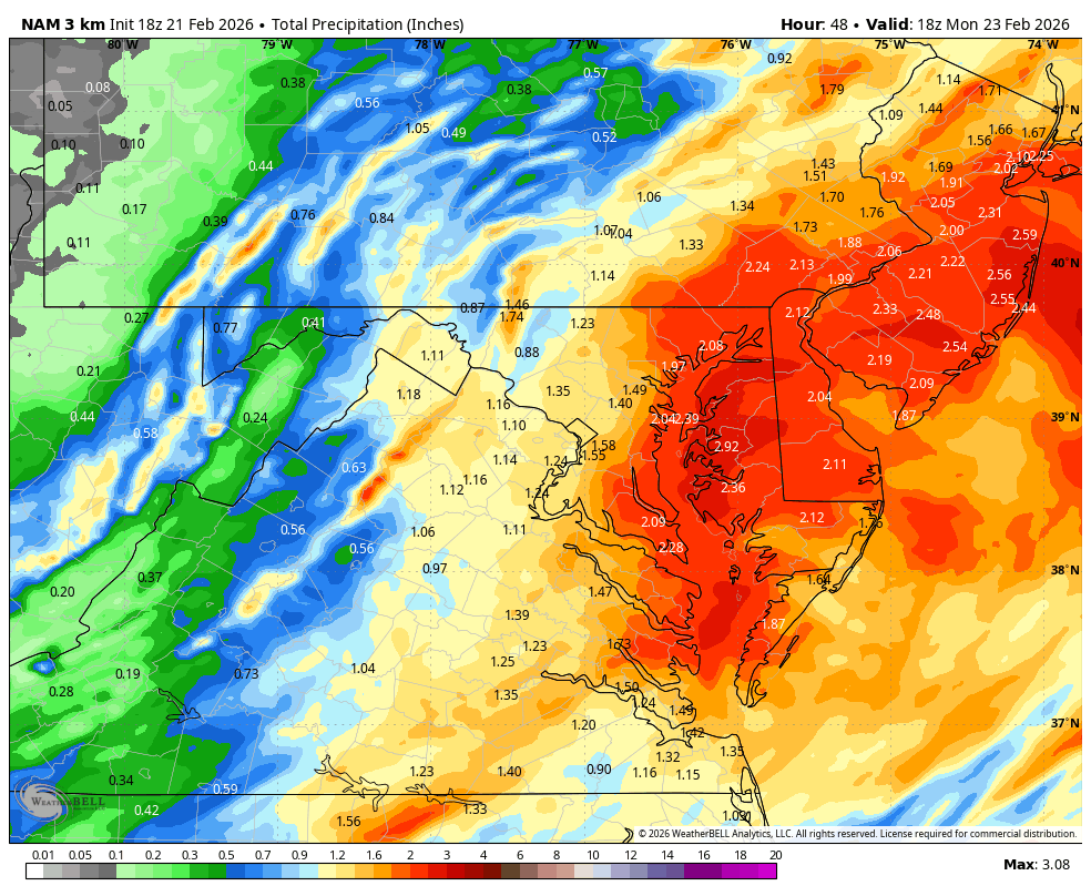
Weather Will replied to Maestrobjwa's topic in Mid Atlantic
0Z 3K NAM was a drier run for the western burbs compared to 18Z. I see no sign of the IVT east of the mountains this run. Reality is setting in that this is a major storm for the eastern DC burbs and the shore. I will be happy with 3-5 inches of snow blowing around in 40 mph gusts Monday am. Maybe I will get a miracle burst from the IVT to jack my totals but not counting on it.