Snowcrazed71
-
Posts
3,216 -
Joined
-
Last visited
Content Type
Profiles
Blogs
Forums
American Weather
Media Demo
Store
Gallery
Everything posted by Snowcrazed71
-
January 2026 regional war/obs/disco thread
Snowcrazed71 replied to Baroclinic Zone's topic in New England
Man.. I'm really hoping you make up for it later this month and into February. -
January 2026 regional war/obs/disco thread
Snowcrazed71 replied to Baroclinic Zone's topic in New England
Looks like we're on track for the pattern change after this storm. -
January 2026 regional war/obs/disco thread
Snowcrazed71 replied to Baroclinic Zone's topic in New England
Ha!! Ok... -
January 2026 regional war/obs/disco thread
Snowcrazed71 replied to Baroclinic Zone's topic in New England
Lol.. really? I thought I handled that well. -
January 2026 regional war/obs/disco thread
Snowcrazed71 replied to Baroclinic Zone's topic in New England
You can keep trying fool. I like the colors though. Cool map! -
January 2026 regional war/obs/disco thread
Snowcrazed71 replied to Baroclinic Zone's topic in New England
What I don't get is there are a select few that like to " feed the fire " and get off on hoping the pattern turns warm. They really get off on twisting the knife. Well.. the good news is most of us know that it's just noise. -
January 2026 regional war/obs/disco thread
Snowcrazed71 replied to Baroclinic Zone's topic in New England
Northeast Weather Alert Over the past couple of months we’ve seen the trade winds steadily weaken, and at times even flip to brief westerlies as persistent convection has taken hold across the Pacific. That’s helped kick off a down-welling Kelvin Wave, which is forcing the subsurface warm pool to rise and slide east. In plain terms La Niña is fading right now, and the background state is already trending toward a developing +ENSO pattern as we move forward. With all due respect La Niña is effectively gone, even though it may still technically linger in the ocean for a short time on paper. The atmosphere has already begun shifting away from a true La Niña base state. I’m going to hold steady on my position, because no matter who you are in this field, you can’t ignore what’s right in front of you. I don’t flip back and forth with every single model run, I filter out the noise. Even in a field full of weeds, there are still solid tomatoes growing on the vine… you just have to know where and how to look for them. -
January 2026 regional war/obs/disco thread
Snowcrazed71 replied to Baroclinic Zone's topic in New England
Is this guy a joke? He doesn't even speak with an ounce of professionalism. -
January 2026 regional war/obs/disco thread
Snowcrazed71 replied to Baroclinic Zone's topic in New England
Here's just another forecast from another MET Ross Elliot out of Ohio. **Weather Nerd Alert: Next Week’s Warmth Is A Warning Sign From Old Man Winter** I have seen a lot of flashy headlines in the past 24 hours on social media that are either misleading or flat out wrong. Yes, we will warm up next week. No, winter isn’t over, and I would not describe what is coming as “A January Heat Wave” either as highs will be in the 40s. In fact, if you hate winter, I would not get too excited for the coming warmth. If you understand what will drive the mild pattern, then you also understand the warmth would be temporary, and it is likely a warning sign of a big arctic blast and potential for bigger winter storms. So what is going on behind the scenes? The pattern so far this winter has generally mimicked what we have today, below normal temperatures in the Great Lakes to the Northeast, warm out west, and extremely cold in Alaska and the Yukon. Nobody up that way wants to hear, “it is Alaska, what do you expect?”. The interior of Alaska just had their coldest December in 45 years. Fairbanks hasn’t been above 0 degrees F in nearly 3 weeks. Lows have been between -40 and -50F every day for the past week. That is not normal cold up that way. Meteorologists have been closely watching this pocket of extreme cold, because when it does start to move, it will have a big impact wherever it goes. The pattern is still locked in over the next 3 days, but after that we start to see a shift east with this entire global pattern. The warmth that is out west starts moving our way, and the trough over Alaska drops into the west. Alaska is the key to the long range forecast, and computer models move a ridge towards the state and it intensifies over the next two weeks. That would do two things. 1) It pushes the set up east. That means we get temporary warming that is in the western states, and in time that cold air in Alaska and western Canada finds a new home in the northern plains and Great Lakes, and eventually the northeast. 2) A strong ridge like what is forecast is also a blocking pattern that would stall out the weather pattern and also split the jet stream into a polar jet and a subtropic jet stream. This would increase the chance for bigger winter storms in the eastern half of the country as that pipeline of moisture would go across the Pacific, and pick up extra moisture from the Gulf. Meanwhile, the polar jet could drop into the Great Lakes bringing lots of cold. When you have this pattern, and the waves sync up, then you often get some bigger winter storms. There is no way of knowing where these storms will end up right now, but the pattern looks ideal for winter storms. At the very least, the cold looks to make a big comeback. In a nutshell, yes it will warm up next week, but be careful what you ask for as the same engine that is driving the warmth would also drive arctic cold our way after it and probably wintery precipitation mid to late January. This entire set up is connected. The screen shots below show the basic pattern as it shifts east over the next couple of weeks. -
January 2026 regional war/obs/disco thread
Snowcrazed71 replied to Baroclinic Zone's topic in New England
I've looked at several posts from different meteorologists around the Northeast. They all say this warm up next week is temporary. They also say snow will be back in our forecast. This is normal and we should always get a warm up at some point in a winter season. Too many people are freaking out like it's the end A winter ( and there are some that wanted to be the end and like to cause chaos ). We just have to hang in there and it will be back. -
January 2026 regional war/obs/disco thread
Snowcrazed71 replied to Baroclinic Zone's topic in New England
When mother nature calls us back. -
January 2026 regional war/obs/disco thread
Snowcrazed71 replied to Baroclinic Zone's topic in New England
Why are you in the winter forum if you don't like the snow? -
January 2026 regional war/obs/disco thread
Snowcrazed71 replied to Baroclinic Zone's topic in New England
? So much doom and gloom on here. Weren't you Mr. Positive recently? Don't let the naysayers get to you. It takes ONE storm..... Just one! If we get to mid to late February and it is still like it is now, then ok. I'll jump from the cliff with ya. -
January 2026 regional war/obs/disco thread
Snowcrazed71 replied to Baroclinic Zone's topic in New England
Listen guys.... No matter what happens with the Weather, if life has taught me one thing, its how greatful I am for what I have. Maybe we get our big Winter this year, or maybe we get our big Storm this year ( or maybe neither ). But, it will happen again. What I do want to say is Happy New Year to all you Weather geeks in here. I don't keep coming back here because I have to... I do because I'm just another weather geek just like the rest of you. Thanks guys... And here's to what we all hope is a great rest of the Winter season of 2026! -
January 2026 regional war/obs/disco thread
Snowcrazed71 replied to Baroclinic Zone's topic in New England
Well that bodes well for you. If you're away on vacation somewhere warm. You're not going to be missing much. Might as well do it now so you can come back to hopefully some good stuff. Enjoy -
January 2026 regional war/obs/disco thread
Snowcrazed71 replied to Baroclinic Zone's topic in New England
Please and thank you -
January 2026 regional war/obs/disco thread
Snowcrazed71 replied to Baroclinic Zone's topic in New England
Well, you didn't really need to respond to my post just to say this. My point is he's he's entitled to his opinion, but his opinions should be in the banter thread. That's all. Carry on -
January 2026 regional war/obs/disco thread
Snowcrazed71 replied to Baroclinic Zone's topic in New England
This actually wasn't about the CC posts. It was about the Pope's posts on always calling for this pattern to be warming up or garbage for any kind of storms. He basically pushes down any kind of threat no matter what. And he's been wrong so many times. It just baffles me that he still posts this crap. Everyone has the right to their opinion, but when he keeps bashing what's happening, that's what I meant when I said to put it in the banter thread. I really think something in his brain is twisted LOL -
January 2026 regional war/obs/disco thread
Snowcrazed71 replied to Baroclinic Zone's topic in New England
What are you trying to say???? I'm part of the pack?? Lol Bring on the fangs! -
January 2026 regional war/obs/disco thread
Snowcrazed71 replied to Baroclinic Zone's topic in New England
Everyone's focusing too much on the subtle changes of the different model runs. The general rule of thumb is the step down to a colder pattern as a whole. There's too much what this model says today and what that model says tomorrow. It has been stepping this way for quite some time. It's like chaos in here LOL. As they say, TO MANY COOKS IN THE KITCHEN!! -
January 2026 regional war/obs/disco thread
Snowcrazed71 replied to Baroclinic Zone's topic in New England
You are the biggest culprit. Take all your comments ( which are almost always shitting on the pattern we are in ) and put it in the proper banter forum ). You truly bring nothing to the table other than stirring the pot. Plus, you have been wrong so many times with your " This is what the pattern is going to do ". Just don't bother posting. -
January 2026 regional war/obs/disco thread
Snowcrazed71 replied to Baroclinic Zone's topic in New England
Well... If giving me the Shit symbol makes you feel better... Do it again. Get it out man. Things will not stay the same forever. -
January 2026 regional war/obs/disco thread
Snowcrazed71 replied to Baroclinic Zone's topic in New England
Lol .. cmon dude.... Things could be so much worse. Stop over analyzing. I really think you need to take a break. Come back in a few weeks when you think the pattern might be better. Focus on something else! :-) -
January 2026 regional war/obs/disco thread
Snowcrazed71 replied to Baroclinic Zone's topic in New England
What you're saying makes no sense whatsoever. Nothing is showing this kind of pattern in the upcoming several weeks? -
December 2025 regional war/obs/disco thread
Snowcrazed71 replied to Torch Tiger's topic in New England
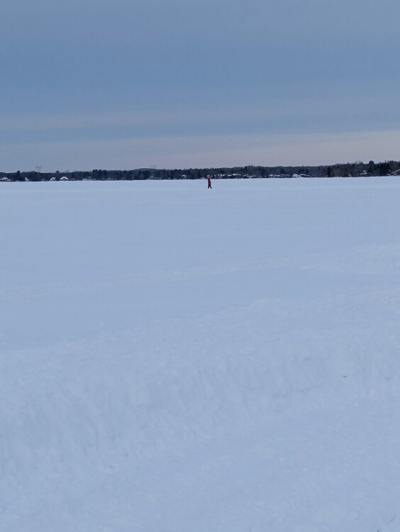
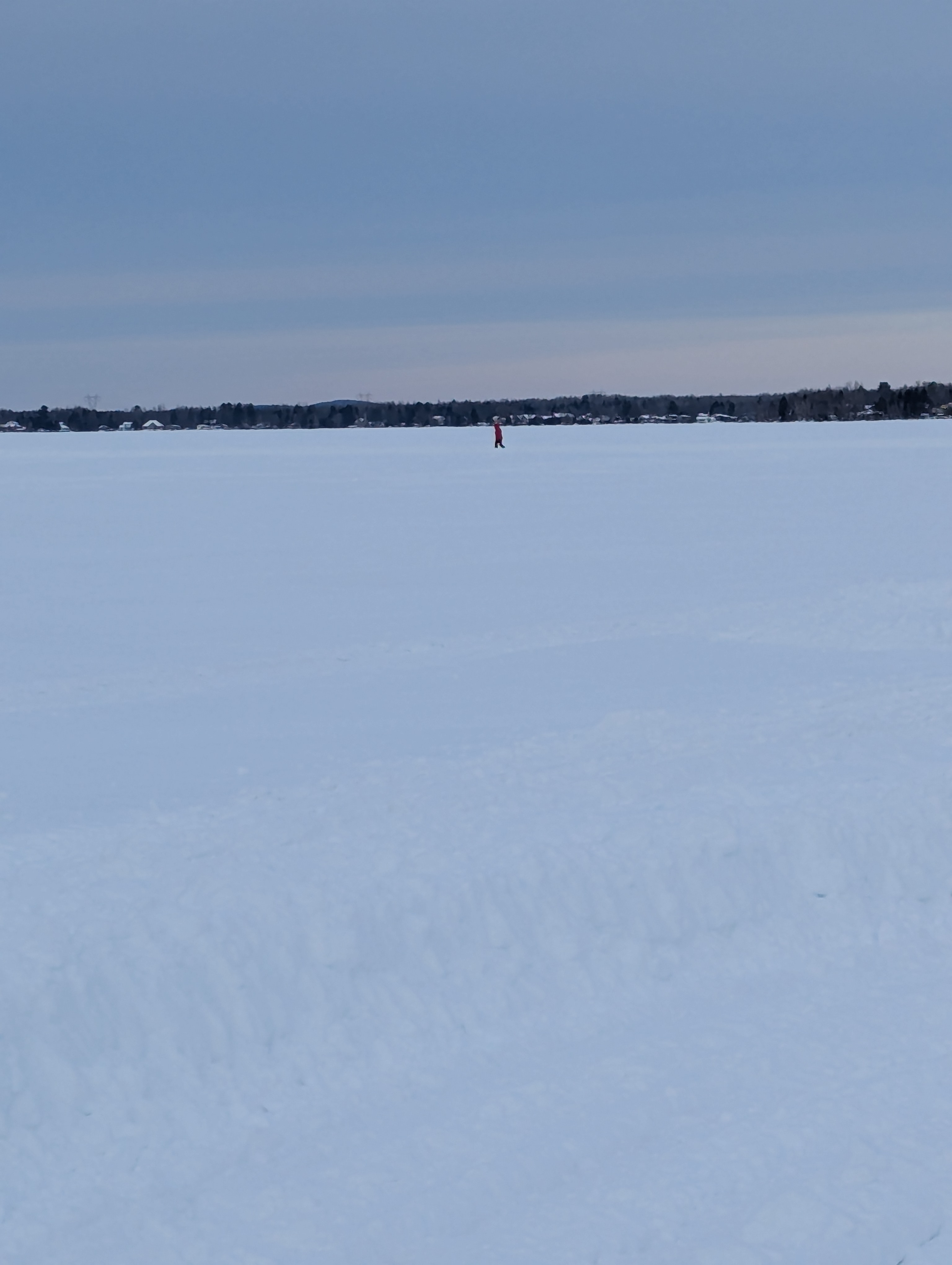
Currently -1° up here in Shawinigan Quebec.... Lake is frozen... They made a large path to walk, ice scate and Snow mobile on the lake. Pretty awesome