SnowDreamer
-
Posts
451 -
Joined
-
Last visited
Content Type
Profiles
Blogs
Forums
American Weather
Media Demo
Store
Gallery
Everything posted by SnowDreamer
-

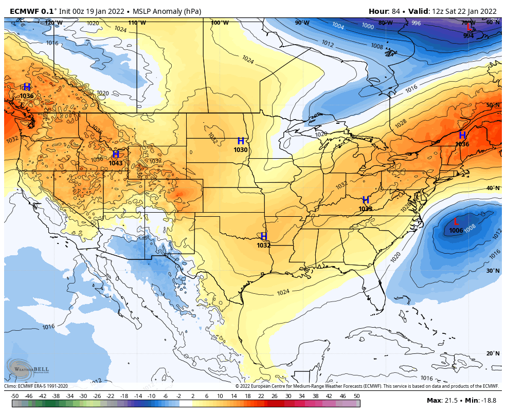
January 28-29, 2022 Miller abcdefu Storm Threat
SnowDreamer replied to WxUSAF's topic in Mid Atlantic
closest approach judging from the CMC website is about 50-75 miles off obx?
-
January 28-29, 2022 Miller abcdefu Storm Threat
SnowDreamer replied to WxUSAF's topic in Mid Atlantic
It's significantly worse at sfc in hr 57... -
January 28-29, 2022 Miller abcdefu Storm Threat
SnowDreamer replied to WxUSAF's topic in Mid Atlantic
Out to 3 hours and I've got no fingernails left -
January 28-29, 2022 Miller abcdefu Storm Threat
SnowDreamer replied to WxUSAF's topic in Mid Atlantic
RGEM Kuch vs. 18Z massive overhaul ...ninja'd by CAPE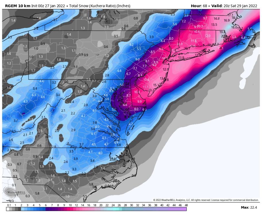
.thumb.png.a965bf386f06020045a2c9d6cea91486.png)
-
January 28-29, 2022 Miller abcdefu Storm Threat
SnowDreamer replied to WxUSAF's topic in Mid Atlantic
They're both a nice chunk in the right direction... abscond! -
January 28-29, 2022 Miller abcdefu Storm Threat
SnowDreamer replied to WxUSAF's topic in Mid Atlantic
It’s interesting that anecdotally the GFS has been taking the EURO’s lunch money this month with these scores. -
January 28-29, 2022 Miller abcdefu Storm Threat
SnowDreamer replied to WxUSAF's topic in Mid Atlantic
I love it when the most likely outcome still isn’t likely. “My forecast is for 1-3”, but there’s a 54% chance I’m wrong” -
January 28-29, 2022 Miller abcdefu Storm Threat
SnowDreamer replied to WxUSAF's topic in Mid Atlantic
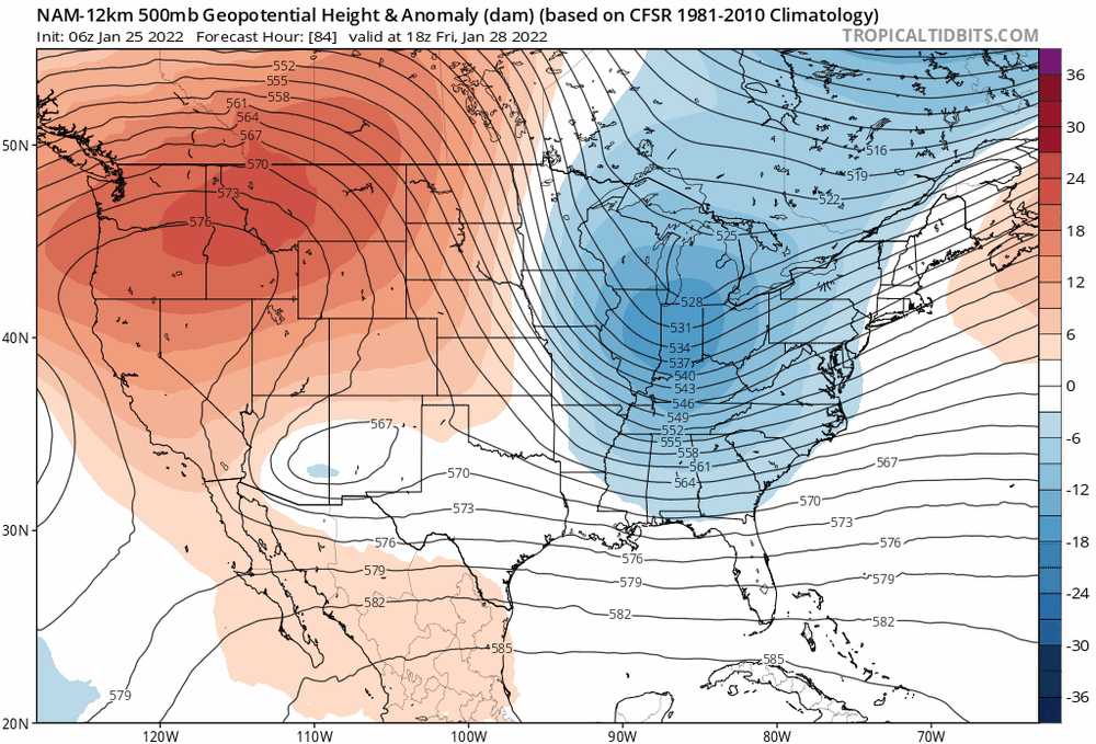
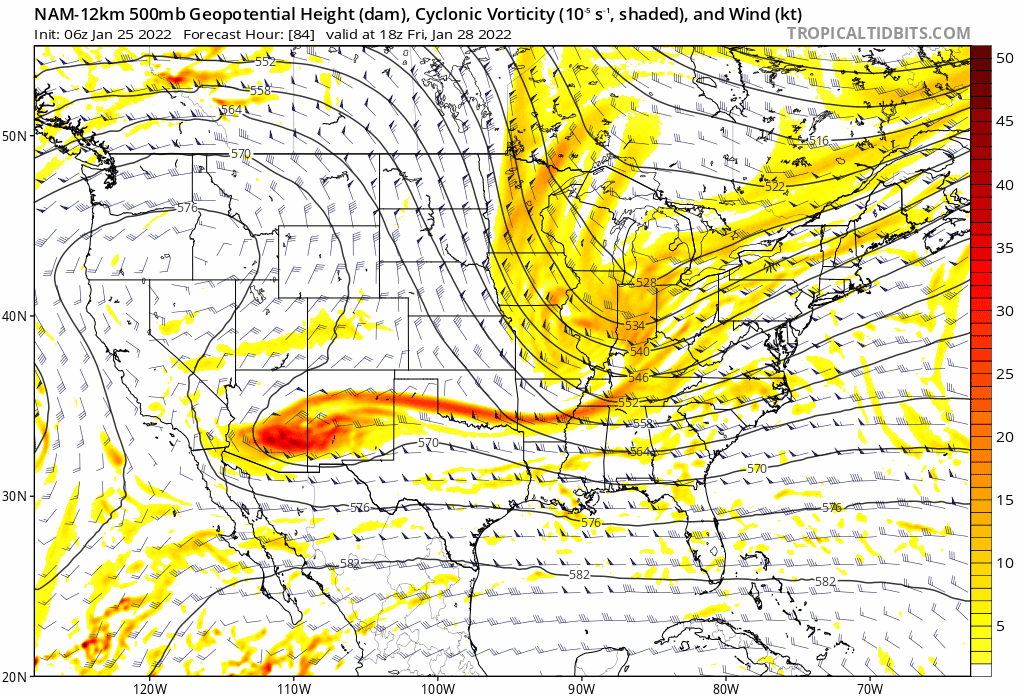
Can really see the trend to more phasing and a deeper dig here...Hoping to see the same on the GFS
-
Late January and February Medium/Long Range Discussion
SnowDreamer replied to WinterWxLuvr's topic in Mid Atlantic
.thumb.gif.2d754ab538612fdad6b75dc640d4f8cf.gif)
- 4,130 replies
-
- 4
-

-
- prime climo
- cold canada
- (and 1 more)
-
Late January and February Medium/Long Range Discussion
SnowDreamer replied to WinterWxLuvr's topic in Mid Atlantic
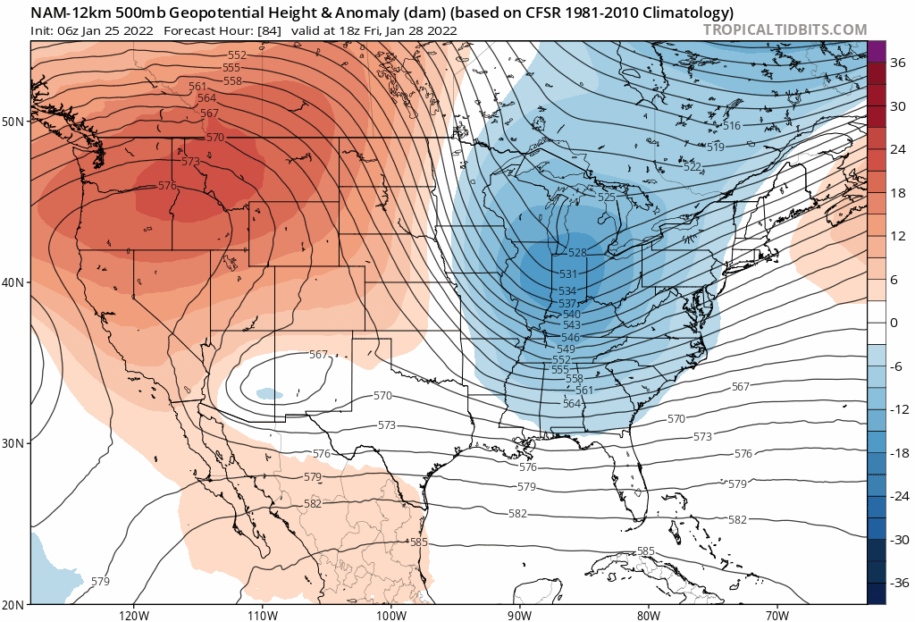
SLP bombs from 1004 to 966 in 24 hours… hot damn.- 4,130 replies
-
- 3
-
-

-
- prime climo
- cold canada
- (and 1 more)
-
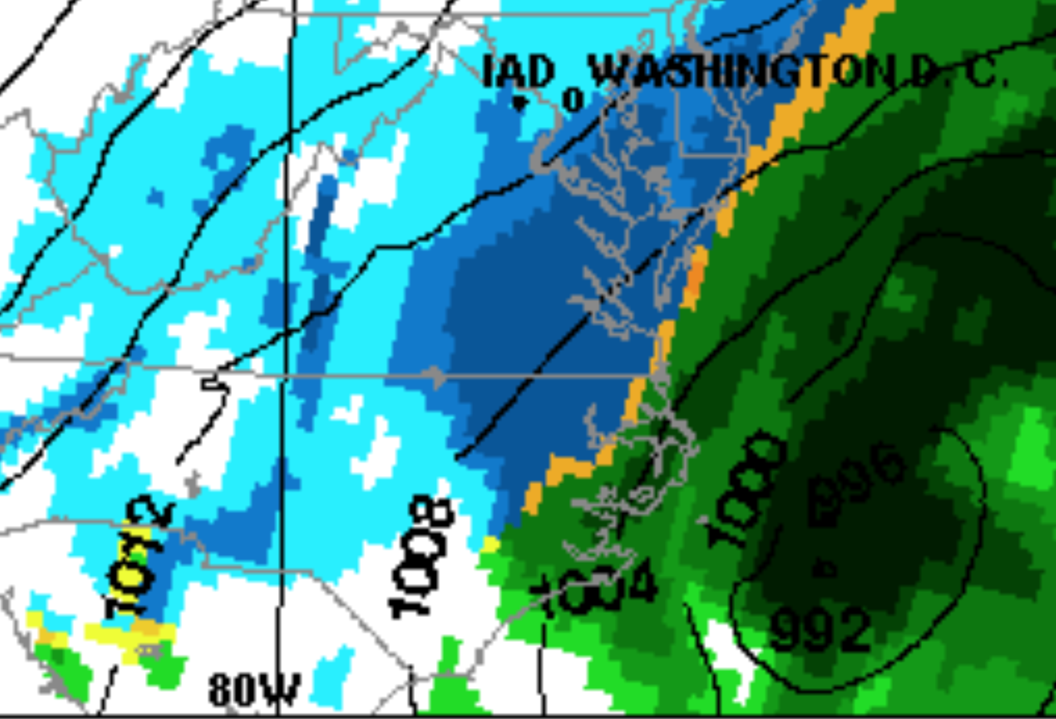
Jan 21 - 22 Weekend SE VA and Eastern Shore Snow
SnowDreamer replied to stormtracker's topic in Mid Atlantic
I agree that the difference is more apparent at the upper levels, but even at the surface you can see the LP is a bit stronger and holds on longer before being shot OTS vs 18Z.
-
You guys are giving up on the run so soon lol. I see a pretty big shift at h5 hr 81.
-
DCA probably going to break through 22F tonight… wonder if this streak is still alive?
-
Someone correct me if I’m wrong, but I’m pretty sure snowfall maps are made with mean at the very end. This is why you’ll sometimes see a mean of 1” snowfall when 1 member has a blizzard but the others have 45 degrees and sunny.
-
Holy crap they finally used the bottom right corner of the matrix! Day made.
-
@Eskimo Joe I love the “relatively on track for now” relatable…
-
I feel like I'm close to the oven for a lot of storms...
-
Taking this to banter, but can anyone explain or justify this man’s maps? Why are they habitually very bullish and (perhaps more importantly) why does his constituency not skewer him for constantly busting? Maybe it’s just MBY, but I usually see 2” less than is on these things. I just don’t get it.
-
FCPS said this: Across Fairfax County, we continue to receive reports of roadways, sidewalks and pathways that remain unsafe for our students.
-
FCPS caved for tomorrow
-
NOHRSC seems to be on the fritz. Looked accurate last night but now makes no sense…
-
Does anyone know the most effective path to local NWS & spotter totals on the LWX site? I know it exists somewhere and I want to bookmark it.
-
Power is flickering here in Fairfax, but I’ve just passed 9”!
-
Yeah the radar looks like an exit is coming soon for us all.


.png.d6de7ade2723e4a825cca603baa22017.png)

.gif.f59c88bc032d24e36ee63fa78090bcd1.gif)