
SnowDreamer
-
Posts
436 -
Joined
-
Last visited
Content Type
Profiles
Blogs
Forums
American Weather
Media Demo
Store
Gallery
Posts posted by SnowDreamer
-
-
1 hour ago, H2O said:
It doesn't seem too far off the others to my untrained weenie contact wearing blueish eyes
Non-native speakers unanimously voted this was where they gave up on the English language.
-
 2
2
-
-
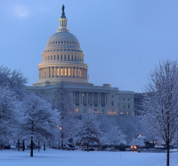
Alright I got the one, you guys! GEPS 00Z member 19. 53" at DCA
What's bigger than a BECS?

-
 2
2
-
1
-
-
No the Euro hasn't been super consistent on the snow totals. But tbh I think the most consistent clown maps have come from the para. It certainly looks more consistent than the euro on these maps, but obviously the clown maps aren't the defining characteristic of consistency.

-
Just now, Maestrobjwa said:
I guess I'm nervous because the euro was the only one that got yesterday's suppressed storm track right. Wondering if we start seeing the other models get more and more suppressed...maybe that's my fears talking, lol
I think overall it's a good sign that people have been sweating on both sides of the coin recently. There was concern by many when Euro was spitting out those huge maxes in PA with lots less in NoVA. Still have a good 36 hours for things to shift before we really get into the short range.
-
I think consensus is that we all take the Ukie

I'm still just thrilled at the likelihood of warning criteria tbh.. Which I would have to think is very very high atm.
-
This could be a really big run for metros.
SLP not going anywhere at all from 80-90.
Eta: gets pushed straight East after.
-
WAA definitely thumpier than 12Z or 18Z @ hour 72.
-
Ukie beatdown right through the heart of the forum. Abscond
-
1
-
-
1 minute ago, nj2va said:
This is a 150% weenie assessment but if you assume the thermals are jacked because 1) it’s the gfs and 2) they are warmer due to the placement of the primary further north than all guidance - it leads me to believe we’d see more snow (and sleet) than depicted.
I think that's the conclusion, yeah. If the thermals are indeed wrong, more snow and sleet, less rain. But honestly I'm just waiting for it to cave instead of trying to figure out how it's wrong.
-
1
-
-
Just now, psuhoffman said:
What’s that word again?
friend?
-
2
-
-
-
Not sure where to put this, but why do some models run shorter than others? This sounds like a dumb question as I'm typing it, but bear with me. If they wanted to run the NAM 12K out to 120 or 180 I don't see why they couldn't. I know that the long range verification scores would be crap. Is it a computing allocation issue, or is that the physics aren't good enough to handle longer lead times so why bother?
-
Just now, Maestrobjwa said:
So now hang on...we gonna have a model camp we're concerned about a late transfer on one end, and suppression/missed transfer on the other? Lol Fun times
There's no shortage of threats to the happiness of a true weenie. In all seriousness, we've seen more runs with late transfers than suppression issues. I know the drum of trend on Euro is being beaten, and it's definitely a drum worth playing, but I still see more late transfers modeled than suppressed solutions.
-
1 minute ago, MN Transplant said:
NAM is also cold at the surface and 925. 850 is another story, but it is all sleet, no rain like the GfS or even Euro.
This is an important point. 925 and below is frosty, and IMO the weenie takeaway is that GFS thermals still look weird against other guidance.
-
This is a little late, but I'm shocked nobody posted this. The GEPS totals at DCA are nutso. Strongest MECS support I've seen from any ensemble so far.
I count 18/20 with 6"+
9/20 with 10"+ by 12z Tues....

-
6
-
-
-
6 minutes ago, Chris78 said:
Any body have the cmc precip maps and snow maps?
Cmc took a dump on TT and pivotal .
I can't find maps anywhere atm. Meteograms for DC looks pretty good. 30mm = 1.18 inches QPF as snow

-
1
-
-
Ukie a sudden contendor for most-hugged model for the NoVA/DC crew.

-
2 minutes ago, psuhoffman said:
There are some subtle differences that would help. I only see a couple members that tuck into the Delmarva like the op. The rest are at the perfect position for us just off the Delmarva coast. That would help with the mixing and getting the ccb wrapper tighter and not blowing off the the NW like the op.
the op was a northwest outlier among the ensemble members.
Big L for op

-
1
-
-
definitely warmer at 102 near DC
-
 1
1
-
-
Just now, ers-wxman1 said:
Ashburn. I went from 25 to 13. Suing PA for taking my digital snow.
I went 15 to 8... wanna start a class action?
-
1
-
1
-
-
Sits on or next to delmarva from 111 to 129... wow. Slightly too far north for D.C. crew, best banding sets up in MD, PA.
-
DC back to snow at 114
-
Agree, huge movement on the GEPS. Big changes wrt comma shape and heaviest snows. Looking very euro tonight vs last several runs.

-
2
-


Jan 31 - Feb 1 Event - STORM MODE THREAD
in Mid Atlantic
Posted
Yes, but at this range I'd be really concerned for the GFS if it didn't