.jpeg.fb71a75fc71475b59e72598d4a9a6f88.jpeg)
TJW014
-
Posts
1,082 -
Joined
-
Last visited
Content Type
Profiles
Blogs
Forums
American Weather
Media Demo
Store
Gallery
Everything posted by TJW014
-
Too bad, I'll be out scouting the snow tonight/tomorrow. State Police only posting because their Durangos and Tahoes only have 8" of ground clearance. I have 15"
-
Nearing blizzard conditions along the shore. Sustained 30-35, gusts to 45 mph. Gonna go out and have fun in the go kart and sleds for a few hours.
-
5:30 PM. 2.5". 1" on roadways. SN/+SN
-
1" on cold surfaces. beginning to stick on sidewalks and roadways. Visibility down to 1/2 mile. Mdt to hvy snow.
-
About 0.5" on non paved surfaces. Updates may be sporadic. Currently well under the influence at the brewery lmao. $1 beers ftw
-
35 air temp
-
Snow beginning to stick to cold surfaces
-
I and @Volcanic Wintermay have a chance at breaking the all-time snow record here in Toms River. Current record was 24.5" from Boxing Day 2010. 24.0" was measured from the Blizzard of 1996. NWS has us for 27" currently
-
We're very lucky it's not a new/full moon
-
What fantastic timing for the boiler for or baseboard heating to blow. Going to be at least a week or two before the new boiler arrives. Oh what fun!
-
Yardstick has been purchased. A ruler will do no good
-
Great, now you just jinxed KDIX
-
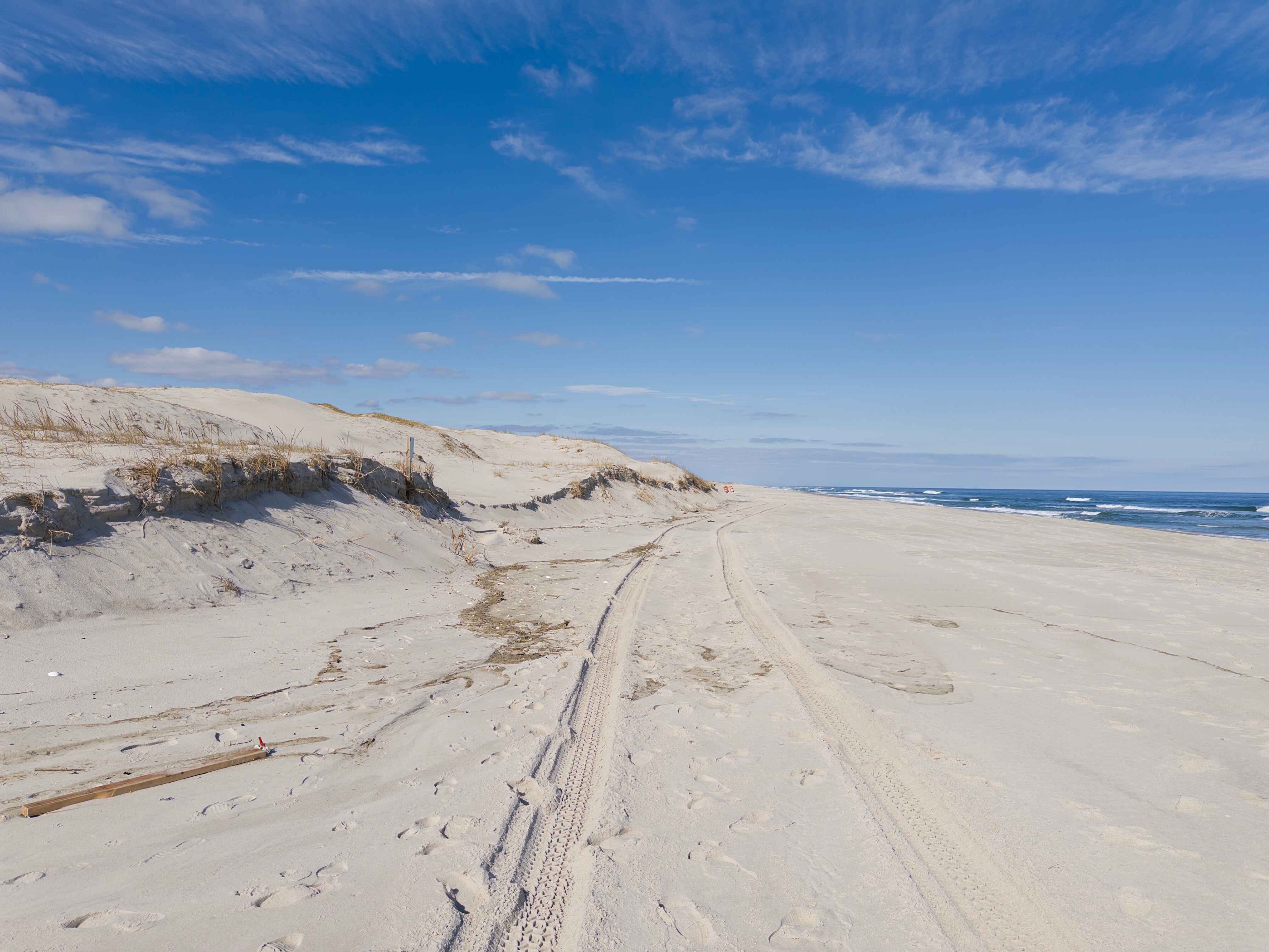
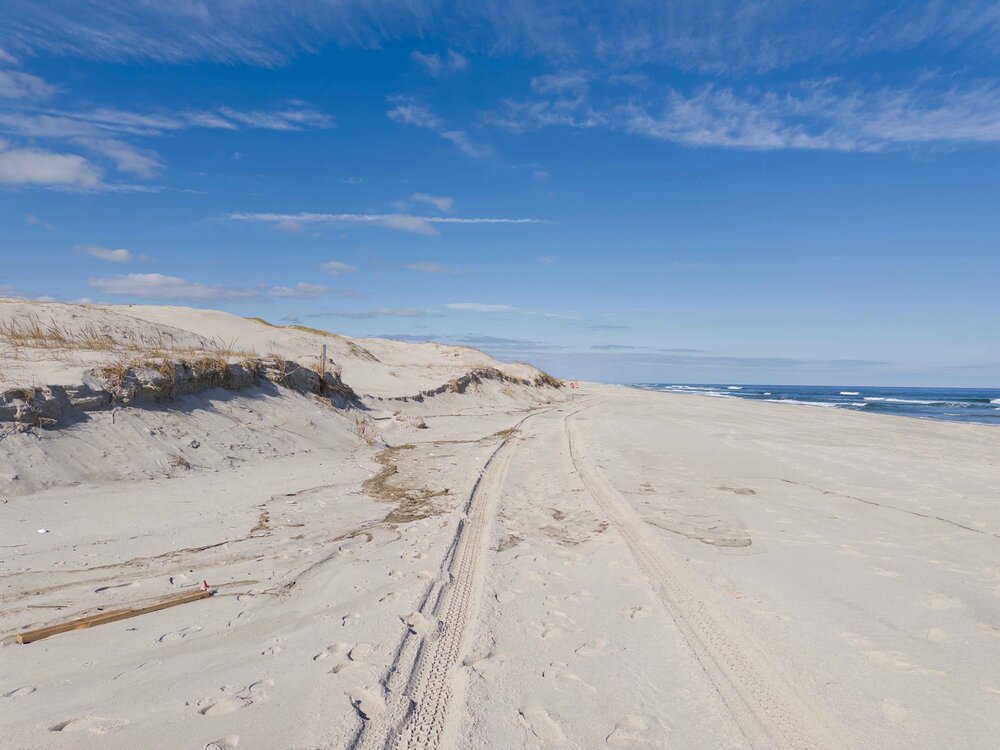
Calm before the storm. Sun feels great, even had the windows down driving along the beach. Got my photogrammetry flights in with the drone, building maps now. Beach is gonna look a whole lot different in 48 hours.
-
3" of QPF will be great for the drought.
-
HRRRicane
-
And it's still snowing
-
You'll be fine. Even once it snows, it's going to take some time to cool the road surfaces enough for snow to stick. After 4 PM I'd stay off the roads. I have friends coming in from Sunday River (8.5 hour drive) They will be back by 4:30 tomorrow
-
I'm going to try and get into IBSP Monday (research purposes). I feel somewhere between there and Squan will be the bullseye. Matter of finding somewhere that doesn't have massive drifts
-
See, you understand! Haven't had a 10+ snow since 2018 (I wasn't here for Jan 2022)
-
98. 100 is SR-33
-
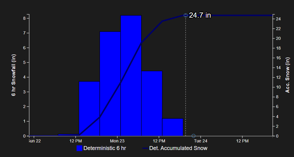
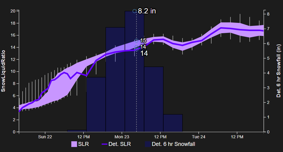
2-29 inches. What a spread lmao
-
NBM is 28.1" of snow for here. Would be biggest storm since Boxing Day. Going with 18" for here.
-
Yeah, yeah, I'm using the NBM here, but these numbers are just incredible. Pretty awesome site: NBM 1D Viewer
-
There is not a single model showing less than 12" for me. Mean average is 20". That's incredible.
-
He'll have 20" in his backyard and still call it a successful forecast
.thumb.jpeg.f5c6ba9d911ec96b3b124f8606aee58e.jpeg)