.jpeg.fb71a75fc71475b59e72598d4a9a6f88.jpeg)
TJW014
-
Posts
1,105 -
Joined
-
Last visited
Content Type
Profiles
Blogs
Forums
American Weather
Media Demo
Store
Gallery
Everything posted by TJW014
-
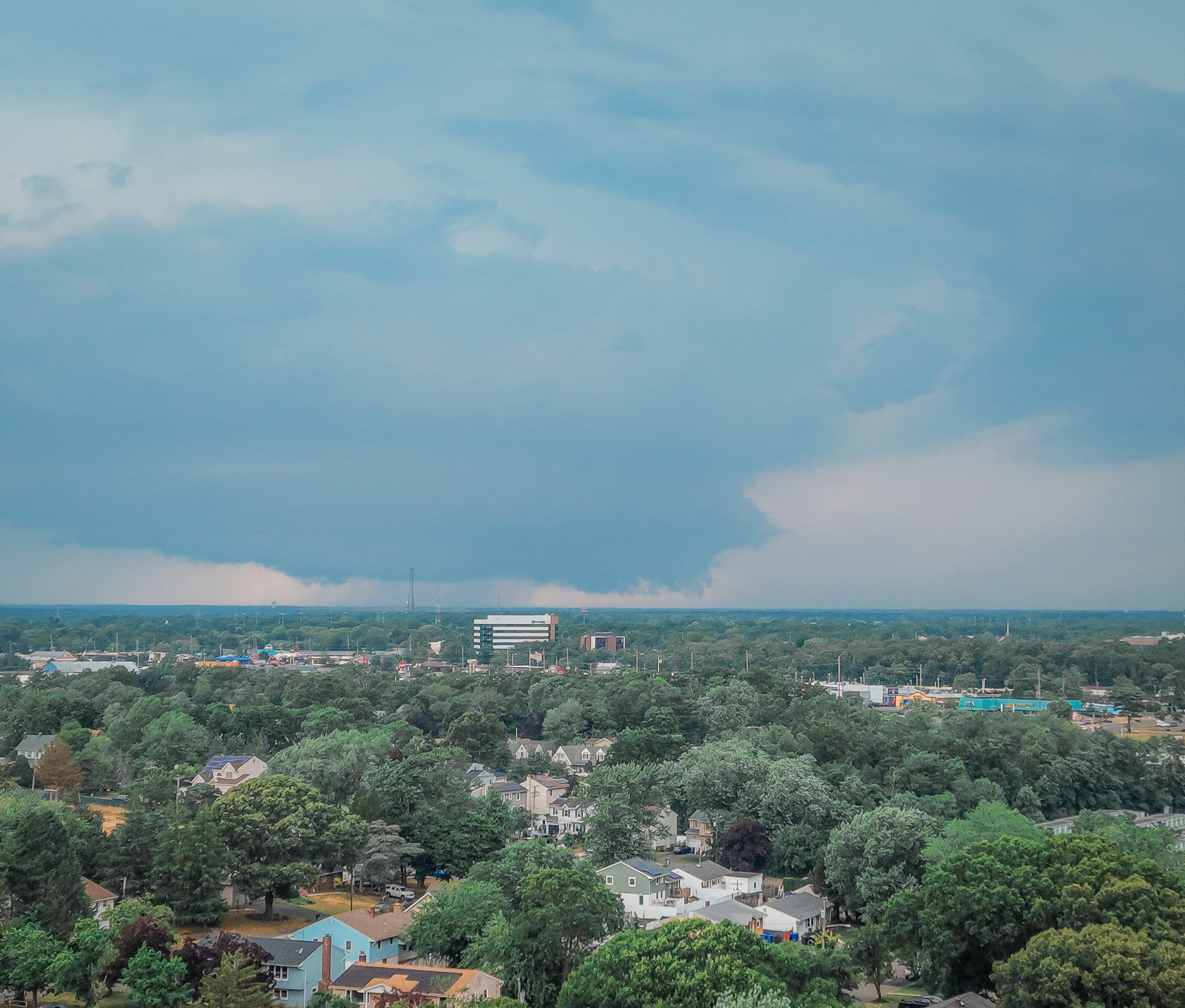
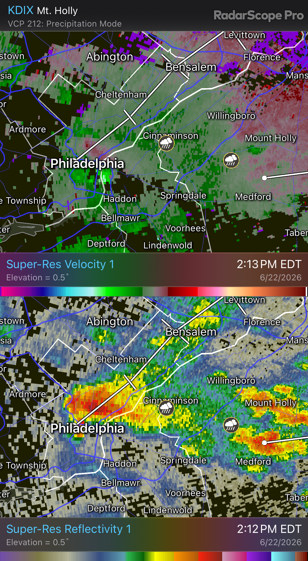
Pretty decent rotation on the one cell that popped up over PHL moving NE
-
This will yet again be a <0.10" event, maybe even nothing here.
-
Echo tops collapsing. Looks like a good soaking at least...
-
Anything that will have the potential to be severe needs to pop off between now and sunset. "Squall" line comes in too late. Sea breeze storm euthanasia is well inland here.
-
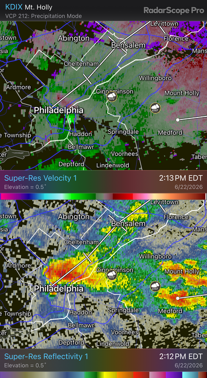
Storm tops already collapsing on that squall line south of Route 80.
-
Most won't see rain till Sunday
-
Epic drought continues. 0.03" from last night. 1.62" since May 1st. 3.53" since April 1st Decent shot some of us go bone dry till Sunday evening.
-
41 this morning so far. Might crack below 40.
-
Waterfront in Toms River
-
Not a drop of rain. Epic drought
-
Water's still ice cold. Garmin watch read 56 degrees during our 4 hour surf session at sunrise. I'm still in a 4mm wetsuit.
-
Gonna be a perfect fishing/bonfire evening at the beach later.
-
Soupy out. DP up to 72
-
Let's see what this fire hose band does. So far, only 0.68" in the bucket. Maybe we'll break 1"
-
Pretty pathetic. 0.41"
-
Theme for pretty much the last two years... QPF overmodeled
-
Drying off after a sunrise surf session. Water temp 47.2 28 degree air temp difference from the boardwalk to the ocean (150 yds)
-
Water is 48 in Seaside Park based on my Garmin watch and a little aquarium thermometer I stuck to my surfboard. Still in a 4mm wetsuit plus boots and gloves.
-
96 at the house. 67 at the beach 2 miles away. Beaches are pretty busy. Lots of shoobie plates.
-
Free skin exfoliation promo at the beach. Peak gust of 47. Pretty significant uptick over the last hour
-
No A/C units installed yet. Thermostat reads 87
- 970 replies
-
- 1
-

-
- april showers bring may..
- rain
- (and 2 more)
-
It's 89 at home. 3 Miles away on the beachfront it's 61.
-
77 here. 50 along the waterfront
-
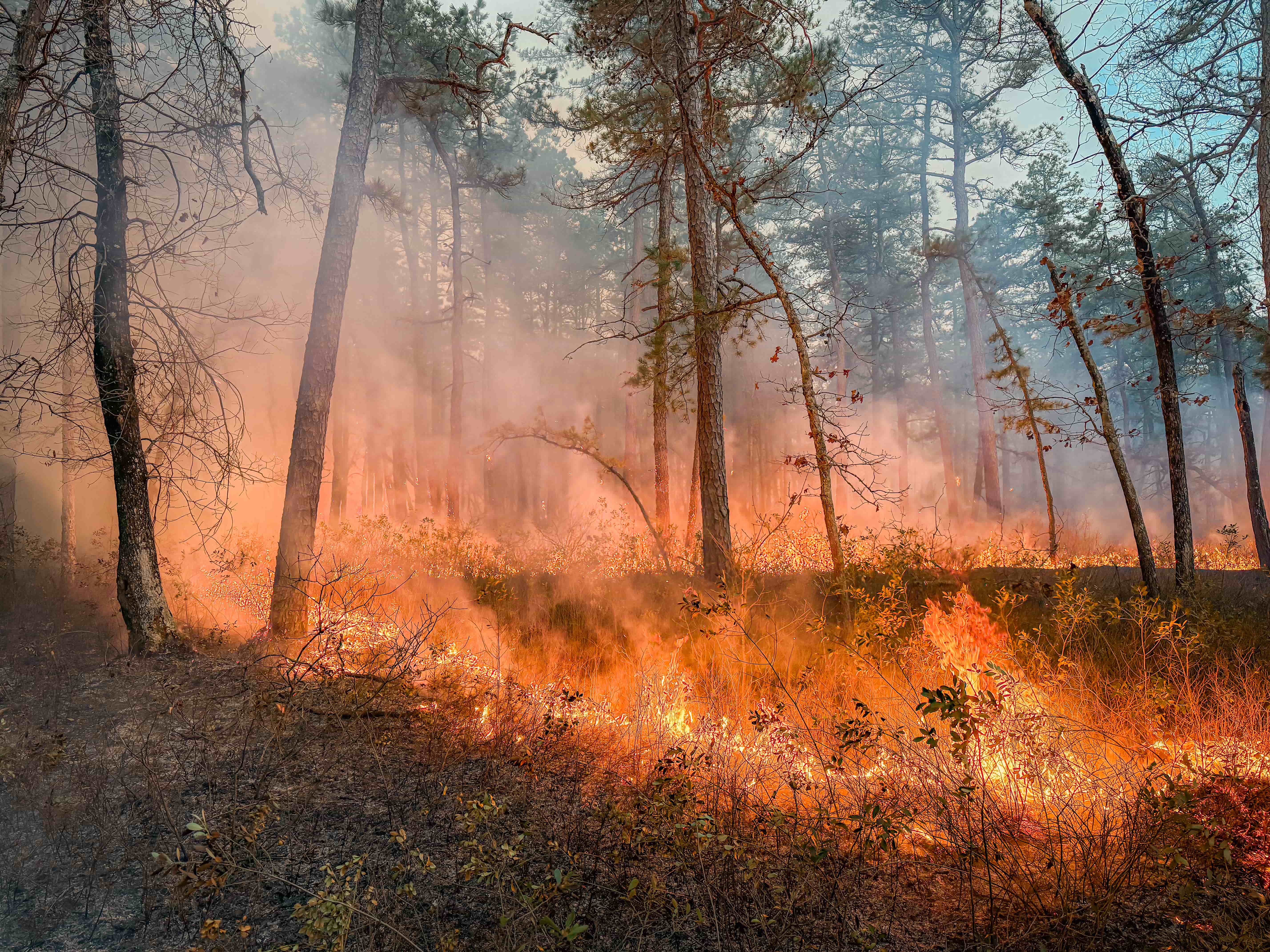
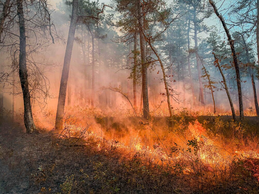
Took a ride yesterday evening through the Pine Barrens. Rolled up on an active prescribed fire area. There was a recently cut fire break, so I decided to get out and follow it to an orange glow in the distance. I made it to the active burning area. The sounds- the roar of the flames and the endless snaps, pops, and crackles were incredible (and I'd be scared shitless if it were an actual wildfire). It's really cool seeing how fire creates its own microclimate. Wind was otherwise calm around 7 PM but within about a 50 yard radius, the wind was significant stronger, hotter (obviously) and progressed the fire quickly (moving at about 50 feet per minute)
.thumb.jpeg.f5c6ba9d911ec96b3b124f8606aee58e.jpeg)