cptcatz
-
Posts
1,109 -
Joined
-
Last visited
Content Type
Profiles
Blogs
Forums
American Weather
Media Demo
Store
Gallery
Everything posted by cptcatz
-
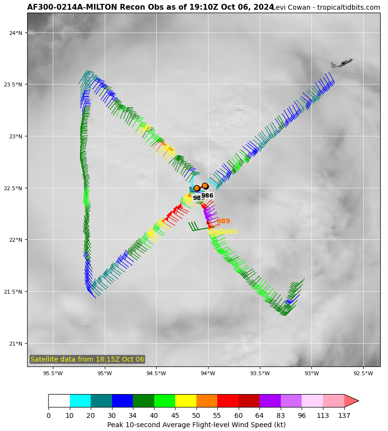
Recon recorded wind speeds really don't support an increase. These last two passes are actually a tad weaker than the first pass of the evening. Could be flattening out now.
-
Airliners are flying at 37,000 feet, well above the storm that far from the center.
-
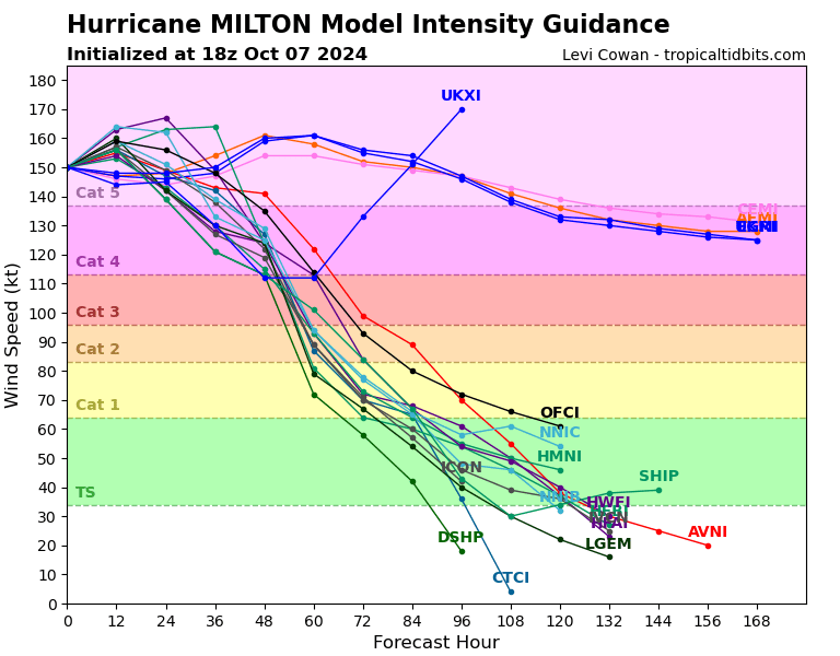
Interesting thing I just noticed. Assuming UKXI is drunk and not including that, there are still four models showing this staying as cat 5 for another 108 hours. Anyone know what those models are seeing that the others aren't?
-
The only thing that bothers me is when there are two planes in at the same time and then none for a few hours. Like why can't they stagger them?
-
Anyone know when the next plane takes off?
-
Unfortunately that's an upper level dropsonde mission. Will be good for forecast but not to get updated storm data.
-
Wow amazing recon data. Gotta think a NHC upgrade is imminent. Question is what will they put it as. 150 mph?
-
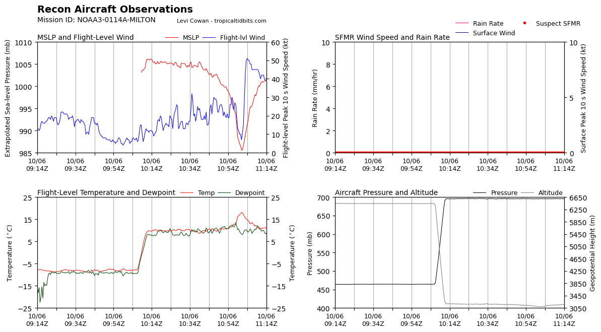
943 MSLP just recorded in this pass. Jesus...
-
I wonder if that blip in altitude was intentional when they punched through the eye or if they just got rocked by the eyewall.
-
Cancun has a radar which may pick up the eye depending on how close it gets https://smn.conagua.gob.mx/es/observando-el-tiempo/radares-meteorologicos-separador/visor-radares-v3
-
I'll add that the weakening of the eyewall but expanding of the windfield, especially in this area of the Florida peninsula, is that it could cause more widespread power outages across the state. Kinda like comparing Charley vs Irma. Charley hit as a tiny 150 mph storm and caused catastrophic damage in basically a 10-mile wide swath, but not basically no impacts outside that swath. Whereas Irma hit the peninsula as a massive 115 mph storm but caused 7.7 million customers to lose power, equating to 73% of the state. So if Milton loses its punch in the eye but expands its tropical storm force windfield causing more widespread power outages in the metros of the Florida peninsula, it's kind of a wash.
-
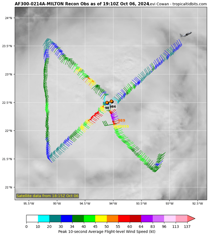
989 to 986 between passes in about an hour and 20 minutes. If it keeps up this rate I don't think the low 900s is out of the question tomorrow.
-
75 knot flight level wind. Should be a hurricane now.
-
Pretty sure every recorded storm has this graphic available on Wikipedia
-
This is ridiculous to say. First of all, Milton seems to have a higher ceiling with multiple models showing possible cat 5. Even if it weakens before landfall the surge will still be there (see Katrina). Second, Helene's surge was over swamp land of the big bend while Miltons will be over developed beachfront properties. Third, even if it hits south of Tampa and spares Tampa Bay, that likely means Fort Myers gets the worst of it which is just now starting to bounce back from Ian. So basically it's a tossup between surge destruction in Tampa Bay or in Fort Myers, either of them will be bad.
-
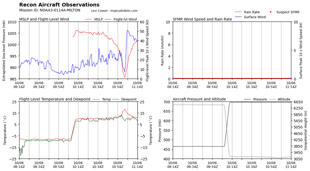
So recon just marked it at 993 mb. NHC had it at 1003 mb. This is going to get interesting. And this probably belongs in the other thread but GFS now has multiple runs showing another major hurricane hitting florida the following week...
-
Wow recon is showing it much stronger than we thought! Those hurricane models could be on to something...
-
Is this the most frightening model image seen in a long time?
-
GFS coming in even stronger. 956 mb at hour 66
-
They both came from the south but Ian and Charley both moved across the state from west to east.
-
Wow that's like legit close to being a tropical storm already. Nice thing about this tracking so close to the CONUS for its entire life will be we should get lots of recon flights. Hopefully they start flying soon.
-
2024 Atlantic Hurricane Season
cptcatz replied to Stormchaserchuck1's topic in Tropical Headquarters
I got 3.2 inches of rain this morning in 2 hours here in Boca Raton. Strong thunderstorm just sat over the Broward/Palm Beach line for two hours. -
2024 Atlantic Hurricane Season
cptcatz replied to Stormchaserchuck1's topic in Tropical Headquarters
Euro coming in way stronger -
2024 Atlantic Hurricane Season
cptcatz replied to Stormchaserchuck1's topic in Tropical Headquarters
I live in Palm Beach County and have recorded up to 15 inches of rain in two days without any flooding whatsoever in my area. But then you have places around Fort Lauderdale which floods like crazy. The geology is pretty similar (they have shallower limestone further south compared to our sand but that limestone is super permeable so I guess it has to do more with their pavement and lack of runoff options. -
2024 Atlantic Hurricane Season
cptcatz replied to Stormchaserchuck1's topic in Tropical Headquarters
Euro and GFS both now show a solid tropical storm with a high 980s pressure approaching Florida. Would be bad if it brought surge back into Tampa Bay.