OrdIowPitMsp
-
Posts
2,819 -
Joined
-
Last visited
Content Type
Profiles
Blogs
Forums
American Weather
Media Demo
Store
Gallery
Everything posted by OrdIowPitMsp
-
Just flipped to snow here. Still thinking 3-4” with a solid ice/slush base from the 0.36” of rain earlier
-

Nov 28-30th Post Turkey Day Winter Storm
OrdIowPitMsp replied to Chicago Storm's topic in Lakes/Ohio Valley
I recall 2004 being a surprise white Thanksgiving. Rain changed to snow. -
Nov 28-30th Post Turkey Day Winter Storm
OrdIowPitMsp replied to Chicago Storm's topic in Lakes/Ohio Valley
I should be in line for a nice snowpack refresher/boost with this one. Have models taken into account the snowpack that will be laid down across MN/WI tonight? Perhaps that will drive the baroclinic zone a tad south for the Chicago peeps. Never underestimate WAA though…. -
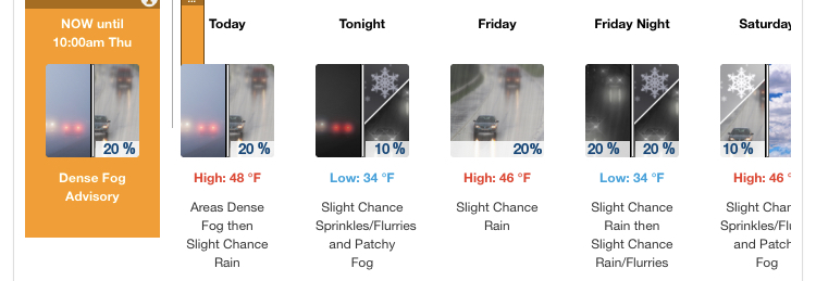
Dense fog and scattered showers this AM. Upgraded to a WSW overnight. I’m still only expecting 3-4” imby but with the combination of wind, busy travel period, and the first significant snowfall of the season I understand why the NWS felt like upgrading most of the southern half of the state.
-
First WWA of the season, so there’s that. Whatever sticks should have staying power. @weatherboif you are out there this should be a good one for you.

-
One last day of record warm temperatures before reality sets in. Getting the last of the yard work completed and tracking 3 systems, life is good.
-
Fantasy land on the GFS looks really good for the upper Midwest, but time will tell if it’s a trend or mirage. 0.03” of precipitation in November, something has got to give.
-
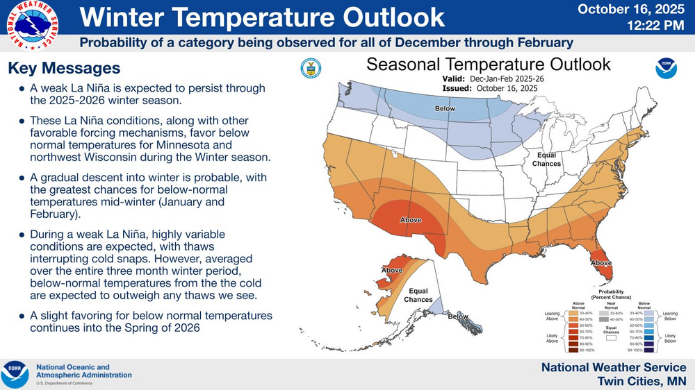
Fall 2025 Medium/Long Range Discussion
OrdIowPitMsp replied to Chicago Storm's topic in Lakes/Ohio Valley
Worrying that there is only a slight risk over the Rockies. Snowpack in Colorado is near record low for this time of year. -
Close call for the Twin Cities tomorrow. Bad thermals and a razor sharp northern edge.
-
Temperatures have overachieved today and we’ve set a new record high in Minneapolis. 72 breaking the old record of 71
-
- 236 replies
-
- 11
-

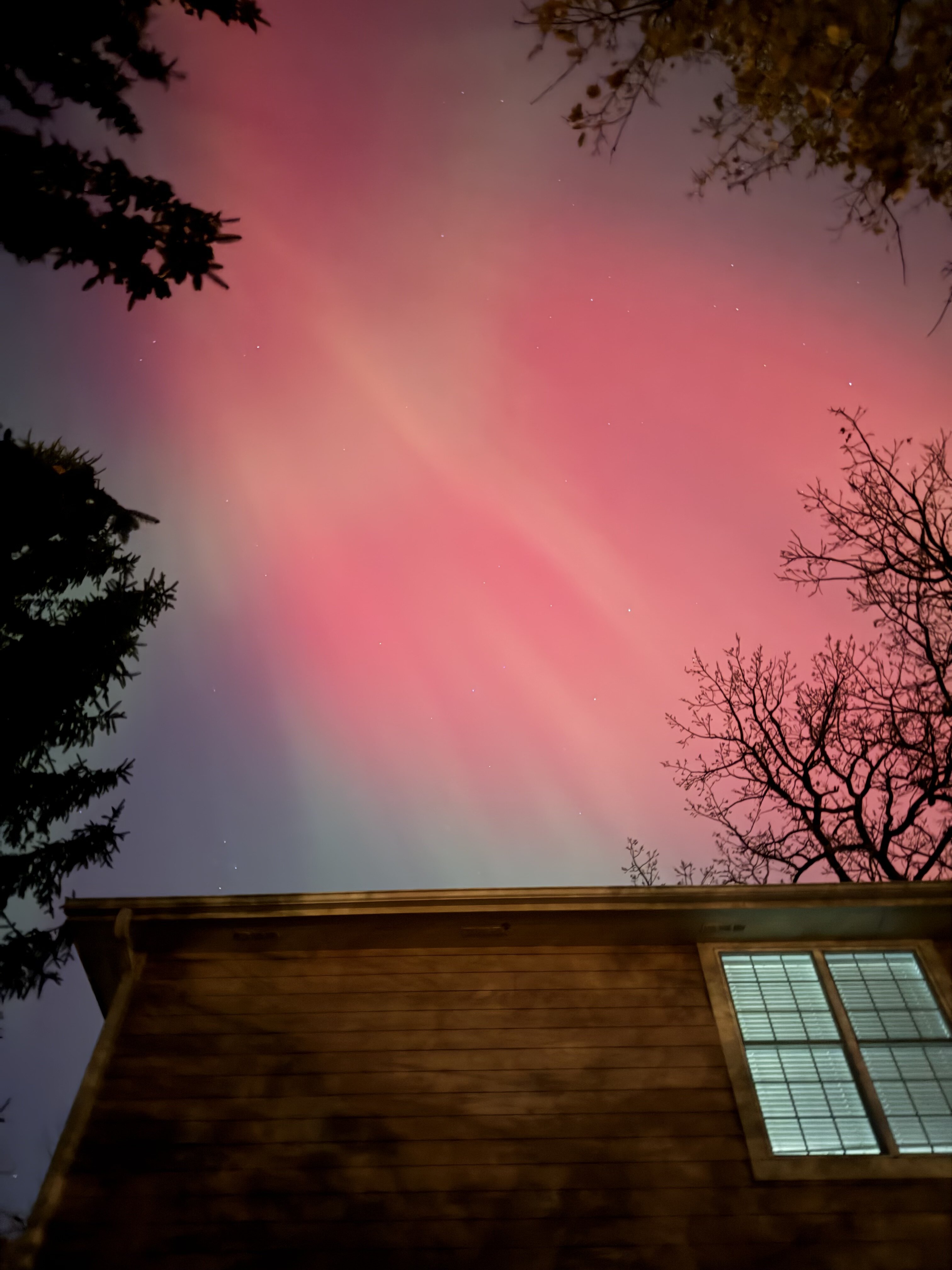
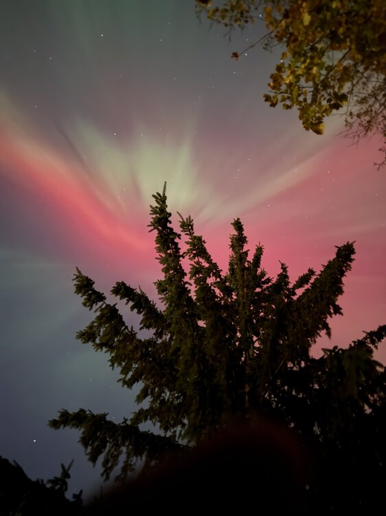
-
Holy cow, very bright and directly overhead, visible to naked eye in the city.
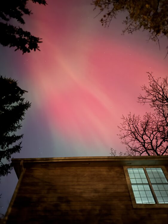
- 236 replies
-
- 10
-
-
11/8-11/10 First Snow and Lake Effect Event
OrdIowPitMsp replied to Geoboy645's topic in Lakes/Ohio Valley
https://www.earthcam.com/usa/illinois/chicago/wrigleyfield/?cam=wrigleyfield_hd -
Dusting overnight. First official flakes of the season at MSP.
-
11/8-11/10 First Snow and Lake Effect Event
OrdIowPitMsp replied to Geoboy645's topic in Lakes/Ohio Valley
What is the all time November snowfall record for Chicago? -
Completely. It’s not snowing in Oklahoma or Texas.
-
Miss south, suppression to start the season. Our time will come.
-
Fall 2025 Medium/Long Range Discussion
OrdIowPitMsp replied to Chicago Storm's topic in Lakes/Ohio Valley
MSP finished with 90.3” in 2022-23 which is 3rd snowiest on record. The WFO office in the western suburbs surpassed 100” -
Watching the first potential action of the season bump south with each GFS run. Model mayhem season is underway. If anything falls here this weekend it will most likely be frozen.
-
It wouldn’t be Halloween in Minnesota without a chance of seeing some snow.
-
30 at MSP. First official freeze at the airport.
-
Frosty 34F at MSP. Coldest low of the season at the airport. Car thermometer read 31F at the office this morning.
-
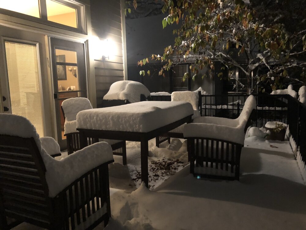
Five years ago today I woke up to this. 7.9” at MSP the 2nd largest October snowfall on record.
-
Damp and chilly today. First sub 50 high of the season likely.
-