Waiting on snow
-
Posts
406 -
Joined
-
Last visited
Content Type
Profiles
Blogs
Forums
American Weather
Media Demo
Store
Gallery
Everything posted by Waiting on snow
-

December 8-10, 2018 Winter Storm
Waiting on snow replied to Orangeburgwx's topic in Southeastern States
Yes climo is a beast. Gonna be a lot of disappointed people if they model hug. The south trend will cease and the nw jog will commence in a day or two. Then once we get within 72 hrs the totals will come down to realistic totals. Climo favored areas north of 85 in SC and NC would be my guess at this point. And a few inches at max. -
December 8-10, 2018 Winter Storm
Waiting on snow replied to Orangeburgwx's topic in Southeastern States
Exactly! At 6 days out I don't see how anyone can say this is a slam dunk. Maybe this is in fact different with such a strong signal. But I personally will hold off on my excitement. -
Southeast Sanitarium - A Place to Vent
Waiting on snow replied to Jonathan's topic in Southeastern States
Almost that time as we turn the corner to December. It's no longer too early to snow. Now we begin with the "models are underestimating the wedge, it'll make it's own cold air, still plenty of time to trend back south, wait until the storm is on the west coast for a sample, the Euro is useless time to watch short range models, and I'm sure many others. Lmao should be a fun ride. -
Southeast Sanitarium - A Place to Vent
Waiting on snow replied to Jonathan's topic in Southeastern States
Yes and that was a terrible, snowless winter up and down the east coast. One freak 1000 year snowstorm hitting the SC lowcountry doesn't mean anything in the big picture. -
Southeast Sanitarium - A Place to Vent
Waiting on snow replied to Jonathan's topic in Southeastern States
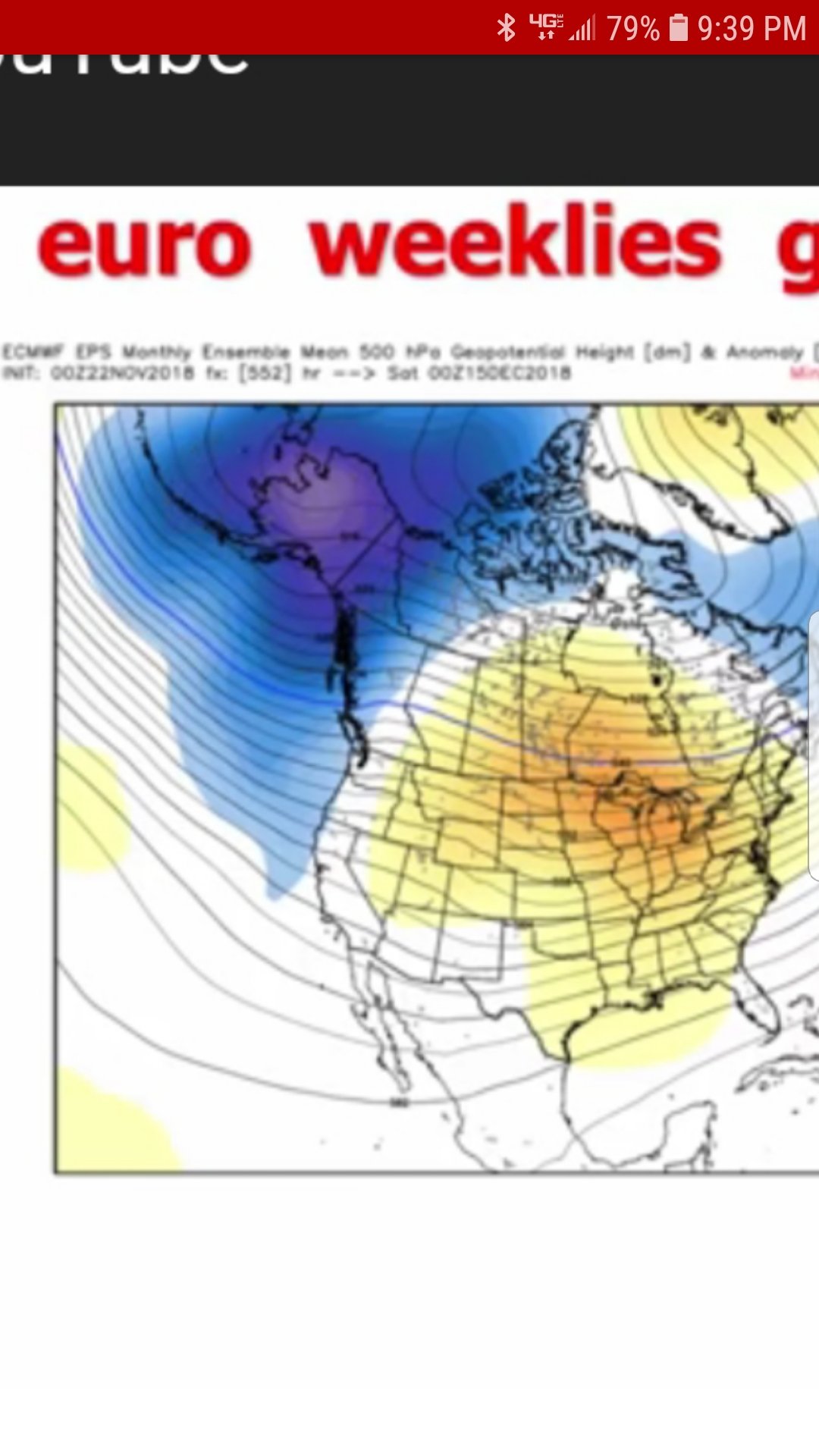
I don't think so. Looks like a ++EPO which is bad.
-
Southeast Sanitarium - A Place to Vent
Waiting on snow replied to Jonathan's topic in Southeastern States
I don't know about the EPS, but the weeklies are awful the second week of December. Has a gulf of Alaska low. My limited knowledge tells me though once that feature is established its stubborn as the SER. I hope it doesn't pan out. -
Southeast Sanitarium - A Place to Vent
Waiting on snow replied to Jonathan's topic in Southeastern States
Since we are rapidly approaching meteorological winter I figured it's time to kick this thread up again. The edge of the cliff will fill up fast soon! -
The Icon and GFS have it 6 days out! Lock it down I'm headed for MHX!!!
-
Southeast Sanitarium - A Place to Vent
Waiting on snow replied to Jonathan's topic in Southeastern States
At least you don't live in CAE. No accumulating snow in 4 years and got f***** again today. Way past the point of ridiculous. -
Southeast Sanitarium - A Place to Vent
Waiting on snow replied to Jonathan's topic in Southeastern States
Sad thing is most of the se has had a memorable winter regardless of what happens next. But as usual and epic dumpster fire for CAE. This place can't buy a flake of snow anymore so I welcome the warm pattern. The results end up the same anyway.
-
Southeast Sanitarium - A Place to Vent
Waiting on snow replied to Jonathan's topic in Southeastern States
99% of the time it's cold and dry or warm and wet. Can't defeat climatology around here. Just proof that cold patterns don't give any better chance than any other pattern. Especially here in CAE. It's all just damn luck when something comes together down here for me. -
Southeast Sanitarium - A Place to Vent
Waiting on snow replied to Jonathan's topic in Southeastern States
No sir, Columbia SC has that honor. Hadn't seen accumulation snow since Feb. 2014 and every time it's just 50 short miles to the northwest.