KoalaBeer
-
Posts
637 -
Joined
-
Last visited
Content Type
Profiles
Blogs
Forums
American Weather
Media Demo
Store
Gallery
Everything posted by KoalaBeer
-
Pretty sure I measured 28” on the west side of town. Used to have a good yardstick photo of that one....but some spots on the other side of Rt 213 and into Haverhill/Bradford had some 30+” reports. Ski Bradford with the jackpot that day lol.
-
About to pour a collab they did with Vitamin Sea. Can’t wait to try it.
-
Ditto this. I've only ever been on a board my whole life but managed a ski/snowboard shop for 5 years before getting out of retail. I would really push the customers to budget out most of there money on boots first whether on skis or a board. You could have the best skis and bindings on the market but if your boots suck you're going to have a bad time. Although I got to say 400-500 days on those boots!? I hope you changed out the toe and heel lugs man those wear down and cause bindings to not release properly. Snowboard boots are 100 days max in my experience but they also aren't made up of hard plastic. Damn I can't wait for the season to get here....
-
 Might as well revive this thread as it looks like the tropics briefly turn active in the WPAC and BOB. TD 01 in the looks like it should make landfall in the Philippines as typhoon as conditions look quite favorable ahead of it as it tracks around the subtropical ridge. The ECMWF solution in the BOB is what really grabs my attention however. It's never a good thing when the Euro is showing a storm as such in this region. Long ways out on that one so things will most definitely change, but the potential is there.
 -
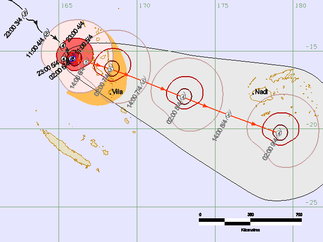
Cat 5 landfall imminent? Waiting to see if it clears out that eye completely.
-
Station went down before the worst hit. https://www.jma.go.jp/en/amedas_h/yesterday-93062.html?areaCode=000&groupCode=65
-
I'm not so sure about that. The radar suggests they only clipped the outer part of the eye wall. I'm sure it was still a rough ride but not as hellacious as that inner eye wall.
-
How about that for a trochoidal wobble.
-
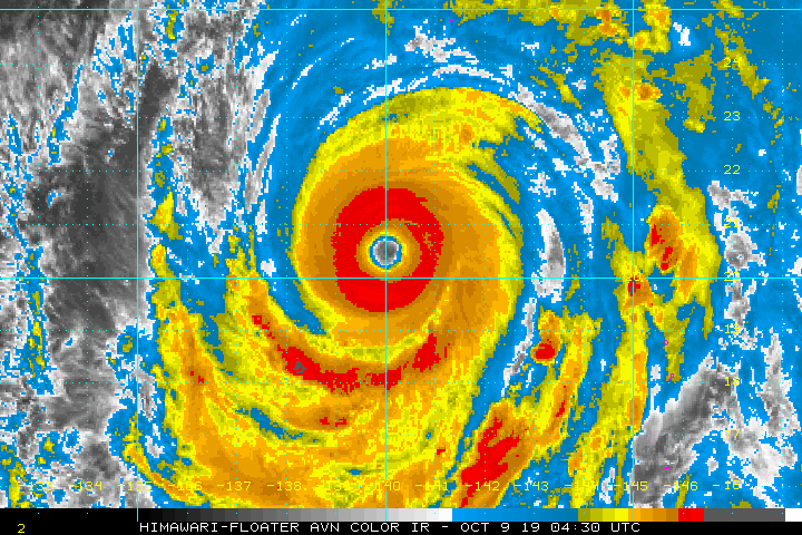
Fani is putting on a hell of a show right before landfall CI# /Pressure/ Vmax 6.0 / 935.7mb/115.0kt Final T# Adj T# Raw T# 6.0 6.2 7.2
-
Not looking good. Look at all the people trapped on roofs escaping the surge/flooding. https://mobile.twitter.com/miguel_carreiro/status/1107695723506737154
-
March 12/13/14 Blizzard/Winter Storm/WWA etc
KoalaBeer replied to Bostonseminole's topic in New England
In a similar conundrum myself here in Methuen. 28.3" here and 27.3" in Dracut on the NWS statement and the Methuen one was a trained spotter. I sit right on the line and couldn't find anywhere around my house over 19 inches with 10 plus measurements taken. Definitely interesting. -
March 12/13/14 Blizzard/Winter Storm/WWA etc
KoalaBeer replied to Bostonseminole's topic in New England
What would you say you have on the ground? Saw on the news 15" in Dracut but I got 9.5" here in Methuen right on the Dracut line. Been sitting barely outside that heavy band all day but really starting to rip now. Wondering if the gradient is that tight from here to Nashua.