Henry's Weather
-
Posts
1,729 -
Joined
-
Last visited
Content Type
Profiles
Blogs
Forums
American Weather
Media Demo
Store
Gallery
Everything posted by Henry's Weather
-
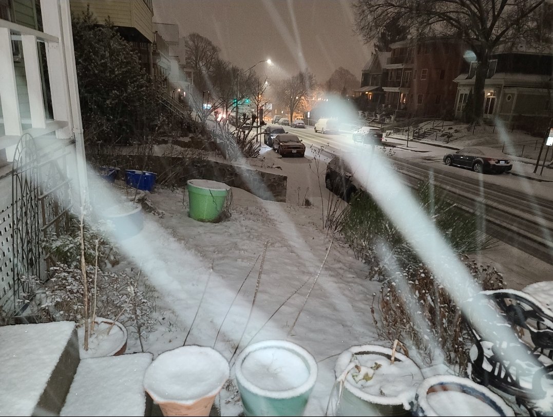
An inch or so in Somerville.

-
 although that low position would create strong easterly winds for sure - wrinkles in a strong scenario for now.
 -
goofus thermals are toasty, seems unlikely
-
You can observe both snow depth and snow accumulation. Plow guys need snow accum. and you can do whatever you want with the depth. Both are sources of data, both are meteorologically useful. No need to pick and choose other than to be consistent with record keeping.
-
Yeah, just joking. I've definitely seen that happen.
-
Yeah, DC proper might only see 36" on grassy surfaces. Meager rates there.
-
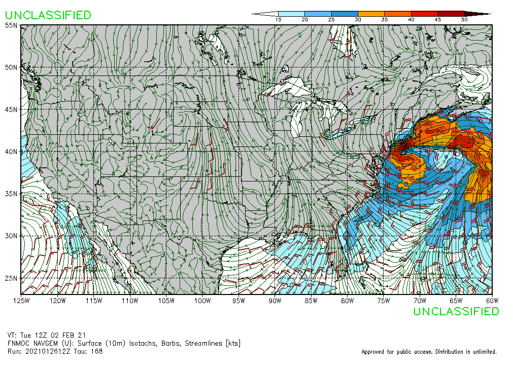
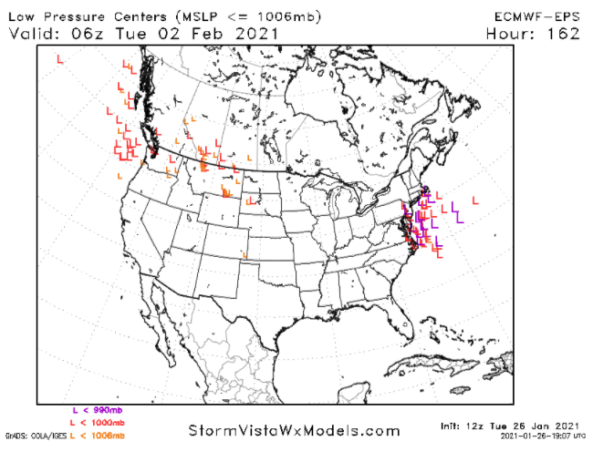
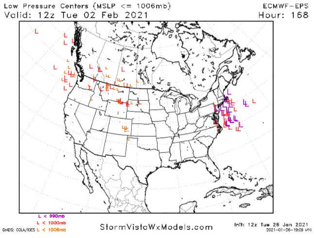
We're seeing slightly lower pressures for the indies on EPS than yesterday. Many get below 990 mb, although the majority remain above.
-
-
The main piece just stalls and new energy phases in.
-
Bonkers solution on 12z navgem

-
Is tip planning on making a thread today? Said something about it yesterday
-
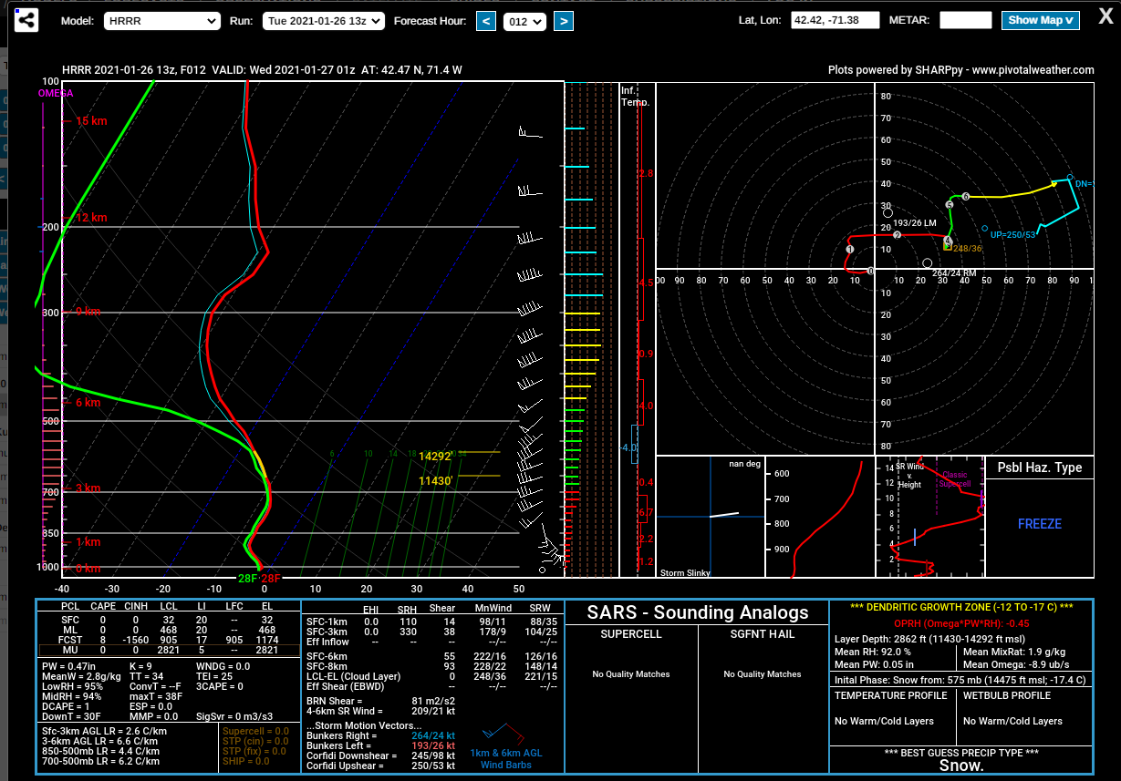
If I'm reading this correctly, there's decent omega in the DGZ, as well as decent saturation. This is 01z on the 13z HRRR.

-
If early next week goes well, can snowcover do work there?
-
that solution's gotta be feet. not out on tt yet, so can't be sure
-
eh, whatever happens will happen regardless of how many times i stay up for the euro Plus, I feel like the rarity of a significant event is lost on me when you see those weenie model outputs for days prior.
-
true that. I wish I had the will to take a break for model-watching for about 4 days.
-
we'd probably want the primary south of Chicago yes?
-
18z EPS?
-
DC gets 2 ft on the para... someone's gonna get walloped
-
Late Feb 1969 redux on the 18z goofus. Displaced a little south, but snows in the area from hour 156 to hour 204.
-
Any examples of some big-hitter omega block miller Bs from the past?
-
Hopefully our "Legrange points" are rather stable. Seems like a nice synoptic setup.
-
absolute pornography here
-
slow moving too
-
textbook