Henry's Weather
-
Posts
1,729 -
Joined
-
Last visited
Content Type
Profiles
Blogs
Forums
American Weather
Media Demo
Store
Gallery
Everything posted by Henry's Weather
-
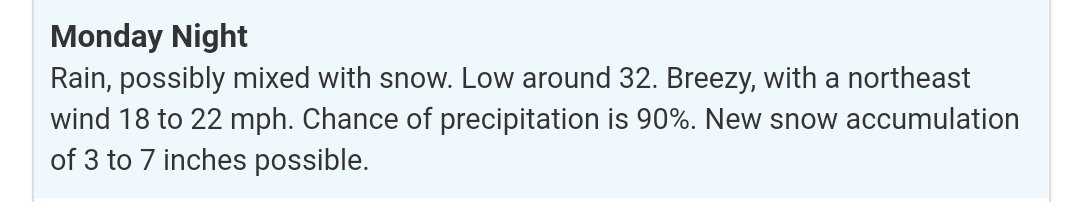
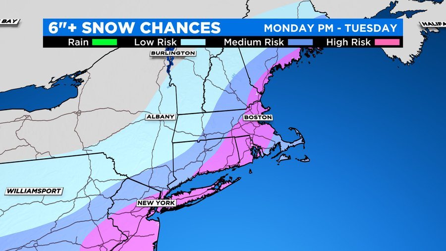
 Possibly mixing with snow, but also 3-7 inches expected.
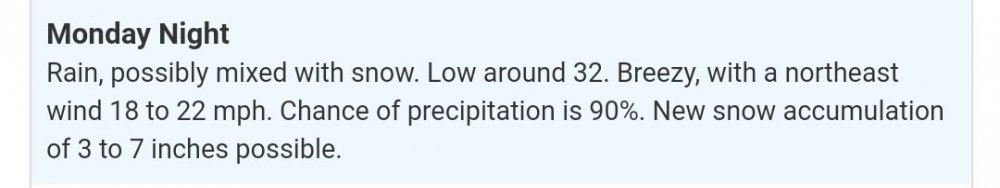
-
lol
-
thats gonna spit out 30 inches in SEPA. Pass
-
days and days
-
Better yet, let's get that H7 to stall south of Hampton Bays
-
2 feet in NYC on that run
-
Incredible
-
I mean, I didn't think we had a CCB up here. Thought we'd occluded by the time the storm gets to our latitude
-
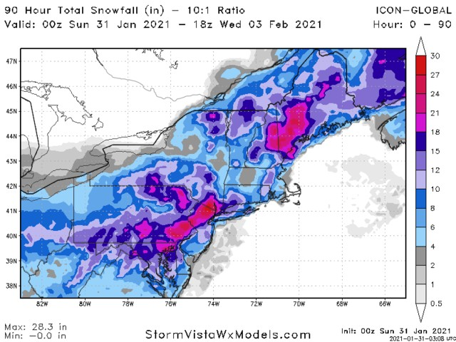
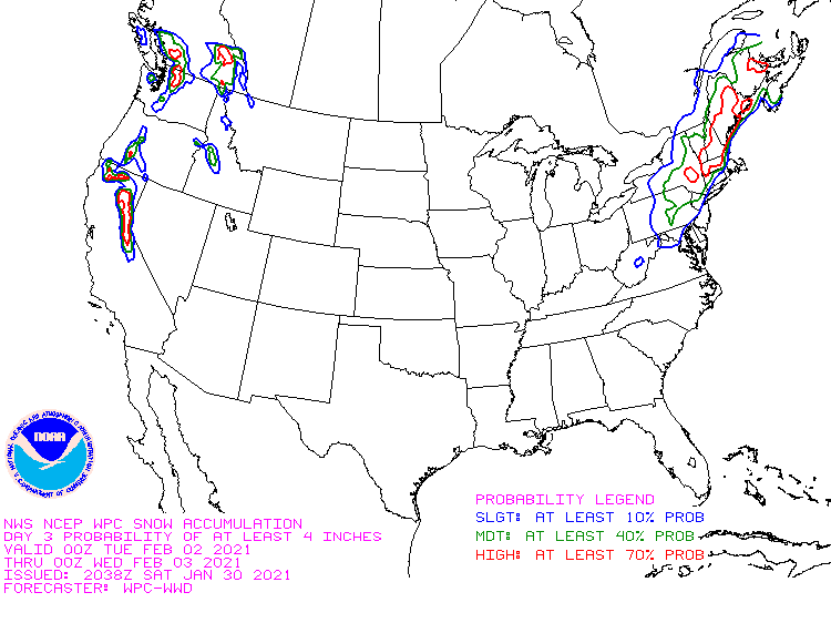
Latest WPC:
-
If we're going from single digits at night to barely maintaining isothermal temp profiles in a day or two, the storm's tucked. Hopefully it doesn't work out that way.
-
when we start having to rely on rates to 'mix down' colder air, we're in trouble.
-
God, that was a horrific euro run for the coast.
-
This is verbatim a blizzard for the immediate coast

-
using your hypnotizing meteorological verbiage to get my hopes up, I always fall for it.
-
We could seriously benefit from the H5 low closing off about 50 miles east
-
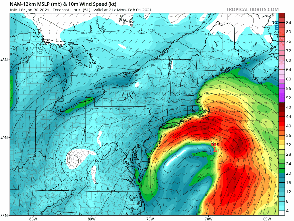
still open at 21z Monday
-
H5 closes later!
-
Any way for this to change as we approach, or is this just the type of system we'll have?
-
Maybe I'm just extremely biased, but I don't understand why QPF isn't pushing 2 inches with a track that slow and such a dynamic system. Is it because it vertically stacks too early?
-
so the two different schools of thought right here?
-
Either they're priming the public for the inevitable increase, or thsy aren't too enthused with the slow rate of strengthening and occlusion.
-
so the derivative of temperature differential? I'll bet it's a good proxy for lift then?
-
ohhhh, is that what x mB frontogenesis actually is? Air temp differential? that makes sense
-
so essentially, warm, moist air off the ocean via storm circulation running into cold, dry air causes more instability?