George BM
-
Posts
2,933 -
Joined
-
Last visited
Content Type
Profiles
Blogs
Forums
American Weather
Media Demo
Store
Gallery
Everything posted by George BM
-
Congratulations!
-
Ditto. Shruggies on a stick there.
-
Yeah I'm a fairly young man (23). I believe @Cobalt is the youngest in our subforum atm... a junior in high school.
-
-
Anyway, congratulations @yoda.
-
Were you ever able to find that VHS recording that you and/or one of your friends took of the 18"+/hr snowfall rates on the glacier?
-
There is something magical about December 5th snow indeed. The December 5th, 2002 event was the first real snow event I have vivid memory of. I just remember opening my window blinds in my apartment in Falls Church as a six-year old looking at this mysterious, bright, radiant, white landscape. It was surreal... almost like I'd been teleported to a foreign planet. Thus further sparking my interest in the wintery aspects of weather. Of course, after that we would see 4 more "first snow on December 5th events" within the following seven years.
-
The southeastern sky was a fiery orangeish/pinkish for a good, long 30+ minutes before the sun broke the horizon. A beauty indeed.
-
e16 and e17 FTW... for the coastal Carolinas.
-
I recently noticed the free ECMWF maps on pivotal. Wow, what a game changer.
-
Lol! What could've been.
-
Just me being Curious George here... Other than the June 29, 2012 derecho (we all know that that's one of the two events you're referring to) what was the other widespread severe event in your 41 years here?
-
Windy with falling temperatures.
-
Oh yeah... this thread exists.
- 2,802 replies
-
- 1
-

-
- severe
- thunderstorms
- (and 4 more)
-
-

-
IAD actually hit 33F.
-
#Unicorn

-
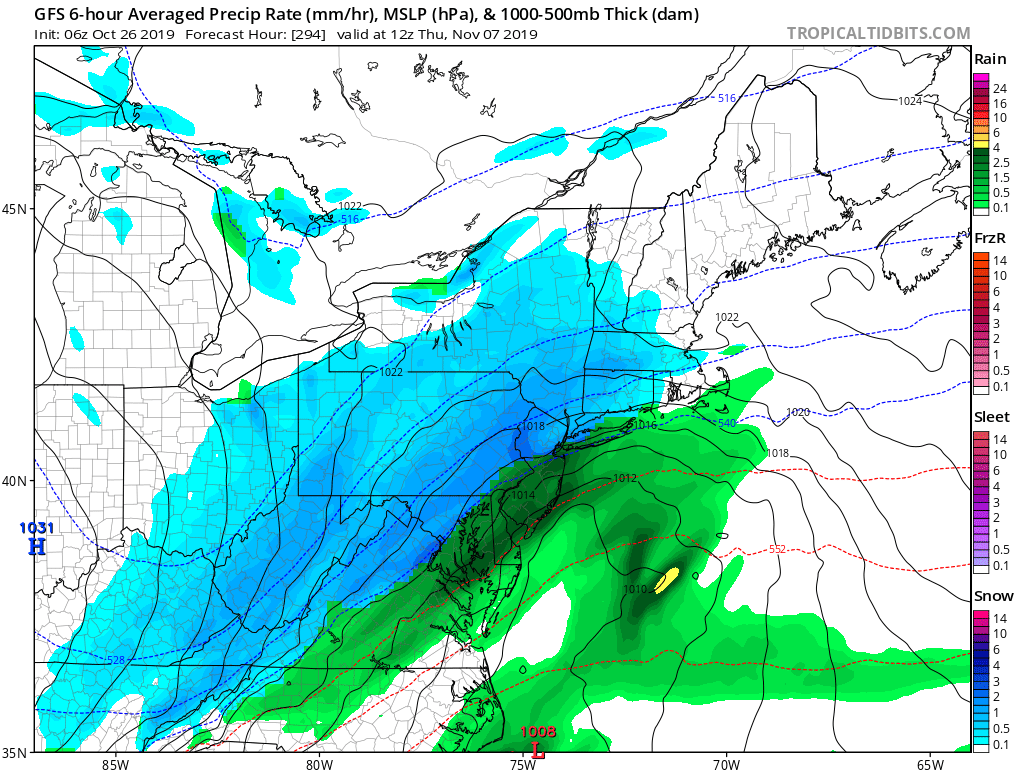
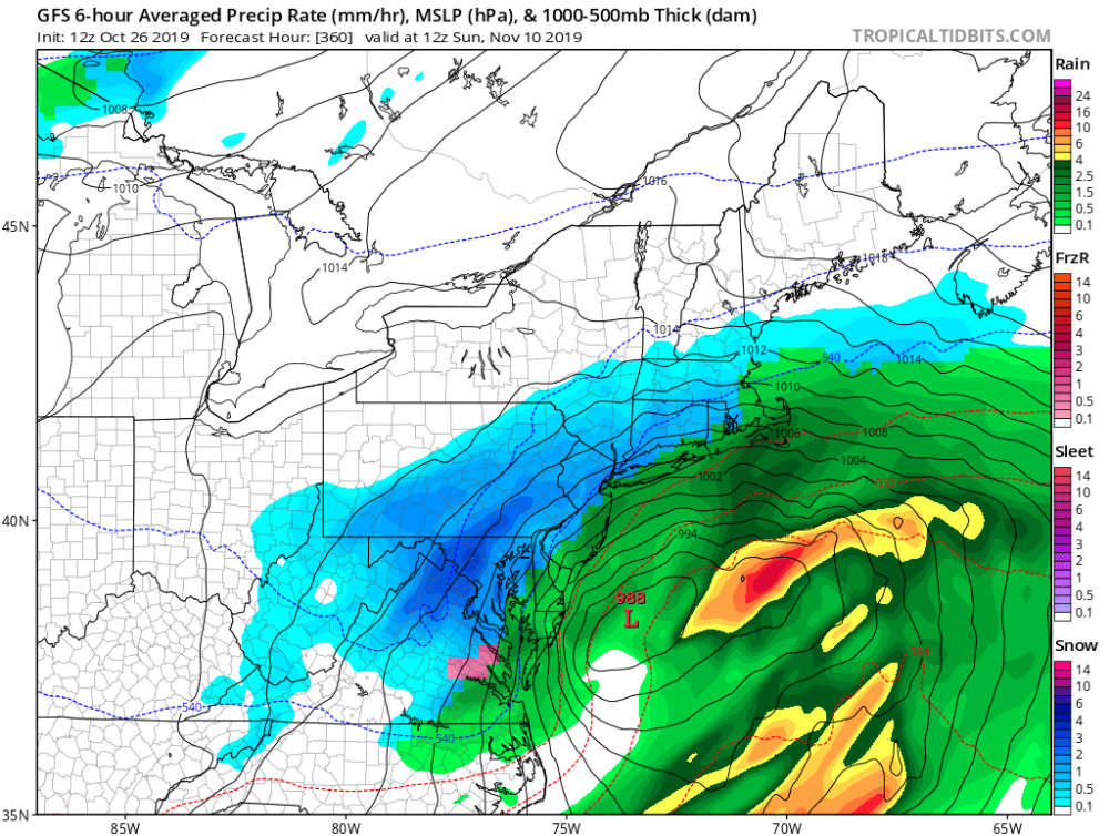
Update: IAD: 10/25 DCA: 11/03 BWI: 10/25 RIC: 11/03 Oct Precip: 24.76"
-
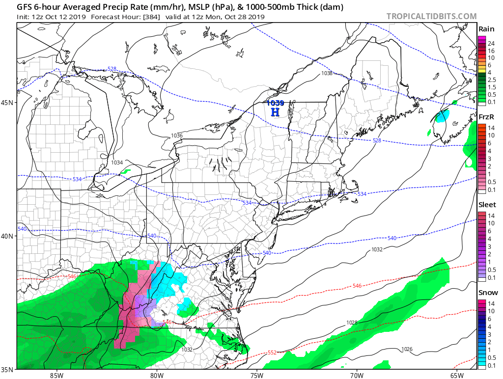
IAD: 1/20 DCA: 1/20 BWI: 1/20 RIC: 1/20 Oct Precip: 99.76"
-
1630z update put us in a SLGT risk for today. ...Northern VA and vicinity this afternoon... A small thunderstorm cluster and diffuse MCV will move eastward from the eastern WV Panhandle across northern VA/MD this afternoon. Surface heating in advance of this minor wave will contribute to moderate buoyancy (MLCAPE near 2000 J/kg), and some loose clustering of storms is expected this afternoon. Steep low-level lapse rates and DCAPE near 1000 J/kg will favor occasional downbursts with some potential for wind damage.
-
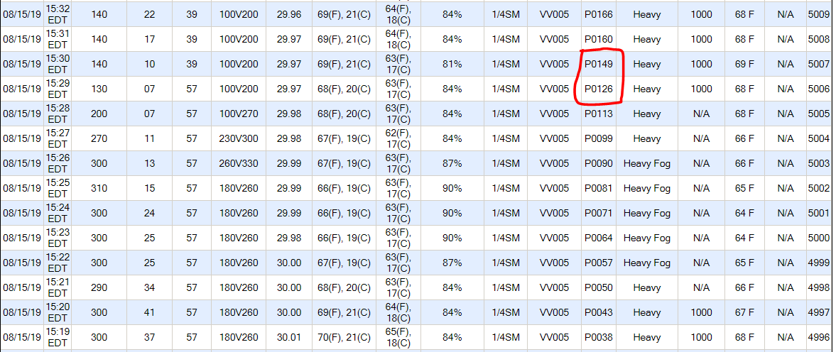
IAD just got 0.23" of rain in one minute between 3:29pm and 3:30pm edt!
- 2,802 replies
-
- 2
-
-
- severe
- thunderstorms
- (and 4 more)
-
weather.us