George BM
-
Posts
3,048 -
Joined
-
Last visited
Content Type
Profiles
Blogs
Forums
American Weather
Media Demo
Store
Gallery
Everything posted by George BM
-
Close lightning/loud thunder or just visible lightning/audible thunder?
-
12z runs on Sat, Nov 28th, 2020. So three days.
-
Hmmmm.... did that happen to be the January 25, 1985 event?
-
Multiple-Hot-Threads-At-Once season is upon us!
-
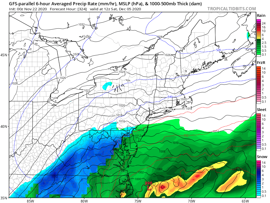
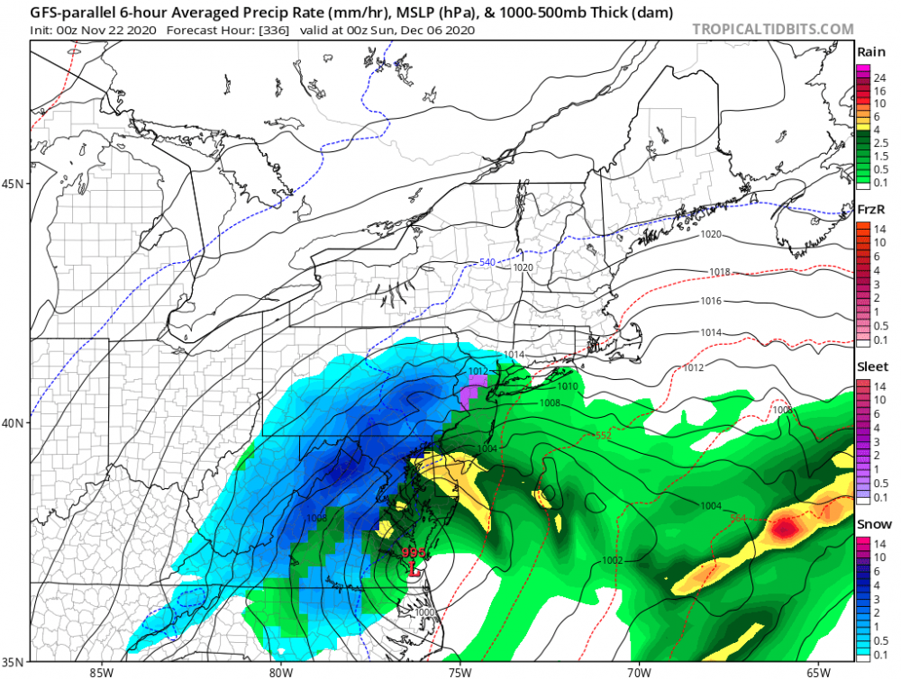
So... nobody's going to talk about the GFS parallel giving us our December 5th snow event?

-
@MN Transplant
-
I'm actually surprised that DCA made it considering that it was a calm night.
-
I'll order number 1, 2 and 5... for the rates. Seeing 4-6"+/hr snowfall rates for hours would something special to experience. Definitely number 2. I'm probably one of 5-10 people on this subforum who's actually been hoping for a complete shutout with warmth all winter this season. It's been known for a very long time that median snow totals are the best that snowlovers can reasonably hope for. With the La Nina and the potential of a stronger PV we should go for the record least snowfall. A repeat of the February 7th mini-tornado outbreak would be awesome! All that being said, if it becomes clear that a significant snow event is in the cards in the shorter range and rates look like they will be on the epic side (See my posts about December 19th) I'll root for it. Good morning.
-
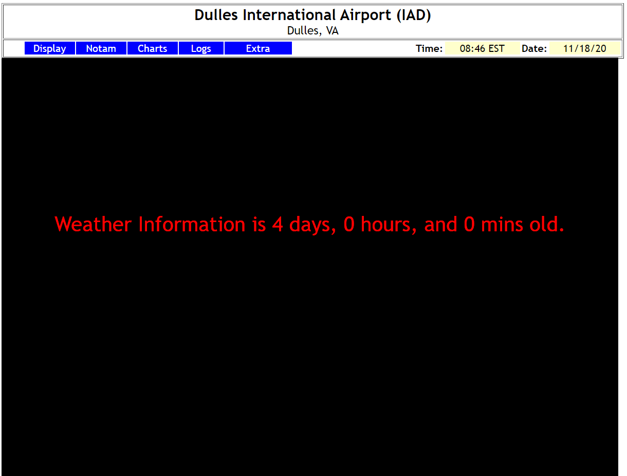
There hasn't been a radar image from LWX since 9:47am local time this morning...
-
Yeap. Can confirm looking at this shortwave IR satellite loop. https://weather.cod.edu/satrad/?parms=subregional-Virginias-07-96-1-25-1&checked=map&colorbar=undefined
-
Between 3am and 4:30am is when cloud cover moved over YBY. You had probably decoupled allowing the temperature to fall to 27F. But when the clouds moved over you the added insulation allowed the warmer air just above the surface to mix down to the surface ( it probably got a bit breezy during that time there). Then those clouds moved away from you after 4:30am allowing radiational cooling to start doing it's work again.
-
2020 Mid-Atlantic Severe Weather - General Thread
George BM replied to Kmlwx's topic in Mid Atlantic
Finally a flush hit for you... In all seriousness I hope the damage isn't too bad there. -
2020 Mid-Atlantic Severe Weather - General Thread
George BM replied to Kmlwx's topic in Mid Atlantic
Awesome! Are you getting much rain? -
2020 Mid-Atlantic Severe Weather - General Thread
George BM replied to Kmlwx's topic in Mid Atlantic
SEL1 URGENT - IMMEDIATE BROADCAST REQUESTED Severe Thunderstorm Watch Number 511 NWS Storm Prediction Center Norman OK 530 PM EST Sun Nov 15 2020 The NWS Storm Prediction Center has issued a * Severe Thunderstorm Watch for portions of District Of Columbia Delaware Central and eastern Maryland New Jersey Southeastern Pennsylvania Northeastern Virginia Coastal Waters * Effective this Sunday afternoon and evening from 530 PM until 1100 PM EST. THUNDERSTORM WIND GUSTS TO 70 MPH...and DANGEROUS LIGHTNING ARE POSSIBLE IN THESE AREAS. The severe thunderstorm watch area is approximately along and 65 statute miles east and west of a line from 25 miles north northeast of Allentown PA to 50 miles southeast of Washington DC. For a complete depiction of the watch see the associated watch outline update (WOUS64 KWNS WOU1). PRECAUTIONARY/PREPAREDNESS ACTIONS... REMEMBER...A Severe Thunderstorm Watch means conditions are favorable for severe thunderstorms in and close to the watch area. Persons in these areas should be on the lookout for threatening weather conditions and listen for later statements and possible warnings. Severe thunderstorms can and occasionally do produce tornadoes. -
2020 Mid-Atlantic Severe Weather - General Thread
George BM replied to Kmlwx's topic in Mid Atlantic
STW now out. -
2020 Mid-Atlantic Severe Weather - General Thread
George BM replied to Kmlwx's topic in Mid Atlantic
Hmmm... Dulles is up to 70F now which is higher than CAMs had the temperature reaching. The dewpoint is a little bit low though at 57F. -
2020 Mid-Atlantic Severe Weather - General Thread
George BM replied to Kmlwx's topic in Mid Atlantic
We've been Slighted in much of the region east of the mountains. ..LOWER GREAT LAKES TO MID-ATLANTIC/NORTHEAST SCATTERED THUNDERSTORMS ARE ONGOING ACROSS SOUTHEAST LOWER MI INTO WESTERN OH WITH A HISTORY OF WIDESPREAD STRONG TO ISOLATED SEVERE WIND GUSTS. THIS INITIAL ACTIVITY MAY STRUGGLE TO FURTHER INTENSIFY OWING TO BOUNDARY-LAYER DEW POINTS IN THE LOWER 50S WITHIN A NARROW SPATIAL CORRIDOR AHEAD OF THIS CONVECTION. IT SHOULD EVENTUALLY OUTPACE THIS NARROW WEDGE OF SURFACE-BASED INSTABILITY AS IT SPREADS EAST/NORTH OF LAKE ERIE LATER THIS AFTERNOON. A MORE PRONOUNCED SQUALL LINE IS EXPECTED TO DEVELOP AROUND 21-23Z FROM CENTRAL NY TO CENTRAL VA AND SWEEP EAST-NORTHEAST ACROSS THE NORTHEAST AND NEW ENGLAND COAST THROUGH EARLY TONIGHT WITHIN AN INTENSE SHEAR/MINIMALLY BUOYANT ENVIRONMENT. THIS SQUALL SHOULD DEVELOP AS THE ROBUST COLD FRONT IMPINGES ON LOW-LEVEL MOISTURE ADVECTING NORTH FROM THE CAROLINAS/SOUTH ATLANTIC COAST. BETWEEN 00-03Z, MID 50S BOUNDARY-LAYER DEW POINTS SHOULD REACH AS FAR NORTH AS EASTERN PA INTO SOUTHERN NEW ENGLAND ALONG THE TRACK OF SECONDARY CYCLOGENESIS. WHILE LOW-LEVEL LAPSE RATES WILL PROBABLY REMAIN WEAKER RELATIVE TO THE LOWER GREAT LAKES REGION, THE COMPARATIVELY RICHER LOW-LEVEL MOISTURE SHOULD COMPENSATE. IT IS PLAUSIBLE THAT LIGHTNING GENERATION MAY BE CONFINED TO AREAS FARTHER NORTH AMID SCANT ELEVATED BUOYANCY AND GREATER LARGE-SCALE ASCENT. NEVERTHELESS, THE PRESENCE OF A LOW-TOPPED SQUALL LINE AMID 50-60 KT 925-MB WINDS SUGGEST STRONG TO SEVERE WIND GUSTS ARE POSSIBLE EVEN IN THE ABSENCE OF LIGHTNING. AS SUCH, THIS REGION HAS BEEN UPGRADED TO SLIGHT RISK. ..GRAMS/DEAN.. 11/15/2020 -
Curious George question: @losetoa6Have you ever raced with any of your daughters in the car before?
-
-
From north and northwest... Note: @losetoa6 is probably over an inch as of this post but not by much. To the metros... To the south and southeast... ... All is in balance. Just how everything is supposed to be in the year we call twenty-twenty. However, everything equals out over time. North and west will get theirs... perhaps in time for winter. Snow and ice will rule the landscape with an icy scepter in the north and west burbs while 33-degree despair inducing rains will fall across the south and east burbs giving Mr. Reaper all-time record high stonks, turning the tides of the optimism of active weather weenies to the north and west. ... OR, we continue this persistence into the winter and @CAPE will get his beach blizzard along with the south and east gang in January with the one good winter event of the season... Yeah that sounds more accurate... REEEEEEEEE!
-
What would you guesstimate the heaviest snowfall rates were at your location in inches/hr? ETA: Also, congrats in advance on your rain jackpot over the next 24 hours.
-
IAD has hit 77F now.
-
IAD has gotten up to 76F now breaking the record of 75F for today.
-
2020 Mid-Atlantic Severe Weather - General Thread
George BM replied to Kmlwx's topic in Mid Atlantic
Yeah. Just wait until February... and also, prior to that, mid/late December. -
Eh. Let it be warm/ slightly humid now. It will get cold enough eventually. Climatology will guarantee that it does EVEN if it remains above average. I'm just soaking it in.