George BM
-
Posts
3,048 -
Joined
-
Last visited
Content Type
Profiles
Blogs
Forums
American Weather
Media Demo
Store
Gallery
Everything posted by George BM
-
Misty and breezy with a temperature of 60F at IAD currently.
-
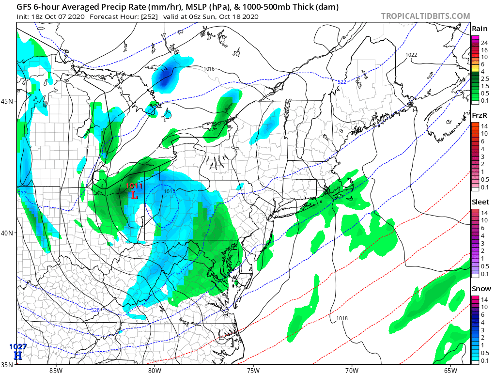
Looks like the two dustbowls have finally seen a 1"+ rain event! Time for a celebration! =
-
Yeap. You two saw this. https://www.amsmeteors.org/2020/09/bright-fireball-caught-above-ohio/
-
What beaches are you two thinking about going to for the early April coastal blizzard? OC MD? ALTC NJ? ... VA beach?
-
Sparkling clean!
-
Scrubbed.
-
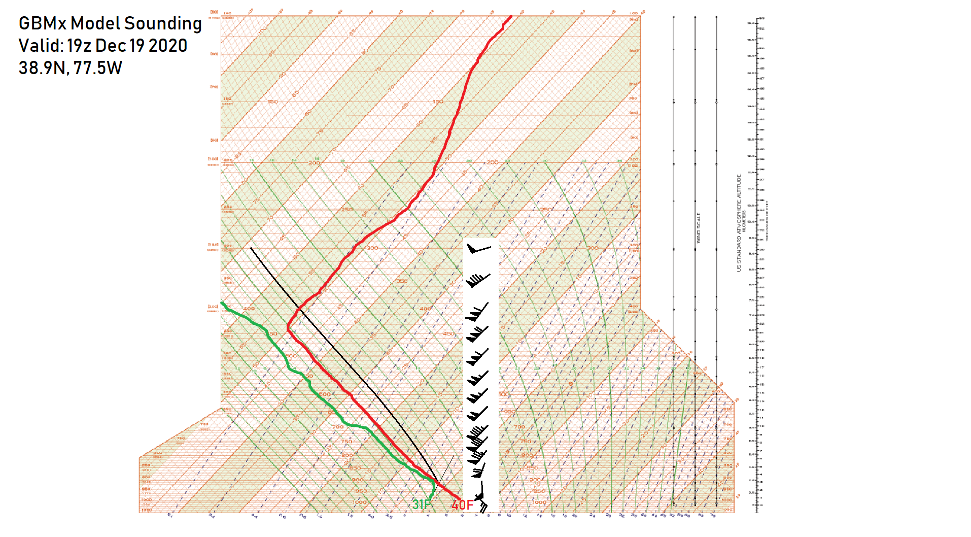
The sounding is valid just ahead of a strongly-forced very fast moving line of severe thunderstorms along an arctic cold front. We are under a Moderate risk of severe weather for WIND (45% hatched). There are also 10% TOR probs across the region... though I'm particularly watching that QLCS tornado threat as effective SRH looks be potentially be on the order of 700 m2/s2. While wind is the main threat don't sleep on the tornado threat at all. All the CAMs have several decent helicity swaths through the entire region, especially along and east of the mountains where CAPE looks to be the highest w/ low LCLs. It would actually not surprise me if we end up seeing more tornadoes w/ this event than with the February 7th event this year. We could also get a quick 6"+ of snow within 30-60 minutes with this event! Overall I'm feeling really excited about this event and am happy that we may finally get a decent area-wide severe event. I definitely look forward to the multiple case studies that will undoubtedly be done for this one.
-
Pumpkin Spice and dead leaves fragrance the air.
-

-
2020 Mid-Atlantic Severe Weather - General Thread
George BM replied to Kmlwx's topic in Mid Atlantic
I remember that day as well. I remember some heavy showers throughout the day w/ breezy conditions. I remember getting home from school in Herndon hust after 2:30pm and being surprised that the main line was already right on my doorstep. Looking back at that thread I remember lots on here being surprised at how early the main line arrived as well. There were brief torrential rains and wind gusts into the 30s (mph) here from the line. I noticed no thunder/lightning at all from it. I too was surprised to see looking back at SPC archives for that event a few years later that we had been placed under a MDT risk for wind (45% non-hatched). That would just be a high-end ENH risk the way that SPC works today. I remember the lack of tornado warnings as well despite being in a 10% non-hatched tor risk. The September 8th, 2012 event ten days prior, on the other hand, was a lot more impressive in the region with a lot of minor wind damage. I got wind gusts of 50+ mph in my neighborhood from that event. The funny thing is that the line from that event seemed more impressive down here than it did up the urban corridor where there was an actual MDT risk in the place... save for the Long Island tornadoes that day. As a whole though, that September was definitely a bit more exciting than usual severe weather-wise. -
BWI: 10/04 IAD: 10/04 DCA: 10/26 RIC: 10/12 Tiebreaker: 87F
-
This is just me being 'Curious George' but what would the winter weather pattern look like if there was ever a "super" la nina (ONI < -2.0C)? - TIA
-
Oh. I thought that you'd put 780F because of the asteroid set to strike the DMV region on October 28th. Nevermind. But I think I'll go 783F for the tie breaker.
-
2020 Mid-Atlantic Severe Weather - General Thread
George BM replied to Kmlwx's topic in Mid Atlantic
667 WWUS20 KWNS 031938 SEL5 SPC WW 031938 DCZ000-DEZ000-MDZ000-NJZ000-PAZ000-VAZ000-WVZ000-CWZ000-040200- URGENT - IMMEDIATE BROADCAST REQUESTED TORNADO WATCH NUMBER 485 NWS STORM PREDICTION CENTER NORMAN OK 340 PM EDT THU SEP 3 2020 THE NWS STORM PREDICTION CENTER HAS ISSUED A * TORNADO WATCH FOR PORTIONS OF DISTRICT OF COLUMBIA DELAWARE MARYLAND SOUTHERN NEW JERSEY SOUTHEAST PENNSYLVANIA NORTHERN VIRGINIA EASTERN WEST VIRGINIA PANHANDLE COASTAL WATERS * EFFECTIVE THIS THURSDAY AFTERNOON AND EVENING FROM 340 PM UNTIL 1000 PM EDT. * PRIMARY THREATS INCLUDE... A FEW TORNADOES LIKELY SCATTERED DAMAGING WINDS LIKELY WITH ISOLATED SIGNIFICANT GUSTS TO 75 MPH POSSIBLE SUMMARY...MULTIPLE SUPERCELLS WILL LIKELY DEVELOP NEAR AND NORTH OF THE GREATER WASHINGTON D.C. AREA AND SPREAD EAST AS A CLUSTER ACROSS THE COASTAL PLAIN THROUGH MID-EVENING. A FEW TORNADOES AND SWATHS OF DAMAGING WINDS ARE LIKELY. THE TORNADO WATCH AREA IS APPROXIMATELY ALONG AND 85 STATUTE MILES EAST AND WEST OF A LINE FROM 45 MILES NORTH NORTHWEST OF WILMINGTON DE TO 30 MILES WEST SOUTHWEST OF PATUXENT RIVER MD. FOR A COMPLETE DEPICTION OF THE WATCH SEE THE ASSOCIATED WATCH OUTLINE UPDATE (WOUS64 KWNS WOU5). PRECAUTIONARY/PREPAREDNESS ACTIONS... REMEMBER...A TORNADO WATCH MEANS CONDITIONS ARE FAVORABLE FOR TORNADOES AND SEVERE THUNDERSTORMS IN AND CLOSE TO THE WATCH AREA. PERSONS IN THESE AREAS SHOULD BE ON THE LOOKOUT FOR THREATENING WEATHER CONDITIONS AND LISTEN FOR LATER STATEMENTS AND POSSIBLE WARNINGS. -
2020 Mid-Atlantic Severe Weather - General Thread
George BM replied to Kmlwx's topic in Mid Atlantic
From the 1630z SPC: OTHERWISE, STORM-SCALE CLUSTERING AND THE DEGREE OF SHEAR MAY YIELD A COUPLE BOWING SEGMENTS WITH 45-65 KT GUSTS CAPABLE OF PRODUCING DAMAGING WIND SWATHS TO THE COAST. -
2020 Mid-Atlantic Severe Weather - General Thread
George BM replied to Kmlwx's topic in Mid Atlantic
I just got back from looking at some of the mesoscale guidance for tomorrow and thought: "Hmm... I bet @high risk made an appearance in the severe thread this morning." Now we patiently await the day that we are actually put under your namesake AND it verifies. -
2020 Mid-Atlantic Severe Weather - General Thread
George BM replied to Kmlwx's topic in Mid Atlantic
Those storms firing up in NW Pennsylvania look like good candidates for the main event here. -
2020 Mid-Atlantic Severe Weather - General Thread
George BM replied to Kmlwx's topic in Mid Atlantic
Did you also notice the Day 5 15% risk for us? -
2020 Mid-Atlantic Severe Weather - General Thread
George BM replied to Kmlwx's topic in Mid Atlantic
Mesoscale Discussion 1373 NWS Storm Prediction Center Norman OK 0300 PM CDT Sat Aug 01 2020 Areas affected...northern Virginia...eastern West Virginia...much of Maryland...and the District of Columbia Concerning...Severe potential...Watch possible Valid 012000Z - 012200Z Probability of Watch Issuance...40 percent SUMMARY...Convection over eastern West Virginia will gradually spread eastward, posing a risk for damaging wind gusts and perhaps an isolated tornado. A WW may eventually be needed pending convective trends. DISCUSSION...Isolated convection has developed across portions of eastern West Virginia over the past hour or so, with one cell showing signs of broad/weak rotation aloft. The airmass supporting these storms has become moderately unstable, with 70s F dewpoints and 80s F surface temperatures resulting in 2000-2500 J/kg along and south of a warm front located from PIT to WAL. The cells are also in a weakly forced synoptic environment, with a mid-level trough located well west of the region. Nevertheless, weak inhibition and buoyancy in tandem with weak surface confluence has fostered initial development in eastern West Virginia. This regime should continue through the evening, with 30-40 knots of deep shear fostering organization. Damaging wind gusts will be the primary threat with this activity, although a tornado cannot be ruled out given favored cellular storm mode and potential for updraft interactions with the aforementioned warm front. Convective trends are being monitored, and a Severe Thunderstorm Watch may be needed especially if a greater concentration of convection can be achieved through nightfall. ..Cook/Bunting.. 08/01/2020 -
2020 Mid-Atlantic Severe Weather - General Thread
George BM replied to Kmlwx's topic in Mid Atlantic
SLGT shifted ENE to the Potomac river. (1300z update) -
2020 Mid-Atlantic Severe Weather - General Thread
George BM replied to Kmlwx's topic in Mid Atlantic
URGENT - IMMEDIATE BROADCAST REQUESTED Severe Thunderstorm Watch Number 393 NWS Storm Prediction Center Norman OK 1200 PM EDT Wed Jul 22 2020 The NWS Storm Prediction Center has issued a * Severe Thunderstorm Watch for portions of District Of Columbia Western and Central Maryland South Central Pennsylvania Northern and Central Virginia Eastern Panhandle of West Virginia Coastal Waters * Effective this Wednesday afternoon and evening from NOON until 700 PM EDT. * Primary threats include... Scattered damaging wind gusts to 70 mph likely Isolated large hail events to 1.5 inches in diameter possible SUMMARY...Thunderstorms will intensify and over the mountains of northern Virginia and southwest Pennsylvania and spread eastward this afternoon and early evening. Damaging winds and perhaps hail are expected with the more intense storms today. -
2020 Mid-Atlantic Severe Weather - General Thread
George BM replied to Kmlwx's topic in Mid Atlantic
Yeah... It sure seems like we've not seen too many of those events this year. -
2020 Mid-Atlantic Severe Weather - General Thread
George BM replied to Kmlwx's topic in Mid Atlantic
Indeed. Cells taking advantage of decent speed shear with otherwise modest instability would do that. -
2020 Mid-Atlantic Severe Weather - General Thread
George BM replied to Kmlwx's topic in Mid Atlantic
Did you lose power and/or notice any damage to your house after it took a direct hit from lightning during the June 4th storm?