

George BM
-
Posts
2,614 -
Joined
-
Last visited
Content Type
Profiles
Blogs
Forums
American Weather
Media Demo
Store
Gallery
Posts posted by George BM
-
-
BWI: 3.5"
DCA: 0.9"
IAD: 3.1"
RIC: 6.0"
Tiebreaker (SBY): 6.2"
-
 1
1
-
 1
1
-
-
Is anyone on here in Montgomery county without power due to the small plane that flew into high-voltage powerlines?
-
2 hours ago, Eskimo Joe said:
Seems like a possible.high wind threat Wed into Thusday, no? We do seem to do that well.
I've been looking at that. That's a strong and fast moving cold front. Whether we get a pressure surge w/ rapid pressure rises and/or sufficient mixing immediately behind the front or not, I could definitely see the potential of a line of strong gusty low-topped convection along said front.
-
A low of 24F at IAD this morning... It has already risen to 57F at not even 10:30am.
-
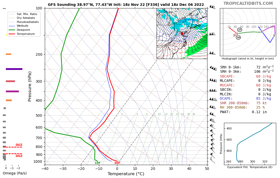
Not digital snow but... that's quite the digital wind event showing up on the happy-hour gfs for 12/6. I love the 60-65 kt winds at 1km within a dry-adiabatic lapse rate, strong CAA environment.


-
2
-
-
Nice purple hue in the western sky currently post-sunset.
-
2
-
-
17 minutes ago, TSG said:
Can't remember the last time we had air this dry. 45/-2 at CHO. That's 14% RH...

Yeah. My lips have definitely noticed.

-
1
-
-
7 hours ago, WxWatcher007 said:
There are no words for what I experienced tonight.
Yes there are:
A little piece of heaven. That's what you experienced last night.


-
3
-
-
20 minutes ago, mappy said:
Are there chances of a quick passing shower today? A met on WBAL this am was saying snow could move through this evening.
Yeap. A disturbance w/ associated cold front will pass through this afternoon/evening a few light showers/snow showers could form near the front. The further north and east you are the better the chances of you getting hit by a brief shower or two.
-
 1
1
-
-
4 minutes ago, mappy said:
enjoy it friend!
We'll get ours next week Wednesday.
")
-
46 minutes ago, nw baltimore wx said:
Total absolute BS that the Buffalo game got moved to Detroit.
They ain't true weenies. Frauds! The all of thems!
-
7 minutes ago, Bob Chill said:
My weenie brain is so fookin afflicted... I have photographic memory of OTHER weenies' tragedies. Some call it empathy, others call it sadistic pleasure. I just call it F'd up and move on with my day
Perhaps we can score an event with a foot of snow caked in a foot of ice on top this year? We could use something anomalous.

-
Current 12z GFS looking very "incoming-y" at 186hrs. Possible digital treat coming up?
-
Getting ice pellets w/ rain here in Herndon. Where are the rest of y'all at?
-
11/15/2022: T
-
1
-
-
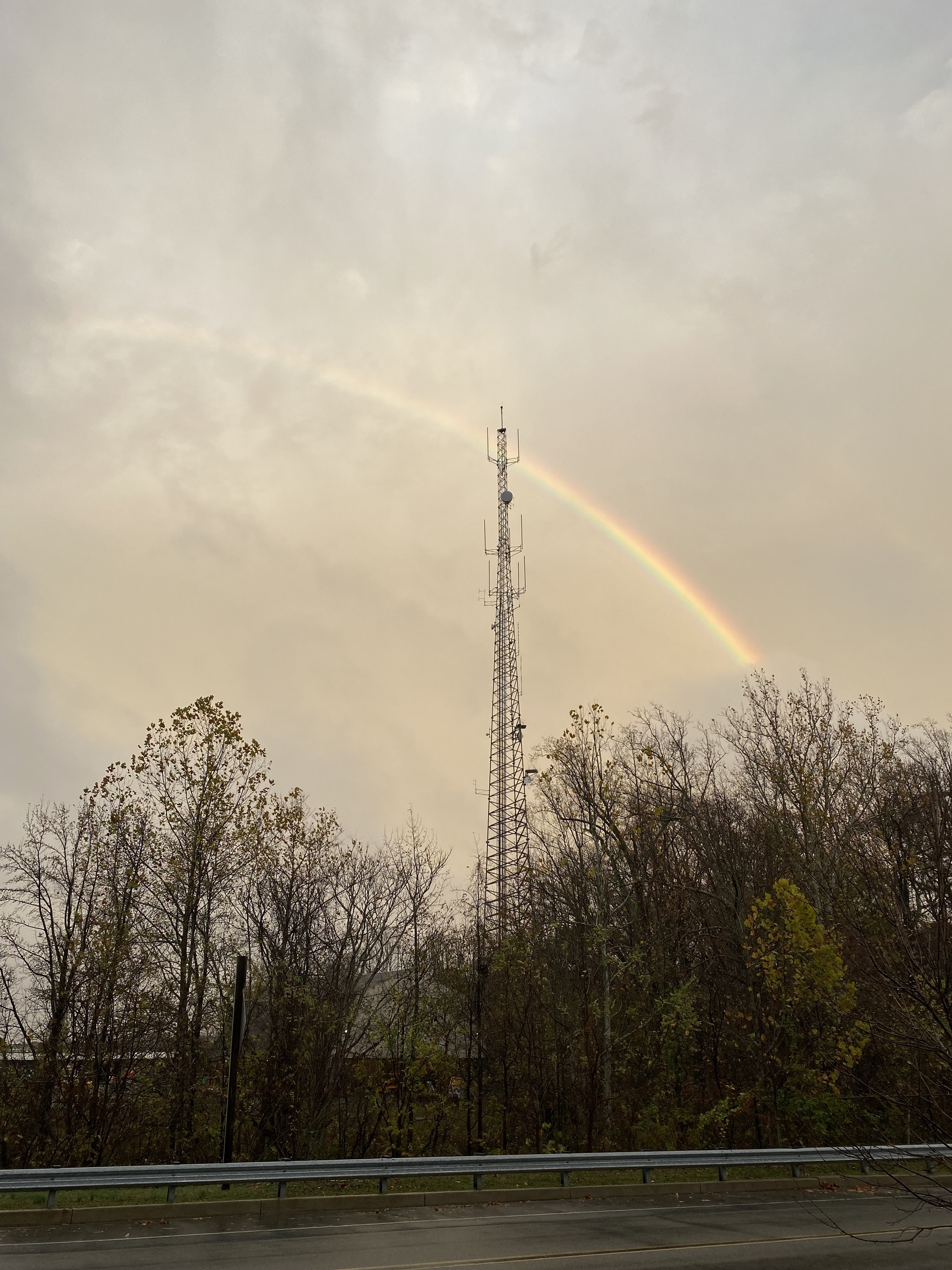
49 minutes ago, PrinceFrederickWx said:
Took this walking on Prince Frederick Blvd last Friday- MDOT's radio tower appears to be shooting rainbow laser beams at my house in the distance

Did you consider checking around your property for gold?
-
1
-
1
-
-
-
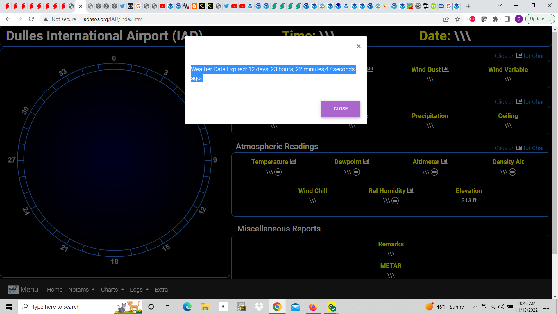
A 0.84" total at IAD.
-
3 minutes ago, nj2va said:
1.6”
1:1 ratios though.

-
5
-
 1
1
-
-
Looking forward to your winter outlook.
-
6 minutes ago, stormtracker said:
What up peeps. No Nicole rainfall thread. Yall slackin
-
8 minutes ago, pazzo83 said:
gotta wonder when was the last time that DCA had a higher max in November vs October.
Not sure. But now that you made me look, IAD hit a max of 80F in Oct. It got up to 81F so far this month there.
-
A mild and damp start.
-
Forecast Discussion
Wednesday, November 23, 2022 11:58AM EST
NWSGeorgeBMHeadquarters
A very strong and compact mid/upper level-low will continue to move ENE-wards into our region during the afternoon and into the evening. Currently ahead of it much of the area is experiencing light drizzle. Temperatures have slowly climbed to around 40F or so across the immediate Greater Washington Metropolitan region with low/mid 40s in southern and eastern MD and mid/upper 30s in far north and western regions. The Greater Metropolitan region should peak in the lower 40s over the next few hours. Afterwards, by early/mid afternoon (18z-20z) heights will fall very dramatically (500mb height falls: 12-15 dam/ 6hrs) as the compact system moves in. This will create very strong lift through a deep-layer of the atmosphere resulting in two significant things taking place.
1. Heavy precipitation will develop leading to dynamic cooling of the column allowing a quick changeover from rain to snow. With some elevated instability some elevated thunderstorms may develop, especially near the leading edge of this area of strong lift. Some small hail may even be possible with the most intense storms. But, more importantly, the snowfall rates will be very heavy. Although the system should be in and out within 6 hours there could be 1.5”+ of liquid equivalent precip within that time, much of it falling as snow. Therefore, snowfall rates could be in excess of 3”/hr. Current snow totals look to be in the 8-14”+ range. The snow will be high in moisture content (~8-10:1 ratios) leading to the potential of power outages.
2. In response to this strong mid/upper level system a surface low will rapidly strengthen over the southern Chesapeake Bay and move NE-wards across the Delmarva and into the western Atlantic through the evening as it continues to deepen. This will result in winds increasing throughout the region. Northerly wind gusts as high as 35 mph will be possible.
With the very heavy snowfall rates coupled with the gusty winds, visibility will fall to below a quarter mile. A Winter Storm Warning is in effect for the region. Winds won’t be quite strong enough for Blizzard Warning issuances. Nonetheless, it will certainly seem blizzard-like throughout the late afternoon/evening. Overall, this will be a quick hitting and high impact event with snow departing the region by 3z tonight.
-
5
-
8th Annual Mid-Atlantic Snowfall Contest
in Mid Atlantic
Posted
Lol you thought!
Update:
BWI: 52.4"
DCA: 39.5"
IAD: 57.2"
RIC: 30.7"
Tiebreaker (SBY): 31.0"