

George BM
-
Posts
2,603 -
Joined
-
Last visited
Content Type
Profiles
Blogs
Forums
American Weather
Media Demo
Store
Gallery
Posts posted by George BM
-
-
20 minutes ago, SnowenOutThere said:
Just watched the cells over Reston and chantilly pop up as the outflow crossed over. Unfortunately it also canceled the swim lesson I was giving with a crack of thunder.
Yeap, saw that single lightning bolt on Radarscope w. the Chantilly cell.
-
1 hour ago, WxWatcher007 said:
Meh day here in CO but my luck continues because I captured a brief time lapse of the one severe warned storm in the area today. Dropped 1” hail according to a spotter report.
Happy birthday to me lol
Happy Birthday Retired Reaper!

-
 1
1
-
-
5 hours ago, CAPE said:
What are we all drinking?
Old fashioned mood here.
Water.

-
 2
2
-
 1
1
-
-
A tri-monthly ONI of 0.5C for AMJ per CPC.
https://origin.cpc.ncep.noaa.gov/products/analysis_monitoring/ensostuff/ONI_v5.php
-
Upgraded to an ENH at 1630z.
-
3
-
-
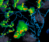
Watching what that batch of convection in eastern WV will do over the next few hours.
-
Showers starting to pop up from a band of agitated cumulus congestus stretching from Manassas to Alexandria.
-
3
-
-
Just now, BlizzardNole said:
A big 0.15 for the desert! Better than nothing I guess
Sorry in advance but what my area needs is a tropical storm landfall in the NE gulf which tracks slowly up the east coast. I'll need some of you to take one for the team and deal with 8-10 inch amounts so that I can get a 2" rainfall.
Sounds more interesting than what we've had in a hot minute. I'll do so gladly.
Currently 75/72 at IAD.
-
Second half of the year arriving. Hopefully more eventful than the first half.
-
-
Tornado Warning East/central Howard County.
-
1 hour ago, mattie g said:
I heard LWX radar is back online.
Anyone else?
Yeap. Noticed it being back yesterday afternoon actually.
(Yes, I was aware of your sarcasm)
-
2
-
-
12 hours ago, Kmlwx said:
18z 12km NAM has some decent parameters flowing in on Sunday evening. But...it's also the NAM at range.
11 hours ago, yoda said:Pretty impressive at range and especially overnight too
Hr 81 just south of DC is lol
I see we have a Day 3 SLGT for the region.
-
9 hours ago, Stormfly said:
Hit Miss Storms?

I remember a lot of the music they played in the early 90s. Rippingtons Russ Freeman stuff.
Real jazz right there. I listen to jazz music heard on the LOT8s forecasts frequently. Big nostalgia.
-
2
-
-
Tomorrow has now gone Code Red for the DC region w/ Friday being an Orange.
-
-
1
-
-
8 minutes ago, Terpeast said:
Got jumped again. Ashburn.
So this is how it’s gonna be…
Got brief torrential rain w/ few lightning strikes here with the complex in Herndon as it developed to your east.
-
1
-
-
1 hour ago, KAOS said:

-
1
-
2
-
-
IAD at 82/69 currently.
-
8 minutes ago, Stormfly said:
I came back from being out of town for 2 weeks, figured the drought timing was good enough to let things go and now I need to trim and mow some acres and the weather isn't playing nice.
It ALWAYS works that way! Wash the car, RAIN. Snow plow isn't ready, SNOW. Haven't run the A/C all summer long, get legit 70 DP, start up and blows hot hair. Compressor contactor wire burned off terminal. Etc Etc Etc.
Please procrastinate and don't prep the snow plow this year. That combined w/ El Nino will bring some fun times.
")
TIA for your service.
-
2
-
2
-
-
Deeper blue.
-
1
-
-
I'm actually mildly surprised that they put us in a MRGL for Day 3 as I personally don't see any glaringly obvious signs of models decisively backing off on Mondays potential yet (still better than usual MLLRs leading to sufficient CAPE w/ at least modest deep-layer shear). We'll see what transpires with CAMs and future SPC outlooks.
-
1 hour ago, CAPE said:
/cdn.vox-cdn.com/uploads/chorus_asset/file/15788591/sean-bean.0.1536008193.jpg)
I know my extreme naivety is showing here but what's this from?
-
Summer! At 10:57am edt the sun hit its furthest point north of the equator (23.4 degrees N of equ.) directly above the earth's surface. It's on it's way back south now.
-
1
-


July Discobs 2023
in Mid Atlantic
Posted
Got a nice heavy downpour from the Herndon cell. A little IC lightning and some gusty breezes as it was ending.