Cobalt
-
Posts
5,253 -
Joined
-
Last visited
Content Type
Profiles
Blogs
Forums
American Weather
Media Demo
Store
Gallery
Everything posted by Cobalt
-
I would imagine that, so long as we don't get a Super Nino, the prospect of any Nino raises the floor of winter at least? At least in the event of a warm winter. At DCA for instance, 40F+ winter average and La Nina are a no-go combo, the last 5 such cases averaged 4.4" of snow. 40F+ El Ninos are a different story, 2 of the last 3 exceeded climo, with 23-24 being the odd one out, though its snow total is pretty comparable to this year's despite being 8 degrees warmer lol. Again that's all in hoping that a Super Nino doesn't come in and wreck everything, anything weaker and it seems like we at least won't get nothingburgered.
-
Pretty sure he just got an AI to modify the Jan 2016 blizzard map. Dont blame him, blame the machines. They’re gonna vex your locale and turn the snow drifts to puddles
-
It didn't even hold for 12 hours, I was looking at 0z by accident though the ensembles are pretty consistently underdoing cold into the medium range still. Incredibly persistent bias this winter.
-
This aged almost as badly as your call saying there'd be no storm.
-
I for one believe in the 100 hours of subfreezing temperatures + snowstorm that the Euro shows for our region at the end of the run.. going into the second week of March. That'll happen.
-
Wow, the snowiest guidance was wrong? What other newfound wisdom will you bestow upon us today?
-
Dang, was banking on BWI getting into the Western edge of a late-developing storm like they did in March 2018. Yesterday was the chance, but the window just passed.
-
Already surpassed yesterday’s 6z RGEM that @snowman19 had as his pick for the model that represented the most likely outcome. Speaking of which.. where is snowman? Enjoying the storm, I hope
-
The two will merge and usher in the new ice age, Day After Tomorrow style
-
Branches breaking due to wet nature of the snow according to my folks in McLean
-
BWI literally got 6.3 inches of snow nearly 11 years to the day - Feb 21st, 2015. Your superstitious view on late February warning-level snow is really just a byproduct of the fact that warning level snow at any time of winter is incredibly rare, but it also just isn't true.
-
Can confirm, went from light rain to sizeable snowflakes in the past 10 minutes.
-
He didn’t put work into it, it’s AI generated. If not the contours, then at the very least the base map is entirely AI.
-
The second this storm ends he'll be back in the La Nina thread. That or forecasting a Super El Nino next year. Book it
-
Y'all are gonna get walloped. Enjoy! Make a snowman.. or 19 of them.
-
Lol the NAM's gonna put down 2.0" QPF+ at BWI.. 1.5" at DCA
-
That's 0z lol
-
lol the HRRR has precip in the vicinity of the DC area from hour 15-48 (and counting)
-
got room for one more?
-
Best run since 6z, insane that the GFS keeps lobbing up these solutions. AI GFS improved also
-
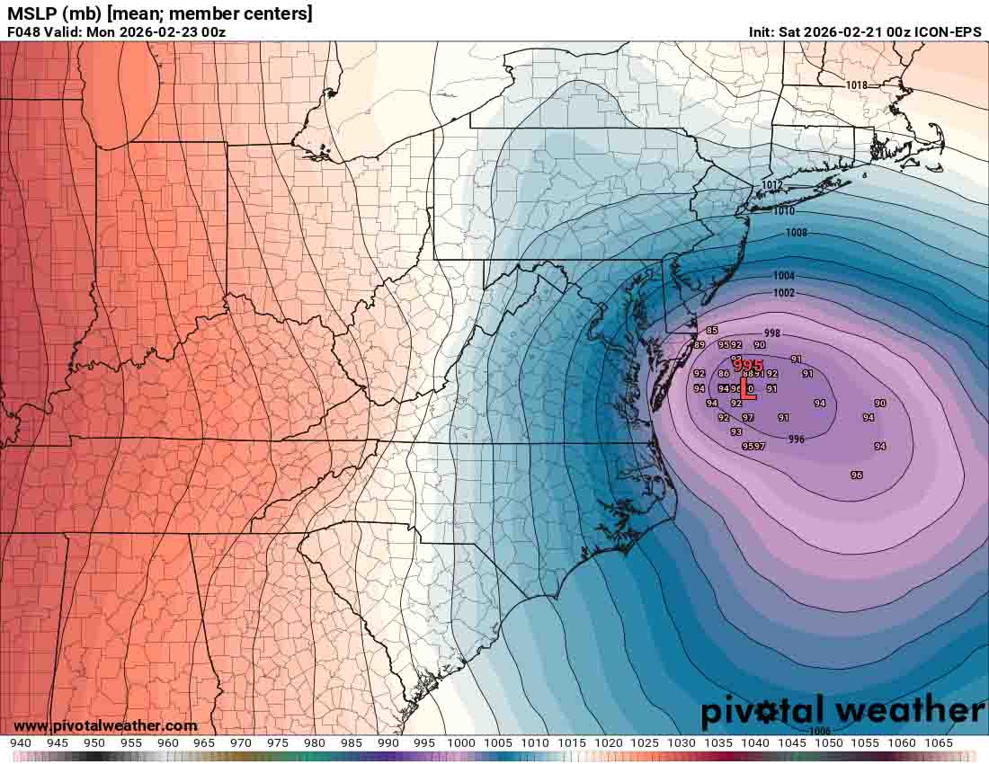
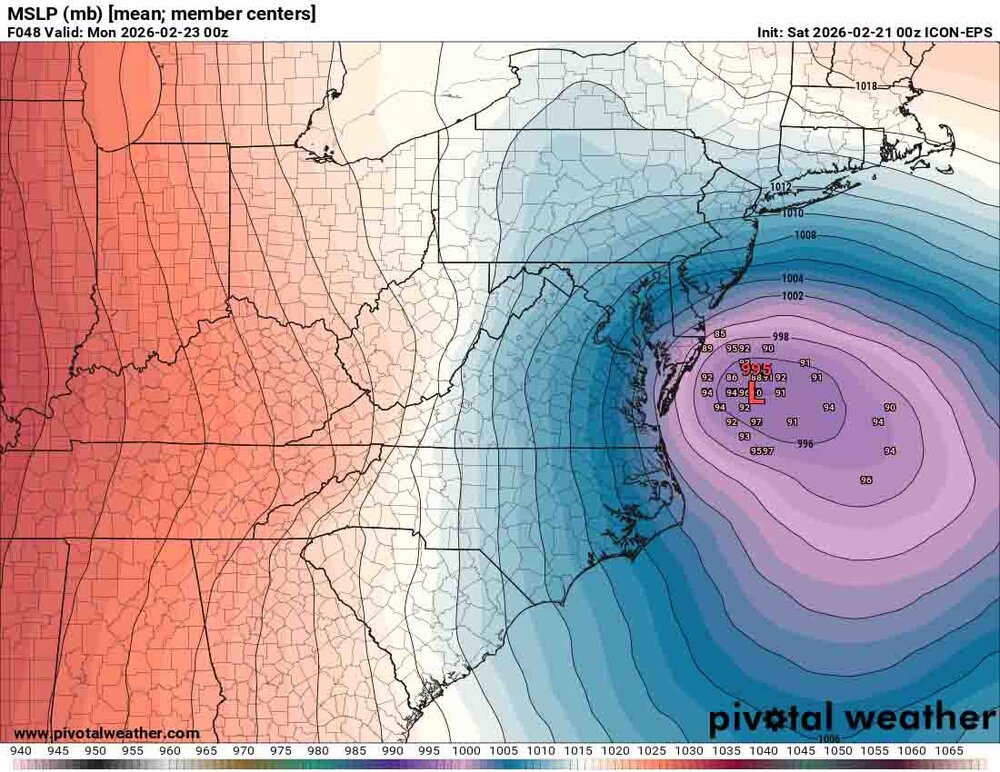
Icon EPS is 0.9" QPF for DC. Substantial shift west from 18z. Some pretty tucked members in the mix.
-
To calm PSU's nerves hopefully.. Every model but the Euro (naturally, since it has yet to run at 0z) places the IVT West of DC. We can all rest easy.
-
Add the ICON to that list.. really just the RGEM and Euro need to display that configuration for the GFS to have nailed that synoptic setup well in advance.
-
That looks like the footprint of the IVT? Before today's NAM runs the only model pulling it that far west was the GFS. The other guidance joining in on that would be its ultimate victory.
-
A lot of that comes down to the initial advance of precip before the coastal takes over. Few of the other models are giving that much of a thought, and from the looks of it the HRRR is actually wetter with that batch than even the GFS.