Paleocene
-
Posts
1,955 -
Joined
-
Last visited
Content Type
Profiles
Blogs
Forums
American Weather
Media Demo
Store
Gallery
Everything posted by Paleocene
-
Came on quick here, milky skies onset pretty fast.
-
Cracking thunder all around, but now I see blue sky to the west. Nary a drop. Oh well
-
Clouds, wind, outflow boundaries(?) and humid near downtown silver spring, but nary a drop. Precip is SE of me, so far.
-
Indeed, my lawn is finally starting to get crisp/brown in spots (just in the last week) in Silver Spring, after being green and lush all year. Mowed every 7 days lol
-
Welp
-
Indeed. We've earned a nice couple weeks, I think. Late August-early Sept is a great time to have normal/below normal high temps. We usually seem to excel at getting those in March/April
-
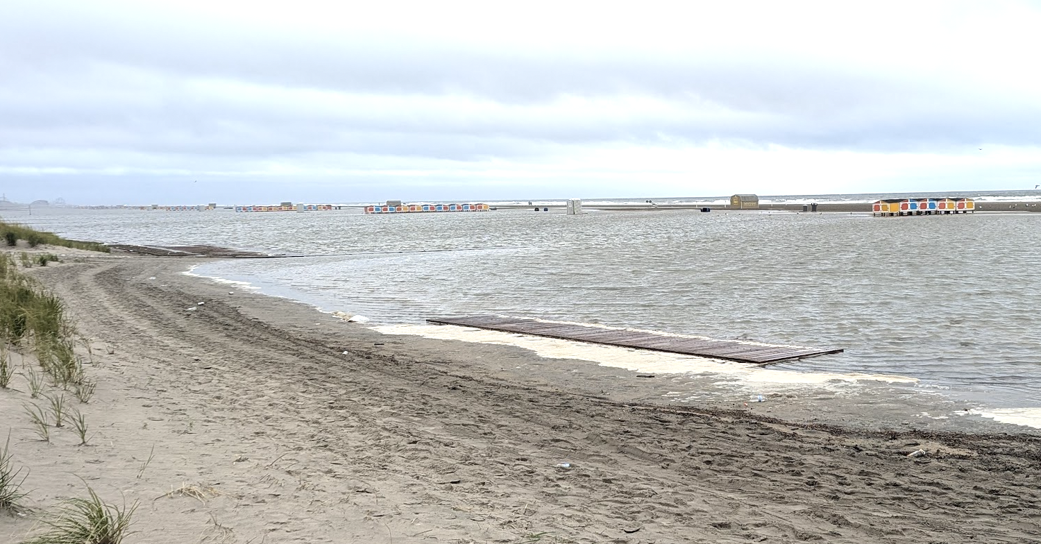
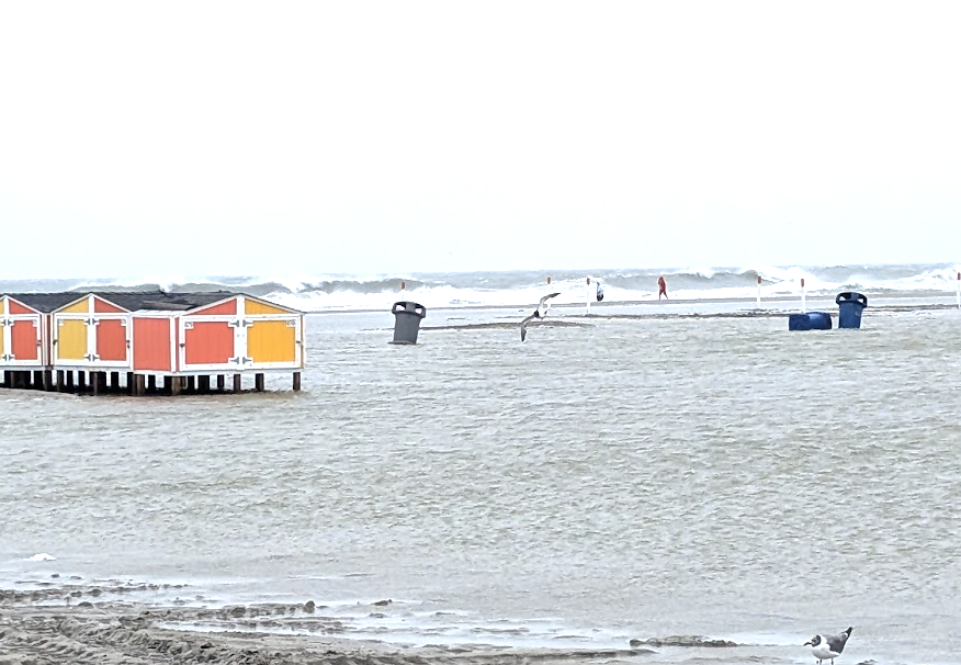
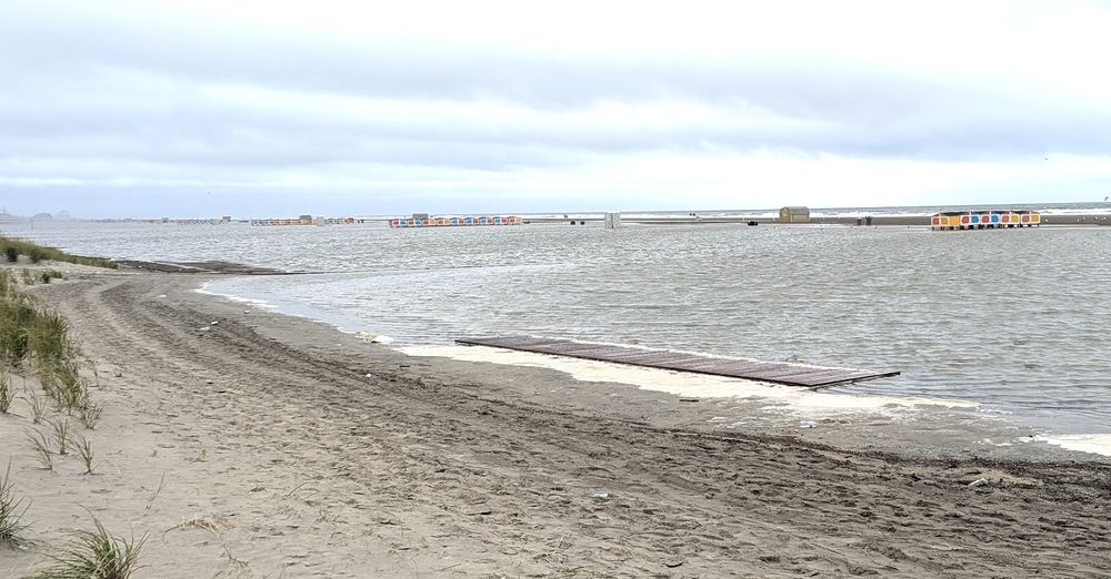
@frd Took two quick vids and I am not a videographer. High tide took the waves and water up to the dunes, which are usually 300-400 feet from the high tide line nearest our beach access here in Wildwood Crest. All the beach paraphernalia (rental equipment shacks, trash cans, porta potties, boardwalks to make the sand easier to cross) have been scattered about by the waves. Big cleanup job for the municipal crews coming up. https://streamable.com/7gouw7 https://streamable.com/yuiz6c
-
We are down at the other end of the island, near the border with diamond beach. My grandparents bought a house in Wildwood in the 70s but then the family 'upgraded' to Wildwood Crest in the 90s. "wild situation" sums it up here today... I will go back down at high tide and try to get more pics and vids as the surf continues to build up. The wind is tolerable standing on the beach, but the constant flow from the N/NE just has the sea continuing to build. There's a very very distinct flow downshore to the south.
-
Total overwash in wildwood crest NJ in a pretty stiff breeze. Low tide now, seagulls be like "SCREEEE!" flying by. Will be a fun high tide later. The ocean is ROUGH. I've never seen the horizon look so choppy here (been coming for 35+ years)
-
This is great for the kids starting school next week. My son walks and his school was having AC issues in June.
-
Sustained onshore wind already causing some overwash in wildwood crest, nj; not yet feeling the effects of the 'cane
-
I hope we get a "beach day" or two Fri/Sat. We'll have 4 kids under 12 so no one is going to be going in the water much past their knees, if that.
-
Well, picked a great week to go to Wildwood NJ to visit family. Leaving tonight. I'll try to get some surf pix/vids when its most rough Thurs.
-
8" here over the same period. Feast or famine.
-
picked up maybe .2" yesterday, keeping things greenish. my lawn has never been this green in august.
-
It's already fun to track the structure of Erin visually: looking to really shape up over the next day or two. https://weather.cod.edu/satrad/?parms=meso-meso1-02-96-1-100-1&checked=map&colorbar=undefined
-
Agreed. We came back from Maine in the middle of last week and were like... uh are we still in Maine?
-
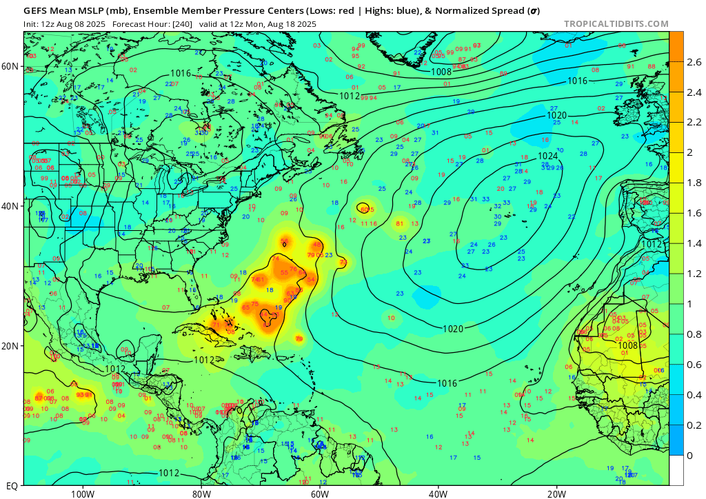
12z GEFS today still has the cluster in the atlantic at about 240 hours. only a couple members head west for the gulf

-
Wild. Warmer in ME, where we are currently under wildfire smoke gloom
-

July 2025 Obs/Disco ... possible historic month for heat
Paleocene replied to Typhoon Tip's topic in New England
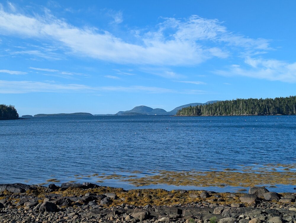
visiting in-laws for a few weeks in downeast maine (northern part of frenchman bay) and it is dry as a bone here. cooked. had maybe a half inch of rain two weeks ago and since then basically nil. a dry summer for this part of the world. better than the absolute inferno that has been my home in MD tho -
Yep. Near bar harbor Maine, we barely hit 70 yesterday, in full sun, and evening lows are in the low 50s. Felt downright cold, like October weather in the heat island where I usually live.
-
Looks like Sligo Creek almost hit (still may hit) moderate flood stage in Takoma Park: https://water.noaa.gov/gauges/tkpm2 Also looks like it may be a recent record.
-
everyone in the mid-atl forum should head to maine; now. 72/52; absolute bliss.
-
I've been in Maine for a couple days now; this part of state seems to be having the opposite pattern to us. They were very wet in April - May; but having a very dry June-July. 72/68 and foggy. Feels almost cold after the last 6 weeks in the DMV.
-
Up in Maine and enjoying dews in the high 60s and temps in the 80s. Very hot and humid for the Mainers though..they get hot above 70°