
GunBlade
-
Posts
482 -
Joined
-
Last visited
Content Type
Profiles
Blogs
Forums
American Weather
Media Demo
Store
Gallery
Everything posted by GunBlade
-
January 20-22 “bring the mojo” winter storm threat
GunBlade replied to lilj4425's topic in Southeastern States
It does (barely) but the northern wave is slightly faster and weaker this run compared to the last run. I wouldn't put much faith in that expansion west of moisture as it is not driven by the ull energy and will be hitting very dry air and is often overdone in modeling. -
January 20-22 “bring the mojo” winter storm threat
GunBlade replied to lilj4425's topic in Southeastern States
Miniscule differences in this run for the NAM so far, doubt much will change for the remainder of the run compared to 12z. NAM definitely did not move closer to the GFS but it doesn't look to be any worse than it's last run... -
January 20-22 “bring the mojo” winter storm threat
GunBlade replied to lilj4425's topic in Southeastern States
NAM so far looks similar but the southern energy looks a little stronger. See how that plays out shortly. -
January 20-22 “bring the mojo” winter storm threat
GunBlade replied to lilj4425's topic in Southeastern States
Canadian made a big step towards the GFS with the H5 looking very similar compared to the prior Canadian run. -
January 20-22 “bring the mojo” winter storm threat
GunBlade replied to lilj4425's topic in Southeastern States
With a typical low yes. But this is more dependent on the northern and southern streams phasing, where that occurs, how much they dig etc... The big Ukie run a couple days ago went neutral/negative tilt right over the NC/TN/SC/GA borders and then closed off even near the coast the next frame. The most recent GFS run for instance is still positively tilted and centered in the piedmont of NC. -
January 20-22 “bring the mojo” winter storm threat
GunBlade replied to lilj4425's topic in Southeastern States
As mentioned a lot, how the upper level energy is handled is what will make or break this for many. There may be a better resource for this but below is the SPC current data to view the 500mb energy. As several mentioned nowcasting, it becomes as much about monitoring current conditions compared to model predictions and subsequent model runs. Tiny differences in this energy has big implications. https://www.spc.noaa.gov/exper/mesoanalysis/new/viewsector.php?sector=19&parm=pmsl# -
I live just south of Charlotte and we were shut down for a week after that storm. I doubt I’ll ever see anything like that again in my life as long as I love here. Yet for some stupid reason, every possible storm on the horizon I hope inside will be just like this… Funny thing is my family moved down from Iowa in 1987 thinking they’d get away from snow and less than a year later Charlotte had its second biggest snow all time in 1988. This 2004 storm was “officially” less than that storm for one day snow but we ended up with over 16” in total at our house. Sad how exciting just 2-4” is now after being here for a storm like that. And yea burrel that Bermuda snow triangle you live in is crazy. I’ve hung around this board for years, never contributed much, and seen that happen to you over and over again.
-
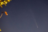
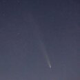
I had hoped to take photos of an ISS moon transit on the 21st. The outlook of snow made that not happening feel better. So I’ll be really annoyed if we don’t get snow either.
-
January 20-22 “bring the mojo” winter storm threat
GunBlade replied to lilj4425's topic in Southeastern States
-
January 20-22 “bring the mojo” winter storm threat
GunBlade replied to lilj4425's topic in Southeastern States
That’s not eyewalls map, another met made it. Signature in bottom right. That’s the most realistic solution. And even if the bigger totals of earlier runs come close to verifying, putting places like CLT in the 1-2” covers all a met needs to. If they get 4” great! If Mets say 4” and CLT gets 1” it’s the biggest bust in the 21st century…. -
January 20-22 “bring the mojo” winter storm threat
GunBlade replied to lilj4425's topic in Southeastern States
Every industry requires a consumer base and most companies rely on vendors to advance their technology. It’s too expensive to implement and build internally. We are talking about maybe a dozen models here and that’s it. It’s not worth it financially for a third party to develop and staff individuals for an industry that won’t grow any larger tomorrow than it is today. There’s no money in it for private companies. So then you have to rely on the government to pay. By the time governments approve funding (local or national) it’s always too little too late. The infrastructure alone for these models is massive and can’t keep up with the changing landscape of technology and is many times ancient. I’ve seen the systems a lot of this data is on, they’re old and many times past end of life. Due to the criticality of these systems, money spent on up time/availability is far more important than AI and so on and they can’t fund that properly. At the end of the day most people in the country could care less about how accurate these models are and how far out they’re accurate. And I highly doubt many would agree they should pay more money so they can be advanced even further. From a technology perspective it’s unfortunate as I agree there could likely be major advances in accuracy. But at the same time that’s what makes the people like Matthew East and Brad P and so on special. They know the climo where they live and can use human intellect paired with these models to predict much more accurately than any model does or could. -
January 20-22 “bring the mojo” winter storm threat
GunBlade replied to lilj4425's topic in Southeastern States
I was thinking the same thing earlier. Transient slow moving front that popped a low off the coast with good ratios and ground temps if I remember correctly. Our other hope in these parts is a low bombing off the coast but that brings convection issues from the gulf and tight gradients as well. Always threading the needle around here. -
January 20-22 “bring the mojo” winter storm threat
GunBlade replied to lilj4425's topic in Southeastern States
Yea GFS is looking more like the others in the upper levels but the southern wave is still left out to dry, just not as bad as the 18z run. 18z GFS popped a second low off the coast of Florida because of the leftover southern wave. At least this run there’s more interaction between the waves. In the end, it’s another trend to the upper levels we are seeing in other models which is great to start to see. -
January 20-22 “bring the mojo” winter storm threat
GunBlade replied to lilj4425's topic in Southeastern States
The NAM moved toward the 18z RGEM solution so good to see the 00z RGEM the same. 18z RGEM was the first I saw with the upper levels like we’ve seen the last few runs. And while the Euro was drier it was still similar earlier in the run to the RGEM and now NAM. RGEM is a little faster with the northern wave dropping down than the NAM so the low moves out sooner. If we can get some more interaction with the southern wave things would likely be even better. -
January 20-22 “bring the mojo” winter storm threat
GunBlade replied to lilj4425's topic in Southeastern States
Let’s see where the next few NAM frames go. Short waves looking more like the RGEM and Euro to this point which could be an improvement over the last run where the southern stream ejected the northern stream. -
January 20-22 “bring the mojo” winter storm threat
GunBlade replied to lilj4425's topic in Southeastern States
The RGEM looks almost like it has a second smaller northern shortwave the southern energy interacts with which then also phases in the main northern stream later on, the same one the NAM let eject out. -
January 20-22 “bring the mojo” winter storm threat
GunBlade replied to lilj4425's topic in Southeastern States
That's because you don't live in Union County anymore! We are now in the heavy snow blob that was probably drawn blindfolded since nobody knows what is going on. -
January 20-22 “bring the mojo” winter storm threat
GunBlade replied to lilj4425's topic in Southeastern States
Yea at hour 63 NAM looked like it wanted to phase and dig more but then fizzled out and the southern wave just hung back in Texas. -
January 20-22 “bring the mojo” winter storm threat
GunBlade replied to lilj4425's topic in Southeastern States
To me it’s not the warm nose of storms has been worse. For central NC like CLT, we’ve always needed a low to track near Jacksonville and turn up the coast for good snow. That plays in to climo for us and limits/eliminates the WAA. We haven’t been able to get a pattern to stick in the winter for those storms. Moisture overriding cold almost never works out for CLT. If it does, it’s short lived and/or ends as sleet or freezing rain. It’s amazing to me that central NC got as much sleet this past storm with the low passing to the west. -
Winter Storm Izzy Obs Thread
GunBlade replied to Prismshine Productions's topic in Southeastern States
Down to 30/25 with wind gusts consistently in the upper 20’s to low 30’s. Still lots of sleet mixed in with snow. I’m basically at the Mecklenburg/Union county border. -
Winter Storm Izzy Obs Thread
GunBlade replied to Prismshine Productions's topic in Southeastern States
Lots of sleet mixing in now in Matthews NC. Currently 31/23 with a 27 wet bulb. Elevated surfaces already have a coating of sleet. It’s gonna get nasty once the ZR hits later this morning. -
Latest HRRR is nowhere close to current radar and ground reports. Much larger precip shield and lots of snow in places showing as a mix.
-
Winter Storm Izzy Obs Thread
GunBlade replied to Prismshine Productions's topic in Southeastern States
Snowing in Matthews NC as well. -
850’s still doing a little better than forecasted for this time.
-
Winter Storm Izzy Obs Thread
GunBlade replied to Prismshine Productions's topic in Southeastern States
Temps and DP steadily falling in Matthews, NC. Currently 36/27.


