GunBlade
-
Posts
482 -
Joined
-
Last visited
Content Type
Profiles
Blogs
Forums
American Weather
Media Demo
Store
Gallery
Everything posted by GunBlade
-
January 30th- Feb 1st ULL and coastal storm obs
GunBlade replied to JoshM's topic in Southeastern States
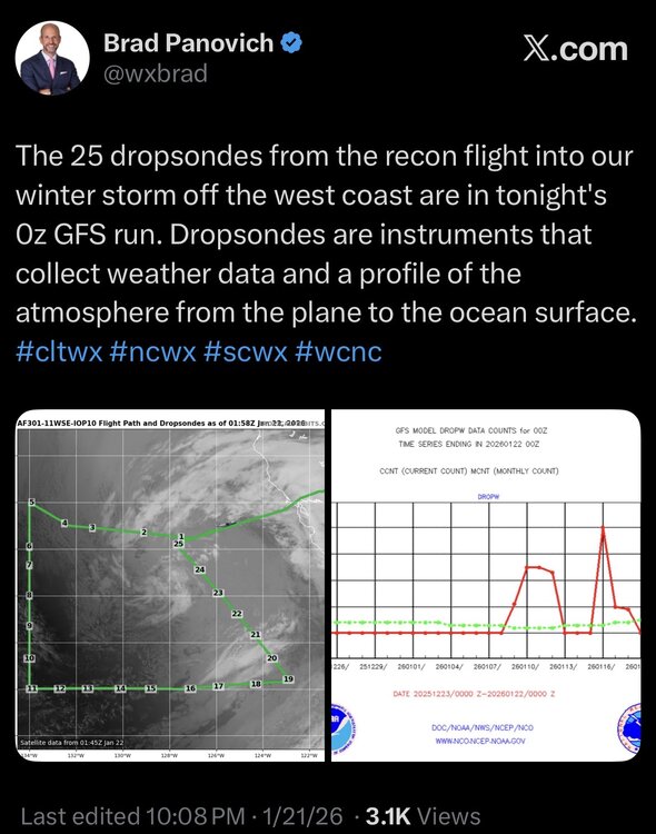
And the dry slot Brad P was concerned about and so many gave him crap for played out pretty accurately. Obviously totals were basically higher everywhere than forecasted but still the gap between the ULL and coastal low played out. -
The “I bring the mojo” Jan 30-Feb 1 potential winter storm
GunBlade replied to lilj4425's topic in Southeastern States
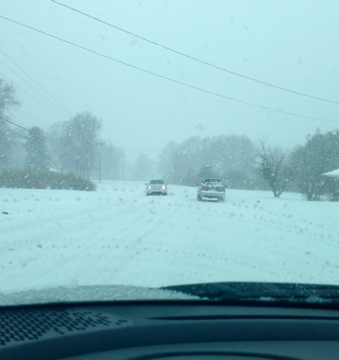
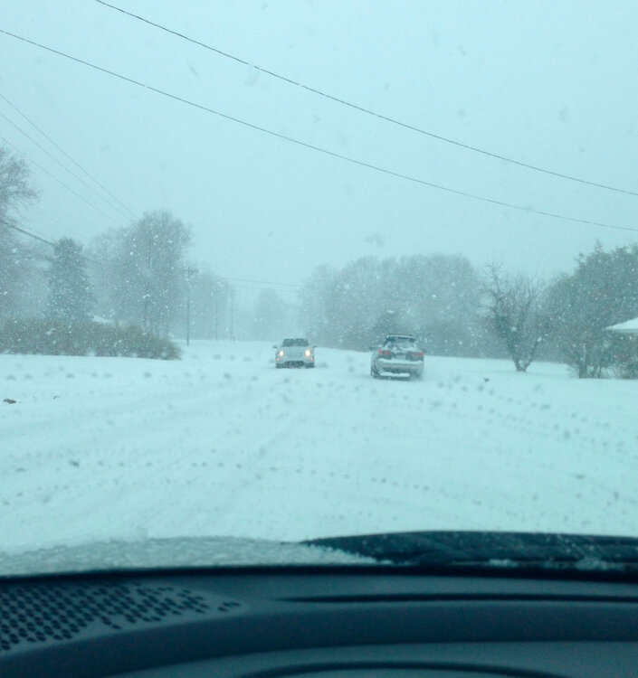
Yea there was no road driving home for that storm. It stuck so quick.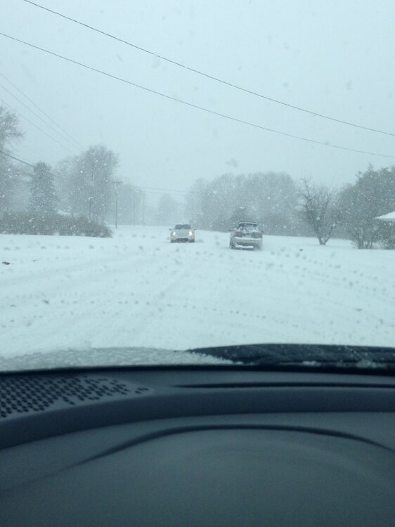
-
The “I bring the mojo” Jan 30-Feb 1 potential winter storm
GunBlade replied to lilj4425's topic in Southeastern States
Getting more negative tilt too would help throw more moisture back that way and setup some great totals. -
The “I bring the mojo” Jan 30-Feb 1 potential winter storm
GunBlade replied to lilj4425's topic in Southeastern States
Eastland? If so I lived off driftwood drive and central back then. We had just moved from Iowa -
The “I bring the mojo” Jan 30-Feb 1 potential winter storm
GunBlade replied to lilj4425's topic in Southeastern States
Nowhere close. Much further east still. And it’s NAM at 84. The move towards the GFS in phasing and upper levels is what we wanted to see and the trends are good. -
So much banter when models have barely changed. Every few miles or couple degrees is a bust. Save it for X or somewhere else and let people who know what they’re talking about share.
-
0Z GFS will be telling
-
After almost 10 years on this board, some things (and people) haven’t changed at all Good luck everyone. Reminds me of 2014 with the front end snow, to sleet then freezing rain. Snow stuck around forever. Just need a little more front end snow to make this stick around for a while.
-
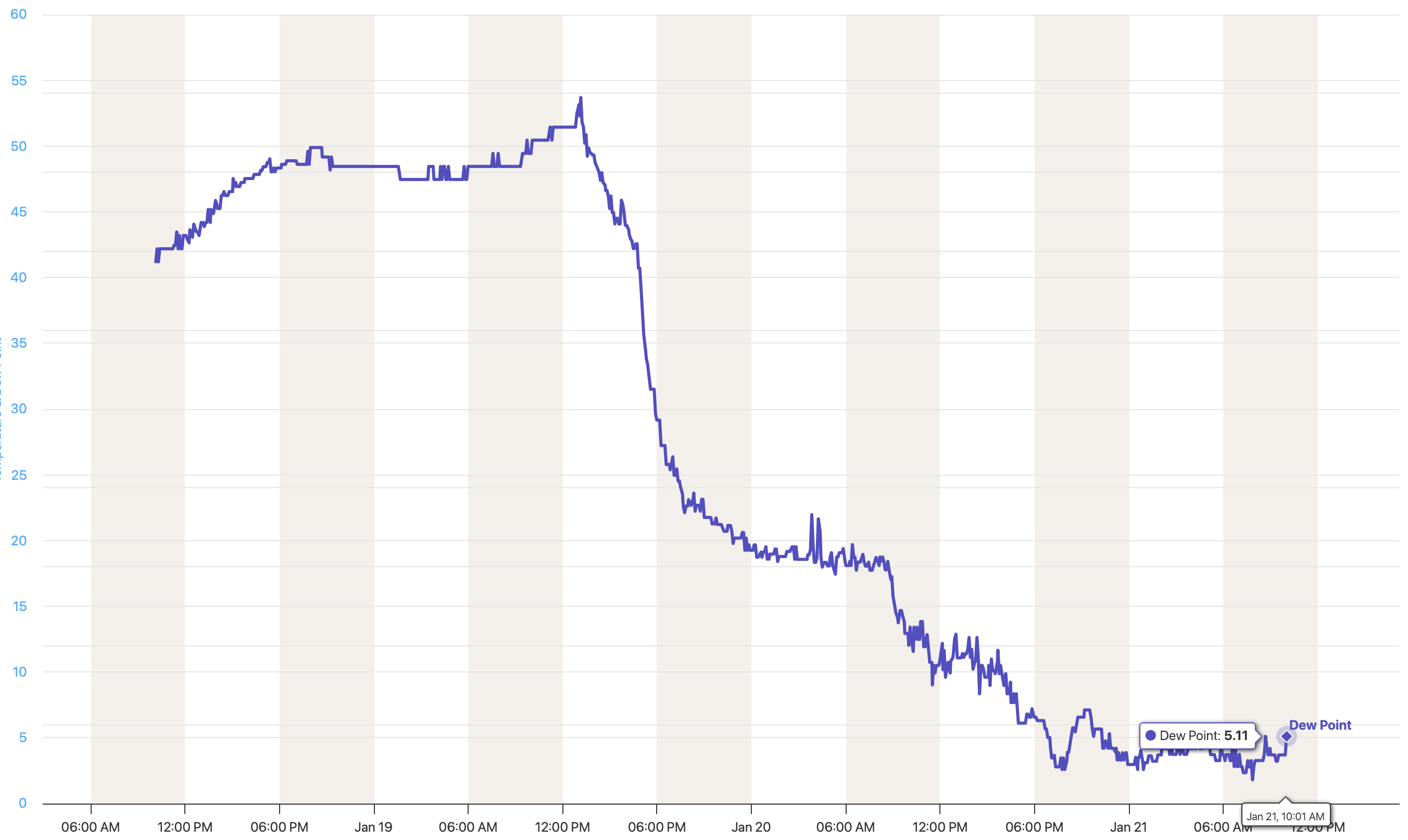
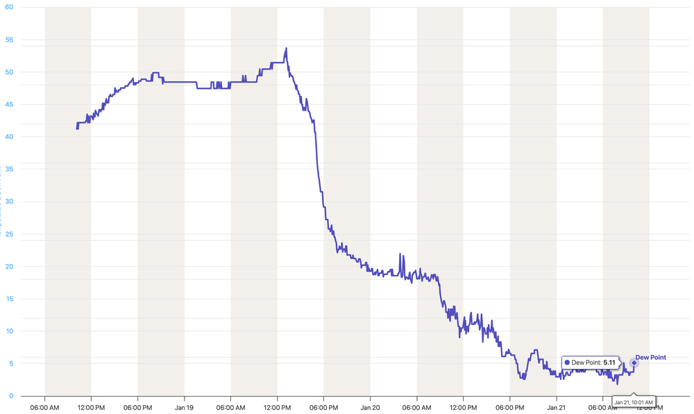
Yup. Just outside Charlotte and the humidity is still going down (49 this am to 39 now) with a 5 DP and only 26 degrees. This cold air is in no hurry to saturate.
-
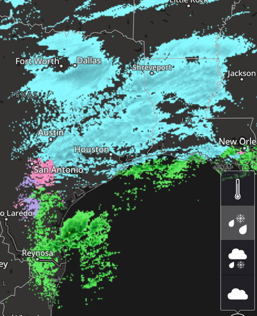
South Lake Charles, LA looks like New England during a nor'easter
-
Little dry out there lol
-
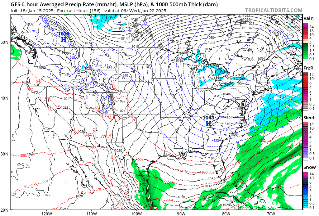
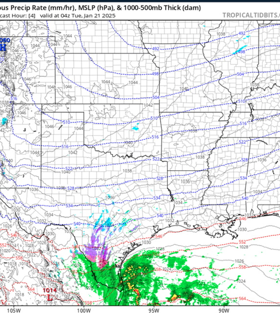
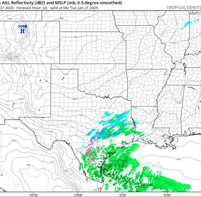
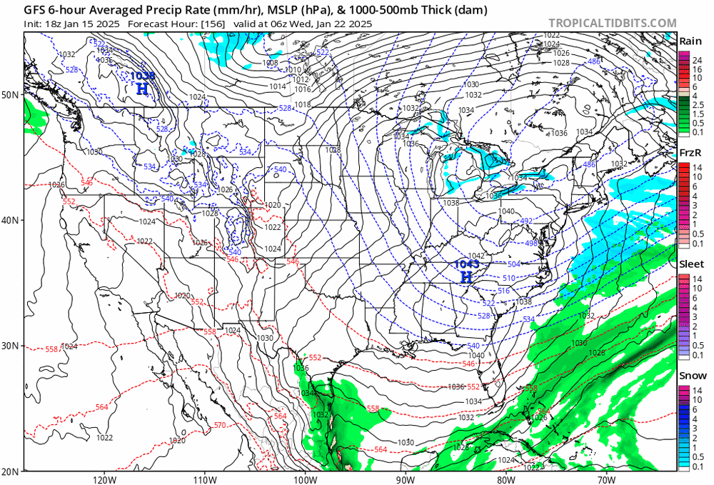
Not that this translates to a bigger NW shift or more snow for those of us on the edge but it’s sad how poorly the latest model runs depict the current radar…First is NAM second is HRRR.
-
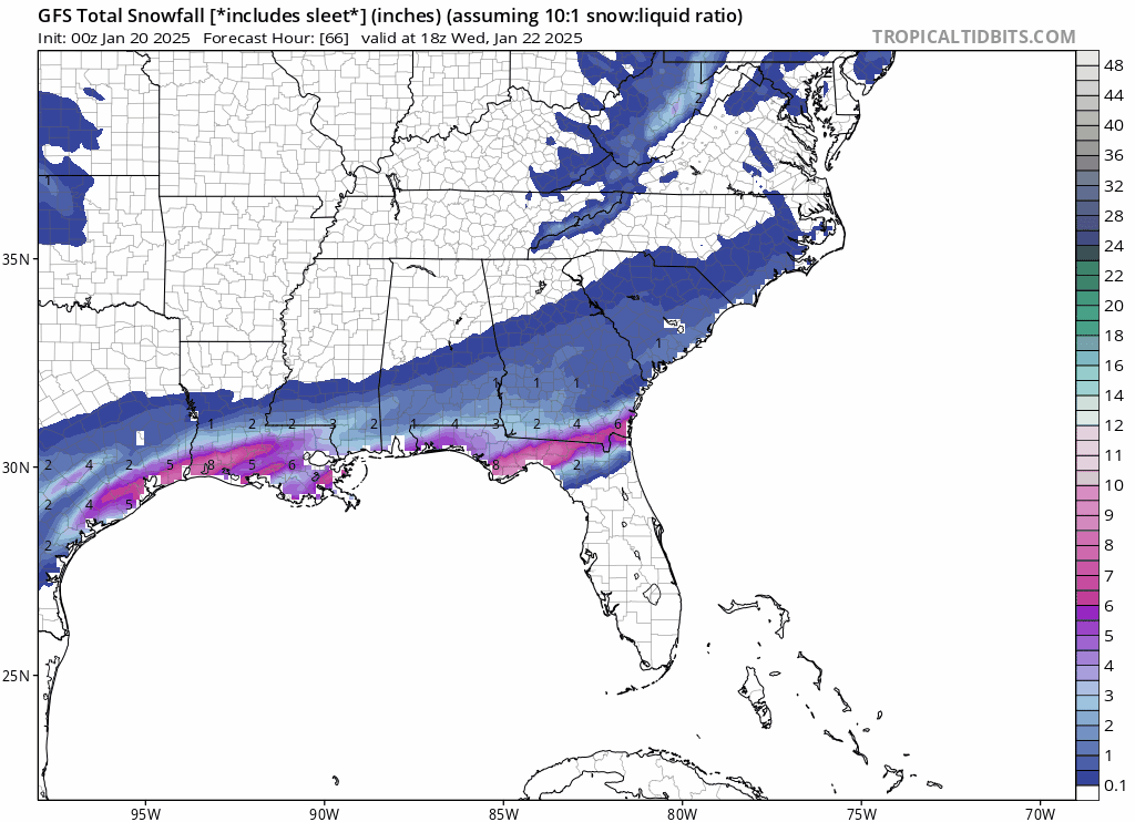
Another run or two of trends like this and everyone will be running back for more model run torture. This is the free goofy snow map which isn’t accurate but shows the growing precip field across the area.

-

-
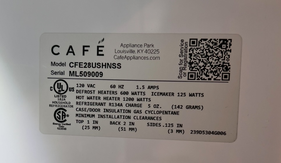
Did you see my note about your fridge wattage? If not go back and look at my quoted response. Something is not correct. Your power backups should work fine.
-
I highly respect Brad and think he’s normally spot on and level headed. But model trends would show otherwise. You can see the low move. Maybe you can argue there wasn’t a low there prior but still it clearly is shifting.
-
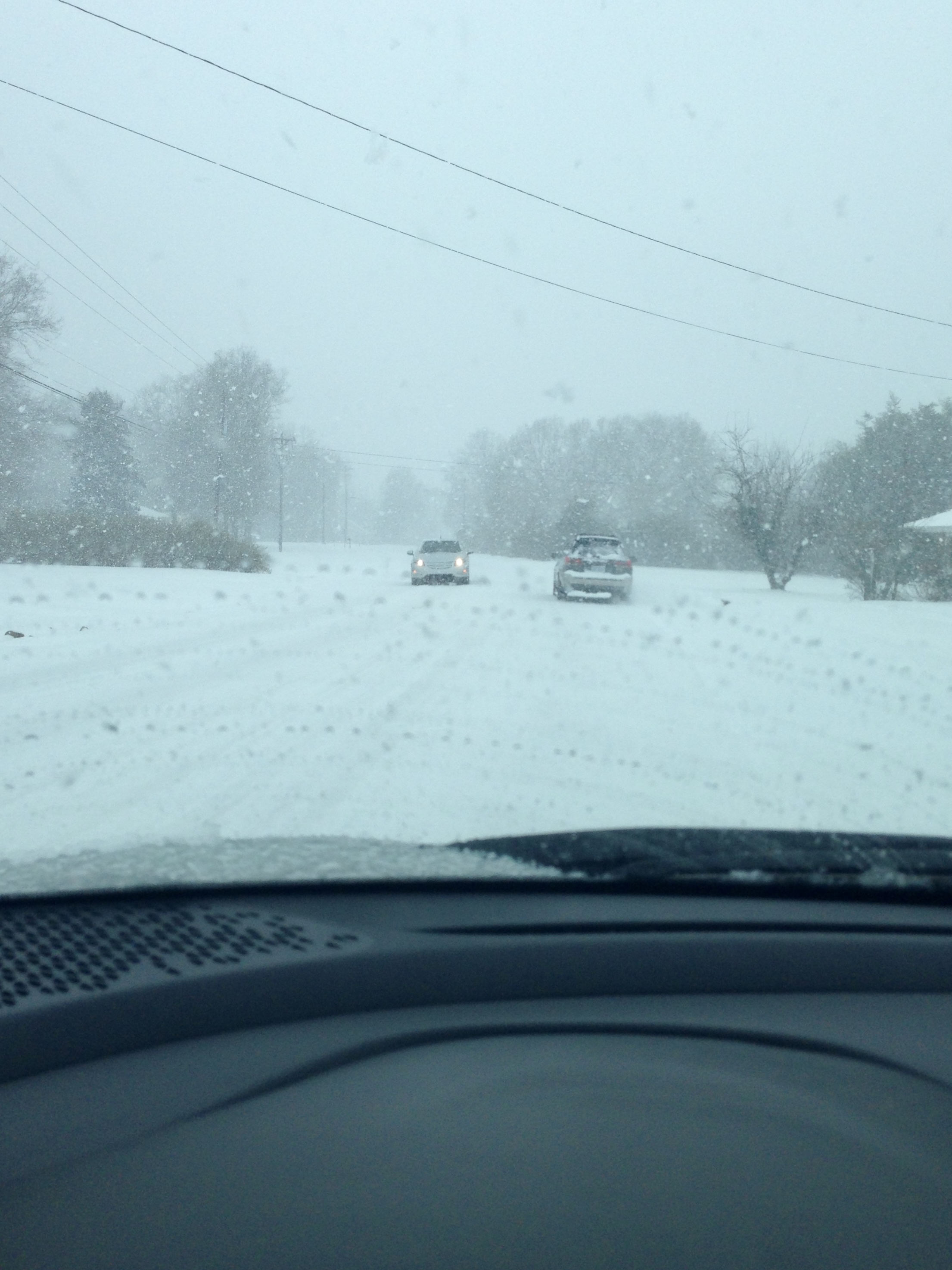
I’ll take a 2014 repeat all day long! This was only about 1.5 hours or so after it started snowing.

-
That can’t be right. A microwave is 1,000 watts and uses WAY more power than a fridge. Verify the fridge voltage and amps. That’s your wattage. For example, mine is 120v and 1.5 amps which means 180 watts. My fridge has a Keurig built into it and even that is only 1,200 watts. You should have a sticker inside your fridge like this.
-
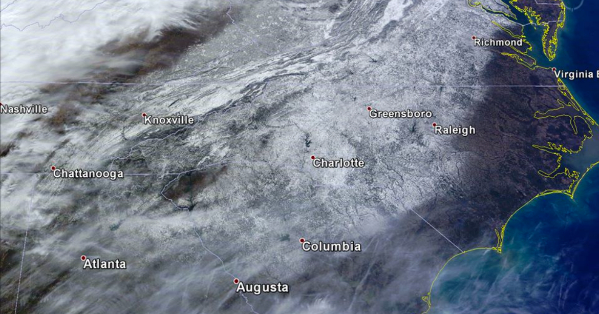
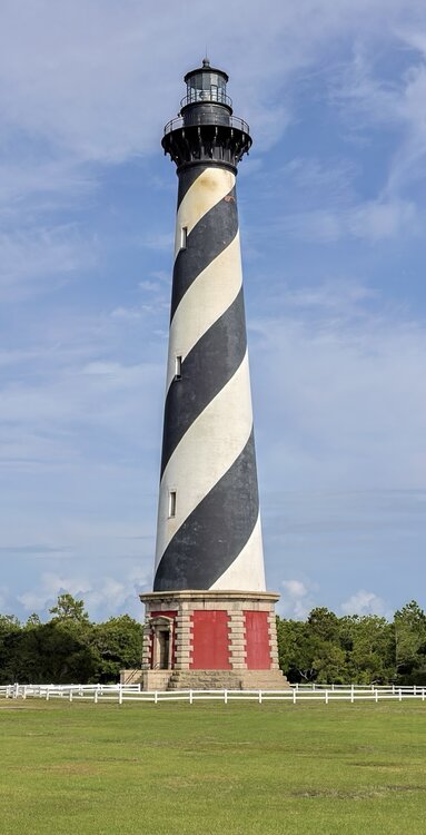
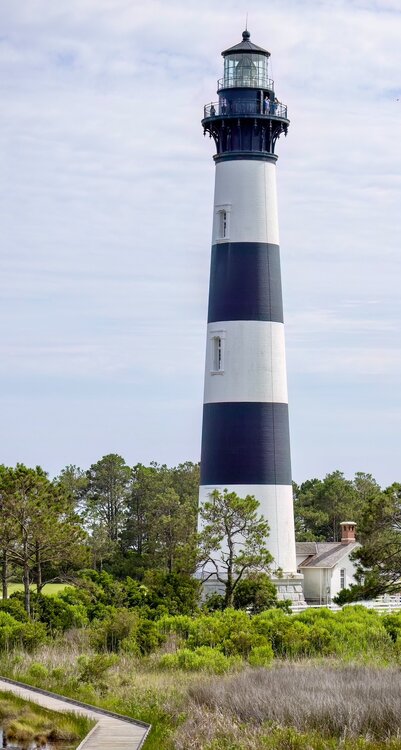
What a blast to be on the outer banks if this happened. Add 6” of snow to these photos and that would be an amazing site.
-
Yup. And reports for that storm quote tens of thousands in metro Atlanta impacted. Imagining the millions in the area now and it would be devastating. Same for Charlotte and other major SE cities that 20-30+ years ago were fractions of what they are today.
-
My family moved from Iowa in 87 and then Charlotte got record snowfalls from that storm in 88 lol. They thought they didn’t get away from the snow. Only took 16 more years to get another storm like that in 2004 hah. Maybe 21 years later we can threepeat
-
It also takes the NAM 5 hours to model what the radar returns currently look like…
-
And if it were the opposite they would be the only “correct” models….
-
Classic I-85 north special
-
I updated to include imby lol