SnowDawg
-
Posts
1,087 -
Joined
-
Last visited
Content Type
Profiles
Blogs
Forums
American Weather
Media Demo
Store
Gallery
Everything posted by SnowDawg
-
Yeah that's definitely on the table. I think it was Eric Webb that was saying this setup is sort of big amped up storm, or squashed all the way into the Gulf, with very little in between. And when it comes down to those two scenarios, well we are unfortunately forced into a my backyard contest. Something like the Icon just means sunny, cold, and windy for me. While a GFS solution is close to a classic I-85N winter storm, with the admitted thermal risks. Just the unfortunate reality of the geographics of this board, systems that make us all happy are practically once in a lifetime events.
-
Block and 50/50 have trended weaker on the GFS. But admittedly, some of that weakening may be responsible for us having a storm at all and not a suppressed strung out mess. Gonna have to strike a balance between giving our wave room to amplify but not invite too much ridging in front of it wrecking thermals.
-
I'm not gonna overly fuss about p-types until we actually have a storm in hi-res model range. Right now close is close enough for me. Let's actually get that snow pack on the ground to our north, and see how the models adjust.
-
EPS looks much better than the GEFS. Even shows a low pressure anomaly in the northern gulf.
-
Op euro with another tick towards the GFS. GFS just had a slightly better attempt at the phase so it was a bit stronger. Like having op euro at least somewhat onboard for sure though.
-
Ensemble still just doesn't seem to really like it. As I said before I think it's possible they are a bit too coarse to solve the situation with the three different pieces of energy at this lead, especially the baja low maybe they are lagging behind the OP in seeing it tick east. Hopefully we see things change in the coming days, but have to be cautious until the ensemble shows support.
-
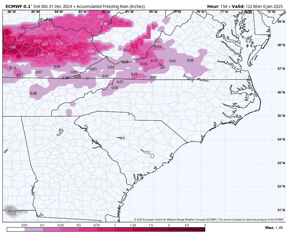
Just glancing at soundings and again the ice is a bit overdone
-
So close to more, phase was just a little too messy so it lost some oomph as it got into the northern gulf.
-
Taller ridge also makes the northern stream energy dig harder, making a phase more likely. Normally I would say this could quickly trend to too much of a good thing and it could end up wanting to cut, but the blocking and 50/50 confluence over the top should largely prevent that.
-
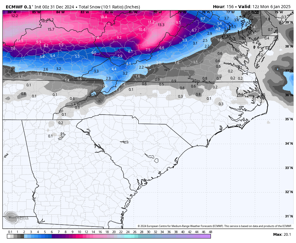
Love the look, think if it were to come to pass it'd be more widespread snow/sleet and not as much ice as it was showing but far too early to sweat p-types at this point. Hopefully we start to see some ensemble convergence on the handling of the energy in the SW.
-
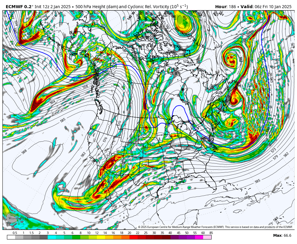
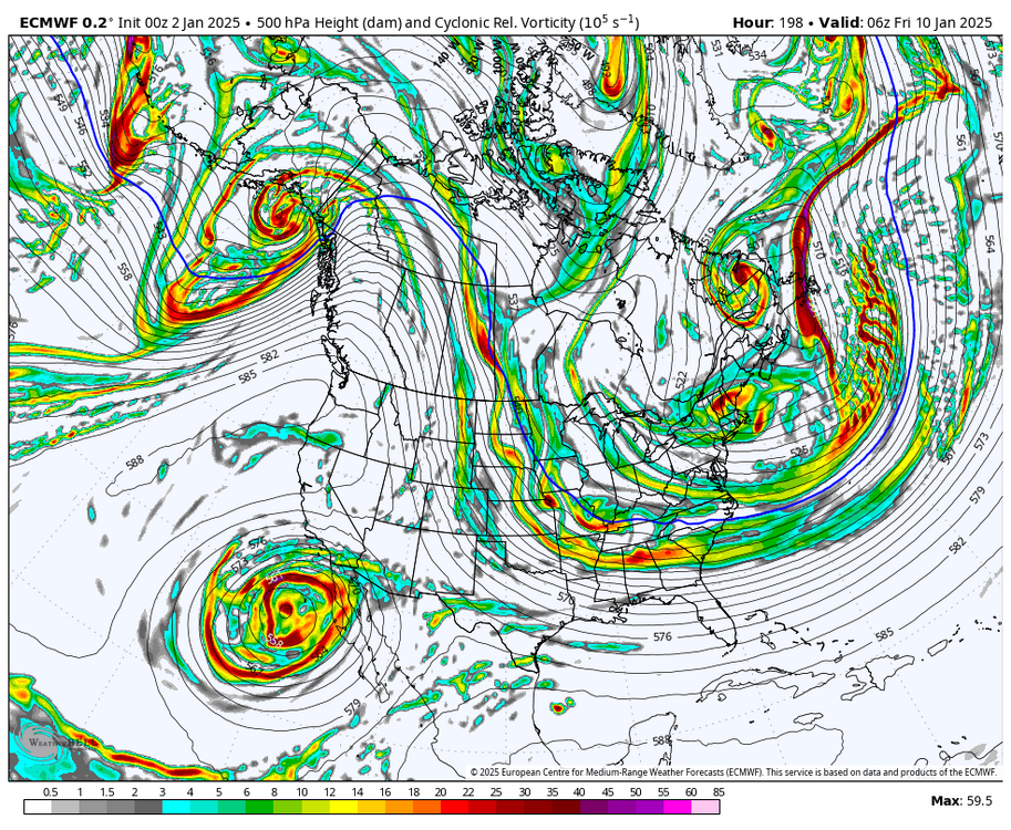
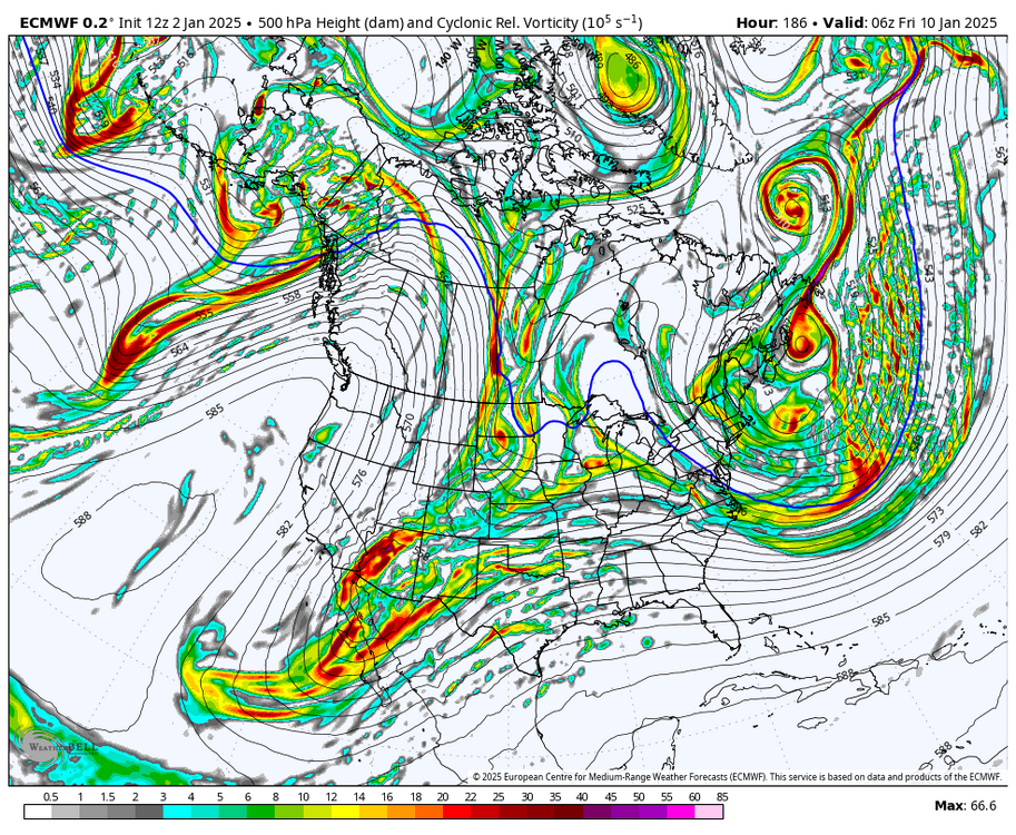
So looking at the 500mbar vorticity maps so we can see our pieces of energy, notice how unlike at 0z last night the Euro is not taking that big SW cutoff out into the pacific. At the same time our northern energy is digging further SW and attempting to phase. It ultimately fails, but it's a step in the right direction. (0z followed by new 12z)
-
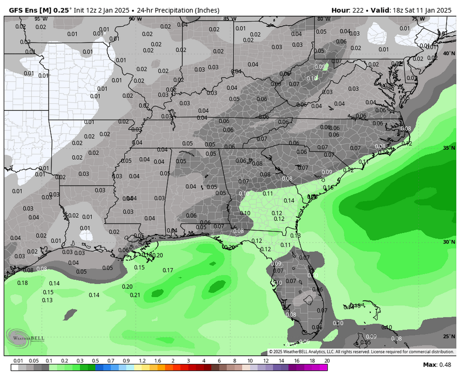
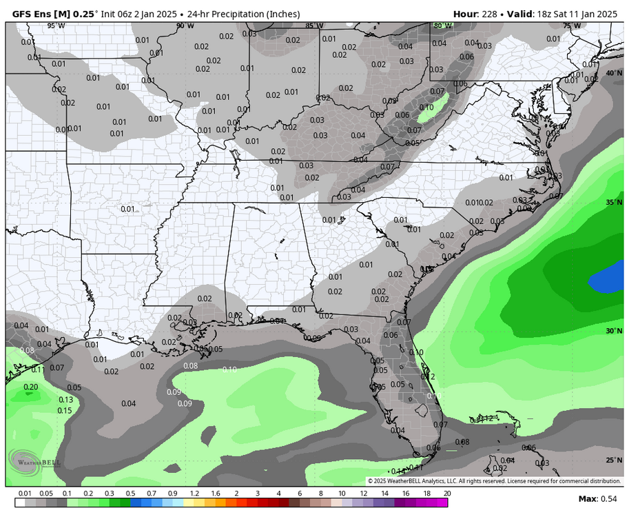
Pretty substantial increase in QPF for the 10th/11th on the GEFS. Let's see if we can get this to continue trending this direction. Also fwiw, the Euro made a big jump towards the GFS with the handling of the SW energy.
-
That Miller A threat is still close on razor thin margins, it'll all come down to exactly how all three pieces of energy interact with one another. And frankly at this lead, the ensembles may be a little too coarse in their resolution to lean on. Just need to wait it out, but acknowledge cold/dry is the easier outcome to get. Side note as I'm just looking at it, but selfishly I'd take the 6z GFS in a heartbeat.
-
Agreed, and at least grand scale all the pieces were still there they just missed connecting by very small margins. Funny how at 12z we got the fantasy run but the GEFS got worse, but tonight the OP misses and the ensemble actually improved marginally.
-
GFS much closer to the 12z run than 18z. Just a bit too much interaction with the cutoff energy in the SW caused the phase to just miss.
-
Close enough. Storm signal is still there. Not much else to takeaway at this point. Just playing the waiting game for now.
-
Honestly the GEFS wasn't all that enthused either, at least in comparison to the OP. Still looks very suppressed. But still showing multiple threats 9-15 so on to the next run I guess.
-
Can we lock that one in? Everybody should be happy with it. Crushing snow very far south and extreme high ratio powder in the mtns and foothills. We all need snow, so no use fighting over the bullseye lol
-
As much as it was fun to think we could pull it off, the 6th storm was always supposed to be the stage setter in the step down process so I'm not going to fret too much about losing it. Should get at least two shots between the 9th and 15th, and in the past we'd be saying suppressed is right where we want them at this range. But we've lost a few storms to suppression during this drought so instead it just feels like it's set in stone already.
-
Nice change on the following wave. Ideally it gets going quicker in the Gulf to get everyone more involved. But a good signal for now nonetheless.
-
Had a feeling that would be the outcome when it dug so hard out west.
-
Could mean it tries to amplify and cut sooner. Let's see how our block does at slamming the door.
-
Same trend as above but for ice.

-
3 run trend from the Euro. It's coming south for now at least. If we could just get slower and weaker too, we'd be in business.

-
Based on the 18z euro I'd say timing is just as big a factor as North/South. The waves aren't tracking all that different but the faster euro has more room to amplify, less time for the CAD to build in, and precip starts during the warmest part of the day instead of overnight/early morning.