SnowDawg
-
Posts
1,253 -
Joined
-
Last visited
Content Type
Profiles
Blogs
Forums
American Weather
Media Demo
Store
Gallery
Everything posted by SnowDawg
-
I'd like to say I could just take that and be happy for you guys but I'd be lying. 2018 was sad enough, this would be worse.
-
Not great for N GA there. Even surface thermals were way warmer earlier in run. That phase will pump the heights out ahead.
-
Yep, mixing was already a given in my mind as climatology says it usually is. I’m just hoping to see at least 50% of the QPF go to snow. Then ideally as little zr as possible but as long as it stays around 0.25-0.5 there shouldn't be too many issues. Frankly, none of that feels like too much to ask for. I could be really crazy and be clinging to the all snow GFS solution, but I'd like to think I've matured enough to know better lol
-
Yeah in general that’s it. Technically in this scenario they are actually both slowing down and phasing later timing wise, but further west nonetheless. I think if we are going to have a phase, a quicker one is the better of the two evils cause at least the TPV and HP won’t be retreating by then.
-
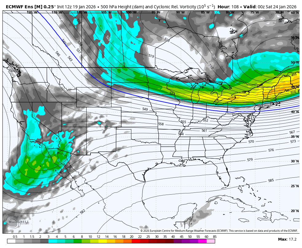
EPS trend with the energy pieces. Baja tend is good but northern energy trend is bad. All together bad for us in terms of wanting more snow and less ice. Can we trend back to a more progressive look with the northern energy? Progressive has been the theme of late but this is an entirely different pattern.

-
I’m certainly not knowledgeable enough to argue with him on that but most others Mets are saying that a slower ejection increases the risk of phasing, and gives the TPV lobe and HP more time to start retreating, opening the door for more north trends. I guess a slower ejection can be good but only if the northern stream wave doesn’t also slow down and dig more west to phase?
-
While a sizable split, most individual members within the GEFS favored Kentucky into Virginia for the main snow swath despite the OP being dumb as usual.
-
Still plenty of room for this to come north. GFS is a terrible model. BAM and all those snarky northern guys are gonna be right aren’t they?
-
Largely agree but individual ensemble members still say north is a risk.
-
Good trend but not necessarily one you wanna see too much more of. As GSP put in their morning discussion this is still on the table, albeit low probability. The main point is that yes, the model guidance is signaling for a potential winter storm stretching over the weekend. There is also the possibility for the area of high pressure to extend further south, which also could cutoff precipitation chances entirely.
-
The biggest worry at this point has to be how far amped and north can this get? That HP will help, but it is beginning to retreat especially with the later timing. That phase of the Baja low out west can continue to bring this north some in my opinion. The further west it phases the more it’s going to pump the SE ridge and wanna steer the low track further inland. I would only feel super confident in far Northern NC and Virginia at this point.
-
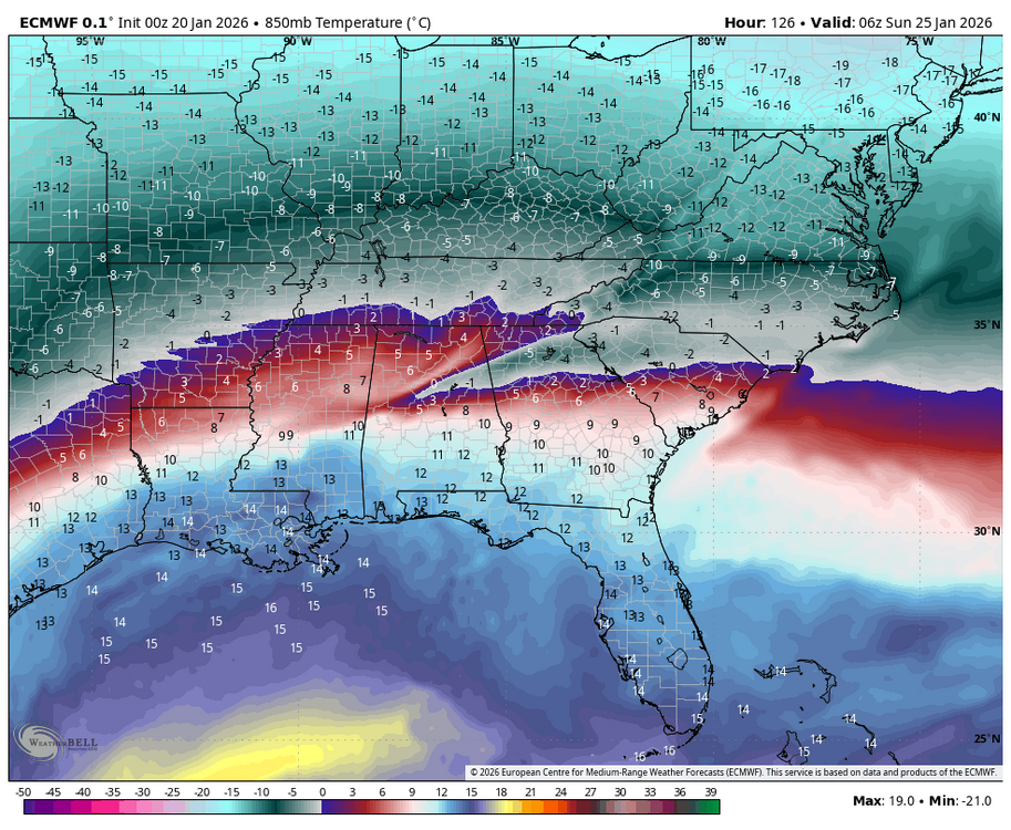
Yep depth of the cold is the key here. There will no doubt be a warm nose, but experience says the heart of the wedge will almost always verify with more SN/IP. Alluding to that, one thing that stuck out to me on that Euro was the wedge signature starting to show up even at 850mbar. That is deep cold. As a result the sn/ip line held south for longer than earlier runs despite being more amped. Not to mention the potential for dynamic cooling fighting against the warm nose with such high rates possible.
-
Incredible run but that amped trend is not sustainable unless you are darn near in Virginia. At least if you want mostly snow.
-
Should probably be more amped and north based on how the energy interacted out west.
-
For some. Not even close for others.
-
Have to cheer against that phasing out west. Would be our luck…everything for years struggles to phase, then when we actually need more strung out it gets phased and amped up. It’s always the stupid GFS with the good solution…
-
That south side cutoff on the Euro is brutal… The mid level warmth looks quite strong for a relatively weak storm and a decent track; FL panhandle to off Savannah.
-
Will be absolutely incredible if this actually ends up as long duration as it’s showing it could be. Been a long time since seeing something like that.
-
I’m hopeful but still cautious. The confidence some very good Mets have at the chance for the low track to still be as high as TN/KY worries me. We really need a missed phase and weaker strung out system to fight that. Who woulda thought we’d be cheering for that after these last few years lol?
-
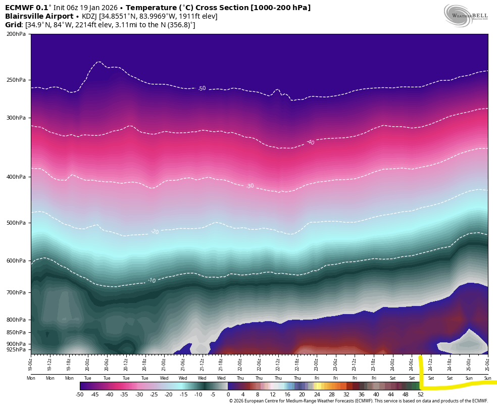
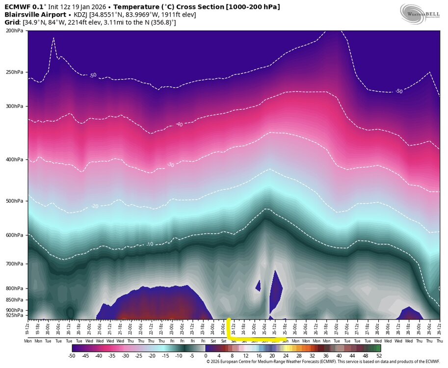
Euro moved towards way less upper air warmth on the 12z run in North GA. This temp cross section is at Blairsville, GA. Notice how much more of the column is isothermal most of the time than in the 6z run. The 6z run of course cuts off with the storm in progress but still noticeable difference nonetheless. If things can trend a bit more that direction as we move forward, I’d expect more snow/sleet vs ZR to start showing up over N GA and the Upstate. Of course track/intensity would need to cooperate, but that’s a given.

-
The idea of a cutter is ridiculous unless the HP is just way weaker or later than currently shown. Now, a more amped further north track certainly on the table, and honestly the ensembles did move slightly in that direction.
-
I’ll preface this by saying the ceiling of any event is rarely met for one reason or another, but this is one of the higher ceiling events I’ve seen in quite some time.
-
In my experience, at least at my location, if those upper air temps verify I’ll be shocked not to see almost entirely snow/sleet.
-
Sleet is always under-modeled. The closer you get to the all snow line the more snow/sleet I think you’d see and less freezing rain.
-
Probably not a bad thing that the multi-year base state has been for mostly weaker/suppressed/strung out storms and that is the exact scenario that works in our favor this time.